Sweldon Wood

Wood, Forest in Glamorgan

Wales

Sweldon Wood

Ordnance Survey Cut Mark This OS cut mark can be found on No491 Cowbridge Road West. It marks a point 58.577m above mean sea level.
Ordnance Survey Cut Mark Credit: Adrian Dust

Sweldon Wood is a picturesque forest located in Glamorgan, Wales. Spanning over a vast area, it is renowned for its natural beauty and rich biodiversity. The wood is predominantly made up of deciduous trees, including oak, beech, and birch, which create a stunning canopy of green throughout the year.

The forest offers visitors a tranquil escape from the hustle and bustle of city life. Walking through its peaceful trails, one can admire the vibrant wildflowers and hear the soothing sounds of birds chirping. Sweldon Wood is also home to a variety of wildlife, including foxes, badgers, and numerous species of birds, making it a haven for nature enthusiasts and photographers.

The wood is well-maintained and offers several amenities for visitors. There are designated picnic areas where families can enjoy a meal surrounded by nature. Additionally, the forest has well-marked trails of varying lengths, catering to different fitness levels, ensuring that visitors can explore at their own pace.

Sweldon Wood is a popular destination for recreational activities such as hiking, cycling, and birdwatching. It is also a great place for educational field trips, as it provides an opportunity to learn about different plant and animal species in their natural habitat.

Overall, Sweldon Wood in Glamorgan is a cherished natural treasure, offering a peaceful and rejuvenating experience for locals and tourists alike. Its diverse flora and fauna, combined with its well-maintained trails and amenities, make it a must-visit destination for nature lovers.

If you have any feedback on the listing, please let us know in the comments section below.
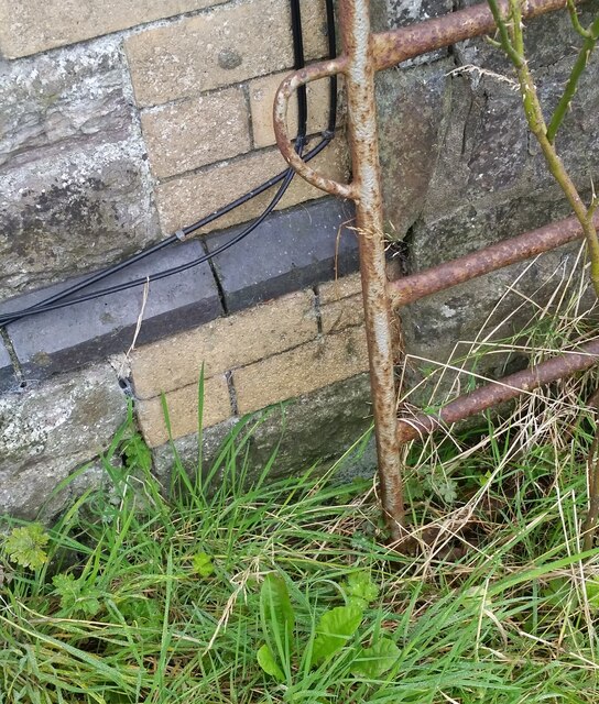
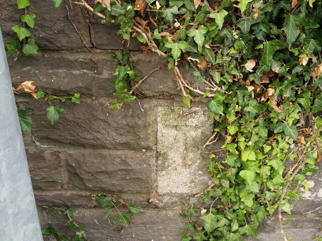
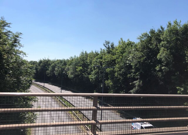
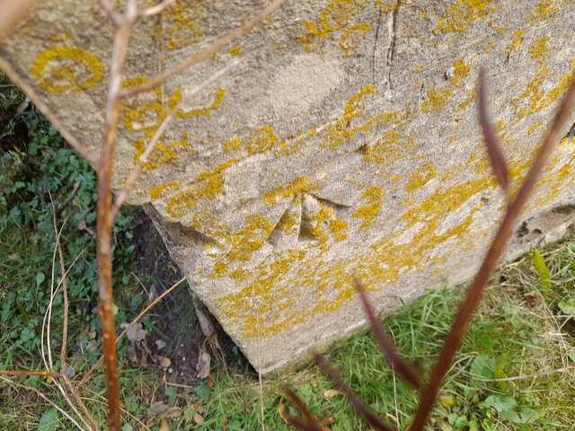
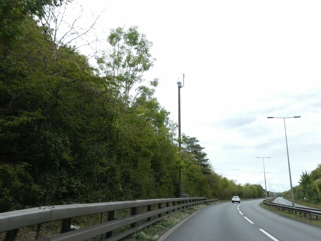
Sweldon Wood Images

Images are sourced within 2km of 51.46704/-3.2555442 or Grid Reference ST1274. Thanks to Geograph Open Source API. All images are credited.

Ordnance Survey Cut Mark This OS cut mark can be found on No491 Cowbridge Road West. It marks a point 58.577m above mean sea level.
Ordnance Survey Cut Mark
This OS cut mark can be found on No491 Cowbridge Road West. It marks a point 58.577m above mean sea level.
Ordnance Survey Cut Mark This OS cut mark can be found on the SW angle of the cemetery wall on Cowbridge Road West. It marks a point 65.556m above mean sea level.
Ordnance Survey Cut Mark
This OS cut mark can be found on the SW angle of the cemetery wall on Cowbridge Road West. It marks a point 65.556m above mean sea level.
Ordnance Survey Cut Mark This OS cut mark can be found on the wall SE side of Cowbridge Road West. It marks a point 14.661m above mean sea level.
Ordnance Survey Cut Mark
This OS cut mark can be found on the wall SE side of Cowbridge Road West. It marks a point 14.661m above mean sea level.
The A4232 at Culverhouse Cross
Ordnance Survey Cut Mark This OS cut mark can be found on NW angle of St Michael's Church. It marks a point 34.211m above mean sea level.
Ordnance Survey Cut Mark
This OS cut mark can be found on NW angle of St Michael's Church. It marks a point 34.211m above mean sea level.
Ordnance Survey Cut Mark This OS cut mark can be found on the wall SW side of Tumbledown. It marks a point 103.919m above mean sea level.
Ordnance Survey Cut Mark
This OS cut mark can be found on the wall SW side of Tumbledown. It marks a point 103.919m above mean sea level.
Tesco superstore, Culverhouse
Slip road off A48 for eastbound traffic entering Culverhouse retail park
Footbridge and road bridge over A4232 east of Culverhouse Cross
A4232 in cutting near Caerau
Traffic camera on A4232 near Caerau
Drope Road bridge over A4232
Entrance to Tychwith Farm
Overgrown Roman road This overgrown track was once a major road linking the Roman settlements of Caerwent and Caerleon to the east with Neath and Carmarthen to the west.  It was later replaced by a less steep road, now the A48.
Overgrown Roman road
This overgrown track was once a major road linking the Roman settlements of Caerwent and Caerleon to the east with Neath and Carmarthen to the west. It was later replaced by a less steep road, now the A48.
On the A4232 at the Drope Road bridge
On the roundabout passing Starbucks drive-through
Entering 50mph zone on A4050, heading south
Roundabout on the A4050
Show me another place!

Sweldon Wood is located at Grid Ref: ST1274 (Lat: 51.46704, Lng: -3.2555442)

Unitary Authority: Cardiff

Police Authority: South Wales

What 3 Words

///stop.jelly.flying. Near Wenvoe, Vale of Glamorgan

Nearby Locations

Sweldon Wood

Related Wikis

Mary Immaculate High School

Mary Immaculate High School (Welsh: Ysgol Uwchradd Y Fair Ddihalog) is a Roman Catholic comprehensive school located in Wenvoe, Vale of Glamorgan, Wales...

Caerau Hillfort

Caerau Hillfort (Welsh: Bryngaer Caerau) is a large triangular multivallate Iron Age hillfort, built on a previously occupied Neolithic site, occupying...

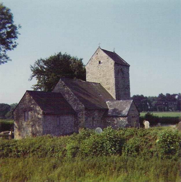
St Mary the Virgin Church, Caerau, Cardiff

St Mary the Virgin Church is a deconsecrated and ruined church in the parish of Caerau with Ely, Cardiff, Wales. It was built in the 13th century on a...

Caerau (Ely) A.F.C.

Caerau (Ely) Association Football Club is a Welsh team based in Cardiff. It was formed in 1955. The club plays in the Cymru South, which is second tier...

Nearby Amenities

Located within 500m of 51.46704,-3.2555442
Crossing
Crossing: unmarked
Lat/Long: 51.4705217/-3.2518415
Crossing
Crossing: zebra
Lat/Long: 51.4702652/-3.2541147
Crossing
Crossing: traffic_signals
Crossing Ref: pelican
Lat/Long: 51.4706638/-3.2591084
Mini Roundabout
Lat/Long: 51.467219/-3.2588974
Bus Stop
Operator: Cardiff Bus
Route Ref: 17
Shelter: no
Lat/Long: 51.4703168/-3.2528597
Bus Stop
Naptan AtcoCode: 5710AWA11494
Naptan NaptanCode: cdiamdm
Operator: Cardiff Bus
Route Ref: 17
Shelter: yes
Lat/Long: 51.4701805/-3.2546047
Bus Stop
Naptan AtcoCode: 5710AWA11493
Naptan NaptanCode: cdiamdp
Operator: Cardiff Bus
Route Ref: 18
Shelter: no
Lat/Long: 51.4703005/-3.2546591
Crossing
Crossing: zebra
Lat/Long: 51.470284/-3.2562982
Crossing
Crossing: unmarked
Lat/Long: 51.4703849/-3.2562805
Bus Stop
Naptan AtcoCode: 5710AWA11491
Naptan NaptanCode: cdidmga
Operator: Cardiff Bus
Route Ref: 17
Shelter: yes
Lat/Long: 51.4703853/-3.2579426
Bus Stop
Naptan AtcoCode: 5710AWA11492
Naptan NaptanCode: cdidmgd
Operator: Cardiff Bus
Route Ref: 18
Shelter: yes
Lat/Long: 51.4704588/-3.2575349
Balas Farm
Place: farm
Lat/Long: 51.4628581/-3.2549985
Caerau Hillfort
Historic: archaeological_site
Wikidata: Q5016882
Wikipedia: en:Caerau Hillfort
Lat/Long: 51.4673777/-3.2489552
Barrier: yes
Lat/Long: 51.4688174/-3.2541025
Direction: 165
Generator Method: photovoltaic
Generator Output Electricity: yes
Generator Solar Modules: 4
Generator Source: solar
Generator Type: solar_photovoltaic_panel
Location: roof
Power: generator
Lat/Long: 51.4710731/-3.2561813
Direction: 165
Generator Method: photovoltaic
Generator Output Electricity: yes
Generator Solar Modules: 10
Generator Source: solar
Generator Type: solar_photovoltaic_panel
Location: roof
Power: generator
Lat/Long: 51.4711034/-3.2561857
Direction: 80
Generator Method: photovoltaic
Generator Output Electricity: yes
Generator Solar Modules: 10
Generator Source: solar
Generator Type: solar_photovoltaic_panel
Location: roof
Power: generator
Lat/Long: 51.465051/-3.2491315
Direction: SE
Generator Method: photovoltaic
Generator Output Electricity: yes
Generator Solar Modules: 12
Generator Source: solar
Generator Type: solar_photovoltaic_panel
Location: roof
Power: generator
Lat/Long: 51.4666712/-3.2524587
Direction: SW
Generator Method: photovoltaic
Generator Output Electricity: yes
Generator Solar Modules: 12
Generator Source: solar
Generator Type: solar_photovoltaic_panel
Location: roof
Power: generator
Lat/Long: 51.4667385/-3.2520574
Direction: NNW
Generator Method: photovoltaic
Generator Output Electricity: yes
Generator Solar Modules: 10
Generator Source: solar
Generator Type: solar_photovoltaic_panel
Location: roof
Power: generator
Lat/Long: 51.4669317/-3.2613435
Direction: SE
Generator Method: photovoltaic
Generator Output Electricity: yes
Generator Solar Modules: 13
Generator Source: solar
Generator Type: solar_photovoltaic_panel
Location: roof
Power: generator
Lat/Long: 51.4675073/-3.2624282
Direction: 105
Generator Method: photovoltaic
Generator Output Electricity: yes
Generator Solar Modules: 8
Generator Source: solar
Generator Type: solar_photovoltaic_panel
Location: roof
Power: generator
Lat/Long: 51.4669943/-3.2622696
Direction: 105
Generator Method: photovoltaic
Generator Output Electricity: yes
Generator Solar Modules: 8
Generator Source: solar
Generator Type: solar_photovoltaic_panel
Location: roof
Power: generator
Lat/Long: 51.4669371/-3.2623004
Direction: 170
Generator Method: photovoltaic
Generator Output Electricity: yes
Generator Solar Modules: 15
Generator Source: solar
Generator Type: solar_photovoltaic_panel
Location: roof
Power: generator
Lat/Long: 51.4700094/-3.2517764
Direction: 165
Generator Method: photovoltaic
Generator Output Electricity: yes
Generator Solar Modules: 4
Generator Source: solar
Generator Type: solar_photovoltaic_panel
Location: roof
Power: generator
Lat/Long: 51.4699263/-3.2504457
Direction: 165
Generator Method: photovoltaic
Generator Output Electricity: yes
Generator Solar Modules: 6
Generator Source: solar
Generator Type: solar_photovoltaic_panel
Location: roof
Power: generator
Lat/Long: 51.4699125/-3.2505047
Direction: SW
Generator Method: photovoltaic
Generator Output Electricity: yes
Generator Solar Modules: 6
Generator Source: solar
Generator Type: solar_photovoltaic_panel
Location: roof
Power: generator
Lat/Long: 51.4682588/-3.2535598
Direction: SW
Generator Method: photovoltaic
Generator Output Electricity: yes
Generator Solar Modules: 11
Generator Source: solar
Generator Type: solar_photovoltaic_panel
Location: roof
Power: generator
Lat/Long: 51.4699436/-3.2563151
Direction: WSW
Generator Method: photovoltaic
Generator Output Electricity: yes
Generator Solar Modules: 18
Generator Source: solar
Generator Type: solar_photovoltaic_panel
Location: roof
Power: generator
Lat/Long: 51.468155/-3.25538
Direction: 235
Generator Method: photovoltaic
Generator Output Electricity: yes
Generator Solar Modules: 8
Generator Source: solar
Generator Type: solar_photovoltaic_panel
Location: roof
Power: generator
Lat/Long: 51.4670002/-3.2524359
Direction: 145
Generator Method: photovoltaic
Generator Output Electricity: yes
Generator Solar Modules: 8
Generator Source: solar
Generator Type: solar_photovoltaic_panel
Location: roof
Power: generator
Lat/Long: 51.4658263/-3.2532496
Direction: SE
Generator Method: photovoltaic
Generator Output Electricity: yes
Generator Solar Modules: 14
Generator Source: solar
Generator Type: solar_photovoltaic_panel
Location: roof
Power: generator
Lat/Long: 51.4650352/-3.2495975
Direction: SSW
Generator Method: photovoltaic
Generator Output Electricity: yes
Generator Solar Modules: 7
Generator Source: solar
Generator Type: solar_photovoltaic_panel
Location: roof
Power: generator
Lat/Long: 51.4656885/-3.249055
Direction: 260
Generator Method: photovoltaic
Generator Output Electricity: yes
Generator Solar Modules: 6
Generator Source: solar
Generator Type: solar_photovoltaic_panel
Location: roof
Power: generator
Lat/Long: 51.4650427/-3.249171
Direction: 215
Generator Method: photovoltaic
Generator Output Electricity: yes
Generator Solar Modules: 6
Generator Source: solar
Generator Type: solar_photovoltaic_panel
Location: roof
Power: generator
Lat/Long: 51.4683196/-3.2562356
Direction: 175
Generator Method: photovoltaic
Generator Output Electricity: yes
Generator Solar Modules: 8
Generator Source: solar
Generator Type: solar_photovoltaic_panel
Location: roof
Power: generator
Lat/Long: 51.4683286/-3.2563037
Direction: 235
Generator Method: photovoltaic
Generator Output Electricity: yes
Generator Solar Modules: 8
Generator Source: solar
Generator Type: solar_photovoltaic_panel
Location: roof
Power: generator
Lat/Long: 51.4679133/-3.2609271
Direction: 145
Generator Method: photovoltaic
Generator Output Electricity: yes
Generator Solar Modules: 8
Generator Source: solar
Generator Type: solar_photovoltaic_panel
Location: roof
Power: generator
Lat/Long: 51.4679054/-3.2608678
Direction: SSE
Generator Method: photovoltaic
Generator Output Electricity: yes
Generator Solar Modules: 9
Generator Source: solar
Generator Type: solar_photovoltaic_panel
Location: roof
Power: generator
Lat/Long: 51.4674146/-3.2613211
Direction: WSW
Generator Method: photovoltaic
Generator Output Electricity: yes
Generator Solar Modules: 7
Generator Source: solar
Generator Type: solar_photovoltaic_panel
Location: roof
Power: generator
Lat/Long: 51.4674131/-3.2613985
Direction: S
Generator Method: photovoltaic
Generator Output Electricity: yes
Generator Solar Modules: 12
Generator Source: solar
Generator Type: solar_photovoltaic_panel
Location: roof
Power: generator
Lat/Long: 51.4665835/-3.2593872
Direction: SSE
Generator Method: photovoltaic
Generator Output Electricity: yes
Generator Solar Modules: 12
Generator Source: solar
Generator Type: solar_photovoltaic_panel
Location: roof
Power: generator
Lat/Long: 51.4669093/-3.2613238
Direction: SSE
Generator Method: photovoltaic
Generator Output Electricity: yes
Generator Solar Modules: 15
Generator Source: solar
Generator Type: solar_photovoltaic_panel
Location: roof
Power: generator
Lat/Long: 51.4667648/-3.2627148
Direction: 195
Generator Method: photovoltaic
Generator Output Electricity: yes
Generator Solar Modules: 10
Generator Source: solar
Generator Type: solar_photovoltaic_panel
Location: roof
Power: generator
Lat/Long: 51.4665777/-3.2626739
Post Box
Check Date: 2021-03-09
Operator: Royal Mail
Operator Wikidata: Q638098
Post Box Type: pillar
Source: streetlevel imagery
Lat/Long: 51.4699732/-3.256512
Crossing
Lat/Long: 51.4671343/-3.2588296
Crossing
Crossing: marked
Lat/Long: 51.4643184/-3.2576785
The data included in this document is from www.openstreetmap.org. The data is made available under ODbL.

Have you been to Sweldon Wood?

Leave your review of Sweldon Wood below (or comments, questions and feedback).