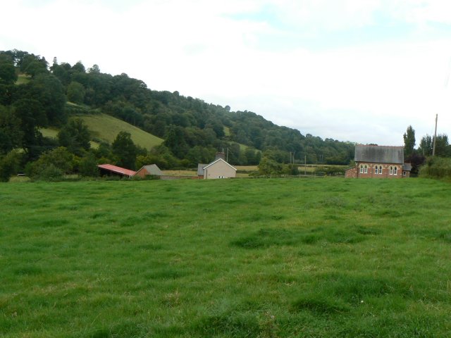
Pant Wood

Wood, Forest in Montgomeryshire

Wales

Pant Wood

The Newtown/Llanfair Road On an unremittingly cold, dull, damp Christmas Day.
I risked the hazard of venturing out a little before noon, when some folk are zooming along the lanes to wherever they are being fed their Christmas lunch. I met and avoided a few. The risk was greater for the jogger who greeted me as he passed, he must be fit, it's a long, winding hill, I can't walk and talk on that sort of gradient.
The Newtown/Llanfair Road Credit: Penny Mayes

Pant Wood, located in Montgomeryshire, is a picturesque forest known for its natural beauty and diverse wildlife. The wood covers an expansive area, providing a serene escape for nature enthusiasts and outdoor lovers.

The forest is primarily composed of deciduous trees, such as oak, beech, and ash, which create a vibrant display of colors during the autumn months. The canopy of the trees forms a dense cover, allowing only dappled sunlight to filter through, creating a tranquil and peaceful atmosphere.

Pant Wood is home to a wide variety of wildlife, including deer, badgers, foxes, and numerous bird species. Birdwatchers can spot species such as woodpeckers, owls, and various songbirds while exploring the woodland trails. The forest also supports a diverse range of plant life, with carpets of bluebells and wild garlic visible in the spring.

The wood offers numerous walking trails and paths, allowing visitors to explore its hidden corners and discover its natural wonders. These paths are well-maintained and provide a great opportunity for both leisurely strolls and more challenging hikes.

Pant Wood has a rich history, with evidence of human activity dating back centuries. Remnants of ancient settlements and earthworks can be found within the forest, adding to its historical significance.

Overall, Pant Wood is a stunning natural treasure in Montgomeryshire, offering visitors a chance to immerse themselves in the beauty of nature and experience the peacefulness of a well-preserved woodland.

If you have any feedback on the listing, please let us know in the comments section below.

Pant Wood Images

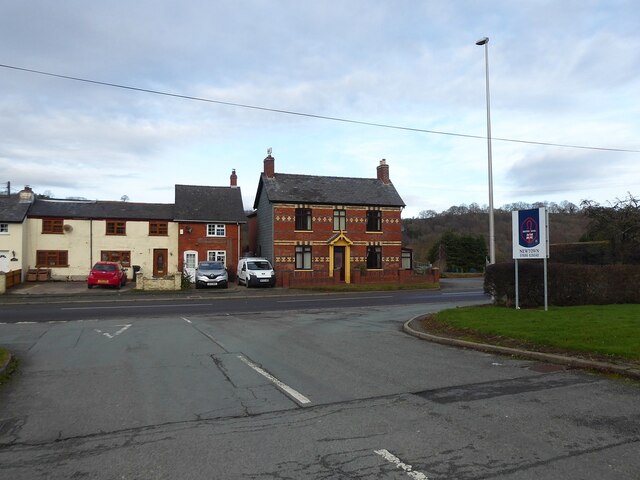
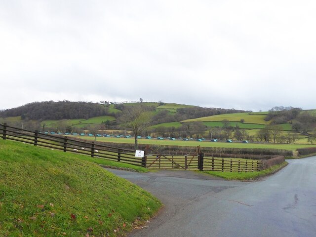
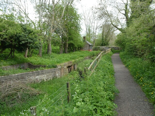
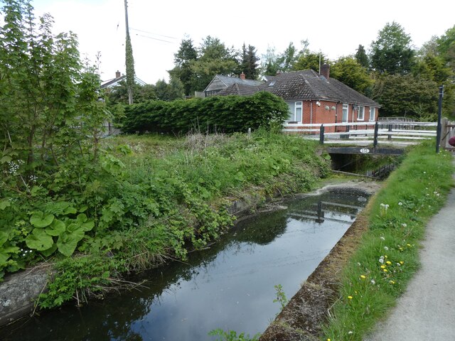
Images are sourced within 2km of 52.537556/-3.2886562 or Grid Reference SO1294. Thanks to Geograph Open Source API. All images are credited.

The Newtown/Llanfair Road On an unremittingly cold, dull, damp Christmas Day.
I risked the hazard of venturing out a little before noon, when some folk are zooming along the lanes to wherever they are being fed their Christmas lunch. I met and avoided a few. The risk was greater for the jogger who greeted me as he passed, he must be fit, it's a long, winding hill, I can't walk and talk on that sort of gradient.
The Newtown/Llanfair Road
On an unremittingly cold, dull, damp Christmas Day. I risked the hazard of venturing out a little before noon, when some folk are zooming along the lanes to wherever they are being fed their Christmas lunch. I met and avoided a few. The risk was greater for the jogger who greeted me as he passed, he must be fit, it's a long, winding hill, I can't walk and talk on that sort of gradient.
View to Highgate from the Newtown/Llanfair Road On an unremittingly cold, dull, damp Christmas Day.
I risked the hazard of venturing out a little before noon, when some folk are zooming along the lanes to wherever they are being fed their Christmas lunch. I met and avoided a few. The risk was greater for the jogger who greeted me as he passed, he must be fit, it's a long, winding hill, I can't walk and talk on that sort of gradient.
View to Highgate from the Newtown/Llanfair Road
On an unremittingly cold, dull, damp Christmas Day. I risked the hazard of venturing out a little before noon, when some folk are zooming along the lanes to wherever they are being fed their Christmas lunch. I met and avoided a few. The risk was greater for the jogger who greeted me as he passed, he must be fit, it's a long, winding hill, I can't walk and talk on that sort of gradient.
Eastern junction of Heol Dyffryn with Pool Road Gro Cottages and Gro Villa, across the road.
See <a title="https://www.geograph.org.uk/photo/7104429" href="https://www.geograph.org.uk/photo/7104429">Link</a> for a closer view of Gro Villa.
Eastern junction of Heol Dyffryn with Pool Road
Gro Cottages and Gro Villa, across the road. See Link for a closer view of Gro Villa.
Gro Villa, Pool Road, Newtown A fine example of polychromatic brick decoration, frequently seen in the area in various designs.
Gro Villa, Pool Road, Newtown
A fine example of polychromatic brick decoration, frequently seen in the area in various designs.
Llanllwchaiarn Church
Animal shelters near Highgate I'm not sure what sort of livestock they are for - pigs, game birds or something else?
Animal shelters near Highgate
I'm not sure what sort of livestock they are for - pigs, game birds or something else?
Severn Way (NCN81) in Llanllwchaiarn The National Cycle Network is a network of cycle routes. It was created by the charity Sustrans <span class="nowrap"><a title="http://www.sustrans.org.uk/what-we-do/national-cycle-network" rel="nofollow ugc noopener" href="http://www.sustrans.org.uk/what-we-do/national-cycle-network">Link</a><img style="margin-left:2px;" alt="External link" title="External link - shift click to open in new window" src="https://s1.geograph.org.uk/img/external.png" width="10" height="10"/></span>  (Sustainable Transport), aided by a National Lottery grant.

Many routes aim to minimise contact with motor traffic, though 70% of them are on roads. In some cases the NCN uses pedestrian routes, disused railways, minor roads, canal towpaths, or traffic-calmed routes in towns and cities.
Severn Way (NCN81) in Llanllwchaiarn
The National Cycle Network is a network of cycle routes. It was created by the charity Sustrans LinkExternal link (Sustainable Transport), aided by a National Lottery grant. Many routes aim to minimise contact with motor traffic, though 70% of them are on roads. In some cases the NCN uses pedestrian routes, disused railways, minor roads, canal towpaths, or traffic-calmed routes in towns and cities.
Bridge over Severn Way (NCN81), Llanllwchaiarn The National Cycle Network is a network of cycle routes. It was created by the charity Sustrans <span class="nowrap"><a title="http://www.sustrans.org.uk/what-we-do/national-cycle-network" rel="nofollow ugc noopener" href="http://www.sustrans.org.uk/what-we-do/national-cycle-network">Link</a><img style="margin-left:2px;" alt="External link" title="External link - shift click to open in new window" src="https://s1.geograph.org.uk/img/external.png" width="10" height="10"/></span>  (Sustainable Transport), aided by a National Lottery grant.

Many routes aim to minimise contact with motor traffic, though 70% of them are on roads. In some cases the NCN uses pedestrian routes, disused railways, minor roads, canal towpaths, or traffic-calmed routes in towns and cities.
Bridge over Severn Way (NCN81), Llanllwchaiarn
The National Cycle Network is a network of cycle routes. It was created by the charity Sustrans LinkExternal link (Sustainable Transport), aided by a National Lottery grant. Many routes aim to minimise contact with motor traffic, though 70% of them are on roads. In some cases the NCN uses pedestrian routes, disused railways, minor roads, canal towpaths, or traffic-calmed routes in towns and cities.
Severn Way  (NCN81), Llanllwchaiarn
Severn Way (NCN81), Llanllwchaiarn
Severn Way (NCN81) east of Llanllwchaiarn The National Cycle Network is a network of cycle routes. It was created by the charity Sustrans <span class="nowrap"><a title="http://www.sustrans.org.uk/what-we-do/national-cycle-network" rel="nofollow ugc noopener" href="http://www.sustrans.org.uk/what-we-do/national-cycle-network">Link</a><img style="margin-left:2px;" alt="External link" title="External link - shift click to open in new window" src="https://s1.geograph.org.uk/img/external.png" width="10" height="10"/></span>  (Sustainable Transport), aided by a National Lottery grant.

Many routes aim to minimise contact with motor traffic, though 70% of them are on roads. In some cases the NCN uses pedestrian routes, disused railways, minor roads, canal towpaths, or traffic-calmed routes in towns and cities.
Severn Way (NCN81) east of Llanllwchaiarn
The National Cycle Network is a network of cycle routes. It was created by the charity Sustrans LinkExternal link (Sustainable Transport), aided by a National Lottery grant. Many routes aim to minimise contact with motor traffic, though 70% of them are on roads. In some cases the NCN uses pedestrian routes, disused railways, minor roads, canal towpaths, or traffic-calmed routes in towns and cities.
Severn Way (NCN81) west of Dolfor The National Cycle Network is a network of cycle routes. It was created by the charity Sustrans <span class="nowrap"><a title="http://www.sustrans.org.uk/what-we-do/national-cycle-network" rel="nofollow ugc noopener" href="http://www.sustrans.org.uk/what-we-do/national-cycle-network">Link</a><img style="margin-left:2px;" alt="External link" title="External link - shift click to open in new window" src="https://s1.geograph.org.uk/img/external.png" width="10" height="10"/></span>  (Sustainable Transport), aided by a National Lottery grant.

Many routes aim to minimise contact with motor traffic, though 70% of them are on roads. In some cases the NCN uses pedestrian routes, disused railways, minor roads, canal towpaths, or traffic-calmed routes in towns and cities.
Severn Way (NCN81) west of Dolfor
The National Cycle Network is a network of cycle routes. It was created by the charity Sustrans LinkExternal link (Sustainable Transport), aided by a National Lottery grant. Many routes aim to minimise contact with motor traffic, though 70% of them are on roads. In some cases the NCN uses pedestrian routes, disused railways, minor roads, canal towpaths, or traffic-calmed routes in towns and cities.
Severn Way (NCN81) in riverside woodland west of Dolfor The National Cycle Network is a network of cycle routes. It was created by the charity Sustrans <span class="nowrap"><a title="http://www.sustrans.org.uk/what-we-do/national-cycle-network" rel="nofollow ugc noopener" href="http://www.sustrans.org.uk/what-we-do/national-cycle-network">Link</a><img style="margin-left:2px;" alt="External link" title="External link - shift click to open in new window" src="https://s1.geograph.org.uk/img/external.png" width="10" height="10"/></span>  (Sustainable Transport), aided by a National Lottery grant.

Many routes aim to minimise contact with motor traffic, though 70% of them are on roads. In some cases the NCN uses pedestrian routes, disused railways, minor roads, canal towpaths, or traffic-calmed routes in towns and cities.
Severn Way (NCN81) in riverside woodland west of Dolfor
The National Cycle Network is a network of cycle routes. It was created by the charity Sustrans LinkExternal link (Sustainable Transport), aided by a National Lottery grant. Many routes aim to minimise contact with motor traffic, though 70% of them are on roads. In some cases the NCN uses pedestrian routes, disused railways, minor roads, canal towpaths, or traffic-calmed routes in towns and cities.
Severn Way (NCN81) at Dolfor Lock on Montgomery Canal
Overgrown canal at Dolfor Lock on Montgomery Canal The Severn Way (NCN81) runs beside this.
Overgrown canal at Dolfor Lock on Montgomery Canal
The Severn Way (NCN81) runs beside this.
Dried section of Montgomery Canal at Freestone
Montgomery Canal
Montgomery Canal
Canal bridge at Aberbechan
House and canal bridge at Aberbechan
Show me another place!

Pant Wood is located at Grid Ref: SO1294 (Lat: 52.537556, Lng: -3.2886562)

Unitary Authority: Powys

Police Authority: Dyfed Powys

What 3 Words

///newlyweds.appetite.stamp. Near Newtown, Powys

Related Wikis

Aberbechan Hall

Aberbechan Hall was a timber framed mansion in the township of Aberbechan within the parish of Llanllwchaearn in the historic county of Montgomeryshire...

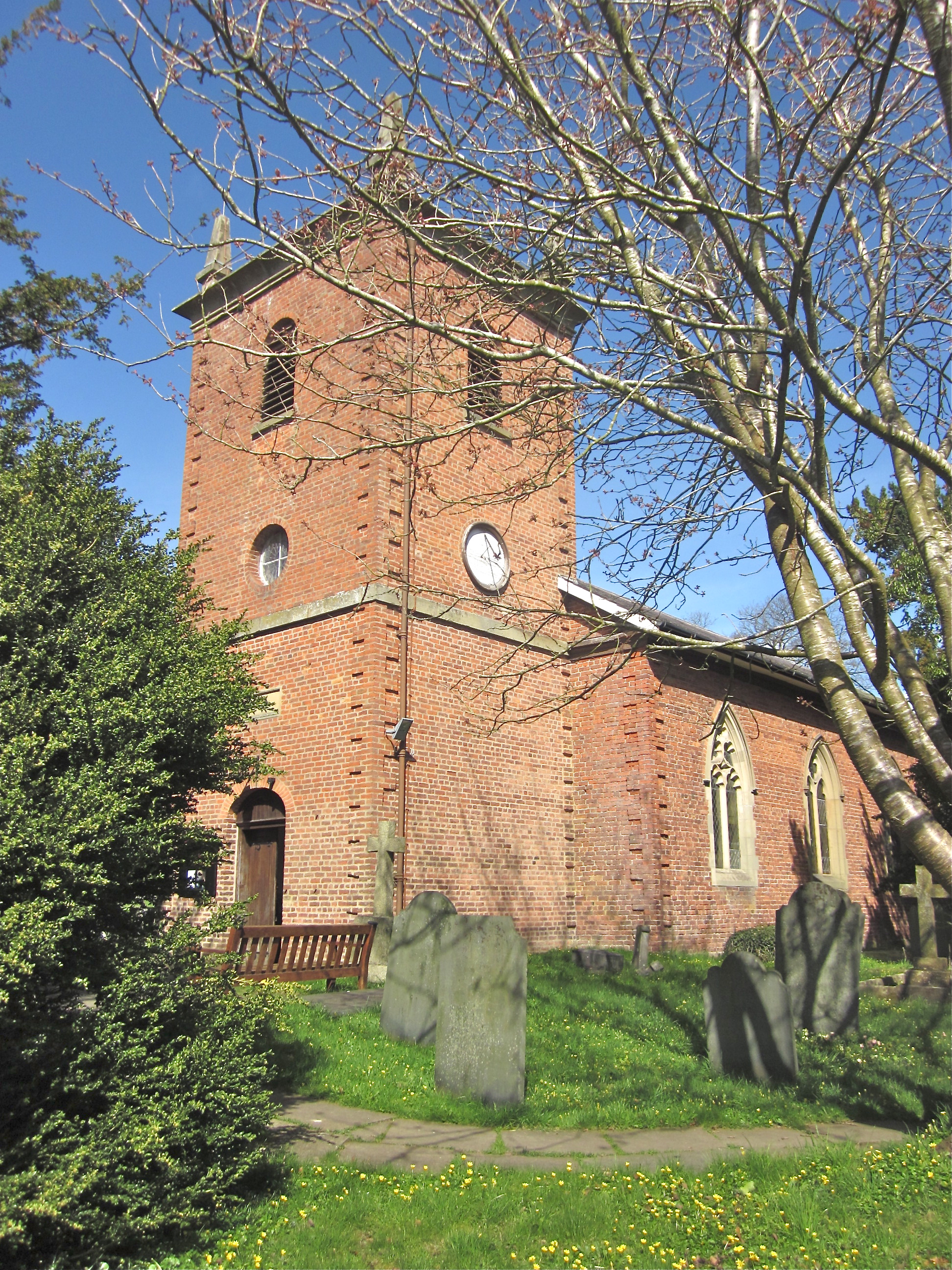
St Llwchaiarn's Church, Llanllwchaiarn

St Llwchaiarn's church, Llanllwchaiarn was the parish church of Llanllwchaiarn, now within the community of Newtown with Llanllwchaiarn and lies within...

Aberbechan

Aberbechan was formerly a township in the parish of Llanllwchaearn in the historic county of Montgomeryshire. The township of Aberbechan was transferred...

Penarth (Newtown and Llanllwchaiarn)

Penarth is a timber-framed house set back from the A483 road near to Newtown, Wales, close to the banks of the river Severn. It is within the parish...

Nearby Amenities

Located within 500m of 52.537556,-3.2886562
Power: pole
Lat/Long: 52.538345/-3.2816398
Power: pole
Lat/Long: 52.539531/-3.2838044
Power: pole
Lat/Long: 52.5401688/-3.2861164
Power: pole
Lat/Long: 52.5408573/-3.2886136
Power: pole
Lat/Long: 52.5418442/-3.2906413
Ford: yes
Lat/Long: 52.538265/-3.2813674
The data included in this document is from www.openstreetmap.org. The data is made available under ODbL.

Have you been to Pant Wood?

Leave your review of Pant Wood below (or comments, questions and feedback).