Coed y Cornel-cae
Wood, Forest in Flintshire
Wales
Coed y Cornel-cae

Coed y Cornel-cae is a picturesque woodland located in Flintshire, Wales. Covering an area of approximately 50 acres, it is a haven for nature enthusiasts and those seeking tranquility amidst lush greenery. The woodland is situated near the village of Caerwys and is easily accessible by road.
The forest is predominantly made up of native tree species, including oak, ash, beech, and birch. These trees create a dense canopy, providing shade and shelter for a diverse range of flora and fauna. Bluebells, wild garlic, and ferns carpet the forest floor, painting a vibrant scene during the spring months.
The woodland is crisscrossed by a network of footpaths and trails, allowing visitors to explore its beauty at their own pace. These paths lead to scenic viewpoints, where one can marvel at the panoramic vistas of the surrounding countryside. The forest is also home to a variety of wildlife, including birds, squirrels, and deer, which can often be spotted during a leisurely walk.
Coed y Cornel-cae is not only a place of natural beauty but also holds historical significance. It is believed to have been part of an ancient royal hunting ground and has remnants of an Iron Age fort within its boundaries. These historical features add to the charm and intrigue of the woodland.
Overall, Coed y Cornel-cae offers a tranquil escape from the hustle and bustle of everyday life. Whether it's a leisurely stroll, birdwatching, or simply enjoying the serenity of nature, this woodland is a must-visit destination for nature lovers and history enthusiasts alike.
If you have any feedback on the listing, please let us know in the comments section below.
Coed y Cornel-cae Images
Images are sourced within 2km of 53.287596/-3.313085 or Grid Reference SJ1277. Thanks to Geograph Open Source API. All images are credited.


Coed y Cornel-cae is located at Grid Ref: SJ1277 (Lat: 53.287596, Lng: -3.313085)
Unitary Authority: Flintshire
Police Authority: North Wales
What 3 Words
///tickling.tightest.lamps. Near Whitford, Flintshire
Nearby Locations
Related Wikis
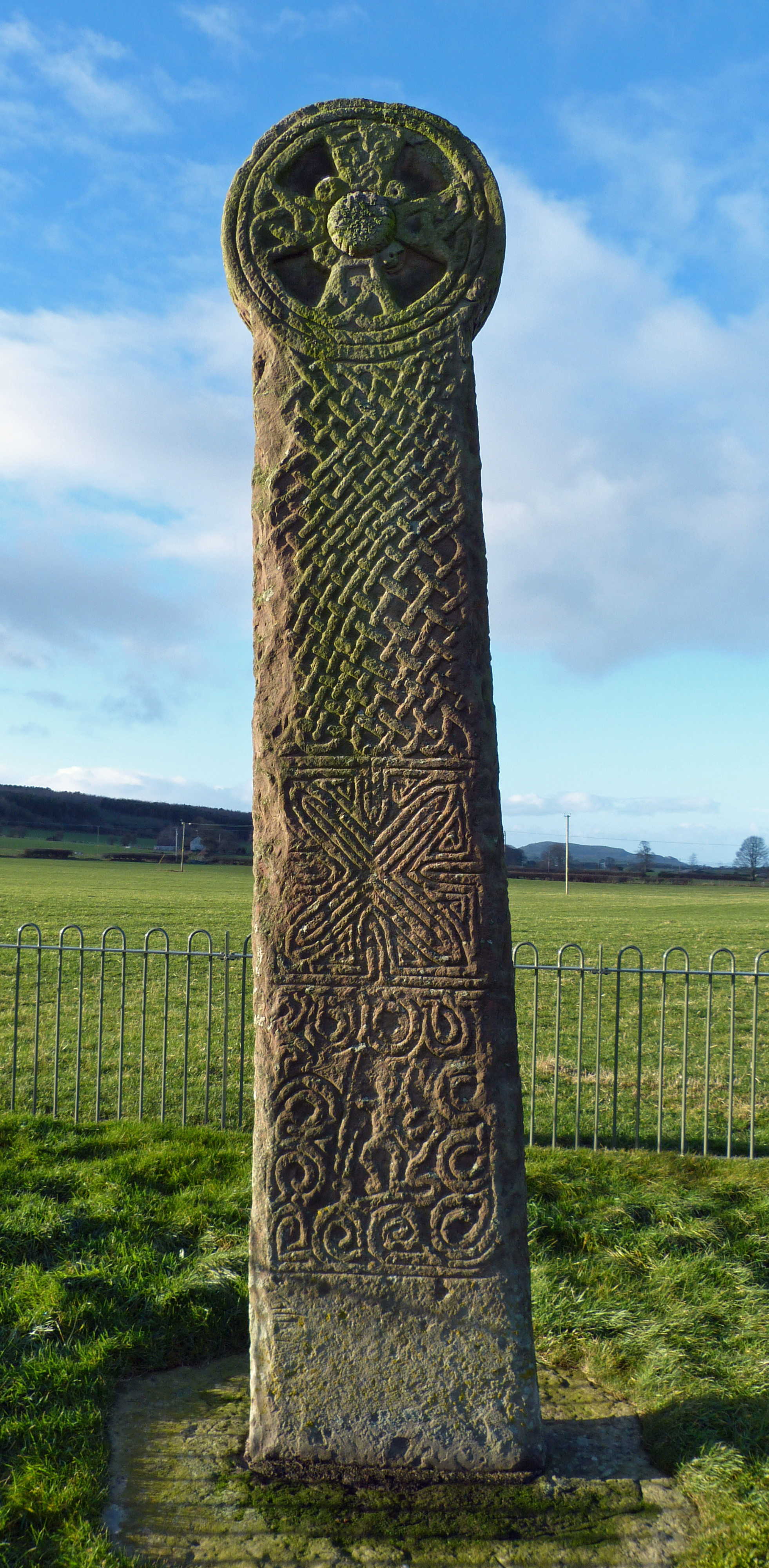
Maen Achwyfan Cross
Maen Achwyfan Cross (Welsh: Maen Achwyfan, Croes Maen Achwyfan), located near the village of Whitford, Flintshire, Wales, is a high cross dating from the...
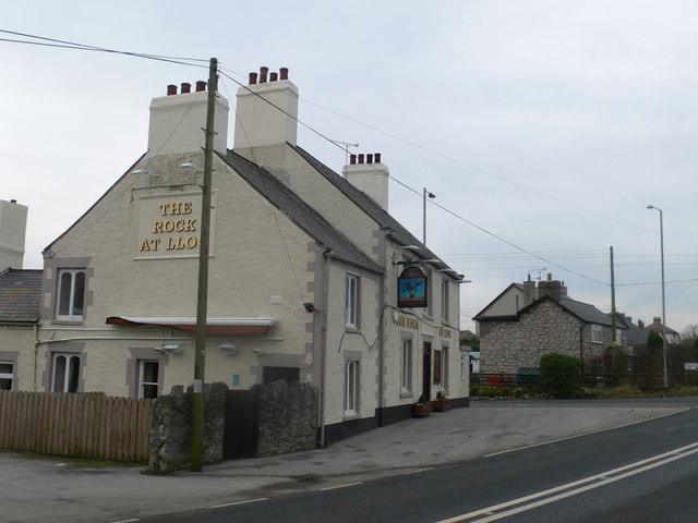
Lloc
Lloc is a small village in Flintshire, north Wales. It is located within the community of Whitford. It lies north of the Clwydian Range, just east of the...

Whitford, Flintshire
Whitford (Welsh: Chwitffordd) is a village, community and an electoral ward near Holywell in Flintshire, northeast Wales. The population of both the community...

Church of St Beuno and St Mary
The Church of St Beuno and St Mary is a Grade I listed church in Whitford, overlooking the estuary of the river Dee. The church has a well preserved late...
Nearby Amenities
Located within 500m of 53.287596,-3.313085Have you been to Coed y Cornel-cae?
Leave your review of Coed y Cornel-cae below (or comments, questions and feedback).