Byfleet
Settlement in Surrey Woking
England
Byfleet
Byfleet is a small village located in the county of Surrey, England. Situated approximately 20 miles southwest of central London, Byfleet is part of the borough of Woking. The village is well-connected, with easy access to major transportation routes, including the M25 motorway and the A3, providing convenient links to London and other major cities.
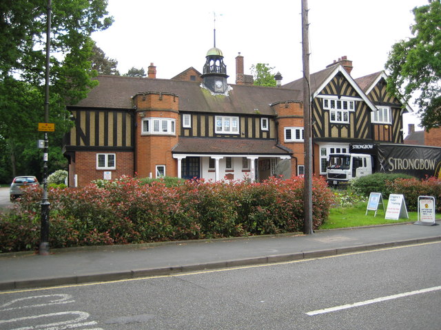
Byfleet has a long history dating back to the Saxon period, and evidence of its rich past can still be seen in certain areas. The village features a mix of architectural styles, ranging from old cottages to modern developments. The village center is a bustling hub, offering a variety of local amenities, including shops, cafés, and restaurants, catering to the needs of residents and visitors alike.
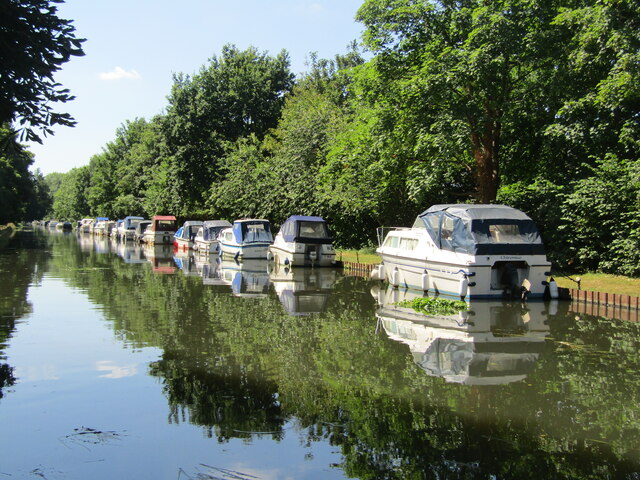
Nature enthusiasts can enjoy the scenic beauty of Byfleet, as the village is surrounded by picturesque countryside and is located close to the River Wey. The area offers several opportunities for outdoor activities, such as walking and cycling, with numerous footpaths and trails to explore.
Byfleet is home to a close-knit community, with a range of social and recreational clubs and organizations. The village also has several schools, making it an attractive location for families. Additionally, Byfleet benefits from its proximity to the larger towns of Woking and Guildford, where residents can access a wider range of services and amenities.
Overall, Byfleet offers a charming mix of history, natural beauty, and modern conveniences, making it a desirable place to live or visit in Surrey.
If you have any feedback on the listing, please let us know in the comments section below.
Byfleet Images
Images are sourced within 2km of 51.340521/-0.474418 or Grid Reference TQ0661. Thanks to Geograph Open Source API. All images are credited.
![Brooklands - Napier Railton - Lap record holder This monster of a car was designed by Reid Railton using a 24-litre W12 (3 banks of 4 cylinders)* Napier Lion aero engine. It was manufactured by Thomson & Taylor who were based at Brooklands. It had been commissioned by amateur racing driver (and three times holder of the World Land Speed record) John Cobb. It is thought that this car cost him around £10,000 in 1933 - more than a million in today's money.
On 7th October 1935 Cobb set the Brooklands Lap Record, completing the circuit in just 69 seconds at an average 143.44mph - see <span class="nowrap"><a title="https://www.brooklandsmuseum.com/about/latest-news/80th-anniversary-of-the-napier-railtons-ultimate-outer-lap-record#:~:text=On%20the%207th%20October%201935,beaten%20average%20of%20143.44mph" rel="nofollow ugc noopener" href="https://www.brooklandsmuseum.com/about/latest-news/80th-anniversary-of-the-napier-railtons-ultimate-outer-lap-record#:~:text=On%20the%207th%20October%201935,beaten%20average%20of%20143.44mph">Link</a><img style="margin-left:2px;" alt="External link" title="External link - shift click to open in new window" src="https://s1.geograph.org.uk/img/external.png" width="10" height="10"/></span> for more details of this run.
Its fuel tank holds 65 gallons, which at today&#039;s [2022] petrol prices would cost about £500 to fill - mind you, it needs a decent sized tank as it only manages about 5mpg!
This car is still in perfect running order and is often seen around the country at events such as the Goodwood Festival of Speed.
* Engine details: High compression version (6.1:1) (RAF specification). Naturally aspirated (no supercharger) Napier Lion aero engine. W12 (broad arrow) cylinder configuration of 23.944 litres capacity. Producing 580 bhp (433 kW) at 2585rpm (recorded at 5,000ft), and 1,250 pound-foot (1.695 kNm) of torque.](https://s2.geograph.org.uk/geophotos/07/12/06/7120698_83e9f0cd.jpg)
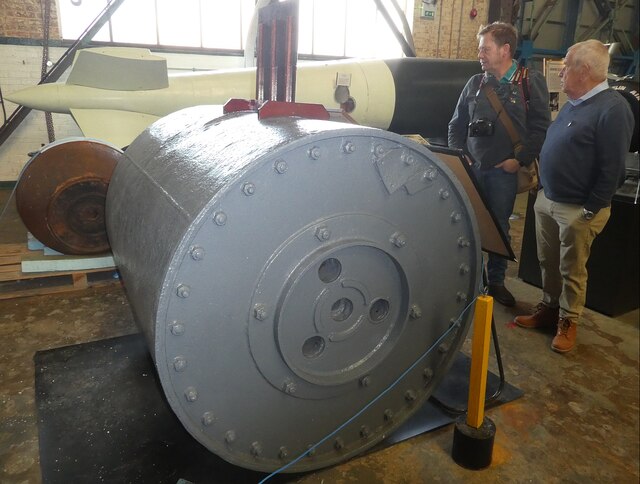
![Brooklands - Rolls Royce Merlin Engine Mk61 The Rolls Royce Merlin Engine was fitted to many iconic WWII aircraft including the Hawker Hurricane (fighter) from its prototype in 1935, the Vickers Wellington (bomber) and Supermarine Spitfire (fighter). The Mk61 seen here was developed in 1942 and was fitted to the Spitfire Mk IX and XI, the latter being a photo-reconnaissance aircraft.
The engine specification for the Mk61 is:
Upright 60° V12 (12 cylinder)
1260bhp (940kW)
27 litre (1637 cu in)
Bore 5.4&quot; (137mm)
Stroke 6&quot; (152mm)
[Note: Assuming the capacity and bore are correct, the stroke is probably nearer 5.95&quot; than 6&quot;]](https://s2.geograph.org.uk/geophotos/07/12/09/7120986_05bb7416.jpg)

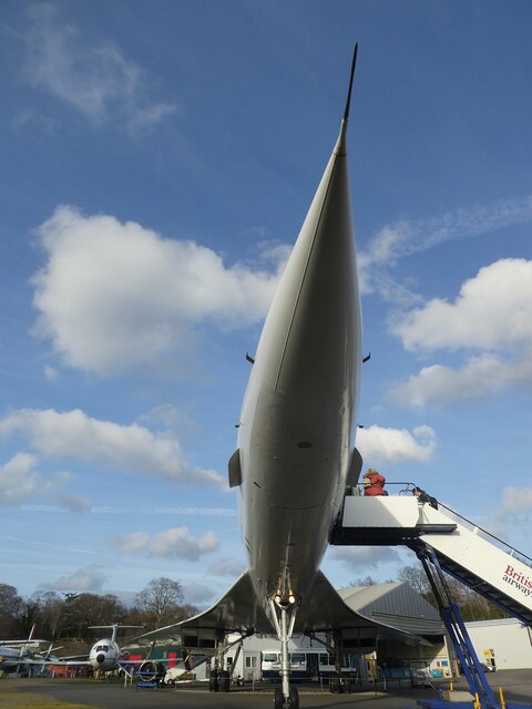
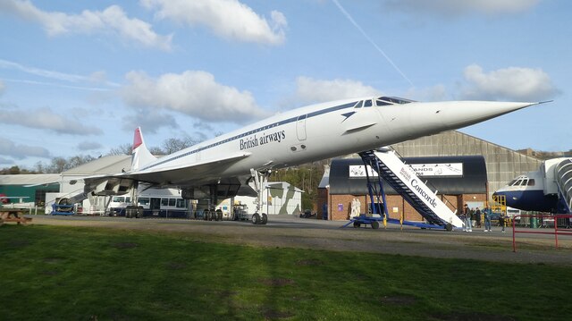
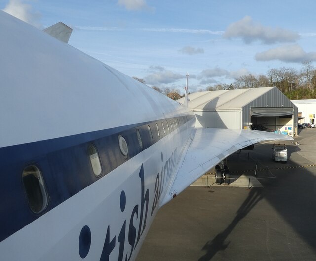
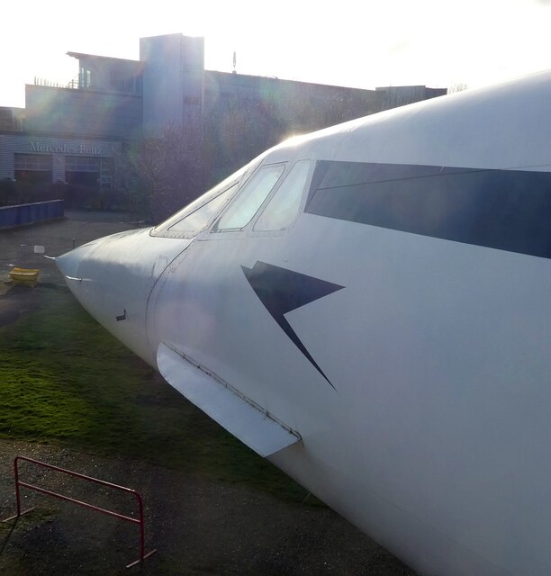
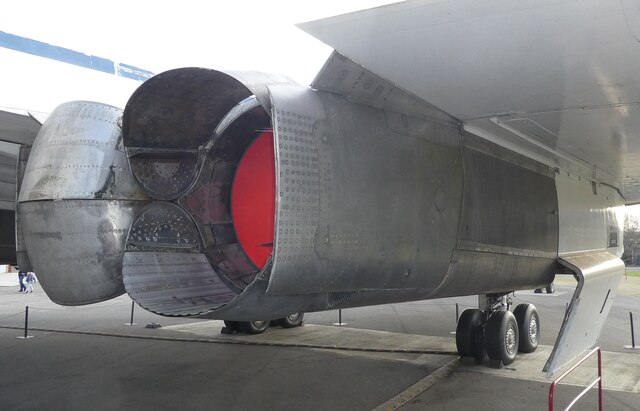
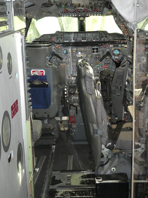
![Brooklands - Concorde 202 G-BBDG ('Delta Golf') A view of Concorde 202 G-BBDG (&#039;Delta Golf&#039;) looking along its fuselage from its pointed nosecone. G-BBDG was the first plane in history to carry 100 passengers at twice the speed of sound. It also has the distinction of having been used as the training plane for every Concorde pilot.
If you visit Brooklands, you can pay a little extra [£6 as of 2022] to enjoy the Concorde Experience where you go onboard and learn a lot of interesting facts about this amazing piece of engineering.](https://s1.geograph.org.uk/geophotos/07/12/12/7121285_96ce0c87.jpg)

Byfleet is located at Grid Ref: TQ0661 (Lat: 51.340521, Lng: -0.474418)
Administrative County: Surrey
District: Woking
Police Authority: Surrey
What 3 Words
///than.rates.deed. Near West Byfleet, Surrey
Nearby Locations
Related Wikis
Byfleet
Byfleet is a village in Surrey, England. It is located in the far east of the borough of Woking, around 1.5 miles (2.4 km) east of West Byfleet, from which...

British Aerospace Company Ground
British Aerospace Company Ground was a cricket ground in Byfleet, Surrey. The ground was built as a works venue for the nearby Vickers-Armstrongs factory...

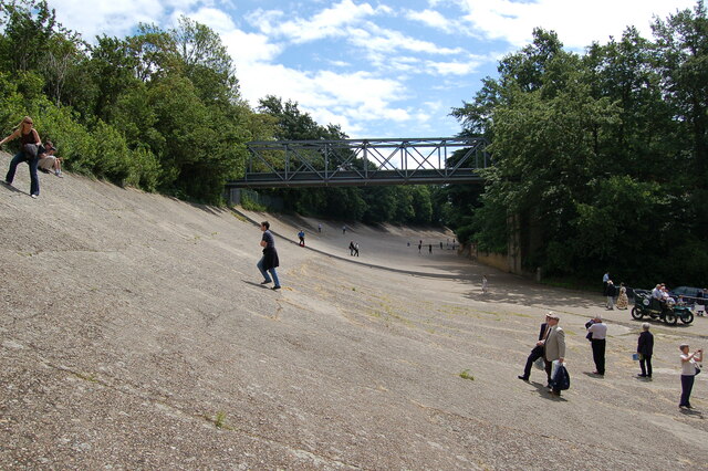
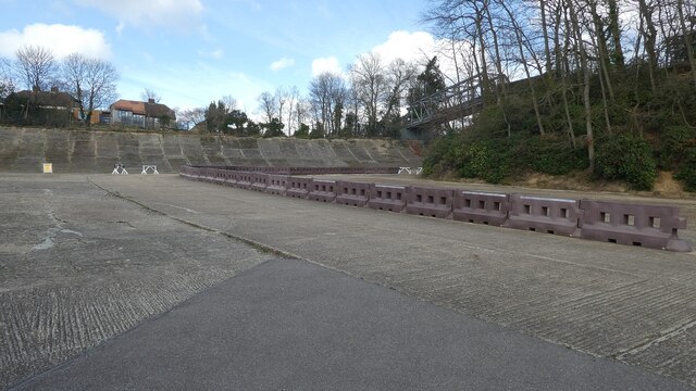
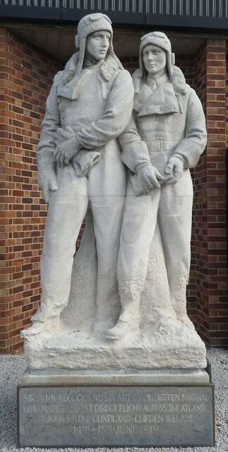
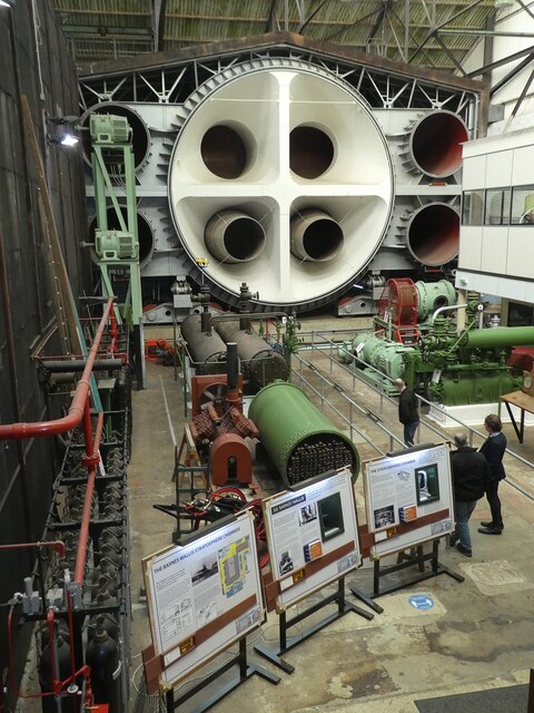
Brooklands
Brooklands was a 2.767-mile (4.453 km) motor racing circuit and aerodrome built near Weybridge in Surrey, England, United Kingdom. It opened in 1907 and...
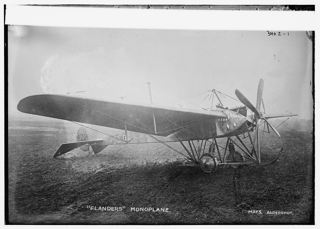
1912 Brooklands Flanders Monoplane crash
The 1912 Brooklands Flanders Monoplane crash was the first aviation accident in which an investigation was made into the cause of the accident and a report...
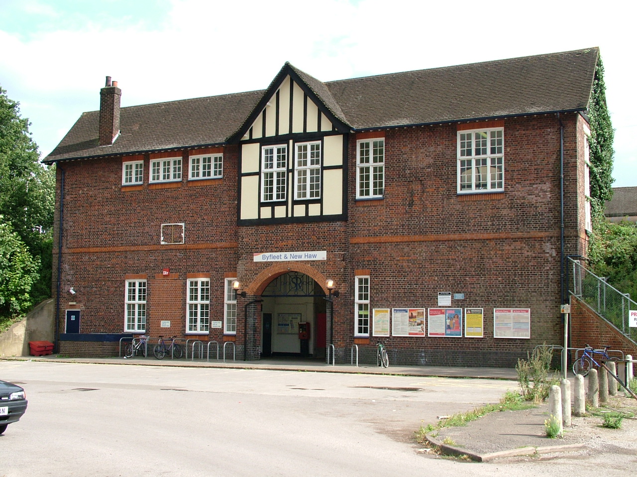
Byfleet & New Haw railway station
Byfleet & New Haw railway station is on the London to Woking line, operated by South Western Railway. The station is at the northern edge of Byfleet with...
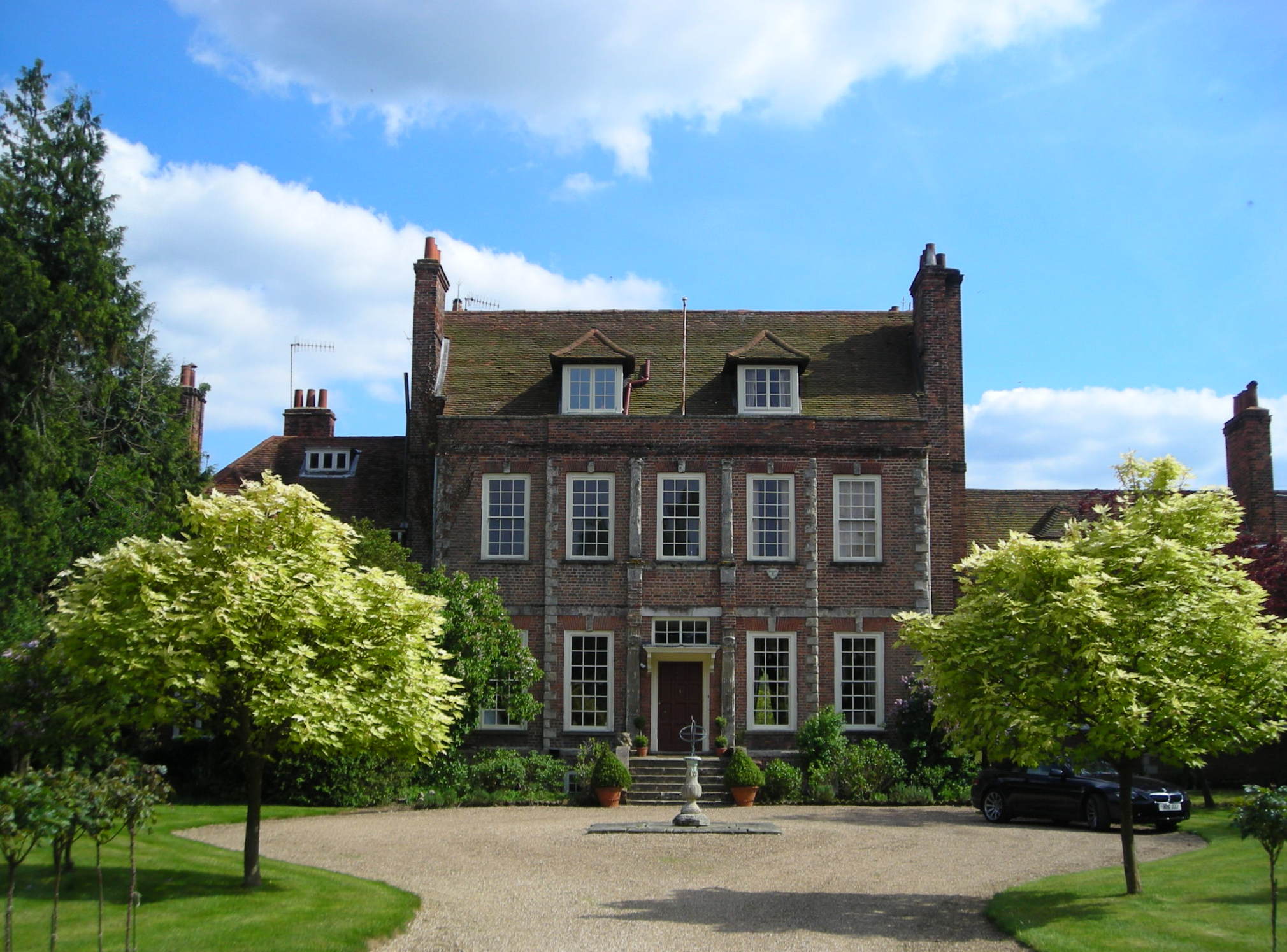
Byfleet Manor
Byfleet Manor is a Grade II* listed house in Byfleet, Surrey, England. Byfleet Manor has been used as a filming location in three television series, most...
1937 Campbell Trophy
The 1937 Campbell Trophy (formally known as I Campbell Trophy) was a Grand Prix that was held on 1 May 1937 at Brooklands near Weybridge, United Kingdom...
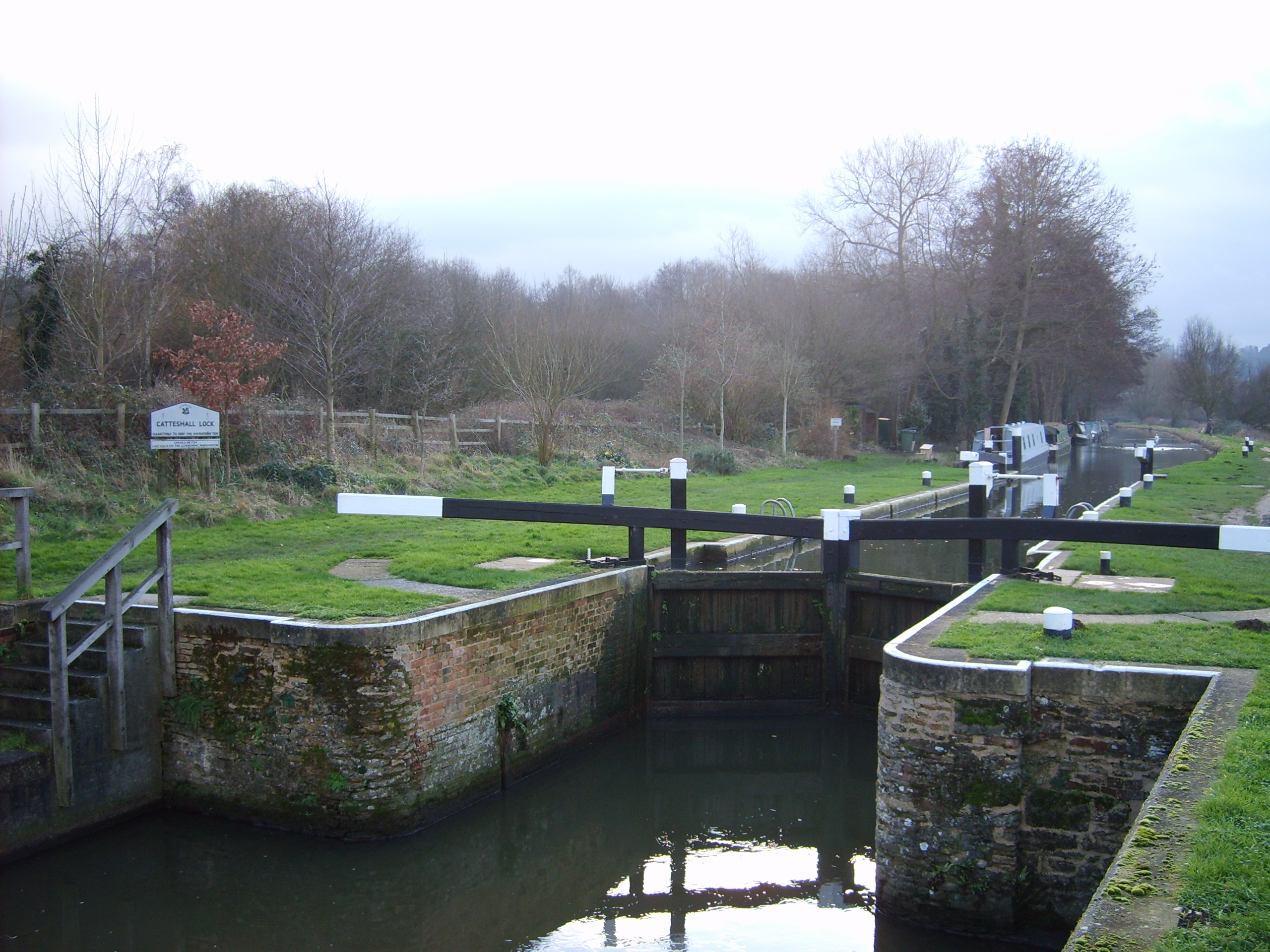
Wey and Godalming Navigations
The River Wey Navigation and Godalming Navigation together provide a 20-mile (32 km) continuous navigable route from the River Thames near Weybridge via...
Nearby Amenities
Located within 500m of 51.340521,-0.474418Have you been to Byfleet?
Leave your review of Byfleet below (or comments, questions and feedback).