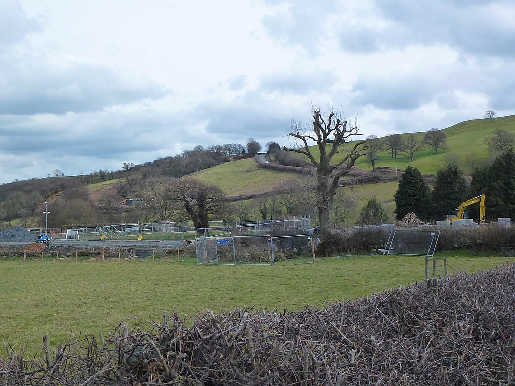
Brimmon Wood

Wood, Forest in Montgomeryshire

Wales

Brimmon Wood

Looking towards the Newtown Bypass construction Mochdre Industrial Estate (<a href="https://www.geograph.org.uk/gridref/SO0990">SO0990</a>) just right of centre.
Looking towards the Newtown Bypass construction Credit: Penny Mayes

The requested URL returned error: 429 Too Many Requests

If you have any feedback on the listing, please let us know in the comments section below.

Brimmon Wood Images

Images are sourced within 2km of 52.507109/-3.2989338 or Grid Reference SO1190. Thanks to Geograph Open Source API. All images are credited.

Looking towards the Newtown Bypass construction Mochdre Industrial Estate (<a href="https://www.geograph.org.uk/gridref/SO0990">SO0990</a>) just right of centre.
Looking towards the Newtown Bypass construction
Mochdre Industrial Estate (SO0990) just right of centre.
Newtown Bypass construction I think this is a base for the construction team beside the Dolfor Road.
Newtown Bypass construction
I think this is a base for the construction team beside the Dolfor Road.
Last of the snow On the ridge road to Dolfor.
We had heavy snow falls a couple of weeks previously and I'm guessing when this road was cleared a lot was piled up in this wider spot which usually serves as a passing place. Being north facing with a bank and hedge behind it, direct sun did not play any part in shifting it.
Last of the snow
On the ridge road to Dolfor. We had heavy snow falls a couple of weeks previously and I'm guessing when this road was cleared a lot was piled up in this wider spot which usually serves as a passing place. Being north facing with a bank and hedge behind it, direct sun did not play any part in shifting it.
Texel tup On the ridge road to Dolfor.
Texel tup
On the ridge road to Dolfor.
Snow on the mountains Looking west from the ridge road to Dolfor.
Snow on the mountains
Looking west from the ridge road to Dolfor.
Ewe with twin lambs
Ewe with twin lambs
Ewe with twin lambs
Ewe with twin lambs
Ewe with twin lambs
Ewe with twin lambs
The Berwyns under snow Viewed from the ridge road to Dolfor.
The Berwyns under snow
Viewed from the ridge road to Dolfor.
The Berwyns under snow Viewed from the ridge road to Dolfor with the eastern parts of Newtown in the foreground.
Heading north, left of centre, is Llanfair Road; the big house to its right is Plas-y-Bryn. The white terraces closer to the camera are Coed y Ffridd with the Barnfields estate between the two and houses around Canal Road between Coed y Ffridd and the river which is marked by the line of trees just visible beyond the grassy slopes of the ridge.

See <a title="https://www.geograph.org.uk/photo/5966304" href="https://www.geograph.org.uk/photo/5966304">Link</a> for a closer look at the mountains.
See <a title="https://www.geograph.org.uk/photo/5966364" href="https://www.geograph.org.uk/photo/5966364">Link</a> for a closer look at the town.
The Berwyns under snow
Viewed from the ridge road to Dolfor with the eastern parts of Newtown in the foreground. Heading north, left of centre, is Llanfair Road; the big house to its right is Plas-y-Bryn. The white terraces closer to the camera are Coed y Ffridd with the Barnfields estate between the two and houses around Canal Road between Coed y Ffridd and the river which is marked by the line of trees just visible beyond the grassy slopes of the ridge. See Link for a closer look at the mountains. See Link for a closer look at the town.
Old Milestone by the A483, Dolfor Road, Newtown Stone post by the A483, in parish of Newtown and Llanllwchaiarn  (Powys District), opposite Black Hall, on verge.

Broken, and more recent major roadworks suggest it may be lost.

Inscription once read:-
(NEWTOWN 1)
(BUILTH 34)

Surveyed

Milestone Society National ID: MOT_NTBU01
Old Milestone by the A483, Dolfor Road, Newtown
Stone post by the A483, in parish of Newtown and Llanllwchaiarn (Powys District), opposite Black Hall, on verge. Broken, and more recent major roadworks suggest it may be lost. Inscription once read:- (NEWTOWN 1) (BUILTH 34) Surveyed Milestone Society National ID: MOT_NTBU01
Roundabout on the recently completed Newtown bypass Roundabout and junction for the A483 South towards Llandrindod Wells on the recently opened Newtown bypass.
Roundabout on the recently completed Newtown bypass
Roundabout and junction for the A483 South towards Llandrindod Wells on the recently opened Newtown bypass.
Eastbound on the new Newtown bypass Eastbound on the recently completed and opened Newtown, Powys bypass.
Eastbound on the new Newtown bypass
Eastbound on the recently completed and opened Newtown, Powys bypass.
Black Hall, Newtown C17 timber framed building with later alterations and additions. It is listed Grade II.
Black Hall, Newtown
C17 timber framed building with later alterations and additions. It is listed Grade II.
Middle Dolfor Road, riding up in The Dingle A long slog uphill out of Newtown on a sunny afternoon
Middle Dolfor Road, riding up in The Dingle
A long slog uphill out of Newtown on a sunny afternoon
Show me another place!

Brimmon Wood is located at Grid Ref: SO1190 (Lat: 52.507109, Lng: -3.2989338)

Unitary Authority: Powys

Police Authority: Dyfed Powys

What 3 Words

///enrolling.boom.baseline. Near Newtown, Powys

Nearby Locations

Brimmon Wood

Related Wikis

Brimmon Oak

The Brimmon Oak is a veteran tree in Newtown, Powys, Wales. A pedunculate oak (sometimes called "English oak"), it is thought to be around 500 years old...

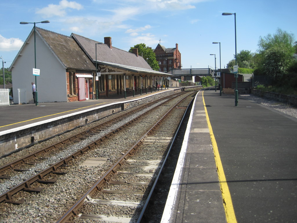
Newtown railway station (Wales)

Newtown railway station (Welsh: Y Drenewydd) is a railway station serving Newtown, Powys, Wales. == History == Newtown was the last major station before...

Newtown, Powys

Newtown (Welsh: Y Drenewydd) is a town in Powys, Wales. It lies on the River Severn in the community of Newtown and Llanllwchaiarn, within the historic...
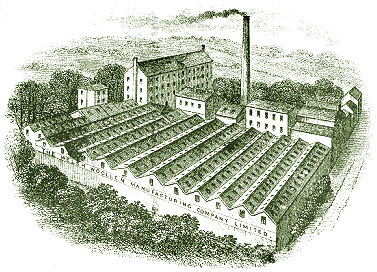
Cambrian Mills

The Cambrian Mills was a complex of woollen mill buildings in Newtown, Powys, Wales, that operated from 1856 to 1912, when they were destroyed by fire...

Nearby Amenities

Located within 500m of 52.507109,-3.2989338
Power: pole
Lat/Long: 52.5104734/-3.3034343
Power: pole
Lat/Long: 52.5111149/-3.3005389
Power: pole
Lat/Long: 52.5114218/-3.2986023
Power: pole
Lat/Long: 52.5107558/-3.3021482
Power: pole
Lat/Long: 52.5108439/-3.3010378
Power: pole
Lat/Long: 52.5104815/-3.3025774
Power: pole
Lat/Long: 52.5112063/-3.2995894
Power: pole
Lat/Long: 52.5114381/-3.2991334
Power: pole
Lat/Long: 52.5100734/-3.3043101
Building: yes
Lat/Long: 52.5079509/-3.2940942
Building: yes
Lat/Long: 52.504716/-3.2947989
The data included in this document is from www.openstreetmap.org. The data is made available under ODbL.

Have you been to Brimmon Wood?

Leave your review of Brimmon Wood below (or comments, questions and feedback).