Ciderhouse Wood

Wood, Forest in Montgomeryshire

Wales

Ciderhouse Wood

Old Milestone by the A483, east of Cwmyrhiwdre, Kerry Parish By the A483, in parish of Kerry (Powys District), South of Cwmyrhiwdre Brook Bridge, on verge.

Inscription reads:- : NEWTOWN / 7 MILES / BUILTH / 28 :

Surveyed

Milestone Society National ID: MOT_NTBU07.
Old Milestone by the A483, east of Cwmyrhiwdre, Kerry Parish Credit: Milestone Society

The requested URL returned error: 429 Too Many Requests

If you have any feedback on the listing, please let us know in the comments section below.

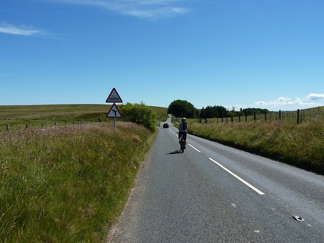
Ciderhouse Wood Images

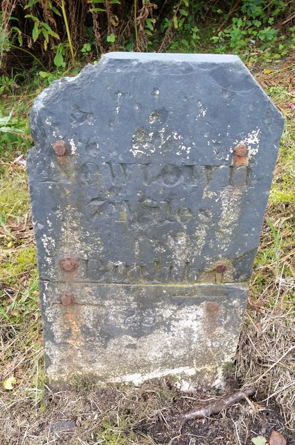
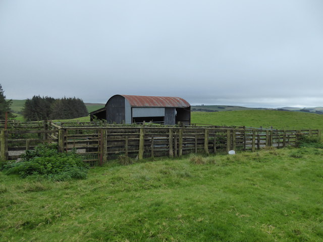
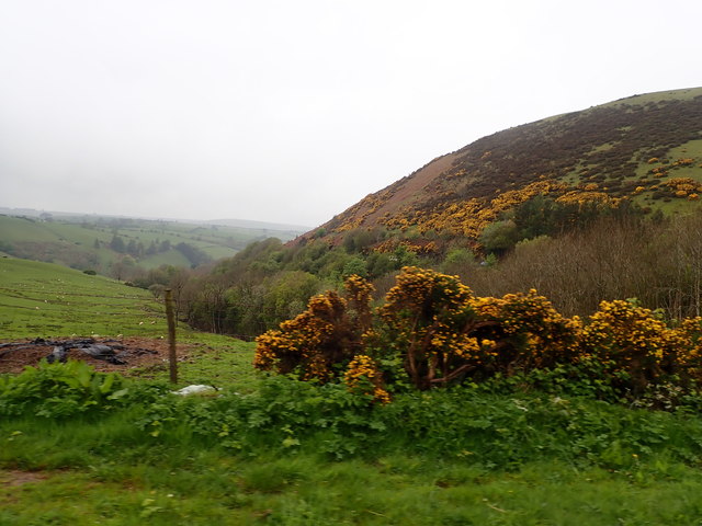
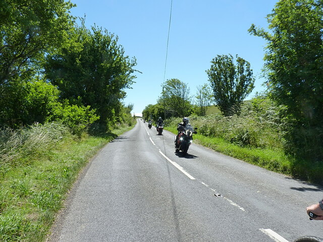
Images are sourced within 2km of 52.450316/-3.3127274 or Grid Reference SO1084. Thanks to Geograph Open Source API. All images are credited.

Old Milestone by the A483, east of Cwmyrhiwdre, Kerry Parish By the A483, in parish of Kerry (Powys District), South of Cwmyrhiwdre Brook Bridge, on verge.

Inscription reads:- : NEWTOWN / 7 MILES / BUILTH / 28 :

Surveyed

Milestone Society National ID: MOT_NTBU07.
Old Milestone by the A483, east of Cwmyrhiwdre, Kerry Parish
By the A483, in parish of Kerry (Powys District), South of Cwmyrhiwdre Brook Bridge, on verge. Inscription reads:- : NEWTOWN / 7 MILES / BUILTH / 28 : Surveyed Milestone Society National ID: MOT_NTBU07.
Mils Stone - Newtown 7 There is an Ordnance Survey Cut Mark on the stone which marked a point 1157.7ft above mean sea level. However the stone has been repositioned to the opposite side of the road and a little to the east.
Mils Stone - Newtown 7
There is an Ordnance Survey Cut Mark on the stone which marked a point 1157.7ft above mean sea level. However the stone has been repositioned to the opposite side of the road and a little to the east.
Pens and barn beside the path Old complex here.
Pens and barn beside the path
Old complex here.
Pond beside the track A nice little pond.
Pond beside the track
A nice little pond.
Path and track on the hill I wonder how often this is walked?
Path and track on the hill
I wonder how often this is walked?
Hillside path and track Near the top of the hill.
Hillside path and track
Near the top of the hill.
Path and track on the hill top Looking westwards.
Path and track on the hill top
Looking westwards.
Looking westwards, down onto the busy A483 road I've driven that section of this road countless times, so it is nice to look down from above, from a peaceful hillside.
Looking westwards, down onto the busy A483 road
I've driven that section of this road countless times, so it is nice to look down from above, from a peaceful hillside.
Looking back to Glog What an interesting hill Glog is: covered in prehistoric earthworks it was obviously a very important place in the Bronze Age.
Looking back to Glog
What an interesting hill Glog is: covered in prehistoric earthworks it was obviously a very important place in the Bronze Age.
Television mast on the mountain I was zoning out this very tall mast as I walked along, but as I got nearer I became aware of its thrumming hum, like a giant wind harp as the numerous supporting cables seemed to tune up at my approach, accompanied by hesitant howls and whines from its main structure. It was not tuneful but it was very apt.
Television mast on the mountain
I was zoning out this very tall mast as I walked along, but as I got nearer I became aware of its thrumming hum, like a giant wind harp as the numerous supporting cables seemed to tune up at my approach, accompanied by hesitant howls and whines from its main structure. It was not tuneful but it was very apt.
View west from the A483 In the hills south of Newtown
View west from the A483
In the hills south of Newtown
Motorbikes approaching the bend The leading bike is just starting to lean into the long sweeping left-hander at Cwm Mule.
Motorbikes approaching the bend
The leading bike is just starting to lean into the long sweeping left-hander at Cwm Mule.
Long straight on the B4355 A tail-end Charlie amongst a group of motorbikes, who was following his mates <a href="https://www.geograph.org.uk/photo/7224606">SO1186 : Motorbikes approaching the bend</a> into the next bend just behind me.
Long straight on the B4355
A tail-end Charlie amongst a group of motorbikes, who was following his mates SO1186 : Motorbikes approaching the bend into the next bend just behind me.
B4355 road near Black Gate
B4355 near Ciderhouse Wood
Approaching the cattle grid and junction at Crugynnau
The minor road across Banc Gorddwr An unfenced section of the narrow lane across the moor.
The minor road across Banc Gorddwr
An unfenced section of the narrow lane across the moor.
Sweeping right-hander on the road across Banc Gorddwr
Show me another place!

Ciderhouse Wood is located at Grid Ref: SO1084 (Lat: 52.450316, Lng: -3.3127274)

Unitary Authority: Powys

Police Authority: Dyfed Powys

What 3 Words

///ourselves.return.decreased. Near Mochdre, Powys

Related Wikis

Mid Wales

Mid Wales (Welsh: Canolbarth Cymru or simply Y Canolbarth, meaning "the midlands") or Central Wales is a region of Wales, encompassing its midlands, in...

Dolfor

Dolfor is a small hamlet in the north of Powys, Wales. It is located about three miles to the south of Newtown, at the junction of the B4355 and A483 roads...

Mochdre, Powys

Mochdre () is a small village in the community of Mochdre with Penstrowed, in Montgomeryshire, Powys, Wales. == Geography == About 3 miles (4.8 km) southwest...

Mochdre with Penstrowed

Mochdre with Penstrowed (Welsh: Mochdre gyda Phenystrywaid), or just Mochdre, is a community in Montgomeryshire, Powys, Wales. The community includes Mochdre...

Nearby Amenities

Located within 500m of 52.450316,-3.3127274
Barrier: cattle_grid
Lat/Long: 52.4470223/-3.3104411
Leisure: picnic_table
Lat/Long: 52.4547074/-3.312843
Information: map
Map Size: region
Map Type: topo
Lat/Long: 52.4547152/-3.3127901
Crugynnau
Natural: peak
Lat/Long: 52.4472464/-3.3132662
Building: yes
Lat/Long: 52.4524311/-3.312795
The data included in this document is from www.openstreetmap.org. The data is made available under ODbL.

Have you been to Ciderhouse Wood?

Leave your review of Ciderhouse Wood below (or comments, questions and feedback).