Bailey's Wood

Wood, Forest in Radnorshire

Wales

Bailey's Wood

Hillside view from Llanbister Viewed across the valley of the River Ithon.
Hillside view from Llanbister Credit: Jaggery

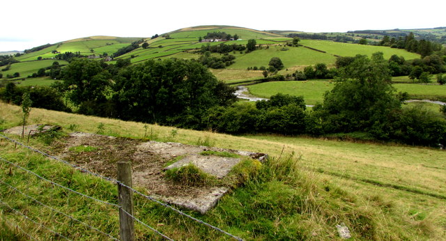
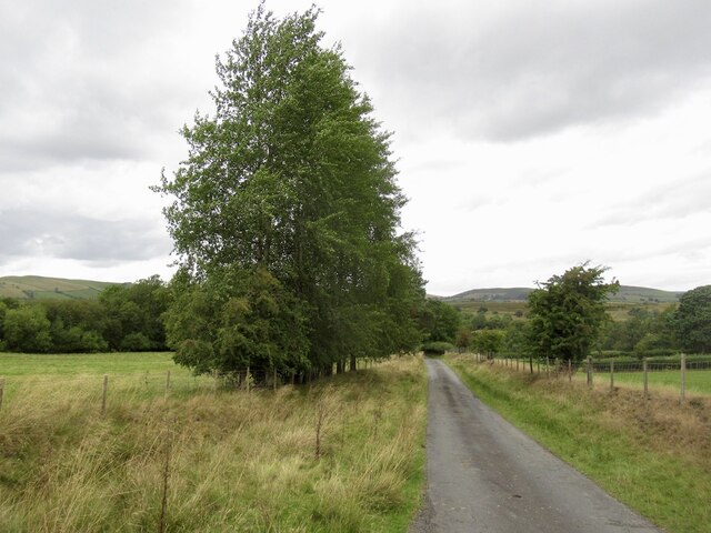
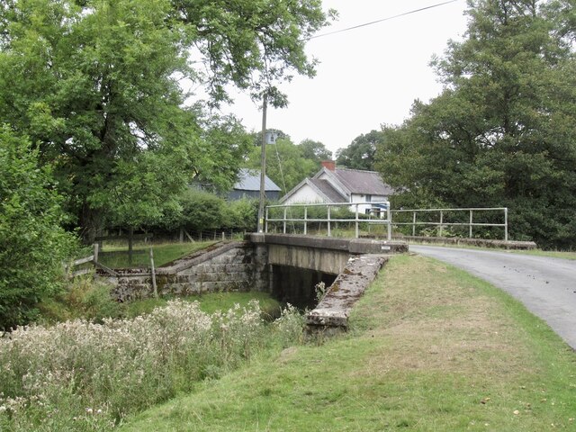
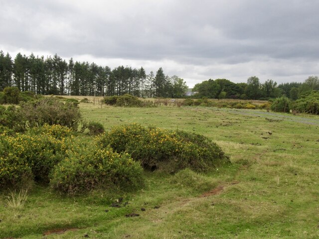
Bailey's Wood is a serene and enchanting forest located in the picturesque county of Radnorshire, Wales. Covering an expansive area of approximately 500 acres, this woodland paradise offers a haven of tranquility and natural beauty for locals and visitors alike.

The wood is primarily composed of a variety of native tree species, including oak, beech, ash, and birch, which create a vibrant and diverse ecosystem. The dense canopy formed by these majestic trees provides a cool and shaded retreat, making it an ideal destination for nature enthusiasts and hikers seeking respite from the summer heat.

Bailey's Wood is also home to a plethora of wildlife, ranging from small mammals like squirrels and hedgehogs to a rich array of bird species. Ornithologists can often spot woodpeckers, jays, and thrushes amidst the lush foliage, while the lucky observer may even catch a glimpse of a majestic red kite soaring overhead.

Visitors to Bailey's Wood are treated to a network of well-maintained walking trails that wind through the forest, allowing for a leisurely exploration of its natural wonders. The paths are scattered with wildflowers, adding splashes of color to the green surroundings, and occasional clearings offer breathtaking views of the rolling Radnorshire countryside.

For those seeking a peaceful retreat, there are several designated picnic areas where families and friends can enjoy a leisurely lunch amidst the serenity of nature. Additionally, the wood is equipped with basic facilities, such as parking and restrooms, ensuring a comfortable visit for all.

Bailey's Wood truly embodies the essence of Radnorshire's natural beauty, offering an idyllic escape from the hustle and bustle of everyday life. Whether it's a leisurely stroll, a birdwatching adventure, or simply a moment of solitude, this enchanting forest promises an unforgettable experience for all who venture within its leafy embrace.

If you have any feedback on the listing, please let us know in the comments section below.

Bailey's Wood Images

Images are sourced within 2km of 52.333874/-3.3154842 or Grid Reference SO1071. Thanks to Geograph Open Source API. All images are credited.

Hillside view from Llanbister Viewed across the valley of the River Ithon.
Hillside view from Llanbister
Viewed across the valley of the River Ithon.
Road off the common Leaving Maelienydd.
Road off the common
Leaving Maelienydd.
Bridge over Camddwr
Bridge over Camddwr
Telephone box near Llanbister
Field near Llanbister
Cultivated ground
Cultivated ground
Book exchange A former telephone box, Llanbister.
Book exchange
A former telephone box, Llanbister.
Cefn Llanbister
Cefn Llanbister
Llanbister war memorial This war memorial is situated opposite the parish church of St. Cynllo and is placed by the B4356 road.
Llanbister war memorial
This war memorial is situated opposite the parish church of St. Cynllo and is placed by the B4356 road.
Path to St. Cynllo's church (Llanbister) The parish church at Llanbister was built on a steep hill, and the structure was built in the early C14. The bell tower was built at the east end in the C15 or C16, and the belfry was remodelled in 1752 when the church was altered that year. The church was restored by W.D. Caröe and H. Passmore in 1908, who rebuilt most of the nave south wall and added two features in the west end; the baptistery and south porch. This was grade II* listed in October 1951, and the interior was full of screeching bats on my visit.
Path to St. Cynllo's church (Llanbister)
The parish church at Llanbister was built on a steep hill, and the structure was built in the early C14. The bell tower was built at the east end in the C15 or C16, and the belfry was remodelled in 1752 when the church was altered that year. The church was restored by W.D. Caröe and H. Passmore in 1908, who rebuilt most of the nave south wall and added two features in the west end; the baptistery and south porch. This was grade II* listed in October 1951, and the interior was full of screeching bats on my visit.
Yew trees at St. Cynllo's church (Llanbister) There are many yew trees south of the parish church building at Llanbister.
Yew trees at St. Cynllo's church (Llanbister)
There are many yew trees south of the parish church building at Llanbister.
Doorway inside St. Cynllo's church (Llanbister) This is the early C14 south doorway at Llanbister parish church, protected by the south porch of 1908.
Doorway inside St. Cynllo's church (Llanbister)
This is the early C14 south doorway at Llanbister parish church, protected by the south porch of 1908.
Windows inside St. Cynllo's church (Llanbister) These windows were inserted in the restoration of 1908 at Llanbister parish church, situated in the west end of the nave.
Windows inside St. Cynllo's church (Llanbister)
These windows were inserted in the restoration of 1908 at Llanbister parish church, situated in the west end of the nave.
Inside St. Cynllo's church (Llanbister) The interior at Llanbister parish church from the west end of the nave, with the panelled and painted reredos of c.1950 in the distance.
Inside St. Cynllo's church (Llanbister)
The interior at Llanbister parish church from the west end of the nave, with the panelled and painted reredos of c.1950 in the distance.
Font at St. Cynllo's church (Llanbister) Here is the medieval font in the west end of the nave, with a stoup (stiff-leaf capital) resting on the base.
Font at St. Cynllo's church (Llanbister)
Here is the medieval font in the west end of the nave, with a stoup (stiff-leaf capital) resting on the base.
Chest at St. Cynllo's church (Llanbister) This ancient chest is in the west end of the nave.
Chest at St. Cynllo's church (Llanbister)
This ancient chest is in the west end of the nave.
Door at St. Cynllo's church (Llanbister) Here is the south door that provides the main entrance to Llanbister parish church.
Door at St. Cynllo's church (Llanbister)
Here is the south door that provides the main entrance to Llanbister parish church.
Window inside St. Cynllo's church (Llanbister) This splayed lancet window is in the south wall of the nave.
Window inside St. Cynllo's church (Llanbister)
This splayed lancet window is in the south wall of the nave.
Show me another place!

Bailey's Wood is located at Grid Ref: SO1071 (Lat: 52.333874, Lng: -3.3154842)

Unitary Authority: Powys

Police Authority: Dyfed Powys

What 3 Words

///gymnasium.mull.altering. Near Penybont, Powys

Nearby Locations

Bailey's Wood

Related Wikis

Rhwng Gwy a Hafren

Rhwng Gwy a Hafren (English: Between Wye and Severn) was a region of medieval Wales, located in the Welsh Marches between Powys to the north and Brycheiniog...
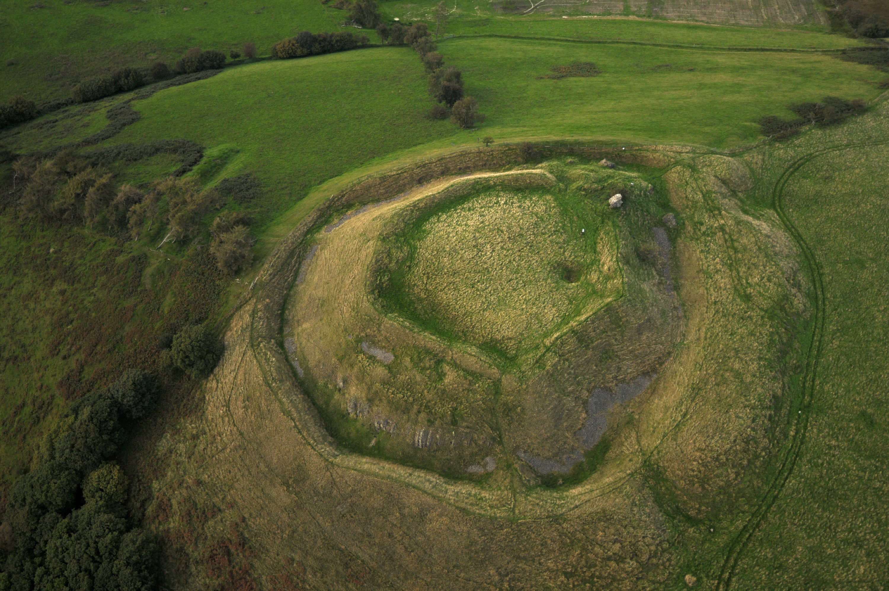
Buddugre Castle

Buddugre Castle (sometimes referred to as Tomen Bedd-Ugre, Castell Cwm Aran, Tomen Bedd Turc and Bedd-y-gre) was a motte and bailey defensive fortification...

Llanbister

Llanbister is a small village and community with a 2011 population of 382 in Powys, mid Wales, in the historic county of Radnorshire. == Facilities... ==

St Anno's Church, Llananno

The Church of St Anno in Llananno, Powys, Wales, is a redundant church dating from the 14th century. Its medieval rood screen is considered "one of the...

Heartsease, Llanddewi Ystradenni

Heartsease is a small settlement or hamlet in the parish and community of Llanddewi Ystradenni in Powys, Wales. It should not be confused with Heartsease...

Llanddewi Ystradenny

Llanddewi Ystradenni is a community in Radnorshire, Powys, Wales. The population of the Community at the 2011 census was 310.Centred on the village of...

Tinboeth Castle

Tinboeth Castle (Welsh: Castell Dinbod) was a medieval castle situated midway between Llanbister and Llanbadarn Fynydd in Wales, on a bend in the River...

Abbeycwmhir

Abbeycwmhir or Abbey Cwmhir (Welsh: Abaty Cwm Hir, "Abbey in the Long Valley") is a village and community in the valley of the Nant Clywedog in Radnorshire...

Nearby Amenities

Located within 500m of 52.333874,-3.3154842
Place: farm
Lat/Long: 52.3355657/-3.3171446
Barrier: cattle_grid
Lat/Long: 52.3341983/-3.3181826
Direction: 175
Generator Method: photovoltaic
Generator Output Electricity: yes
Generator Solar Modules: 8
Generator Source: solar
Generator Type: solar_photovoltaic_panel
Location: roof
Power: generator
Lat/Long: 52.3356177/-3.317222
Direction: 175
Generator Method: photovoltaic
Generator Output Electricity: yes
Generator Solar Modules: 8
Generator Source: solar
Generator Type: solar_photovoltaic_panel
Location: roof
Power: generator
Lat/Long: 52.3356365/-3.317222
The data included in this document is from www.openstreetmap.org. The data is made available under ODbL.

Have you been to Bailey's Wood?

Leave your review of Bailey's Wood below (or comments, questions and feedback).