Coed Cefn-y-coed

Wood, Forest in Montgomeryshire

Wales

Coed Cefn-y-coed

Trackway to Craignant-mawr An extremely peaceful area - a lot of our walked covered the endless lanes and we only saw one car all day - the postman.  Moel Llaethbwlch behind the photographer.
Trackway to Craignant-mawr Credit: Martin Evans

Coed Cefn-y-coed, located in Montgomeryshire, is a charming woodland area that offers a tranquil retreat for nature enthusiasts and outdoor lovers. The name itself translates to "Wood, Forest," which aptly describes the landscape of this stunning location.

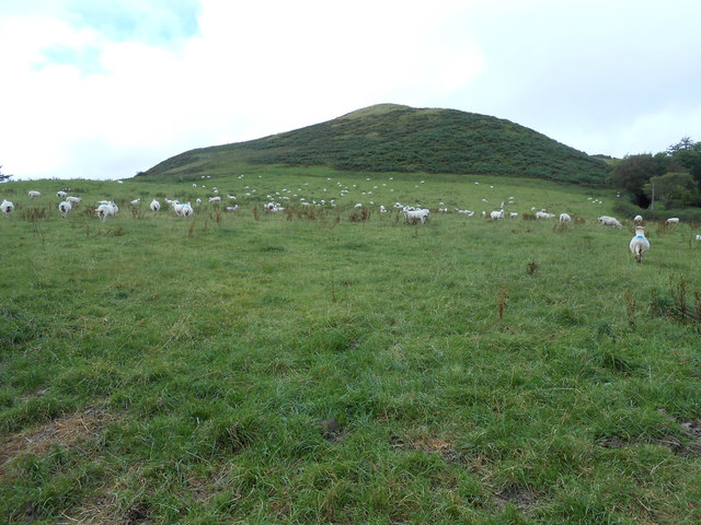
Spanning over acres of land, Coed Cefn-y-coed is characterized by its dense and diverse collection of trees, including oak, beech, and birch. The woodland is home to a plethora of wildlife, with various species of birds, mammals, and insects inhabiting the area. Visitors can often spot squirrels darting through the branches or hear the melodic songs of birds echoing through the trees.

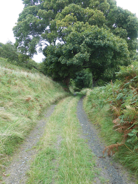
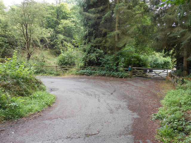
The woodland is crisscrossed by a network of well-maintained footpaths, allowing visitors to explore the area and discover its hidden treasures. As one traverses through the winding trails, they will encounter picturesque streams, glistening in the sunlight, adding to the overall enchantment of the place.

Coed Cefn-y-coed is not only a haven for nature lovers but also a popular destination for outdoor activities such as hiking, picnicking, and photography. The peaceful atmosphere and breathtaking scenery make it an ideal spot for relaxation and rejuvenation. Whether one seeks solitude amidst nature's beauty or an adventure-filled day exploring the trails, Coed Cefn-y-coed has something to offer everyone.

With its natural charm and serene ambiance, Coed Cefn-y-coed in Montgomeryshire is a must-visit destination for those seeking an escape from the hustle and bustle of everyday life.

If you have any feedback on the listing, please let us know in the comments section below.

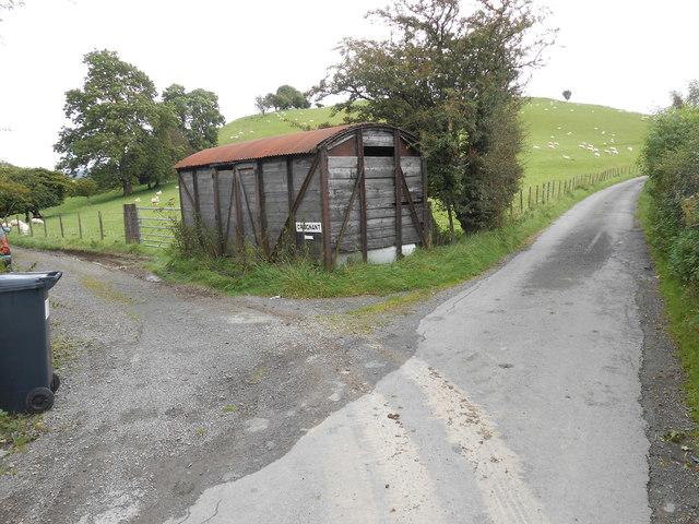
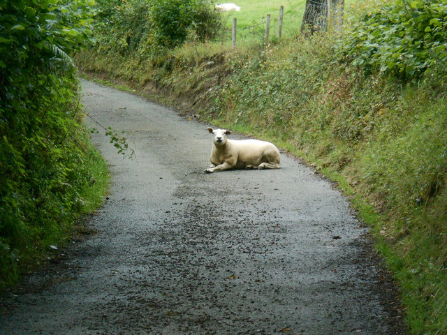
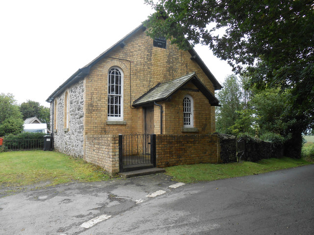
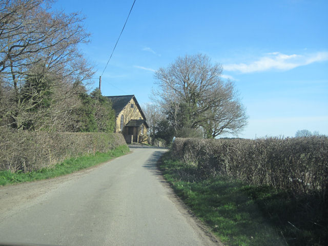
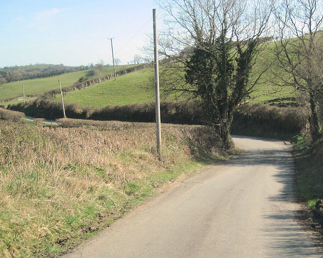
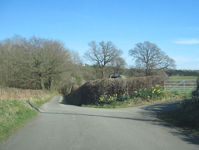
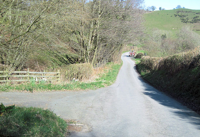
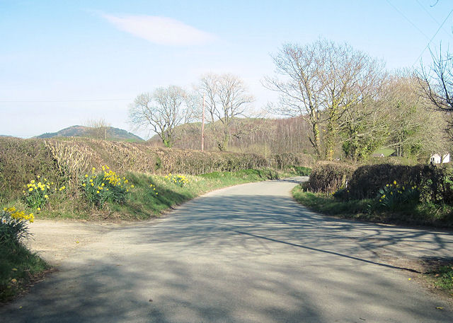
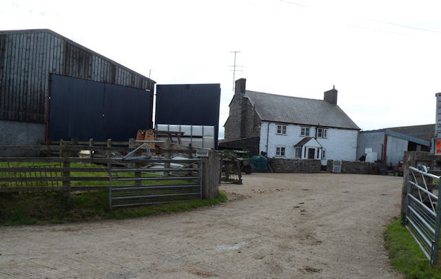
Coed Cefn-y-coed Images

Images are sourced within 2km of 52.732815/-3.3358471 or Grid Reference SJ0915. Thanks to Geograph Open Source API. All images are credited.

Trackway to Craignant-mawr An extremely peaceful area - a lot of our walked covered the endless lanes and we only saw one car all day - the postman.  Moel Llaethbwlch behind the photographer.
Trackway to Craignant-mawr
An extremely peaceful area - a lot of our walked covered the endless lanes and we only saw one car all day - the postman. Moel Llaethbwlch behind the photographer.
Moel Llaethbwlch When I first glanced at the map, without my reading glasses, I read it as Moel Llaethbuwch.  This as a name far more prosaic in that it would have meant Milky Cow Hill.  Milk Pass Hill a good second place.  This hill at 1,190ft stands proud of the many local bumps.  Strangely, there is a spot height of 348 metres slightly northwest and below the summit.
Moel Llaethbwlch
When I first glanced at the map, without my reading glasses, I read it as Moel Llaethbuwch. This as a name far more prosaic in that it would have meant Milky Cow Hill. Milk Pass Hill a good second place. This hill at 1,190ft stands proud of the many local bumps. Strangely, there is a spot height of 348 metres slightly northwest and below the summit.
Start of bridleway across ridge behind Moel Llaethbwlch The one and only footpath sign and stile we found on our entire walk.  And this gate when we tried to open it collapsed - the post had rotted through at the base.  This even though the whole gate and stile seemed fairly new.
Start of bridleway across ridge behind Moel Llaethbwlch
The one and only footpath sign and stile we found on our entire walk. And this gate when we tried to open it collapsed - the post had rotted through at the base. This even though the whole gate and stile seemed fairly new.
Curious cattle on the bridleway by Moel Llaethbwlch If anyone's walked this path this year I'd be surprised.  These youngsters were certainly interested in the first passers-by in a while.
Curious cattle on the bridleway by Moel Llaethbwlch
If anyone's walked this path this year I'd be surprised. These youngsters were certainly interested in the first passers-by in a while.
Track to Pen-y-Ffordd This is where the bridleway becomes track from the ridge of Moel Llaethbwlch down to Pen-y-Ffordd farm.  You couldn't creep up on this farm as we counted at least 6 mental yapping dogs.  Welcoming farmer lady a good chance to speak some Welsh at last.
Track to Pen-y-Ffordd
This is where the bridleway becomes track from the ridge of Moel Llaethbwlch down to Pen-y-Ffordd farm. You couldn't creep up on this farm as we counted at least 6 mental yapping dogs. Welcoming farmer lady a good chance to speak some Welsh at last.
Entrance to Felin Cadwnfa Now here is a quiet place.  With Nant y Pandy on its journey towards Vyrnwy passing under the road on left of picture.
Entrance to Felin Cadwnfa
Now here is a quiet place. With Nant y Pandy on its journey towards Vyrnwy passing under the road on left of picture.
Rambo on the road So little traffic passes this road between Ebeneezer Adgyweiriwyd and Felin Cadwnfa that this ram could call the lane his home.  The ram however was terribly meithered by an injury to its ear.  I trust his diligent farmer would pick this up and treat it.
Rambo on the road
So little traffic passes this road between Ebeneezer Adgyweiriwyd and Felin Cadwnfa that this ram could call the lane his home. The ram however was terribly meithered by an injury to its ear. I trust his diligent farmer would pick this up and treat it.
Penllys (Ebenezer Adgyweiriwyd) Chapel Likely unused chapel along the Meifod to Llanihangel road.  The previously derelict chapel house behind has been largely demolished and work would appear to be in progress as to its replacement.  
This from the Coflein website:
Penllys Independent Chapel was built in 1822 and refurbished in 1878 to form present the chapel. A plaque reads: "Ebenezer/ Adgyweiriwyd/ 1878". This chapel is built in the Simple Round-Headed style with a gable-entry plan, a yellow-brick front gable and yellow-brick window dressings. There are two windows to each return and one to each side of the porch and a twentieth century wooden-boarded door in the porch-side wall. A disused detached chapel house sits at right angles to the rear of the chapel.
Inside the chapel there are painted plaster walls, late ninenteenth or early twentieth century open-bench seats and a pulpit situated against is against the rear gable wall.
Penllys (Ebenezer Adgyweiriwyd) Chapel
Likely unused chapel along the Meifod to Llanihangel road. The previously derelict chapel house behind has been largely demolished and work would appear to be in progress as to its replacement. This from the Coflein website: Penllys Independent Chapel was built in 1822 and refurbished in 1878 to form present the chapel. A plaque reads: "Ebenezer/ Adgyweiriwyd/ 1878". This chapel is built in the Simple Round-Headed style with a gable-entry plan, a yellow-brick front gable and yellow-brick window dressings. There are two windows to each return and one to each side of the porch and a twentieth century wooden-boarded door in the porch-side wall. A disused detached chapel house sits at right angles to the rear of the chapel. Inside the chapel there are painted plaster walls, late ninenteenth or early twentieth century open-bench seats and a pulpit situated against is against the rear gable wall.
Lane above Penarlas Very little to photograph of interest in this grid square, especially given the dearth of open and accessible footpaths.  We walked 10 miles of hill and lane this day and found only one footpath sign.  This bit of lane typical of our day. We only had 3 miles to go at this point.
Lane above Penarlas
Very little to photograph of interest in this grid square, especially given the dearth of open and accessible footpaths. We walked 10 miles of hill and lane this day and found only one footpath sign. This bit of lane typical of our day. We only had 3 miles to go at this point.
Track to somewhere We couldn't even glean from the ordnance survey or later via an internet search just where this track goes to.  Not wanting to trespass, it would seem to be an agricultural building.  It could just be the highly secretive Supreme Headquarters of the Alien Defence Organisation(SHADO).  Then again it might just be a big shed.  But hey, it's in grid square SJ115. Enjoy.
Track to somewhere
We couldn't even glean from the ordnance survey or later via an internet search just where this track goes to. Not wanting to trespass, it would seem to be an agricultural building. It could just be the highly secretive Supreme Headquarters of the Alien Defence Organisation(SHADO). Then again it might just be a big shed. But hey, it's in grid square SJ115. Enjoy.
Chapel on junction for Ffynnon Arthur On Meifod road
Chapel on junction for Ffynnon Arthur
On Meifod road
Meifod road below Pen llys
Entrance to Ty Coch
Entrance to Ty Coch
Entrance east of Ty Coch off Meifod road
Road towards Haulfan
The Voel junction on the Meifod road Near Haulfen
The Voel junction on the Meifod road
Near Haulfen
Junction near Pen-y-Coed Looking towards Meifod
Junction near Pen-y-Coed
Looking towards Meifod
Pendugwm Farm from access road
Show me another place!

Coed Cefn-y-coed is located at Grid Ref: SJ0915 (Lat: 52.732815, Lng: -3.3358471)

Unitary Authority: Powys

Police Authority: Dyfed Powys

What 3 Words

///postings.snow.drifter. Near Llanfyllin, Powys

Nearby Locations

Coed Cefn-y-coed

Related Wikis

Plynlimon and Hafan Tramway

The Plynlimon and Hafan Tramway was a 2 ft 3 in (686 mm) gauge narrow gauge railway in Cardiganshire (now Ceredigion) in Mid Wales. It ran from Llanfihangel...

Llanfihangel-yng-Ngwynfa

Llanfihangel-yng-Ngwynfa () was a parish within the former historic county of Montgomeryshire. It now forms a major part of the community of Llanfihangel...

Pontrobert

Pontrobert is an ecclesiastical parish that was formed in September 1854. It comprises the townships of Teirtref and part of Nantymeichiaid in the parish...

Dolobran, Montgomeryshire

Dolobran, in the county of Montgomeryshire (now Powys) in Wales, is a historic estate which was the earliest known seat of the expansive Lloyd family,...

Nearby Amenities

Located within 500m of 52.732815,-3.3358471
Place: farm
Lat/Long: 52.7364239/-3.3398391
Pen-y-ffordd
Place: farm
Lat/Long: 52.7343024/-3.3304396
Place: farm
Lat/Long: 52.7316908/-3.3368339
Direction: SSE
Generator Method: photovoltaic
Generator Output Electricity: yes
Generator Solar Modules: 21
Generator Source: solar
Generator Type: solar_photovoltaic_panel
Location: roof
Power: generator
Lat/Long: 52.7311359/-3.3383538
Direction: SSE
Generator Method: photovoltaic
Generator Output Electricity: yes
Generator Solar Modules: 16
Generator Source: solar
Generator Type: solar_photovoltaic_panel
Location: roof
Power: generator
Lat/Long: 52.7313819/-3.337246
Power: pole
Lat/Long: 52.7300587/-3.3369159
Power: pole
Lat/Long: 52.7288184/-3.3355366
Power: pole
Lat/Long: 52.7306917/-3.3369635
The data included in this document is from www.openstreetmap.org. The data is made available under ODbL.

Have you been to Coed Cefn-y-coed?

Leave your review of Coed Cefn-y-coed below (or comments, questions and feedback).