Victoria Jubilee Covert

Wood, Forest in Denbighshire

Wales

Victoria Jubilee Covert

Pont Clywedog
Pont Clywedog Credit: Ceri Thomas

Victoria Jubilee Covert is a wood located in Denbighshire, Wales. Situated in the heart of the county, it covers an area of approximately 100 acres, offering a picturesque and serene setting for nature enthusiasts and visitors alike.

The woodland is primarily composed of a diverse mix of native trees, including oak, beech, birch, and ash, creating a rich and vibrant ecosystem. These trees provide a habitat for a wide range of flora and fauna, making it an ideal spot for wildlife observation and nature walks.

The Victoria Jubilee Covert is renowned for its tranquil atmosphere, with its dense foliage and well-maintained pathways providing a peaceful retreat from the hustle and bustle of everyday life. The well-marked trails meandering through the wood offer visitors the opportunity to explore its natural beauty at their own pace, with occasional benches and picnic areas providing resting spots and picnic opportunities.

The wood has also been carefully managed to preserve its natural heritage, with conservation efforts ensuring the protection of its delicate ecosystem. This has resulted in the presence of various rare and protected species, including the lesser horseshoe bat and the red squirrel.

Victoria Jubilee Covert is a popular destination for outdoor enthusiasts, nature lovers, and families seeking a peaceful escape. Its accessibility, diverse wildlife, and well-maintained trails make it an excellent location for leisurely walks, wildlife spotting, and picnicking amidst the beauty of nature.

If you have any feedback on the listing, please let us know in the comments section below.

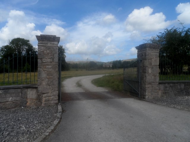
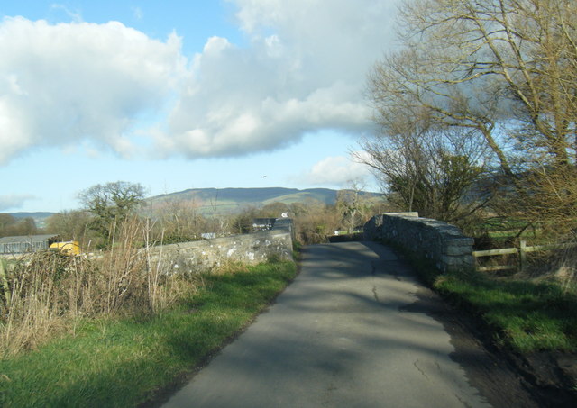
Victoria Jubilee Covert Images

Images are sourced within 2km of 53.1702/-3.350339 or Grid Reference SJ0964. Thanks to Geograph Open Source API. All images are credited.

Pont Clywedog
Pont Clywedog
Arwydd llwybr cyhoeddus / Public footpath sign
Udderly fascinating! No milk from this cow - but Llwyn Banc farm sells fresh milk direct in the adjacent building
Udderly fascinating!
No milk from this cow - but Llwyn Banc farm sells fresh milk direct in the adjacent building
Footpath through a field of maize The path is behind St Saeran's Church
Footpath through a field of maize
The path is behind St Saeran's Church
Y ffordd rhwng Dinbych a Llandyrnog / The road from Denbigh to Llandyrnog A very good road given the light traffic.
Y ffordd rhwng Dinbych a Llandyrnog / The road from Denbigh to Llandyrnog
A very good road given the light traffic.
Y Porth i Glan y Wern / Entrance to Glan y Wern
Field north of Whitchurch Road, Denbigh The trees follow the line of the River Clwyd, but the field was far too wet to walk to the river
Field north of Whitchurch Road, Denbigh
The trees follow the line of the River Clwyd, but the field was far too wet to walk to the river
Whitchurch Road A long straight stretch of road between Denbigh and Llandyrnog
Whitchurch Road
A long straight stretch of road between Denbigh and Llandyrnog
The River Clwyd at Pont Glan y Wern
Llwyn Banc Farm Between Denbigh and Llanrhaeadr in the Vale of Clwyd.
Llwyn Banc Farm
Between Denbigh and Llanrhaeadr in the Vale of Clwyd.
Llwyn Mawr Farm With the Clwydian Hills as a backdrop.
Llwyn Mawr Farm
With the Clwydian Hills as a backdrop.
Lane leading to Llwyn Mawr Farm
Minor road crossing Pont Clwyd Looking south-westward.
Minor road crossing Pont Clwyd
Looking south-westward.
Minor road at Trefechan Looking south-eastward.
Minor road at Trefechan
Looking south-eastward.
Graveyard at Llanrhaeadr Opposite the church at Llanrhaeadr
Graveyard at Llanrhaeadr
Opposite the church at Llanrhaeadr
The King's Head Public house in the old part of Llanrhaeadr, across the road from the church.
The King's Head
Public house in the old part of Llanrhaeadr, across the road from the church.
Gateway and drive to Llanrhaeadr Hall A gentry house of C16 origin. The house was purchased by Maurice Jones of Ddol Esq., who served as High Sheriff of Denbighshire in 1703, the year of his death. The house, then called Plas Newydd, was later renamed Llanrhaeadr Hall. Extensive alterations were carried out in the 1770s for Richard Parry, who inherited in 1759 and who served as High Sheriff in 1775. It is listed grade II* and is now in use as a care home.
Gateway and drive to Llanrhaeadr Hall
A gentry house of C16 origin. The house was purchased by Maurice Jones of Ddol Esq., who served as High Sheriff of Denbighshire in 1703, the year of his death. The house, then called Plas Newydd, was later renamed Llanrhaeadr Hall. Extensive alterations were carried out in the 1770s for Richard Parry, who inherited in 1759 and who served as High Sheriff in 1775. It is listed grade II* and is now in use as a care home.
Stone bridge on lane north east of Llanynys
Show me another place!

Victoria Jubilee Covert is located at Grid Ref: SJ0964 (Lat: 53.1702, Lng: -3.350339)

Unitary Authority: Denbighshire

Police Authority: North Wales

What 3 Words

///inhales.fists.lookout. Near Denbigh, Denbighshire

Nearby Locations

Victoria Jubilee Covert

Related Wikis

Llandyrnog

Llandyrnog is a large village and community in Denbighshire, Wales lying in the valley of the River Clwyd, about 3 miles (4.8 km) from Denbigh and 5 miles...

Llanrhaiadr railway station

Llanrhaiadr railway station was one mile from the village of Llanrhaeadr-yng-Nghinmeirch, Denbighshire, Wales. The station was opened on 1 March 1862 and...

Llwyn

Llwyn is a Site of Special Scientific Interest in the preserved county of Clwyd, north Wales. It consists of two blocks of alder woodland at grid reference...

Llanynys

Llanynys (; Welsh: [ɬanˈənɪs]) is a hamlet and community (Llanynys and Rhewl Community Council) in Denbighshire, north-east Wales; (OS grid reference:...

Nearby Amenities

Located within 500m of 53.1702,-3.350339
Power: pole
Lat/Long: 53.1738213/-3.3468935
Power: pole
Lat/Long: 53.1734105/-3.3472746
Power: pole
Lat/Long: 53.172835/-3.3465784
Power: pole
Lat/Long: 53.1707524/-3.345861
The data included in this document is from www.openstreetmap.org. The data is made available under ODbL.

Have you been to Victoria Jubilee Covert?

Leave your review of Victoria Jubilee Covert below (or comments, questions and feedback).