Coed Pant-rhedynog
Wood, Forest in Denbighshire
Wales
Coed Pant-rhedynog

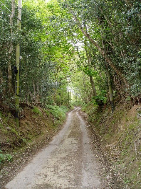
Coed Pant-rhedynog is a charming woodland area located in Denbighshire, Wales. Covering an approximate area of several acres, this wood, also known as Coed y Fron, is a haven for nature enthusiasts and those seeking tranquility in a picturesque setting.
Situated near the village of Llanarmon-yn-Ial, Coed Pant-rhedynog boasts a diverse range of tree species, including oak, birch, beech, and coniferous trees. The lush vegetation provides a habitat for various wildlife, making it an ideal spot for birdwatching and animal spotting. Visitors can expect to see an array of bird species, such as woodpeckers, owls, and various songbirds, as well as small mammals like squirrels and rabbits.
The woodland offers several walking trails that cater to different fitness levels and interests. These trails wind through the trees, allowing visitors to immerse themselves in the beauty of the natural surroundings. The forest floor is carpeted with wildflowers, creating a vibrant and colorful landscape during the spring and summer months.
Coed Pant-rhedynog also has a rich historical significance. The wood contains remnants of an ancient hillfort, dating back to the Iron Age, which adds an extra layer of intrigue and wonder to the area. Archaeological enthusiasts can explore these remains and learn about the fascinating history of the region.
Overall, Coed Pant-rhedynog is a delightful woodland retreat that offers a peaceful escape from the hustle and bustle of everyday life. It provides a harmonious blend of natural beauty, wildlife, and historical intrigue, making it a must-visit destination for nature lovers and history enthusiasts alike.
If you have any feedback on the listing, please let us know in the comments section below.
Coed Pant-rhedynog Images
Images are sourced within 2km of 53.034089/-3.3469616 or Grid Reference SJ0949. Thanks to Geograph Open Source API. All images are credited.


Coed Pant-rhedynog is located at Grid Ref: SJ0949 (Lat: 53.034089, Lng: -3.3469616)
Unitary Authority: Denbighshire
Police Authority: North Wales
What 3 Words
///pushing.vibes.mallets. Near Derwen, Denbighshire
Nearby Locations
Related Wikis

Llanelidan
Llanelidan is a small village and community in the county of Denbighshire in north-east Wales. The community also includes the hamlet of Rhyd-y-Meudwy...
St Elidan's Church, Llanelidan
St Elidan's Church is a Grade II*-listed building in the community of Llanelidan in Denbighshire, Wales. == References == == External links == Media related...

Derwen railway station
Derwen railway station was a station in Derwen, Denbighshire, Wales. The station was opened on 6 October 1864 and closed for passengers in 1953 and completely...
Nantclwyd railway station
Nantclwyd railway station was a station near Nantclwyd Hall, Llanelidan, Denbighshire, Wales. The station was opened on 22 September 1864 by the Denbigh...
Have you been to Coed Pant-rhedynog?
Leave your review of Coed Pant-rhedynog below (or comments, questions and feedback).