Bwlch Trewyn

Settlement in Monmouthshire

Wales

Bwlch Trewyn

Bus stop on the A465
Bus stop on the A465 Credit: Rob Purvis

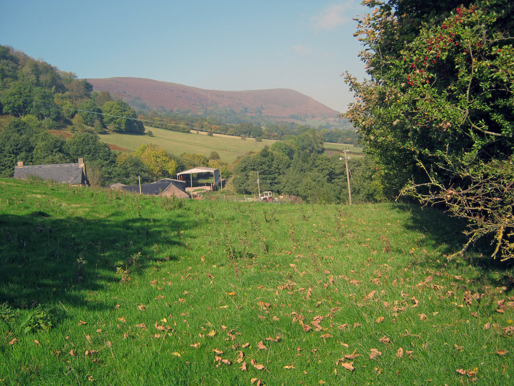
Bwlch Trewyn is a small village located in Monmouthshire, Wales. Situated in the southeastern part of the county, it lies approximately 5 miles west of the town of Monmouth. The village is nestled in a picturesque valley, surrounded by rolling hills and lush green countryside.

The main feature of Bwlch Trewyn is its beautiful and historic church, St. Mary's Church. This Grade II listed building dates back to the 13th century and is known for its stunning architecture, including a striking tower and ancient stained glass windows. The church is still an active place of worship and holds regular services.

The village itself is a quiet and close-knit community, with a small population of around 200 residents. The houses in Bwlch Trewyn are predominantly traditional stone cottages, giving the area a charming and timeless feel. The village also has a small primary school, which serves the local children.

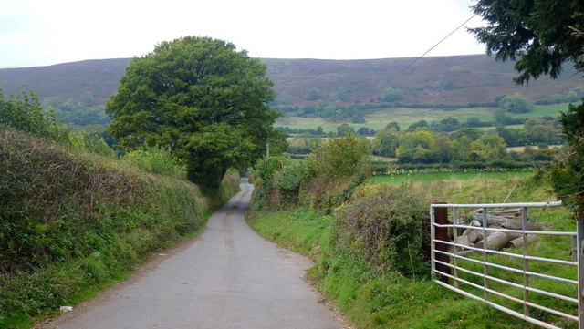
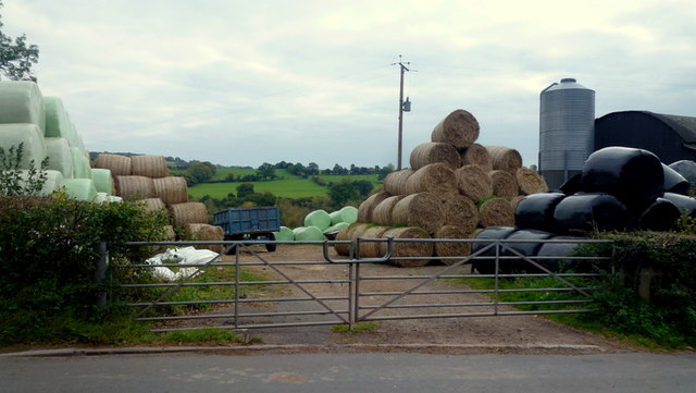
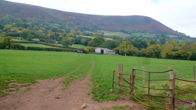
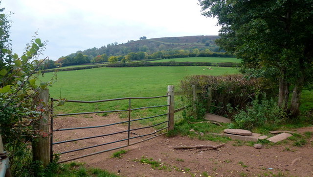
Surrounded by natural beauty, Bwlch Trewyn offers plenty of opportunities for outdoor activities. The nearby countryside is crisscrossed with footpaths and bridleways, making it a popular destination for hikers, cyclists, and horse riders. The village is also close to the Wye Valley Area of Outstanding Natural Beauty, providing access to stunning landscapes, rivers, and woodlands.

Overall, Bwlch Trewyn is a tranquil and idyllic village, perfect for those seeking a peaceful rural lifestyle or a base for exploring the natural wonders of Monmouthshire.

If you have any feedback on the listing, please let us know in the comments section below.
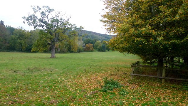
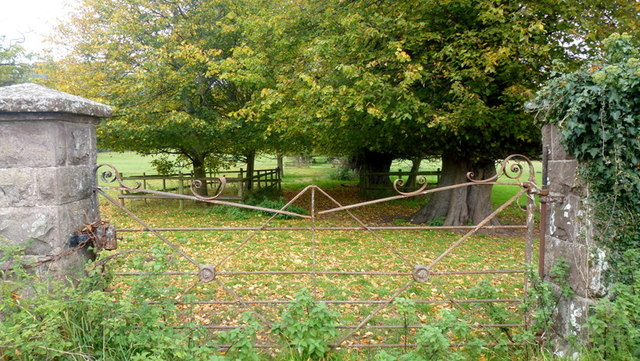
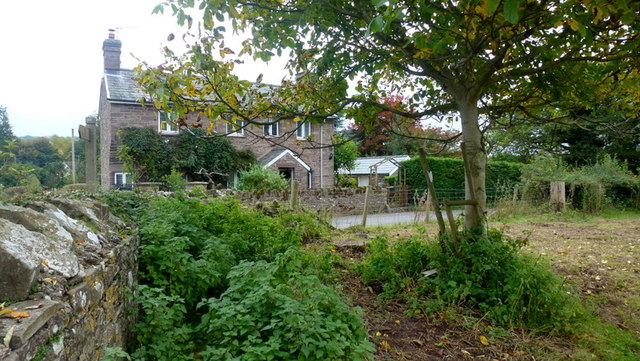
Bwlch Trewyn Images

Images are sourced within 2km of 51.9002/-2.9771 or Grid Reference SO3222. Thanks to Geograph Open Source API. All images are credited.

Bus stop on the A465
Lane to Oldcastle As can be seen, the hamlet nestles in the shelter of Hatterrall Hill.
Lane to Oldcastle
As can be seen, the hamlet nestles in the shelter of Hatterrall Hill.
Silage/haylage storage Farm premises opposite the dead-end lane to Oldcastle.
Silage/haylage storage
Farm premises opposite the dead-end lane to Oldcastle.
Barn in the shadow of Hatterrall Hill Looking along the line of a footpath from the Pandy road.
Barn in the shadow of Hatterrall Hill
Looking along the line of a footpath from the Pandy road.
Farmland below Pentwyn hill fort Lush grazing land on the side of the Monnow valley.
Farmland below Pentwyn hill fort
Lush grazing land on the side of the Monnow valley.
Line of a footpath Heading north-west from Trewyn Lodge.
The hill beyond is Pentwyn hillfort and is at the southern tip of the Hatterrall Ridge which forms the English/Welsh border from Pandy to Hay Bluff.
Line of a footpath
Heading north-west from Trewyn Lodge. The hill beyond is Pentwyn hillfort and is at the southern tip of the Hatterrall Ridge which forms the English/Welsh border from Pandy to Hay Bluff.
Old iron gate Suggestive of the park-like appearance of the field opposite Trewyn Lodge.
See also <a href="https://www.geograph.org.uk/photo/4234222">SO3322 : Gate at Trewyn Lodge, Pandy</a> showing Geographers' minds tend to think alike.
Old iron gate
Suggestive of the park-like appearance of the field opposite Trewyn Lodge. See also SO3322 : Gate at Trewyn Lodge, Pandy showing Geographers' minds tend to think alike.
Trewyn Lodge Viewed from just inside the field on a public footpath.
How many nettle-infested corners like this are there in this great country of ours?
Trewyn Lodge
Viewed from just inside the field on a public footpath. How many nettle-infested corners like this are there in this great country of ours?
Lane to Tre-wyn By Trawellwyd the lane to Tre-wyn
Lane to Tre-wyn
By Trawellwyd the lane to Tre-wyn
Pont Rhys Powell Cerddwyr yn croesi Pont Rhys Powell sy'n rhychwantu Afon Honddu.

Walkers crossing Pont Rhys Powell (trans. Rhys Powell's Bridge) which spans the Honddu River.
Pont Rhys Powell
Cerddwyr yn croesi Pont Rhys Powell sy'n rhychwantu Afon Honddu. Walkers crossing Pont Rhys Powell (trans. Rhys Powell's Bridge) which spans the Honddu River.
Great Llwygy Path Cerddwyr yn dilyn Ffordd y Bannau tuag at Ffarm Great Llwygwy.

Walkers following the Beacons Way towards Great Llwygy Farm.
Great Llwygy Path
Cerddwyr yn dilyn Ffordd y Bannau tuag at Ffarm Great Llwygwy. Walkers following the Beacons Way towards Great Llwygy Farm.
Ger Trawellwyd / Near Trawellwyd Cerddwyr yn dilyn heol fach ger anhedd-dy o'r enw Trawellwyd.

Walkers following a minor road near a property called Trawellwyd.
Ger Trawellwyd / Near Trawellwyd
Cerddwyr yn dilyn heol fach ger anhedd-dy o'r enw Trawellwyd. Walkers following a minor road near a property called Trawellwyd.
Play and sports ground, Werngifford Werngifford is a community off the A465 midway between Llanvihangel Crucorney and Pandy.
Play and sports ground, Werngifford
Werngifford is a community off the A465 midway between Llanvihangel Crucorney and Pandy.
Werngifford Werngifford is a community off the A465 midway between Llanvihangel Crucorney and Pandy. To the left is the community hall.
Werngifford
Werngifford is a community off the A465 midway between Llanvihangel Crucorney and Pandy. To the left is the community hall.
Long distance paths The Offa's Dyke Path and Beacons Way join forces across this ascending grassy field at the start of the south-east end of the Black Mountains.
The hill to the left is Llwygy, 270m.
Overhead, an oak tree.
Long distance paths
The Offa's Dyke Path and Beacons Way join forces across this ascending grassy field at the start of the south-east end of the Black Mountains. The hill to the left is Llwygy, 270m. Overhead, an oak tree.
Summer pasture View from a footpath stile to the west of Treveddw.
Summer pasture
View from a footpath stile to the west of Treveddw.
Offa's Dyke Path and Beacons Way, 1 This is the top end of the field by Trostrey Barn, seen from the bottom in <a href="https://www.geograph.org.uk/photo/5022980">SO3221 : Long distance paths</a>.
Offa's Dyke Path and Beacons Way, 1
This is the top end of the field by Trostrey Barn, seen from the bottom in SO3221 : Long distance paths.
Offa's Dyke Path and Beacons Way, 2 This is the top end of the field by Trostrey Barn, seen from the bottom in <a href="https://www.geograph.org.uk/photo/5022980">SO3221 : Long distance paths</a>.
A mighty fine view of Ysgyryd Fawr from here.
Offa's Dyke Path and Beacons Way, 2
This is the top end of the field by Trostrey Barn, seen from the bottom in SO3221 : Long distance paths. A mighty fine view of Ysgyryd Fawr from here.
Show me another place!

Bwlch Trewyn is located at Grid Ref: SO3222 (Lat: 51.9002, Lng: -2.9771)

Unitary Authority: Monmouthshire

Police Authority: Gwent

What 3 Words

///quilting.elevated.reserved. Near Llancillo, Herefordshire

Related Wikis

Trewyn House

Trewyn House, Llanvihangel Crucorney, Monmouthshire, Wales, is a country house dating from 1692. Its origins are older but the present building was constructed...

Trewyn Farm barn, Llanvihangel Crucorney

The barn at Trewyn Farm, Llanvihangel Crucorney, Monmouthshire is part of a complex of farm buildings dating from the late 16th century. The barn has a...

Pandy railway station

Pandy railway station was a railway station which served the Monmouthshire village of Pandy. It was located on the Welsh Marches Line between Hereford...

River Honddu (Monmouthshire)

The River Honddu (Welsh: Afon Honddu) (pronounced hon-thee) is a river in the Black Mountains within the Brecon Beacons National Park, southeast Wales...

Nearby Amenities

Located within 500m of 51.9002,-2.9771
Post Box
Lat/Long: 51.8999477/-2.9705926
Place: farm
Lat/Long: 51.8993293/-2.9796779
The data included in this document is from www.openstreetmap.org. The data is made available under ODbL.

Have you been to Bwlch Trewyn?

Leave your review of Bwlch Trewyn below (or comments, questions and feedback).