Buttsbury
Settlement in Essex Chelmsford
England
Buttsbury

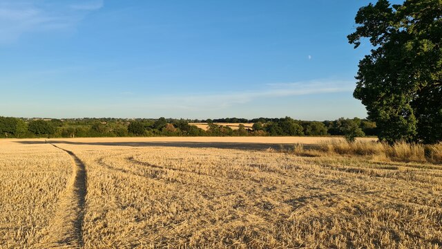
Buttsbury is a small village located in the county of Essex, England. Situated approximately 30 miles east of London, it falls within the borough of Brentwood. The village is surrounded by beautiful countryside, with rolling hills and picturesque landscapes.
Historically, Buttsbury has been inhabited since ancient times, with evidence of human settlement dating back to the Roman period. The village has a rich heritage, and remnants of its past can still be seen today, including the remains of a medieval moat.
The community of Buttsbury is tightly-knit, with a population of around 1,000 residents. It is a peaceful and welcoming village, known for its friendly atmosphere and strong sense of community spirit. The village has a primary school, which serves the local children, and there are several amenities available, including a village hall, a local pub, and a small convenience store.
Buttsbury is surrounded by beautiful countryside, which makes it an ideal location for outdoor enthusiasts. The village is close to several nature reserves and parks, offering opportunities for walking, hiking, and birdwatching. The nearby Buttsbury Wash nature reserve is particularly popular among locals and visitors alike.
Transport links to Buttsbury are good, with easy access to the A12 and A127 roads, connecting the village to nearby towns and cities. The nearest railway station is Shenfield, which provides regular services to London Liverpool Street, making Buttsbury an attractive location for commuters.
Overall, Buttsbury is a charming village with a rich history and a close-knit community. Its beautiful surroundings and convenient location make it an appealing place to live or visit.
If you have any feedback on the listing, please let us know in the comments section below.
Buttsbury Images
Images are sourced within 2km of 51.656276/0.39840034 or Grid Reference TQ6698. Thanks to Geograph Open Source API. All images are credited.


Buttsbury is located at Grid Ref: TQ6698 (Lat: 51.656276, Lng: 0.39840034)
Administrative County: Essex
District: Chelmsford
Police Authority: Essex
What 3 Words
///public.held.tracks. Near Ingatestone, Essex
Nearby Locations
Related Wikis

Buttsbury
Buttsbury is a village and former 2,079-acre (8.4 km2) civil parish (once an ancient parish) now in the parish of Stock, in the Chelmsford district of...
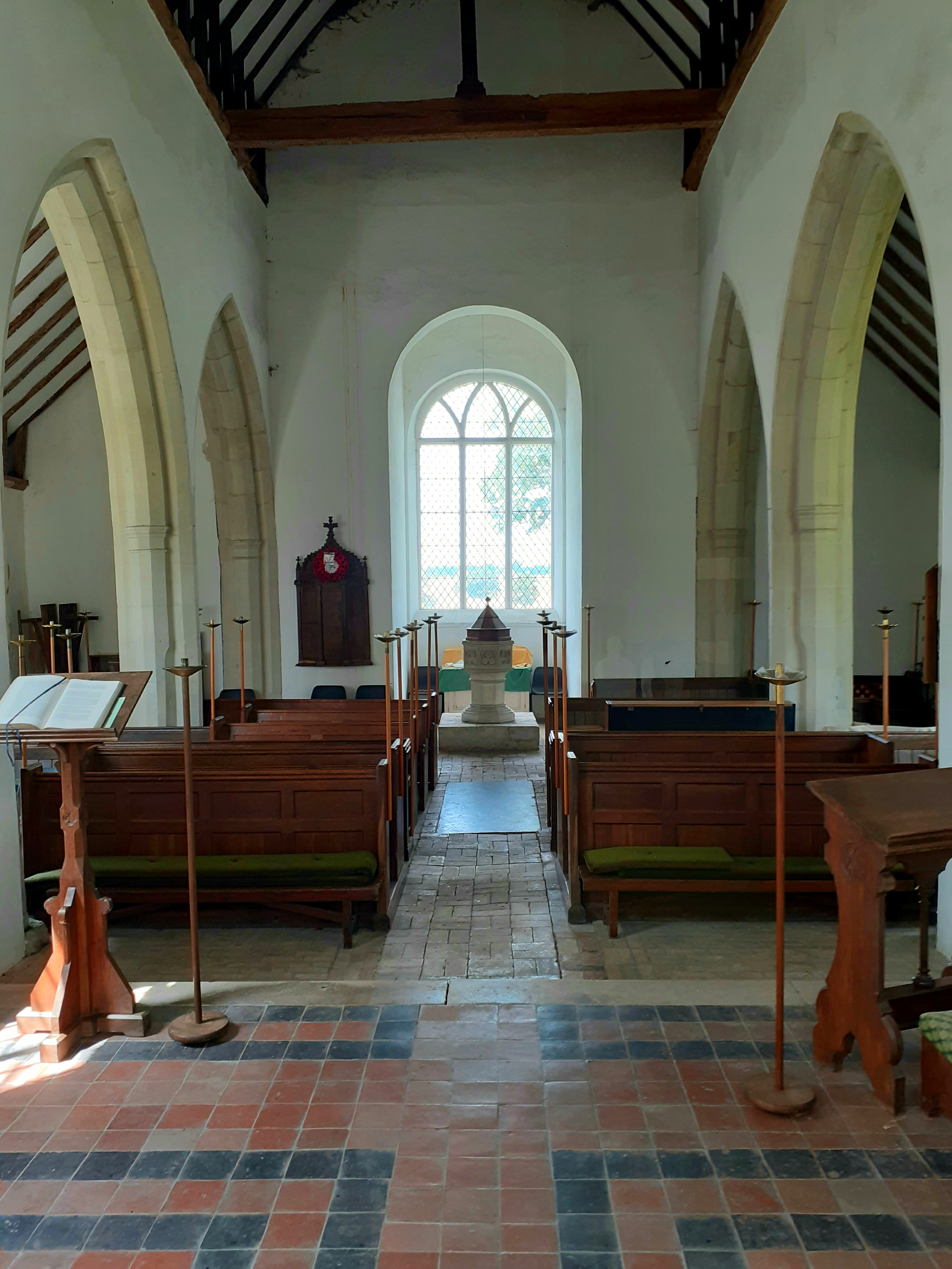
St Mary's Buttsbury
St Mary's is a Grade II* listed parish church in the village of Buttsbury, approximately 1.5 miles (2.4 km) north west of Ingatestone and 3.8 miles (6...
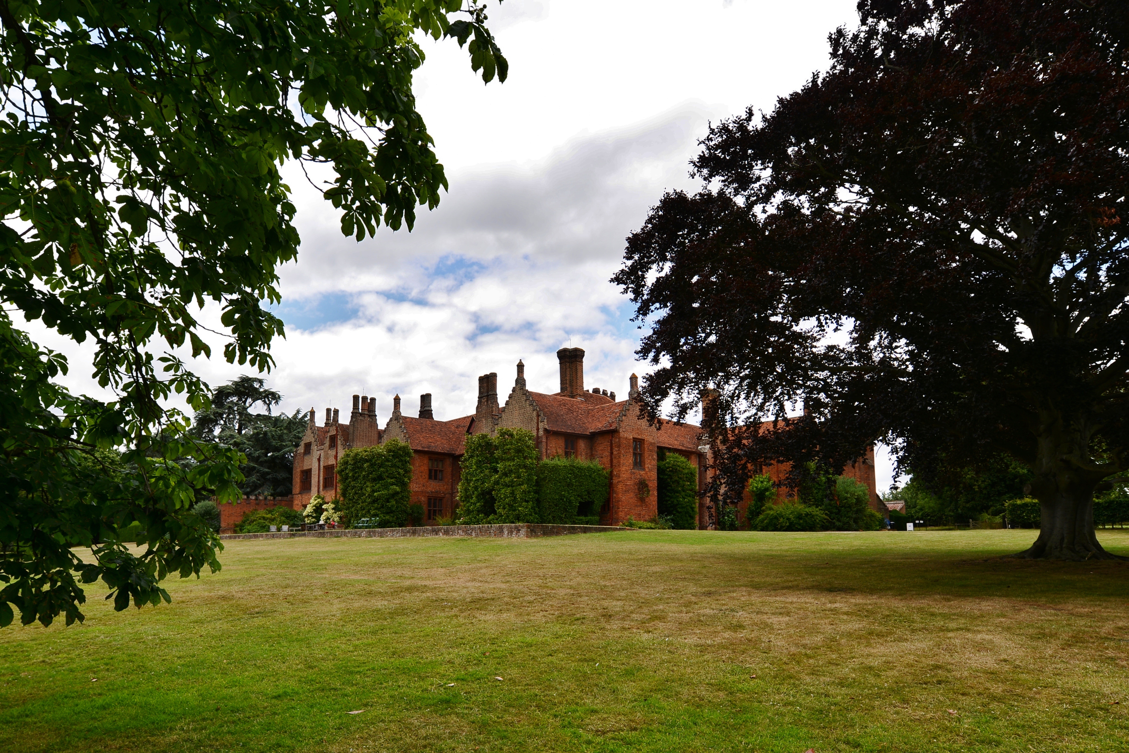
Ingatestone Hall
Ingatestone Hall is a Grade I listed 16th-century manor house in Essex, England. It is located outside the village of Ingatestone, approximately 5 miles...

Padham's Green
Padham's Green is a hamlet in the Brentwood district, in the English county of Essex. It is near the town of Ingatestone. It is assumed to be a manorial...

Ingatestone railway station
Ingatestone railway station is on the Great Eastern Main Line in the East of England, serving the village of Ingatestone, Essex. It is 23 miles 50 chains...

St Edmund and St Mary's Church, Ingatestone
St Edmund and St Mary's Church is the Church of England parish church in the village of Ingatestone in Essex. It dates to the 11th century and received...

Ingatestone
Ingatestone is a village and former civil parish in Essex, England, with a population of 5,409 inhabitants according to the 2021 census. Just north lies...
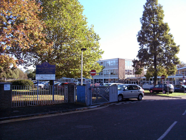
Anglo European School
Anglo European School is a self-governing, co-educational international academy school situated in Ingatestone, Essex. It is a school for boys and girls...
Nearby Amenities
Located within 500m of 51.656276,0.39840034Have you been to Buttsbury?
Leave your review of Buttsbury below (or comments, questions and feedback).