Coed Gerynant
Wood, Forest in Merionethshire
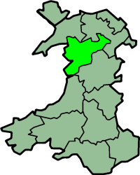
Wales
Coed Gerynant

Coed Gerynant, located in the historical county of Merionethshire, is a captivating woodland area renowned for its natural beauty and biodiversity. Situated in the heart of Snowdonia National Park, this ancient forest spans over 1,000 hectares and offers visitors a tranquil and immersive experience in the midst of nature.
The woodland comprises a diverse range of tree species, including oak, ash, birch, and rowan, which create a rich tapestry of colors throughout the year. Coed Gerynant is particularly famous for its vibrant autumnal displays when the leaves transform into a breathtaking array of red, orange, and gold.
The forest is crisscrossed by a network of well-maintained trails, allowing visitors to explore its enchanting surroundings. These paths meander through the woodland, leading to hidden glades, babbling brooks, and picturesque waterfalls. The sounds of birdsong fill the air, and lucky visitors may catch a glimpse of woodland creatures such as red squirrels, badgers, and deer.
In addition to its natural beauty, Coed Gerynant has historical significance. The forest has a long history of human occupation, with evidence of human activity dating back to the Bronze Age. Remnants of ancient settlements, including stone circles and burial mounds, can still be found within the woodland, providing a fascinating glimpse into the area's past.
Coed Gerynant is a cherished destination for nature lovers, hikers, and those seeking a peaceful retreat. Its picturesque landscapes, abundant wildlife, and rich history make it a truly special place within the idyllic surroundings of Merionethshire.
If you have any feedback on the listing, please let us know in the comments section below.
Coed Gerynant Images
Images are sourced within 2km of 52.922671/-3.3996382 or Grid Reference SJ0537. Thanks to Geograph Open Source API. All images are credited.


Coed Gerynant is located at Grid Ref: SJ0537 (Lat: 52.922671, Lng: -3.3996382)
Unitary Authority: Denbighshire
Police Authority: North Wales
What 3 Words
///scuba.ironic.soak. Near Llandrillo, Denbighshire
Nearby Locations
Related Wikis
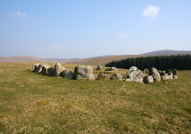
Moel Tŷ Uchaf
Moel Tŷ Uchaf is a stone circle (but most likely a ring cairn) near the village of Llandrillo, Denbighshire, north Wales. It is a collection of 41 stones...

Berwyn range
The Berwyn range (Welsh: Y Berwyn or Mynydd y Berwyn) is an isolated and sparsely populated area of moorland in the northeast of Wales, roughly bounded...

Llandrillo, Denbighshire
Llandrillo (or, in full, Llandrillo yn Edeirnion) is a small village and community in the Edeirnion area of Denbighshire in Wales, between Bala, and Corwen...
Edeirnion
Edeirnion or Edeyrnion is an area of the county of Denbighshire and an ancient commote of medieval Wales in the cantref of Penllyn. According to tradition...
Nearby Amenities
Located within 500m of 52.922671,-3.3996382Have you been to Coed Gerynant?
Leave your review of Coed Gerynant below (or comments, questions and feedback).