Coed Brwynen
Wood, Forest in Montgomeryshire
Wales
Coed Brwynen

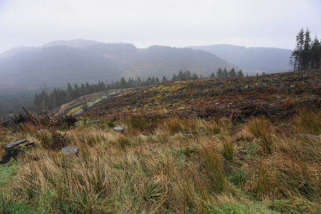
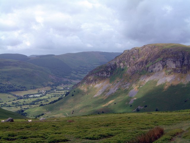
Coed Brwynen, located in Montgomeryshire, is a picturesque woodland area known for its abundance of natural beauty and diverse flora and fauna. Covering a vast expanse, the forest is a popular destination for nature enthusiasts, hikers, and those seeking tranquility away from the bustling city life.
The woodland is predominantly composed of a mix of deciduous and coniferous trees, creating a vibrant and vibrant green canopy that stretches as far as the eye can see. Oak, beech, and ash trees are among the dominant species, providing a rich habitat for various woodland creatures and a diverse range of plant life.
Coed Brwynen offers numerous walking trails, allowing visitors to explore the depths of the forest and discover its hidden treasures. The trails guide visitors through enchanting pathways, meandering streams, and peaceful clearings, creating a truly immersive experience in nature. Along the way, one may encounter a variety of wildlife, including deer, foxes, badgers, and an array of bird species.
The forest is also home to a nature reserve, where efforts are made to protect and conserve the local ecosystem. This reserve provides a safe haven for endangered species such as the red squirrel and the lesser horseshoe bat, highlighting the importance of Coed Brwynen as a vital habitat for biodiversity.
Coed Brwynen is a must-visit destination for anyone seeking solace in the midst of nature's embrace. With its serene atmosphere, diverse wildlife, and captivating landscapes, this woodland offers a truly immersive and unforgettable experience for all who venture into its depths.
If you have any feedback on the listing, please let us know in the comments section below.
Coed Brwynen Images
Images are sourced within 2km of 52.787557/-3.4373368 or Grid Reference SJ0322. Thanks to Geograph Open Source API. All images are credited.


Coed Brwynen is located at Grid Ref: SJ0322 (Lat: 52.787557, Lng: -3.4373368)
Unitary Authority: Powys
Police Authority: Dyfed Powys
What 3 Words
///belly.seating.confusion. Near Llangynog, Powys
Nearby Locations
Related Wikis
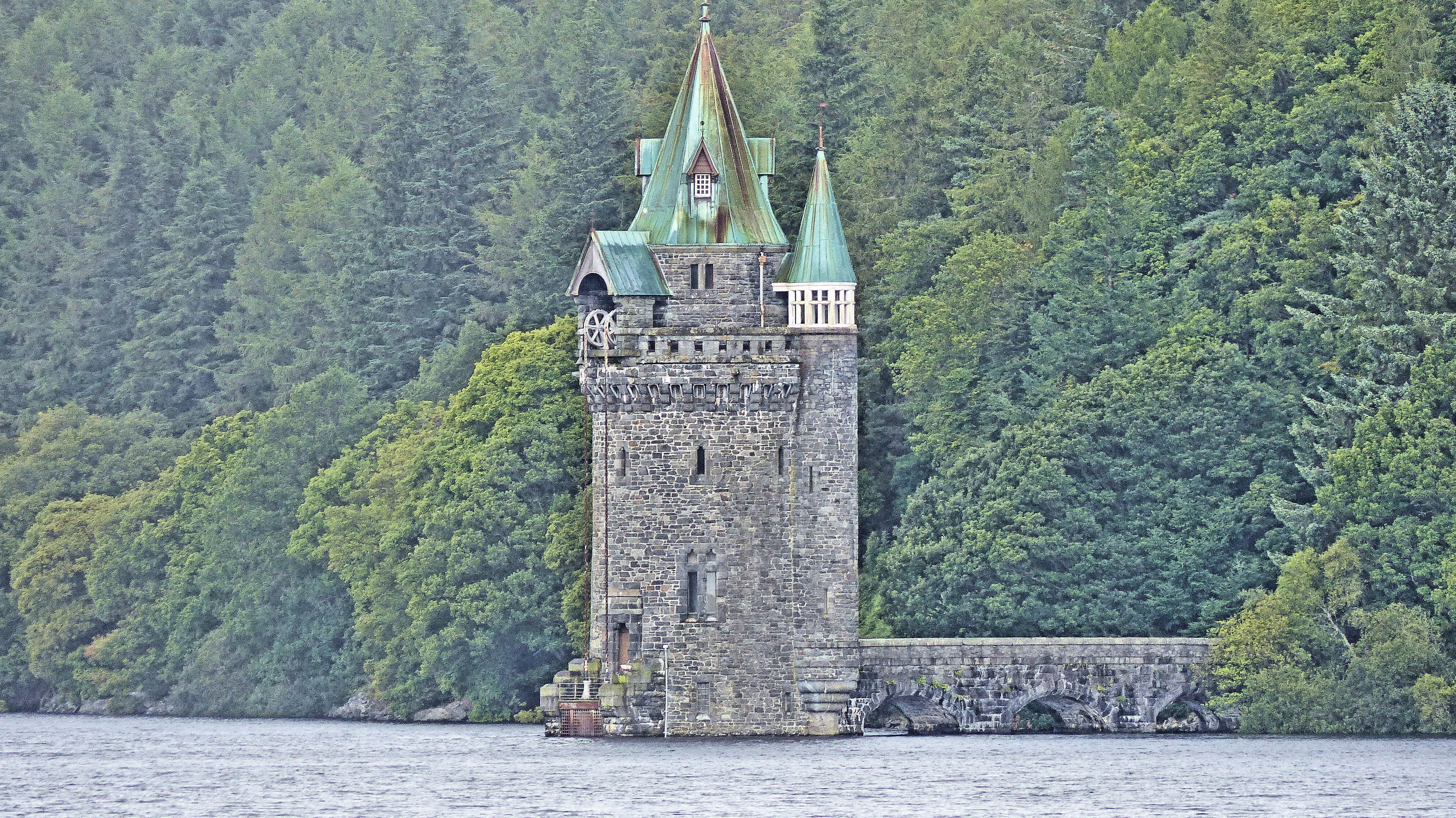
Lake Vyrnwy Straining Tower
The Straining Tower at Lake Vyrnwy is an intake tower built to extract water from the lake. The tower stands on the north shore of Lake Vyrnwy, near the...

Llanwddyn
Llanwddyn () is a village and community in Montgomeryshire, Powys, Wales. The community is centred on the Lake Vyrnwy reservoir. The original Llanwddyn...

Abertridwr, Powys
Abertridwr () is a small village in the historic county of Montgomeryshire in the north of Powys and close to Lake Vyrnwy in the community (civil parish...
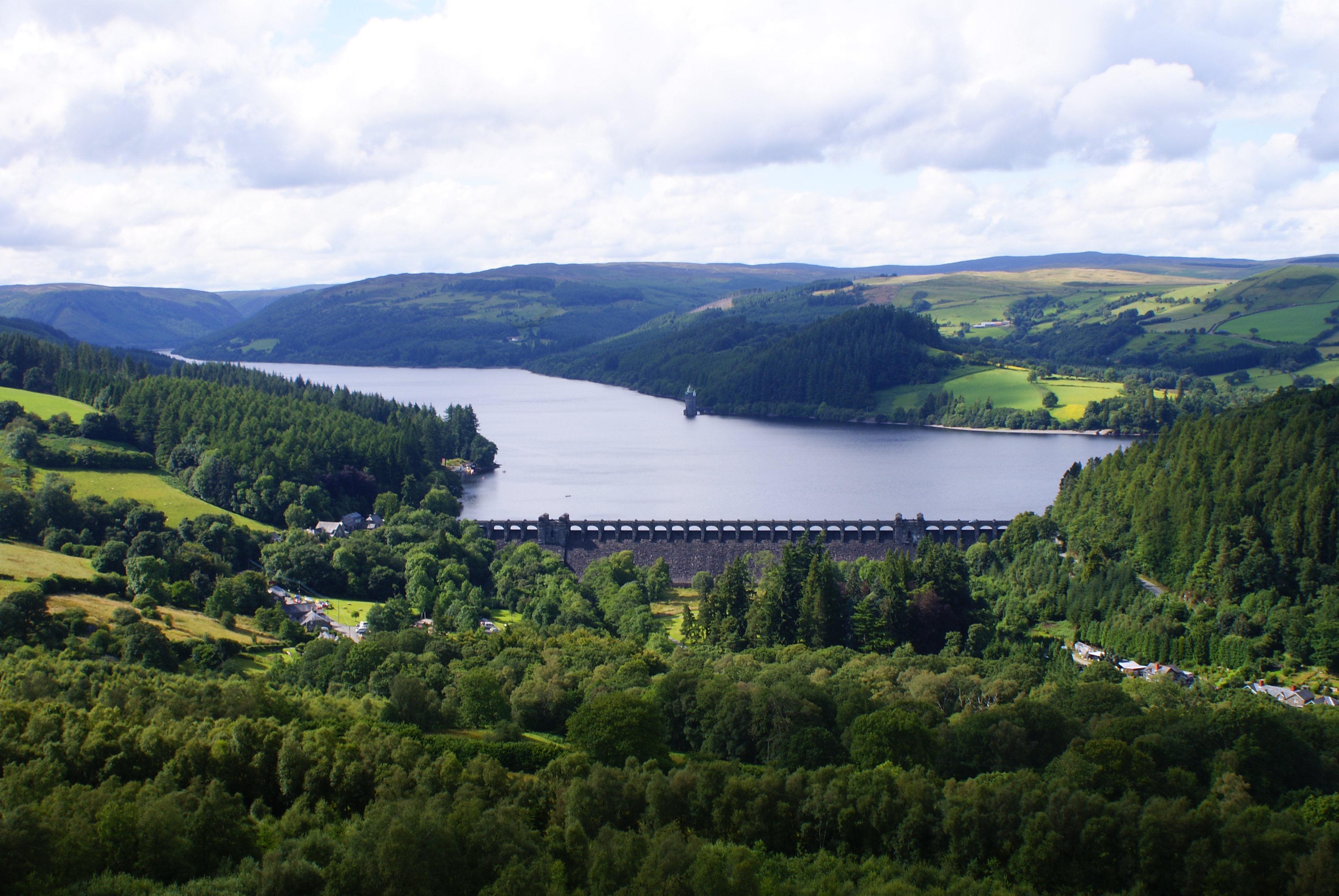
Lake Vyrnwy
Lake Vyrnwy (Welsh: Llyn Efyrnwy, pronounced [ɛˈvərnʊɨ] or Llyn Llanwddyn) is a reservoir in Powys, Wales, built in the 1880s for Liverpool Corporation...

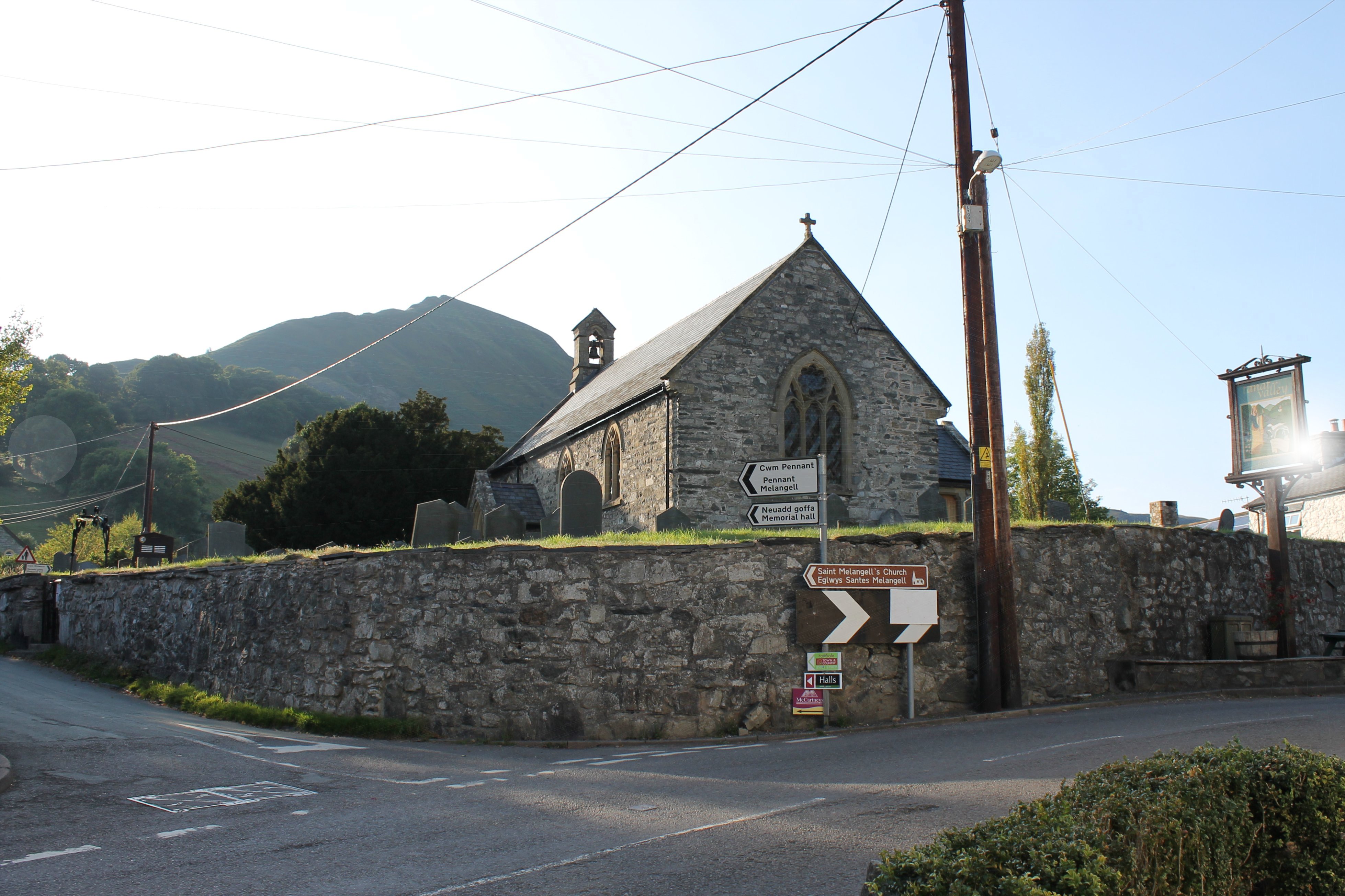
St Melangell's Church, Pennant Melangell
St Melangell's Church, Pennant Melangell, is a small church located on a minor road which joins the B4391 near the village of Llangynog, Powys, Wales....
Llangynog
Llangynog (; grid reference SJ053261) is a village and community at the confluence of the Afon Eirth and the Afon Tanat at the foot of the Berwyn range...

Llangynog railway station
Llangynog railway station was the western terminus station of the Tanat Valley Light Railway in Llangynog, Powys, Wales. The station opened in 1904, closed...
Craig Rhiwarth
Craig Rhiwarth is a mountain in the Berwyn range, in Powys (formerly Montgomeryshire), Wales, overlooking the village of Llangynog to the south. On the...
Nearby Amenities
Located within 500m of 52.787557,-3.4373368Have you been to Coed Brwynen?
Leave your review of Coed Brwynen below (or comments, questions and feedback).