Butterknowle

Settlement in Durham

England

Butterknowle

Field corner by Copley Lane Taken from almost the only public footpath in the square, this view from the Copley Bent Farm access track looks to the corner of the field which it crosses, adjacent to Copley Lane.  Beyond that lie the houses of Copley Bent itself.
Field corner by Copley Lane Credit: Andy Waddington

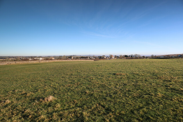
Butterknowle is a small village located in County Durham, England. Situated in the North East of England, it falls within the civil parish of Lynesack and Softley and lies approximately 12 miles southwest of the town of Bishop Auckland. The village is nestled in a rural setting, surrounded by picturesque countryside and rolling hills.

The origins of Butterknowle can be traced back to the medieval period, and its name is believed to have derived from the Old English words "butere" meaning butter and "cnoll" meaning hill. This suggests that the village may have had historical ties to the dairy industry or the presence of butter-making activities.

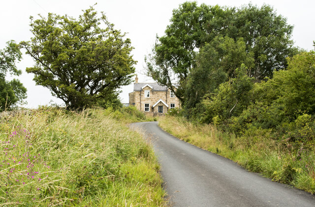
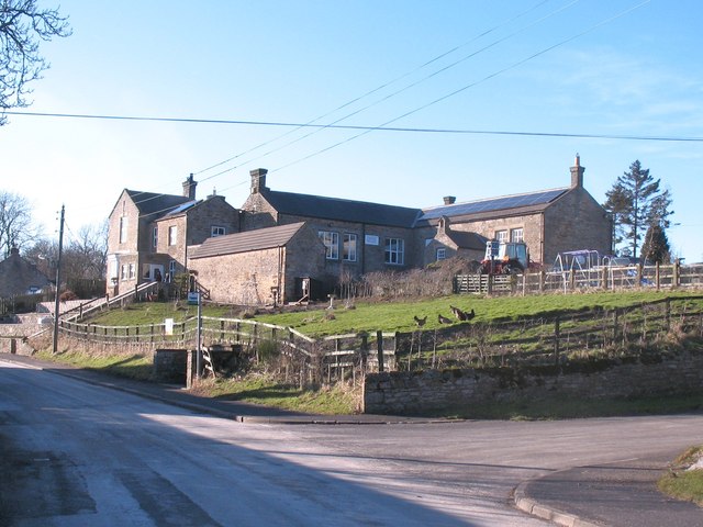
Today, Butterknowle is an idyllic and close-knit community with a population of around 400 residents. The village is characterized by its charming stone houses, many of which date back several centuries. The local economy is predominantly agricultural, with farming playing a significant role in the livelihoods of the inhabitants.

Butterknowle boasts a sense of tranquility and offers a peaceful retreat from the hustle and bustle of city life. It is an ideal location for those seeking a quiet and rural lifestyle. The village also benefits from its proximity to the stunning North Pennines Area of Outstanding Natural Beauty, providing residents with ample opportunities for outdoor activities such as hiking, cycling, and exploring the natural landscapes.

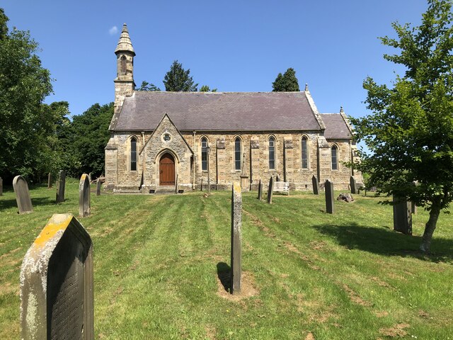
In terms of amenities, Butterknowle has a local primary school, a post office, and a village hall which serves as a hub for community activities and events. The nearest shops and services can be found in the neighboring towns and villages, ensuring that residents have access to essential facilities.

Overall, Butterknowle is a charming and picturesque village with a strong sense of community and a rich history. Its rural location and natural beauty make it an attractive place for those seeking a peaceful and close-to-nature lifestyle.

If you have any feedback on the listing, please let us know in the comments section below.

Butterknowle Images

Images are sourced within 2km of 54.626971/-1.835781 or Grid Reference NZ1025. Thanks to Geograph Open Source API. All images are credited.

Field corner by Copley Lane Taken from almost the only public footpath in the square, this view from the Copley Bent Farm access track looks to the corner of the field which it crosses, adjacent to Copley Lane.  Beyond that lie the houses of Copley Bent itself.
Field corner by Copley Lane
Taken from almost the only public footpath in the square, this view from the Copley Bent Farm access track looks to the corner of the field which it crosses, adjacent to Copley Lane. Beyond that lie the houses of Copley Bent itself.
Road climbing towards Raine's House The road climbs from Butterknowle continuing beyond Raine's House to Softley Farm. It's shown on OS maps as the route of a public footpath.
Road climbing towards Raine's House
The road climbs from Butterknowle continuing beyond Raine's House to Softley Farm. It's shown on OS maps as the route of a public footpath.
Church Of St John The Evangelist Grade II listed church of 1847 .
Church Of St John The Evangelist
Grade II listed church of 1847 .
Gravestones at St John The Evangelist, Lynesack
Road through the hamlet of Lynesack
Postbox, Copley The Victorian reign postbox is at the junction of Grewburn Lane and Copley Lane.  There is an Ordnance Survey bench mark on the brick pillar.  For a closer view of the postbox <a href="https://www.geograph.org.uk/photo/2484759">NZ0825 : Postbox, Copley</a>
Postbox, Copley
The Victorian reign postbox is at the junction of Grewburn Lane and Copley Lane. There is an Ordnance Survey bench mark on the brick pillar. For a closer view of the postbox NZ0825 : Postbox, Copley
Postbox, Copley The Victorian reign postbox is at the junction of Grewburn Lane and Copley Lane.  There is an Ordnance Survey bench mark on the brick pillar.  For a closer view of the bench mark <a href="https://www.geograph.org.uk/photo/2484760">NZ0825 : Bench Mark, Copley Lane</a>
Postbox, Copley
The Victorian reign postbox is at the junction of Grewburn Lane and Copley Lane. There is an Ordnance Survey bench mark on the brick pillar. For a closer view of the bench mark NZ0825 : Bench Mark, Copley Lane
Bench Mark, Copley Lane The Ordnance Survey bench mark is to be found on the southwest face of the postbox.  For a wider view <a href="https://www.geograph.org.uk/photo/2484759">NZ0825 : Postbox, Copley</a> and for further information on the bench mark and others in the area <span class="nowrap"><a title="http://www.bench-marks.org.uk/bm38468" rel="nofollow ugc noopener" href="http://www.bench-marks.org.uk/bm38468">Link</a><img style="margin-left:2px;" alt="External link" title="External link - shift click to open in new window" src="https://s1.geograph.org.uk/img/external.png" width="10" height="10"/></span>
Bench Mark, Copley Lane
The Ordnance Survey bench mark is to be found on the southwest face of the postbox. For a wider view NZ0825 : Postbox, Copley and for further information on the bench mark and others in the area LinkExternal link
Footpath, Lynesack The footpath forms part of the Gaunless Valley Circular Walk.  For a view of the sign <a href="https://www.geograph.org.uk/photo/2484867">NZ0925 : Sign, Lynesack</a>
Footpath, Lynesack
The footpath forms part of the Gaunless Valley Circular Walk. For a view of the sign NZ0925 : Sign, Lynesack
Sign, Lynesack The symbol and direction sign for the five and a half mile circular Gaunless Valley Walk.
Sign, Lynesack
The symbol and direction sign for the five and a half mile circular Gaunless Valley Walk.
Rest a while at Lynesack A pleasant place to rest in the hamlet of Lynesack.
Rest a while at Lynesack
A pleasant place to rest in the hamlet of Lynesack.
The Church of St John the Evangelist, Lynesack The Grade II listed church was built in 1847 of sandstone with ashlar dressings.
The Church of St John the Evangelist, Lynesack
The Grade II listed church was built in 1847 of sandstone with ashlar dressings.
Churchyard, The Church of St John the Evangelist A small stream runs through the edge of the churchyard.
Churchyard, The Church of St John the Evangelist
A small stream runs through the edge of the churchyard.
Drive, Softley Farm The drive, which is also a public footpath leaves Grewburn Lane to take walkers towards Softley Farm and onwards towards Crane Row Lane.
Drive, Softley Farm
The drive, which is also a public footpath leaves Grewburn Lane to take walkers towards Softley Farm and onwards towards Crane Row Lane.
Drive, Copley Bent Farm The drive, which is also used as a public footpath leaves the B6282, Copley Lane and takes walkers towards the Copley Bent Farm.
Drive, Copley Bent Farm
The drive, which is also used as a public footpath leaves the B6282, Copley Lane and takes walkers towards the Copley Bent Farm.
Track and footpath near Gibbsneese Heading north west towards a white painted barn on Gibbsneese Farm.
Track and footpath near Gibbsneese
Heading north west towards a white painted barn on Gibbsneese Farm.
Cottages at Howle Stone built cottages at Howle alongside the beck of the same name.
Cottages at Howle
Stone built cottages at Howle alongside the beck of the same name.
Lynesack Road junction in this quiet Co Durham hamlet. The right turn leads to the church, whilst on the bank ahead is the former village school.
Lynesack
Road junction in this quiet Co Durham hamlet. The right turn leads to the church, whilst on the bank ahead is the former village school.
Show me another place!

Butterknowle is located at Grid Ref: NZ1025 (Lat: 54.626971, Lng: -1.835781)

Unitary Authority: County Durham

Police Authority: Durham

What 3 Words

///ejects.recitals.bribing. Near Cockfield, Co. Durham

Nearby Locations

Butterknowle

Related Wikis

Butterknowle

Butterknowle is a village in Teesdale, County Durham, England. Butterknowle is situated between the market towns of Bishop Auckland (9 miles to the east...

Morley, County Durham

Morley is a village in County Durham, England. It is situated five miles to the west of Bishop Auckland (OS grid reference NZ 1127). Morley is first mentioned...

The Slack

The Slack is a village in County Durham, England. It is situated near to Butterknowle, to the west of Bishop Auckland. == References ==

South Side, County Durham

South Side is a village in County Durham, in England. It is situated to the north of Butterknowle, a few miles west of Bishop Auckland. == References... ==

Nearby Amenities

Located within 500m of 54.626971,-1.835781
Bus Stop
Diamond Inn
Naptan AtcoCode: 13007427D
Naptan Bearing: SE
Naptan CommonName: Diamond Inn
Naptan Indicator: south east bound
Naptan Landmark: Outside Nos 11 and 12
Naptan NaptanCode: durdwjtj
Naptan Street: Pinfold Lane
Naptan Verified: no
Source: naptan_import
Lat/Long: 54.6264615/-1.8358619
Bus Stop
Diamond Inn
Naptan AtcoCode: 13007427H
Naptan Bearing: NW
Naptan CommonName: Diamond Inn
Naptan Indicator: north west bound
Naptan Landmark: opposite No 6
Naptan NaptanCode: durdwjtm
Naptan Street: Pinfold Lane
Naptan Verified: no
Source: naptan_import
Lat/Long: 54.6264534/-1.8365589
Bus Stop
Village Hall
Naptan AtcoCode: 13007428D
Naptan Bearing: SE
Naptan CommonName: Village Hall
Naptan Indicator: south east bound
Naptan Landmark: Outside No 3 Memorial Cottages
Naptan NaptanCode: durdwjtp
Naptan Street: Pinfold Lane
Naptan Verified: no
Source: naptan_import
Lat/Long: 54.6268244/-1.8384471
Bus Stop
Village Hall
Naptan AtcoCode: 13007428H
Naptan Bearing: NW
Naptan CommonName: Village Hall
Naptan Indicator: north west bound
Naptan Landmark: Landmark not known
Naptan NaptanCode: durdwjtw
Naptan Notes: Opposite Fell View- between Tilleys Row and Memorial Cottages- Pinfold Lane- Butterknowle.
Naptan Street: Street not known
Naptan Verified: no
Source: naptan_import
Lat/Long: 54.6268163/-1.8390667
Bus Stop
East End Bus stop
Naptan AtcoCode: 13007444C
Naptan Bearing: E
Naptan BusStopType: MKD
Naptan CommonName: East End Bus stop
Naptan Indicator: E-bound
Naptan Landmark: Outside and east of No 10 The Slack
Naptan NaptanCode: durdwmgm
Naptan RevisionNumber: 3
Naptan Street: Diamond Hill
Naptan Verified: no
Old Name: Bus stop
Source: naptan_import
Lat/Long: 54.6253386/-1.8296709
Bus Stop
East End Bus stop
Naptan AtcoCode: 13007444G
Naptan Bearing: W
Naptan BusStopType: MKD
Naptan CommonName: East End Bus stop
Naptan Indicator: W-bound
Naptan Landmark: Near bridge over stream
Naptan NaptanCode: durdwmgp
Naptan RevisionNumber: 3
Naptan Street: Diamond Hill
Naptan Verified: no
Old Name: Bus stop
Source: naptan_import
Lat/Long: 54.6252046/-1.8302755
Butterknowle
Place: village
Wikidata: Q5002990
Wikipedia: en:Butterknowle
Lat/Long: 54.6263702/-1.8344999
Barrier: cattle_grid
Lat/Long: 54.6253906/-1.829437
Fern Grove Farm
Addr City: Bishop Auckland
Addr Postcode: DL13 5QS
Addr Suburb: Butterknowle
Place: farm
Source Name: OS OpenData StreetView
Source Postcode: CodePoint Open
Lat/Long: 54.6226179/-1.8361116
Butterknowle War Memorial
Historic: memorial
Memorial: war_memorial
Wikidata: Q26677981
Wikimedia Commons: File:War Memorial, Butterknowle - geograph.org.uk - 2513437.jpg
Lat/Long: 54.6268799/-1.8385953
Power: pole
Lat/Long: 54.6274836/-1.8286604
Power: pole
Lat/Long: 54.6266963/-1.828085
Power: pole
Lat/Long: 54.6290455/-1.8298097
Power: pole
Lat/Long: 54.6298576/-1.8303904
Salterburn Farm
Addr City: Bishop Auckland
Addr Postcode: DL13 5LD
Addr Suburb: Butterknowle
Place: farm
Source Name: OS_OpenData_StreetView
Source Postcode: CodePoint Open
Lat/Long: 54.6291162/-1.8402703
Power: pole
Lat/Long: 54.6247895/-1.8350092
Power: pole
Lat/Long: 54.6248524/-1.8390124
Power: pole
Lat/Long: 54.6260038/-1.8392041
Power: pole
Lat/Long: 54.626687/-1.839302
Power: pole
Lat/Long: 54.6247887/-1.8424094
Power: pole
Lat/Long: 54.6247988/-1.8404742
Power: pole
Lat/Long: 54.6248151/-1.8389976
Power: pole
Lat/Long: 54.6246832/-1.8373534
Power: pole
Lat/Long: 54.62451/-1.8352653
The data included in this document is from www.openstreetmap.org. The data is made available under ODbL.

Have you been to Butterknowle?

Leave your review of Butterknowle below (or comments, questions and feedback).