Coed y Saeson

Wood, Forest in Flintshire

Wales

Coed y Saeson

Mini-roundabout, St Asaph This roundabout links the A525/ B5381 and St Asaph Bridge.
Mini-roundabout, St Asaph Credit: David Bremner

Coed y Saeson is a picturesque woodland located in the county of Flintshire, Wales. Nestled in the heart of the countryside, this enchanting forest covers an area of approximately 200 acres, making it a haven for nature enthusiasts and outdoor adventurers alike.

The woodland is characterized by its diverse range of tree species, including oak, beech, and birch, which create a vibrant and lush canopy overhead. This rich variety of trees also supports a wide array of wildlife, from birds such as woodpeckers and owls to mammals like foxes and deer.

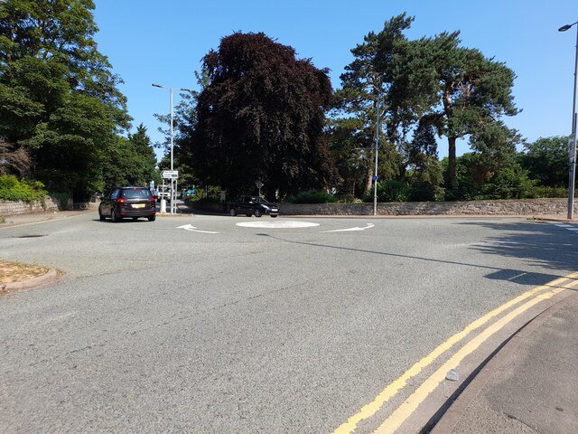
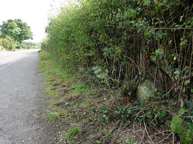
Traversing through Coed y Saeson, visitors will find a network of well-maintained walking trails that wind their way through the forest. These paths offer a chance to explore the natural beauty of the wood and provide an opportunity to observe the flora and fauna that call this place home. The peaceful ambiance and the calming sound of rustling leaves make it an ideal location for a leisurely stroll or a family picnic.

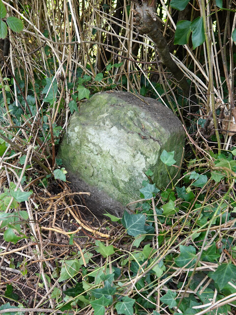
Coed y Saeson also holds historical significance, with evidence of ancient settlements and archaeological finds within its boundaries. This adds an extra layer of intrigue and fascination to the woodland, drawing history enthusiasts and archaeology buffs to delve into the past as they wander among the trees.

Overall, Coed y Saeson is a captivating destination for those seeking tranquility and a connection with nature. Whether it be for a peaceful walk, wildlife spotting, or simply to soak in the serene atmosphere, this forest in Flintshire offers a delightful escape from the hustle and bustle of everyday life.

If you have any feedback on the listing, please let us know in the comments section below.

Coed y Saeson Images

Images are sourced within 2km of 53.246246/-3.4707559 or Grid Reference SJ0173. Thanks to Geograph Open Source API. All images are credited.

Mini-roundabout, St Asaph This roundabout links the A525/ B5381 and St Asaph Bridge.
Mini-roundabout, St Asaph
This roundabout links the A525/ B5381 and St Asaph Bridge.
The Factory Gates Are Closed The entrance to the former Pilkington Special Glass works, demolished in 2009.
The Factory Gates Are Closed
The entrance to the former Pilkington Special Glass works, demolished in 2009.
Glyndwr University Building At St Asaph Business Park. This building was used as a Covid Vaccination Centre.
Glyndwr University Building
At St Asaph Business Park. This building was used as a Covid Vaccination Centre.
A55 between Bodelwyddan and St Asaph The A55 is also known as the North Wales expressway. Originally it ran from Chester to Bangor, but was extended in 2001 across Anglesey to Holyhead. It is dual carriageway along its entire length.
Wikipedia: <span class="nowrap"><a title="http://en.wikipedia.org/wiki/A55_road" rel="nofollow ugc noopener" href="http://en.wikipedia.org/wiki/A55_road">Link</a><img style="margin-left:2px;" alt="External link" title="External link - shift click to open in new window" src="https://s1.geograph.org.uk/img/external.png" width="10" height="10"/></span>
A55 between Bodelwyddan and St Asaph
The A55 is also known as the North Wales expressway. Originally it ran from Chester to Bangor, but was extended in 2001 across Anglesey to Holyhead. It is dual carriageway along its entire length. Wikipedia: LinkExternal link
A55 heading west Between St Asaph and Bodelwyddan - the spire of the Marble Church in the distance
A55 heading west
Between St Asaph and Bodelwyddan - the spire of the Marble Church in the distance
Pond with a lonely swan Near the St Asaph business park
Pond with a lonely swan
Near the St Asaph business park
Carreg Wen Cottage Near the roundabout at St Asaph Business Park
Carreg Wen Cottage
Near the roundabout at St Asaph Business Park
Glascoed Nature Reserve Grassy area with ponds for greater crested newts. This was created when St Asaph Business Park was being created.
Glascoed Nature Reserve
Grassy area with ponds for greater crested newts. This was created when St Asaph Business Park was being created.
Milestone by the B5381, Lower Denbigh Road, St Asaph This milestone is on the west side of the B5381, south of St Asaph and fairly well hidden in the hedge. There's no inscription visible so it may be buried or the stone may be broken. For a wider view see <a href="https://www.geograph.org.uk/photo/7292681">SJ0373 : The B5381, Lower Denbigh Road and a milestone</a>

Inscription once read:
(Rhuddlan 3)
(Denbigh 5)
Milestone by the B5381, Lower Denbigh Road, St Asaph
This milestone is on the west side of the B5381, south of St Asaph and fairly well hidden in the hedge. There's no inscription visible so it may be buried or the stone may be broken. For a wider view see SJ0373 : The B5381, Lower Denbigh Road and a milestone Inscription once read: (Rhuddlan 3) (Denbigh 5)
The B5381, Lower Denbigh Road and a milestone The milestone is on the west side of the B5381, south of St Asaph.
See also: <a href="https://www.geograph.org.uk/photo/7292669">SJ0373 : Milestone by the B5381, Lower Denbigh Road, St Asaph</a>
The B5381, Lower Denbigh Road and a milestone
The milestone is on the west side of the B5381, south of St Asaph. See also: SJ0373 : Milestone by the B5381, Lower Denbigh Road, St Asaph
Ordnance Survey 1GL Bolt This OS bolt can be found on the south parapet of St Asaph Bridge. It marks a point 18.706m above mean sea level.
Ordnance Survey 1GL Bolt
This OS bolt can be found on the south parapet of St Asaph Bridge. It marks a point 18.706m above mean sea level.
Ordnance Survey Cut Mark This OS cut mark can be found on the SW angle of the chapel on Lower Denbigh Road. It marks a point 16.182m above mean sea level.
Ordnance Survey Cut Mark
This OS cut mark can be found on the SW angle of the chapel on Lower Denbigh Road. It marks a point 16.182m above mean sea level.
Study of a Gasoline Station Applegreen, St Asaph.

 This photograph is part of a series taken in homage to the American artist Ed Ruscha's 1963 publication of 'Twentysix Gasoline Stations'.
 More properly known as filling stations in the UK, I am attempting to photograph as many as possible to mark the sixty year anniversary.
Study of a Gasoline Station
Applegreen, St Asaph. This photograph is part of a series taken in homage to the American artist Ed Ruscha's 1963 publication of 'Twentysix Gasoline Stations'. More properly known as filling stations in the UK, I am attempting to photograph as many as possible to mark the sixty year anniversary.
A55 eastbound approaching St Asaph
A55 westbound, west of St Asaph
A55 west of St Asaph The A55 is also known as the North Wales expressway. Originally it ran from Chester to Bangor, but was extended in 2001 across Anglesey to Holyhead. It is dual carriageway along its entire length.
Wikipedia: <span class="nowrap"><a title="http://en.wikipedia.org/wiki/A55_road" rel="nofollow ugc noopener" href="http://en.wikipedia.org/wiki/A55_road">Link</a><img style="margin-left:2px;" alt="External link" title="External link - shift click to open in new window" src="https://s1.geograph.org.uk/img/external.png" width="10" height="10"/></span>
A55 west of St Asaph
The A55 is also known as the North Wales expressway. Originally it ran from Chester to Bangor, but was extended in 2001 across Anglesey to Holyhead. It is dual carriageway along its entire length. Wikipedia: LinkExternal link
A55, westbound The A55 is also known as the North Wales expressway. Originally it ran from Chester to Bangor, but was extended in 2001 across Anglesey to Holyhead. It is dual carriageway along its entire length.
Wikipedia: <span class="nowrap"><a title="http://en.wikipedia.org/wiki/A55_road" rel="nofollow ugc noopener" href="http://en.wikipedia.org/wiki/A55_road">Link</a><img style="margin-left:2px;" alt="External link" title="External link - shift click to open in new window" src="https://s1.geograph.org.uk/img/external.png" width="10" height="10"/></span>
A55, westbound
The A55 is also known as the North Wales expressway. Originally it ran from Chester to Bangor, but was extended in 2001 across Anglesey to Holyhead. It is dual carriageway along its entire length. Wikipedia: LinkExternal link
St Asaph junction, A55 The A55 is also known as the North Wales expressway. Originally it ran from Chester to Bangor, but was extended in 2001 across Anglesey to Holyhead. It is dual carriageway along its entire length.
Wikipedia: <span class="nowrap"><a title="http://en.wikipedia.org/wiki/A55_road" rel="nofollow ugc noopener" href="http://en.wikipedia.org/wiki/A55_road">Link</a><img style="margin-left:2px;" alt="External link" title="External link - shift click to open in new window" src="https://s1.geograph.org.uk/img/external.png" width="10" height="10"/></span>
St Asaph junction, A55
The A55 is also known as the North Wales expressway. Originally it ran from Chester to Bangor, but was extended in 2001 across Anglesey to Holyhead. It is dual carriageway along its entire length. Wikipedia: LinkExternal link
Show me another place!

Coed y Saeson is located at Grid Ref: SJ0173 (Lat: 53.246246, Lng: -3.4707559)

Unitary Authority: Denbighshire

Police Authority: North Wales

What 3 Words

///acclaimed.presumes.radio. Near St Asaph, Denbighshire

Related Wikis

Bedd-y-Cawr Hillfort

Bedd-y-Cawr Hillfort, or Bedd y Cawr Hillfort, is an Iron Age hillfort on a natural inland promontory in the community of Cefnmeiriadog in Denbighshire...

Cefn Meiriadog

Cefn Meiriadog (sometimes Cefnmeriadog) is a rural community in Denbighshire, Wales, just south-west of the city of St Asaph. The boundary of the community...

St Asaph City F.C.

St Asaph City Football Club (Welsh: Clwb Pêl Droed Dinas Llanelwy) is a Welsh football team based in St Asaph, Denbighshire, Wales. They play in the Ardal...
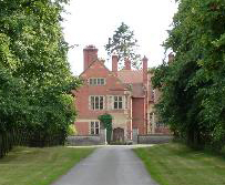
Wigfair Hall

Wigfair Hall is a large country house standing in an elevated position above the River Elwy near the village of Cefn Meiriadog, Denbighshire, Wales. It...

Bontnewydd Palaeolithic site

The Bontnewydd palaeolithic site (Welsh: [bɔntˈnɛuɨ̯ð]), also known in its unmutated form as Pontnewydd (Welsh language: 'New bridge'), is an archaeological...

St Asaph Cathedral

The Cathedral Church of Saints Asaph and Cyndeyrn, commonly called St Asaph Cathedral (Welsh: Eglwys Gadeiriol Llanelwy), is a cathedral in St Asaph, Denbighshire...

Diocese of St Asaph

The Diocese of Saint Asaph is a diocese of the Church in Wales in north-east Wales, named after Saint Asaph, its second bishop. == Geography == The Anglican...

St Asaph

St Asaph (; Welsh: Llanelwy [ɬanˈɛlʊɨ̯] "church on the Elwy") is a city and community on the River Elwy in Denbighshire, Wales. In the 2011 Census it had...

Nearby Amenities

Located within 500m of 53.246246,-3.4707559
Power: tower
Lat/Long: 53.2461433/-3.4763306
Power: tower
Lat/Long: 53.2434221/-3.4666897
Power: tower
Lat/Long: 53.2448365/-3.4717526
Power: pole
Lat/Long: 53.2471668/-3.4649844
Power: pole
Lat/Long: 53.2468356/-3.4635198
Power: pole
Lat/Long: 53.2480381/-3.4654613
Power: pole
Lat/Long: 53.2488992/-3.4658716
Power: pole
Lat/Long: 53.2505147/-3.4687455
Power: pole
Lat/Long: 53.2501041/-3.4675664
Power: pole
Lat/Long: 53.2496507/-3.4662678
The data included in this document is from www.openstreetmap.org. The data is made available under ODbL.

Have you been to Coed y Saeson?

Leave your review of Coed y Saeson below (or comments, questions and feedback).