Allt Ddu

Wood, Forest in Brecknockshire

Wales

Allt Ddu

Ordnance Survey Cut Mark This OS cut mark can be found on the trough NE side of the road. It marks a point 243.602m above mean sea level. <a title="https://www.geograph.org.uk/photo/7460780" href="https://www.geograph.org.uk/photo/7460780">Link</a>
Ordnance Survey Cut Mark Credit: Adrian Dust

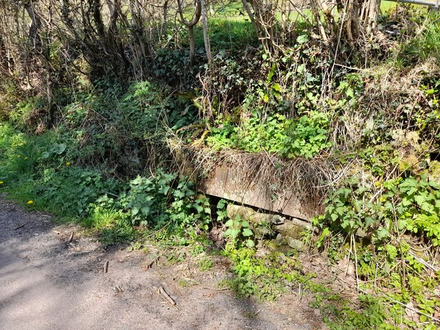
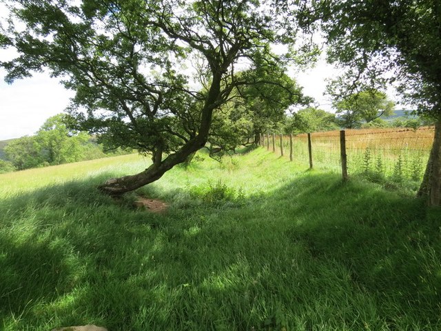
Allt Ddu is a small wood located in Brecknockshire, a historic county in Wales. Situated near the village of Defynnog, the wood covers an area of approximately 50 hectares. It is known for its diverse range of tree species, including oak, beech, ash, and birch.

The wood is a popular destination for nature enthusiasts and hikers due to its tranquil and picturesque surroundings. It offers a variety of walking trails and paths that allow visitors to explore the area at their leisure. The dense tree cover provides shade and shelter, creating a serene atmosphere for those seeking a peaceful escape from the hustle and bustle of everyday life.

Wildlife is abundant in Allt Ddu, with many species of birds, small mammals, and insects calling the wood their home. Visitors may have the opportunity to spot animals such as red foxes, badgers, and various species of birds, including woodpeckers and owls.

Allt Ddu has a rich history as well. It was once part of a larger estate, and remnants of the original manor house can still be found within the wood. These historical features add an element of intrigue and fascination for history enthusiasts who visit the area.

Overall, Allt Ddu is a beautiful and diverse wood that offers a peaceful retreat for nature lovers. With its stunning scenery, diverse wildlife, and historical significance, it is a must-visit destination for those exploring the Brecknockshire region.

If you have any feedback on the listing, please let us know in the comments section below.

Allt Ddu Images

Images are sourced within 2km of 52.014259/-3.4642632 or Grid Reference SN9936. Thanks to Geograph Open Source API. All images are credited.

Ordnance Survey Cut Mark This OS cut mark can be found on the trough NE side of the road. It marks a point 243.602m above mean sea level. <a title="https://www.geograph.org.uk/photo/7460780" href="https://www.geograph.org.uk/photo/7460780">Link</a>
Ordnance Survey Cut Mark
This OS cut mark can be found on the trough NE side of the road. It marks a point 243.602m above mean sea level. Link
Water Trough There is an OS cut mark at the west end of the trough. <a title="https://www.geograph.org.uk/photo/7460779" href="https://www.geograph.org.uk/photo/7460779">Link</a>
Water Trough
There is an OS cut mark at the west end of the trough. Link
Ordnance Survey Cut Mark This OS cut mark can be found on the SW parapet of the bridge. It marks a point 249.269m above mean sea level.
Ordnance Survey Cut Mark
This OS cut mark can be found on the SW parapet of the bridge. It marks a point 249.269m above mean sea level.
Ordnance Survey Cut Mark This OS cut mark can be found on the large stone south side of the road. It marks a point 288.426m above mean sea level.
Ordnance Survey Cut Mark
This OS cut mark can be found on the large stone south side of the road. It marks a point 288.426m above mean sea level.
The Mill House Pont Faen Powys in 2000 Beyond is the Mill being converted into a residence
The Mill House Pont Faen Powys in 2000
Beyond is the Mill being converted into a residence
Safety fencing recently erected around the Churchyard at Pont Faen Powys
Sunny Bank cottage in Pont Faen, Powys
Brynbont cottage in Pont Faen, Powys
Merthyr Cynog Cerddwyr yn anelu i lawr o'r ucheldir tuag at bentre bach Merthyr Cynog. Y cwm yn y pellter yw Ysgir Fawr.

Walkers descending towards the tiny village of Merthyr Cynog. The valley in the distance is that of Cwm Ysgir Fawr.
Merthyr Cynog
Cerddwyr yn anelu i lawr o'r ucheldir tuag at bentre bach Merthyr Cynog. Y cwm yn y pellter yw Ysgir Fawr. Walkers descending towards the tiny village of Merthyr Cynog. The valley in the distance is that of Cwm Ysgir Fawr.
Ceuffordd Merthyr Cynog Holloway Hen geuffordd yn dringo lan y bryn o bentre Merthyr Cynog i gyfeiriad Pentrebach.

Old holloway ascending the hill from Merthyr Cynog village in the direction of Pentrebach.
Ceuffordd Merthyr Cynog Holloway
Hen geuffordd yn dringo lan y bryn o bentre Merthyr Cynog i gyfeiriad Pentrebach. Old holloway ascending the hill from Merthyr Cynog village in the direction of Pentrebach.
Ceuffordd Pontfaen Hollow Way Hen geuffordd sy bellach yn llwybr ceffyl yn arwain o bentref Pontfaen at ucheldir a elwir Cefn Bola Maen.

An old hollow way, now a bridleway, ascending from the village of Pontfaen towards an upland area known as Cefn Bola Maen.
Ceuffordd Pontfaen Hollow Way
Hen geuffordd sy bellach yn llwybr ceffyl yn arwain o bentref Pontfaen at ucheldir a elwir Cefn Bola Maen. An old hollow way, now a bridleway, ascending from the village of Pontfaen towards an upland area known as Cefn Bola Maen.
Sharp bend in road to Merthyr Cynog and Upper Chapel At Pont Rhyd-y-berry
Sharp bend in road to Merthyr Cynog and Upper Chapel
At Pont Rhyd-y-berry
Entrance to the Church of St Cynog at Merthyr Cynog
Drive to Alltcerrig
Drive to Alltcerrig
Ordnance Survey Pivot This OS pivot can be found on the bridge over the Ysgir Fechan. It marks a point 203.052m above mean sea level.
Ordnance Survey Pivot
This OS pivot can be found on the bridge over the Ysgir Fechan. It marks a point 203.052m above mean sea level.
Ordnance Survey Cut Mark This OS cut mark can be found on the SW angle of St Cynog's Church. It marks a point 319.991m above mean sea level.
Ordnance Survey Cut Mark
This OS cut mark can be found on the SW angle of St Cynog's Church. It marks a point 319.991m above mean sea level.
Ordnance Survey Cut Mark This OS cut mark can be found on the roadside wall SW side of the road. It marks a point 217.268m above mean sea level.
Ordnance Survey Cut Mark
This OS cut mark can be found on the roadside wall SW side of the road. It marks a point 217.268m above mean sea level.
Yscir Fawr Looking North off the Jubilee Bridge along the Yscir Fawr Stream.
Yscir Fawr
Looking North off the Jubilee Bridge along the Yscir Fawr Stream.
Show me another place!

Allt Ddu is located at Grid Ref: SN9936 (Lat: 52.014259, Lng: -3.4642632)

Unitary Authority: Powys

Police Authority: Dyfed Powys

What 3 Words

///responds.rejects.spouse. Near Brecon, Powys

Nearby Locations

Allt Ddu

Related Wikis

Merthyr Cynog

Merthyr Cynog is a hamlet and a community in the modern county of Powys, Wales, in the historic county of Brecknockshire. The population of the community...

Cynog ap Brychan

Cynog son of Brychan (Welsh: Cynog ap Brychan; born c. 434), also known as Saint Cynog or Canog (Old Welsh: Kennauc), was an early Welsh saint and martyr...

Yscir with Honddu Isaf and Llanddew

Yscir with Honddu Isaf and Llanddew (formerly known as Yscir) is the name of an electoral ward in southern Powys, Wales. It covers five local government...

Castell Madoc

Castell Madoc is a small rural village in Brecon, Powys. The village lies next to Mynydd Epynt, on Afon Honddu, one of the most important tributaries of...

Have you been to Allt Ddu?

Leave your review of Allt Ddu below (or comments, questions and feedback).