Coed Carreg-y-big
Wood, Forest in Montgomeryshire
Wales
Coed Carreg-y-big

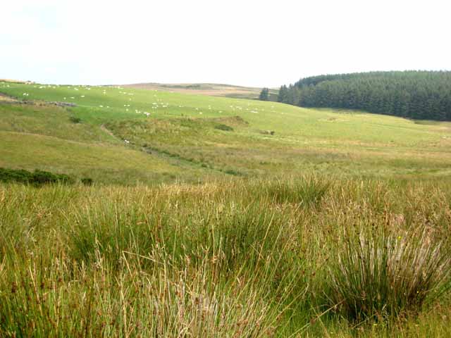
Coed Carreg-y-big is a woodland area located in Montgomeryshire, Wales. Covering a vast expanse, it is a significant natural resource in the region. The name "Carreg-y-big" translates to "rock of the little" in English, hinting at the rocky terrain present within the woodland.
The woodland is predominantly composed of native tree species, such as oak, beech, and birch, which provide a diverse and rich habitat for a variety of wildlife. The dense canopy created by these trees shades the forest floor, creating a cool and tranquil environment. The undergrowth is adorned with a carpet of mosses, ferns, and wildflowers, adding to the area's natural beauty.
Coed Carreg-y-big is a popular destination for nature enthusiasts and hikers. It offers a network of well-maintained trails that wind through the woodland, providing visitors with the opportunity to explore and appreciate the serene surroundings. The trails vary in difficulty, catering to both casual walkers and more experienced hikers.
The woodland is also home to a plethora of wildlife species, including birds, mammals, and insects. Birdwatchers can spot species such as woodpeckers, owls, and various songbirds, while small mammals like squirrels and rabbits can often be seen scurrying amongst the trees. The rich biodiversity of the area makes it a valuable ecological asset.
Overall, Coed Carreg-y-big is a cherished natural gem within Montgomeryshire. Its lush greenery, diverse wildlife, and well-maintained trails make it a must-visit destination for those seeking a tranquil and immersive woodland experience.
If you have any feedback on the listing, please let us know in the comments section below.
Coed Carreg-y-big Images
Images are sourced within 2km of 52.618347/-3.490637 or Grid Reference SH9903. Thanks to Geograph Open Source API. All images are credited.


Coed Carreg-y-big is located at Grid Ref: SH9903 (Lat: 52.618347, Lng: -3.490637)
Unitary Authority: Powys
Police Authority: Dyfed Powys
What 3 Words
///convinces.handle.raves. Near Llangadfan, Powys
Nearby Locations
Related Wikis

Montgomeryshire (UK Parliament constituency)
Montgomeryshire (Welsh: Sir Drefaldwyn) is a constituency in Wales represented in the House of Commons of the UK Parliament. Created in 1542, it elects...

District of Montgomeryshire
The District of Montgomeryshire or Montgomery (Welsh: Maldwyn) was one of three local government districts of the county of Powys, Wales, from 1974 until...

Montgomeryshire (Senedd constituency)
Montgomeryshire (Welsh: Sir Drefaldwyn) is a constituency of the Senedd. It elects one Member of the Senedd by the first past the post method of election...

Montgomeryshire
Montgomeryshire (Welsh: Sir Drefaldwyn meaning "the Shire of Baldwin's town") is one of thirteen historic counties and a former administrative county of...

Cefn Coch
Cefn Coch is a small village or hamlet near Llanfair Caereinion in Mid Wales, located at grid reference SJ 0482 0284. In 2012, the village was chosen as...
Golfa railway station
Golfa railway station is a preserved station that serves the area of Golfa, Powys, Wales, on the Welshpool and Llanfair Light Railway. == History == The...

Llanllugan Abbey
Llanllugan Abbey was a monastery of Cistercian nuns located at Llanllugan, Powys, Wales. It was one of only two Cistercian women's monasteries in Wales...
Carno railway station
Carno is a closed railway station in Carno, on the Cambrian Line, that was part of the Newtown and Machynlleth Railway. The station was closed in 1965...
Nearby Amenities
Located within 500m of 52.618347,-3.490637Have you been to Coed Carreg-y-big?
Leave your review of Coed Carreg-y-big below (or comments, questions and feedback).