Allt Aber-brân-fawr

Wood, Forest in Brecknockshire

Wales

Allt Aber-brân-fawr

Llwybr i Aberbran / Path to Aberbran Llwybr ceffyl yn dod i lawr o'r ucheldir i gyfeiriad pentre Aberbran.

A bridleway descends the hill in the direction of Aberbran village (trans. confluence of the crow stream).
Llwybr i Aberbran / Path to Aberbran Credit: Alan Richards

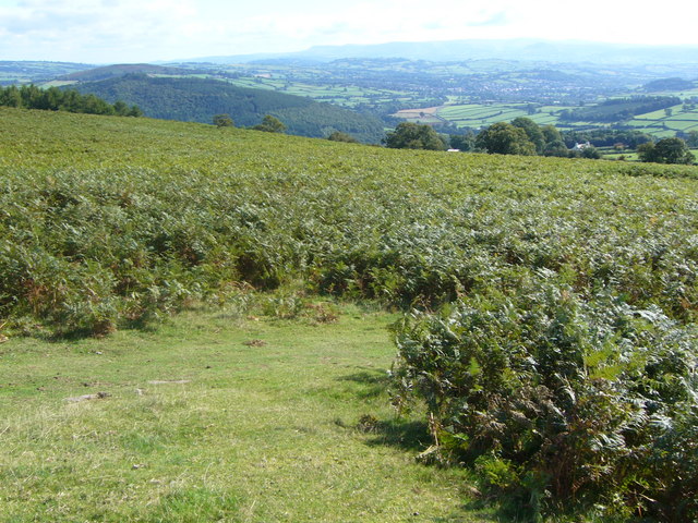
Allt Aber-brân-fawr is a woodland located in the county of Brecknockshire, Wales. Situated in the heart of the Brecon Beacons National Park, this forest is a natural haven known for its scenic beauty and diverse wildlife.

Spanning over an area of approximately 500 acres, Allt Aber-brân-fawr is characterized by its dense canopy of native trees, including oak, beech, and birch. These trees provide a habitat for various species of birds, mammals, and insects, making it a popular destination for nature enthusiasts and birdwatchers.

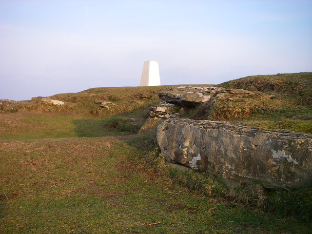
The forest is crisscrossed by a network of well-maintained footpaths, allowing visitors to explore its tranquil surroundings. The paths lead through picturesque glades, past babbling streams, and up to breathtaking viewpoints, offering stunning vistas of the surrounding landscape.

Allt Aber-brân-fawr also boasts a rich history, with evidence of human activity dating back centuries. Ruins of old farmsteads and ancient burial mounds can be found within the woodland, serving as a reminder of the area's past.

Visitors to Allt Aber-brân-fawr can partake in a variety of outdoor activities, such as hiking, cycling, and picnicking. The forest is also a popular spot for nature education and conservation programs, with local organizations working to preserve its unique ecosystem.

Overall, Allt Aber-brân-fawr is a captivating woodland that offers a tranquil retreat for those seeking to connect with nature. Its lush vegetation, diverse wildlife, and stunning vistas make it a cherished destination for both locals and tourists alike.

If you have any feedback on the listing, please let us know in the comments section below.

Allt Aber-brân-fawr Images

Images are sourced within 2km of 51.945041/-3.4701986 or Grid Reference SN9928. Thanks to Geograph Open Source API. All images are credited.

Llwybr i Aberbran / Path to Aberbran Llwybr ceffyl yn dod i lawr o'r ucheldir i gyfeiriad pentre Aberbran.

A bridleway descends the hill in the direction of Aberbran village (trans. confluence of the crow stream).
Llwybr i Aberbran / Path to Aberbran
Llwybr ceffyl yn dod i lawr o'r ucheldir i gyfeiriad pentre Aberbran. A bridleway descends the hill in the direction of Aberbran village (trans. confluence of the crow stream).
Twyn-y-Gaer trig
Twyn-y-Gaer trig
Bracken on Twyn-Y-Gaer
Grassy track up Twyn-y-Gaer
Summit rocks of Twyn y Gaer The sandstone bedrock at the 367m high summit of Twyn y Gaer has been quarried away in the past - possibly when the site was occupied during the Iron Age?
Summit rocks of Twyn y Gaer
The sandstone bedrock at the 367m high summit of Twyn y Gaer has been quarried away in the past - possibly when the site was occupied during the Iron Age?
Pillow mound at Twyn y Gaer This long low L-shaped earthen mound is one of several on the flanks of this hillfort which is interpreted as a pillow mound.  Dating from the 19th century they were provided for rabbits to burrow into as a number of fur farms were established in the area.
Pillow mound at Twyn y Gaer
This long low L-shaped earthen mound is one of several on the flanks of this hillfort which is interpreted as a pillow mound. Dating from the 19th century they were provided for rabbits to burrow into as a number of fur farms were established in the area.
Ponds on Mynydd Illtud Two shallow ponds lie on the plateau-like surface of Mynydd Illtud - an area of common land beside the Brecon Beacons National Park visitor centre (the 'Mountain Centre') at Libanus.  Visible in the background are Pen y Fan (left) and Corn Du (right).
Ponds on Mynydd Illtud
Two shallow ponds lie on the plateau-like surface of Mynydd Illtud - an area of common land beside the Brecon Beacons National Park visitor centre (the 'Mountain Centre') at Libanus. Visible in the background are Pen y Fan (left) and Corn Du (right).
High pressure gas main The 1220 mm diameter pipe can be seen here before it is buried.
High pressure gas main
The 1220 mm diameter pipe can be seen here before it is buried.
Aber-Bran Bridge Aber-Bran Bridge over the River Usk (Afon Wysg) with Aberbran Fach Farmbuildings beyond.
Aber-Bran Bridge
Aber-Bran Bridge over the River Usk (Afon Wysg) with Aberbran Fach Farmbuildings beyond.
Church At Penpont Church at Penpont.
Church At Penpont
Church at Penpont.
Pen-y-Wern Wood Pen y Wern wood on right, the photo shows the A40 with the course of the old road to the right of the fence.
Pen-y-Wern Wood
Pen y Wern wood on right, the photo shows the A40 with the course of the old road to the right of the fence.
West of Aberyscir, near Brecon From near Cusop, overlooking Pontarfran and the Usk Valley.
West of Aberyscir, near Brecon
From near Cusop, overlooking Pontarfran and the Usk Valley.
Dislodged erratics on Mynydd Illtud The soils on this piece of common land are too thin and nutrient poor for anything other than rough grazing, hence its survival as a common to the modern day.  The area was scoured to bedrock by glacial ice some 20,000 years ago and when it melted it deposited hundreds of blocks of sandstone across the plateau surface.  Many have been removed over the years for reasons of land management both on the common and on surrounding farmland. They are now sometimes found stacked together as they are here.  Fan Frynych is seen in the distance.
Dislodged erratics on Mynydd Illtud
The soils on this piece of common land are too thin and nutrient poor for anything other than rough grazing, hence its survival as a common to the modern day. The area was scoured to bedrock by glacial ice some 20,000 years ago and when it melted it deposited hundreds of blocks of sandstone across the plateau surface. Many have been removed over the years for reasons of land management both on the common and on surrounding farmland. They are now sometimes found stacked together as they are here. Fan Frynych is seen in the distance.
Dislodged erratic boulder The presence of moss and lichens on these boulders gives clues as to how long ago they were moved from the resting places they had occupied for over 15,000 years.  The lack of any such growth on the bottom half of this sandstone rock suggests it was moved here quite recently.
Dislodged erratic boulder
The presence of moss and lichens on these boulders gives clues as to how long ago they were moved from the resting places they had occupied for over 15,000 years. The lack of any such growth on the bottom half of this sandstone rock suggests it was moved here quite recently.
Disturbed corner of Mynydd Illtud common The common is owned and managed by the Brecon Beacons National Park Authority though a number of graziers have common rights over it.  Hill ponies and sheep are common sights as are walkers from the nearby National Park Visitor Centre.  Erratic blocks of sandstone are scattered across it as are a number of pools, some appearing only seasonally.
Disturbed corner of Mynydd Illtud common
The common is owned and managed by the Brecon Beacons National Park Authority though a number of graziers have common rights over it. Hill ponies and sheep are common sights as are walkers from the nearby National Park Visitor Centre. Erratic blocks of sandstone are scattered across it as are a number of pools, some appearing only seasonally.
View south from Mynydd Illtud A perfect brackeny platform to take a long view of the Beacons in all their glory.
View south from Mynydd Illtud
A perfect brackeny platform to take a long view of the Beacons in all their glory.
River Usk, downstream from Aber-bran Bridge Adjacent to the confluence with the Nant Bran.
River Usk, downstream from Aber-bran Bridge
Adjacent to the confluence with the Nant Bran.
River Usk - upstream View west from Aber-bran Bridge.
Two children from the nearby campsite are amusing themselves in time-honoured fashion.
River Usk - upstream
View west from Aber-bran Bridge. Two children from the nearby campsite are amusing themselves in time-honoured fashion.
Show me another place!

Allt Aber-brân-fawr is located at Grid Ref: SN9928 (Lat: 51.945041, Lng: -3.4701986)

Unitary Authority: Powys

Police Authority: Dyfed Powys

What 3 Words

///layers.reclusive.routines. Near Brecon, Powys

Related Wikis

Nant Brân

The Nant Brân is a short river which rises on the southern slopes of Mynydd Epynt in Powys, Wales. The word 'brân' means 'crow' in Welsh: the name may...

Aberbran railway station

Aberbran railway station served the village of Aberbran in the traditional county of Brecknockshire, Wales. == History == Opened by the Neath and Brecon...

Aberbrân

Aberbrân is a small settlement in Powys, Wales. It lies on the Afon Brân immediately above its confluence (Welsh 'aber') with the River Usk and is 7 kilometres...

Aberysgir Castle

Aberysgir Castle is a mound, or motte and bailey castle of the Middle Ages – but is missing the usual protective bailey. It is located at Aberysgir, Powys...

Nearby Amenities

Located within 500m of 51.945041,-3.4701986
Parking
Lat/Long: 51.9495125/-3.469955
Tourism: viewpoint
Lat/Long: 51.9418921/-3.4707804
Twyn y Gaer
Ele: 367
Natural: peak
Lat/Long: 51.941662/-3.4706457
Bus Stop
Aberbran Junction
Bus: yes
Public Transport: platform
Lat/Long: 51.9492368/-3.4713967
Bus Stop
Aberbran Junction
Bus: yes
Naptan AtcoCode: 5610AWE90346
Naptan NaptanCode: powadaw
Public Transport: platform
Lat/Long: 51.9494331/-3.4711526
The data included in this document is from www.openstreetmap.org. The data is made available under ODbL.

Have you been to Allt Aber-brân-fawr?

Leave your review of Allt Aber-brân-fawr below (or comments, questions and feedback).