Busk

Settlement in Cumberland Eden

England

Busk

Domed Field with cattle The field lies south-east of the village of Unthank and south of a tree-lined stream, probably named Limekiln Beck.
Domed Field with cattle Credit: Trevor Littlewood

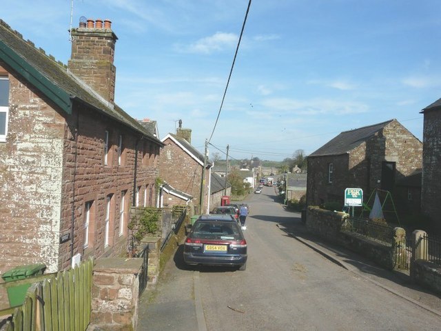
Busk is a small village located in Cumberland, a historic county in the northwest of England. Nestled in the picturesque countryside, the village is known for its tranquil setting and charming atmosphere. With a population of around 300 residents, Busk offers a close-knit community feel.

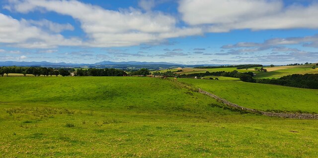
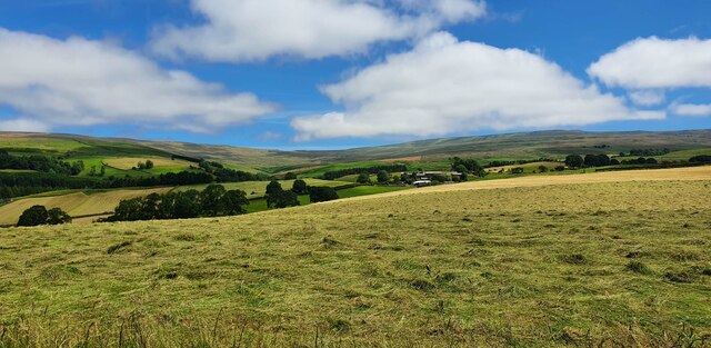
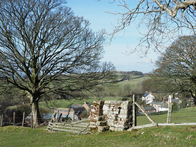
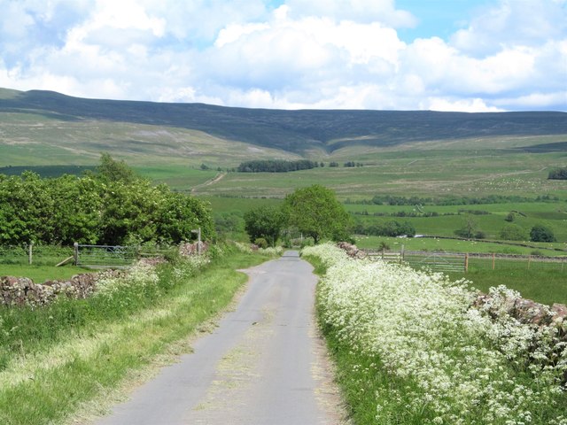
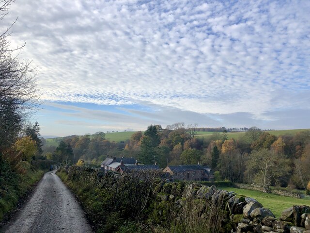
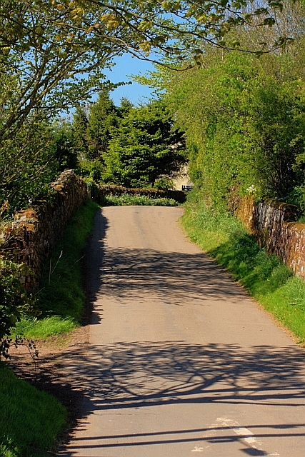
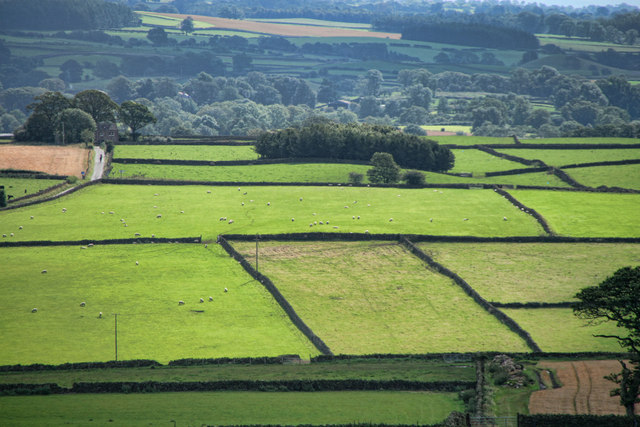
The village is situated near the River Lune, which adds to its scenic beauty. The surrounding landscape is characterized by rolling hills, lush green fields, and wooded areas, providing ample opportunities for outdoor activities such as hiking, cycling, and fishing. The village is also close to the Lake District National Park, renowned for its stunning lakes and breathtaking mountains.

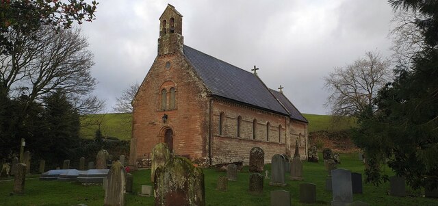
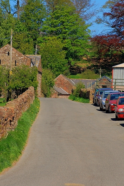
Historically, Busk has roots dating back to medieval times, and remnants of its rich heritage can still be found in the form of quaint cottages and traditional architecture. The local St. Anne's Church, a grade II listed building, is a notable landmark that adds to the village's historical charm.

While Busk is a small village, it offers essential amenities to its residents. The village has a primary school, a post office, and a local pub, providing a sense of community and convenience. The nearest town, Carlisle, is just a short drive away, offering a wider range of services and amenities.

Overall, Busk, Cumberland, is a peaceful and idyllic village, perfect for those seeking a serene countryside lifestyle. Its natural beauty, historical charm, and close-knit community make it an attractive place to live or visit for those looking to escape the hustle and bustle of city life.

If you have any feedback on the listing, please let us know in the comments section below.

Busk Images

Images are sourced within 2km of 54.773209/-2.608556 or Grid Reference NY6042. Thanks to Geograph Open Source API. All images are credited.

Domed Field with cattle The field lies south-east of the village of Unthank and south of a tree-lined stream, probably named Limekiln Beck.
Domed Field with cattle
The field lies south-east of the village of Unthank and south of a tree-lined stream, probably named Limekiln Beck.
North Cumbria View View looking across farmland above Huddlesceugh Hall towards the North Lakes.
North Cumbria View
View looking across farmland above Huddlesceugh Hall towards the North Lakes.
Haresceugh View looking towards Haresceugh and the Pennines.
Haresceugh
View looking towards Haresceugh and the Pennines.
Old Boundary Maker on Raven Bridge, Kirkoswald Parish Boundary Marker set in the parapet of Raven Bridge, Raven Beck, on the south side of the road. Inscribed KIRKOSWALD / HIGH QR on the left and RENWICK on the right with DIVI OF above. High Quarter was a division of Kirkoswald parish. Renwick parish was absorbed into Kirkoswald parish in 1934 so now this is entirely in Kirkoswald parish. See also <span class="nowrap"><a title="http://www.geog.port.ac.uk/webmap/thelakes/photos/btf97.jpg" rel="nofollow ugc noopener" href="http://www.geog.port.ac.uk/webmap/thelakes/photos/btf97.jpg">Link</a><img style="margin-left:2px;" alt="External link" title="External link - shift click to open in new window" src="https://s1.geograph.org.uk/img/external.png" width="10" height="10"/></span>.

Milestone Society National ID: CU_KIRK01pb
Old Boundary Maker on Raven Bridge, Kirkoswald
Parish Boundary Marker set in the parapet of Raven Bridge, Raven Beck, on the south side of the road. Inscribed KIRKOSWALD / HIGH QR on the left and RENWICK on the right with DIVI OF above. High Quarter was a division of Kirkoswald parish. Renwick parish was absorbed into Kirkoswald parish in 1934 so now this is entirely in Kirkoswald parish. See also LinkExternal link. Milestone Society National ID: CU_KIRK01pb
All Saints Church, Renwick All Saints Church is located in Renwick in the Eden district of Cumbria. There has been a church on this site at Renwick since medieval times. The present church was built 1845-1846, replacing an earlier church of 1737. It is thought to be the fourth church on this site. The church has an unusual two decker pulpit, dating from c.1735.
All Saints Church, Renwick
All Saints Church is located in Renwick in the Eden district of Cumbria. There has been a church on this site at Renwick since medieval times. The present church was built 1845-1846, replacing an earlier church of 1737. It is thought to be the fourth church on this site. The church has an unusual two decker pulpit, dating from c.1735.
Wall fragment with stile A curious feature close to the village of Renwick. A fence rises between fields beside which runs the route of a public footpath. The footpath crosses the barrier from one side to the other but at that point, and only there, the fencing is replaced by a short section of walling into which is built the stile.
Wall fragment with stile
A curious feature close to the village of Renwick. A fence rises between fields beside which runs the route of a public footpath. The footpath crosses the barrier from one side to the other but at that point, and only there, the fencing is replaced by a short section of walling into which is built the stile.
Flower fringed lane near Renwick Cow parsley along the roadside adds to the attractive scene here, with the brooding north Pennines ahead.
Flower fringed lane near Renwick
Cow parsley along the roadside adds to the attractive scene here, with the brooding north Pennines ahead.
Barley field, Viol Moor There's a gradual rise from the Vale of Eden eastwards towards the North Pennine scarp, so at this point one is already at the 220m contour. From this crop field one looks over the vale towards the distant Lake District mountains with Blencathra in the centre of the frame.
Barley field, Viol Moor
There's a gradual rise from the Vale of Eden eastwards towards the North Pennine scarp, so at this point one is already at the 220m contour. From this crop field one looks over the vale towards the distant Lake District mountains with Blencathra in the centre of the frame.
Low Mill in the valley of the Raven Beck Narrow back road that passes through Low Mill and Park Head.
Low Mill in the valley of the Raven Beck
Narrow back road that passes through Low Mill and Park Head.
Road to the School, Renwick
Road to Townhead
Road to Townhead
Mooredge Fields on Mooredge seen from near Scales Rigg.
Mooredge
Fields on Mooredge seen from near Scales Rigg.
Pasture, Glassonby A view towards the Pennines at Hartside from the muddy byroad on Viol Moor.
Pasture, Glassonby
A view towards the Pennines at Hartside from the muddy byroad on Viol Moor.
Pasture, Kirkoswald A view over the valley of Harberry Beck from the Renwick to Park Head road.
Pasture, Kirkoswald
A view over the valley of Harberry Beck from the Renwick to Park Head road.
Looking along the main street in Renwick
All Saints Church, Renwick All Saints Church in Renwick was built in 1845 by Rev J Watson to replace an earlier building of 1733.
All Saints Church, Renwick
All Saints Church in Renwick was built in 1845 by Rev J Watson to replace an earlier building of 1733.
All Saints Church, Renwick, Kirkoswald, Cumbria A church has stood here for at least 750 years, and probably much longer – the present building, consisting of chancel, nave, and bell-gable with two bells, being perhaps the fourth.
It was designed by the incumbent John Watson, and built at the expense of the local inhabitants in 1845 – when the village was thronged with miners (who were exploiting the coal seams on Renwick Fell), publicans, and tradesmen.
Pevsner dates the double pulpit (for preacher and parish clerk) to 1735. The bell seen in front of the pulpit is mediaeval – perhaps it was rung by James of Lancaster, an excommunicated monk, who in 1362 had "left his cloister and lived wantonly in Renwick". Church registers date from 1649.
Now Renwick, as in 1250, is a home for farmers raising sheep and cattle, and others who value the tranquillity of this unspoilt corner of England. Always beautiful, Renwick has not always been tranquil. The Romans built a road through here to supply their frontier garrisons; and Norsemen settled here too. The wars Edward I waged with Scotland (circa 1300) triggered 300 years of unrest. In 1642/51 Renwick men fell for King Charles at Rowton Heath, Wigan and Worcester. Legend holds that John Tallantire, perhaps about 1610, slew a cockatrice here and won perpetual exemption from tithes.
All Saints Church, Renwick, Kirkoswald, Cumbria
A church has stood here for at least 750 years, and probably much longer – the present building, consisting of chancel, nave, and bell-gable with two bells, being perhaps the fourth. It was designed by the incumbent John Watson, and built at the expense of the local inhabitants in 1845 – when the village was thronged with miners (who were exploiting the coal seams on Renwick Fell), publicans, and tradesmen. Pevsner dates the double pulpit (for preacher and parish clerk) to 1735. The bell seen in front of the pulpit is mediaeval – perhaps it was rung by James of Lancaster, an excommunicated monk, who in 1362 had "left his cloister and lived wantonly in Renwick". Church registers date from 1649. Now Renwick, as in 1250, is a home for farmers raising sheep and cattle, and others who value the tranquillity of this unspoilt corner of England. Always beautiful, Renwick has not always been tranquil. The Romans built a road through here to supply their frontier garrisons; and Norsemen settled here too. The wars Edward I waged with Scotland (circa 1300) triggered 300 years of unrest. In 1642/51 Renwick men fell for King Charles at Rowton Heath, Wigan and Worcester. Legend holds that John Tallantire, perhaps about 1610, slew a cockatrice here and won perpetual exemption from tithes.
Renwick Ford This byway ford on the Harberry Beck is found at Renwick.
Renwick Ford
This byway ford on the Harberry Beck is found at Renwick.
Show me another place!

Busk is located at Grid Ref: NY6042 (Lat: 54.773209, Lng: -2.608556)

Administrative County: Cumbria

District: Eden

Police Authority: Cumbria

What 3 Words

///truckload.dockers.reject. Near Alston, Cumbria

Nearby Locations

Busk Haresceugh

Related Wikis

Busk, Cumbria

Busk is a hamlet in Cumbria, England. It is located 3.7 miles (6.0 km) by road to the east of Kirkoswald. == See also == List of places in Cumbria ��2...

Renwick, Cumbria

Renwick, formerly known as Ravenwick, is a small village and former civil parish, now in the parish of Kirkoswald, in the Eden district, in the county...

Unthank, Glassonby

Unthank is a village near Gamblesby in the civil parish of Glassonby in Cumbria, England. It is first mentioned in writing as Unthanke in 1332. == See... ==

Gamblesby

Gamblesby is a village near Melmerby, and former civil parish, now in the parish of Glassonby, in the Westmorland and Furness district, in the ceremonial...

St John's Church, Gamblesby

St. John's Church was a Victorian parish Church of England church in the village of Gamblesby, Cumbria, England.The Gothic Revival-style church, with tall...

Black Fell (Pennines)

Black Fell is a hill in the North Pennines, England. It is located just north of the A686 road, west of Alston and is one of the most northerly parts of...

Melmerby, Cumbria

Melmerby is a village and civil parish in the Eden district, in the county of Cumbria, England. It is a small village with a population of around 200....

Kirkoswald Castle

Kirkoswald Castle is located to the southeast of the village of Kirkoswald, Cumbria, England. It is built from Penrith red sandstone and is still partially...

Nearby Amenities

Located within 500m of 54.773209,-2.608556
Five Roads Ends
Place: locality
Lat/Long: 54.7715414/-2.6144481
Power: pole
Lat/Long: 54.769309/-2.6076536
Power: pole
Lat/Long: 54.7702514/-2.60799
Power: pole
Lat/Long: 54.7711966/-2.6083192
Power: pole
Lat/Long: 54.7721446/-2.6086362
Power: pole
Lat/Long: 54.7729962/-2.6089315
Power: pole
Lat/Long: 54.7740251/-2.6091566
Power: pole
Lat/Long: 54.7750735/-2.609343
Power: pole
Lat/Long: 54.7761065/-2.6095317
Power: pole
Lat/Long: 54.7771618/-2.6097641
The data included in this document is from www.openstreetmap.org. The data is made available under ODbL.

Have you been to Busk?

Leave your review of Busk below (or comments, questions and feedback).