Coed Bryn-du

Wood, Forest in Merionethshire

Wales

Coed Bryn-du

Minor road near Bethel
Minor road near Bethel Credit: Steven Brown

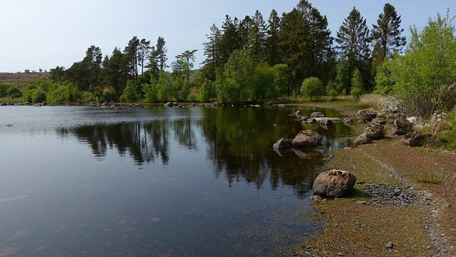
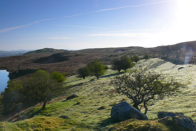
Coed Bryn-du, located in Merionethshire, Wales, is a picturesque woodland area known for its natural beauty and rich history. Covering an area of approximately 150 hectares, the forest is situated near the small village of Llanymawddwy, nestled within the southern slopes of the Cambrian Mountains.

The woodland is predominantly composed of native broadleaf trees, including oak, beech, and birch, creating a diverse and vibrant ecosystem that supports a wide range of flora and fauna. It is home to various wildlife species, such as red squirrels, badgers, and a variety of bird species, making it a popular destination for nature enthusiasts and birdwatchers.

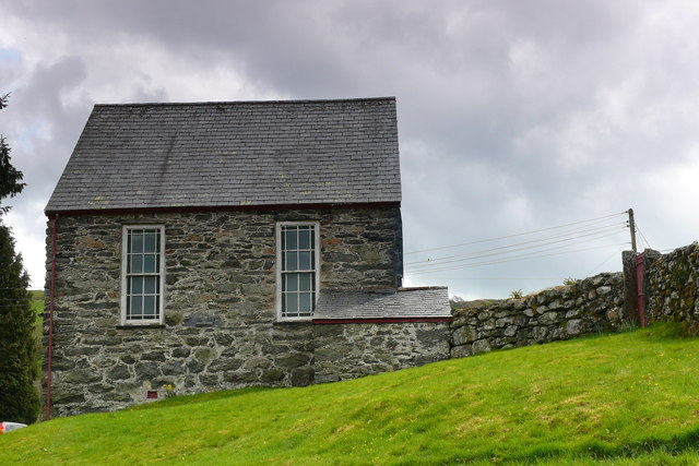
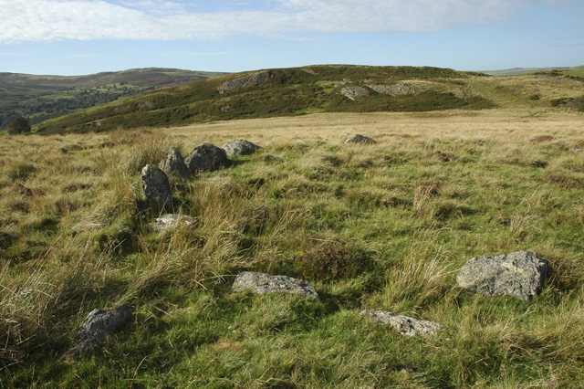
Coed Bryn-du also holds historical significance, with traces of human activity dating back to prehistoric times. The site contains ancient ruins, including a hillfort and an Iron Age settlement, providing fascinating insights into the region's past. Additionally, the woodland was once part of a medieval deer park, and remnants of this era, such as boundary walls and ditches, can still be observed.

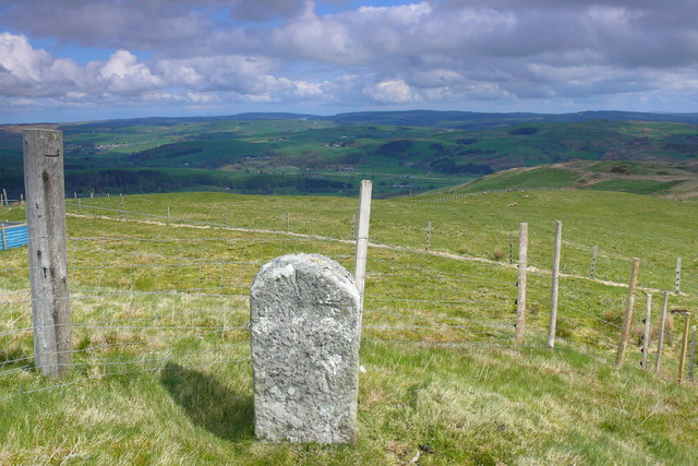
Visitors to Coed Bryn-du can explore the forest through a network of walking trails, offering breathtaking views of the surrounding landscape. The tranquil atmosphere and abundance of wildlife make it an ideal spot for hiking, picnicking, and wildlife watching. The forest is also managed sustainably, with ongoing conservation efforts to preserve its natural beauty and protect its diverse ecosystem.

Overall, Coed Bryn-du in Merionethshire is a captivating woodland area that seamlessly blends natural beauty with historical significance, providing a haven for both nature enthusiasts and history buffs alike.

If you have any feedback on the listing, please let us know in the comments section below.

Coed Bryn-du Images

Images are sourced within 2km of 52.955043/-3.525996 or Grid Reference SH9740. Thanks to Geograph Open Source API. All images are credited.

Minor road near Bethel
Approaching Llyn Caer-Euni The footpath descending to the little visited Llyn Caer-Euni all but disappears in the rough terrain of tussocks and heather as it approaches the shore.
Approaching Llyn Caer-Euni
The footpath descending to the little visited Llyn Caer-Euni all but disappears in the rough terrain of tussocks and heather as it approaches the shore.
Northern tip of Llyn Caer-Euni The north-eastern shore of the rarely visited Llyn Caer-Euni is a lovely deserted spot on this hot sunny day.
Northern tip of Llyn Caer-Euni
The north-eastern shore of the rarely visited Llyn Caer-Euni is a lovely deserted spot on this hot sunny day.
South of Orddu Arenig Fawr in the far distance
South of Orddu
Arenig Fawr in the far distance
Access to Pentre-tai-yn-y-cwm
On Bryn Bras
On Bryn Bras
Ruin at Pentre
Ruin at Pentre
Orddu Summit Climbed from north via point 522m, then Orddu before Foel Goch on lovely spring morning, following fence and boundary stones.
Name: Orddu
Hill number: 3372
Height: 555m / 1821ft
Area: 30D: Barmouth to Betws-y-Coed and Bala
Class: 5
Grid ref: SH 96341 42343
Summit feature: grassy mound South of fence
Drop: 34m
Col: 521m  SH958424
Orddu Summit
Climbed from north via point 522m, then Orddu before Foel Goch on lovely spring morning, following fence and boundary stones. Name: Orddu Hill number: 3372 Height: 555m / 1821ft Area: 30D: Barmouth to Betws-y-Coed and Bala Class: 5 Grid ref: SH 96341 42343 Summit feature: grassy mound South of fence Drop: 34m Col: 521m SH958424
Llyn Caer-Euni Llyn Caer-Euni yng ngolau'r wawr / Llyn Caer-Euni in the dawn light.
Llyn Caer-Euni
Llyn Caer-Euni yng ngolau'r wawr / Llyn Caer-Euni in the dawn light.
Cefn Caer-Euni Gwlith ar y glaswellt ger Llyn Caer-Euni / Dew on the grass near Llyn Caer-Euni.
Cefn Caer-Euni
Gwlith ar y glaswellt ger Llyn Caer-Euni / Dew on the grass near Llyn Caer-Euni.
Capel Rhydywernen Capel Rhydywernen yng Nghwm Main / Rhydywernen Chapel in Cwm Main.
Capel Rhydywernen
Capel Rhydywernen yng Nghwm Main / Rhydywernen Chapel in Cwm Main.
Cwm Main Yn edrych i lawr i Gwm Main rhwng Llawr y Cwm a Hendre / Looking down to Cwm Main between Llawr y Cwm and Hendre.
Cwm Main
Yn edrych i lawr i Gwm Main rhwng Llawr y Cwm a Hendre / Looking down to Cwm Main between Llawr y Cwm and Hendre.
Cwm Nant y Ceiliog Yn edrych i fyny i Foel Cae'r Celiog a Pen y Cerrig Serth / Looking up to Moel Cae'r Celiog and Pen y Cerrig Serth.
Cwm Nant y Ceiliog
Yn edrych i fyny i Foel Cae'r Celiog a Pen y Cerrig Serth / Looking up to Moel Cae'r Celiog and Pen y Cerrig Serth.
Carreg derfyn / Boundary stone Ffin rhwng Sir Ddinbych a Sir Feirionnydd / Boundary between Denbighshire and Merionethshire.
Carreg derfyn / Boundary stone
Ffin rhwng Sir Ddinbych a Sir Feirionnydd / Boundary between Denbighshire and Merionethshire.
Boundary Stone with OS Pivot The OS pivot marks a point 1815.0ft (1875 map) above mean sea level.
Boundary Stone with OS Pivot
The OS pivot marks a point 1815.0ft (1875 map) above mean sea level.
Boundary Stone
Boundary Stone
Old Boundary Marker on Orddu summit, Llandderfel parish Parish Boundary Marker in parish of Llandderfel (Gwynedd District), Summit of Orddu, beside fence.

Surveyed

Milestone Society National ID: MER_DERF03pb
Old Boundary Marker on Orddu summit, Llandderfel parish
Parish Boundary Marker in parish of Llandderfel (Gwynedd District), Summit of Orddu, beside fence. Surveyed Milestone Society National ID: MER_DERF03pb
Show me another place!

Coed Bryn-du is located at Grid Ref: SH9740 (Lat: 52.955043, Lng: -3.525996)

Unitary Authority: Gwynedd

Police Authority: North Wales

What 3 Words

///pigtails.serious.niece. Near Llangwm, Conwy

Nearby Locations

Bryn-du Coed Bryn-du

Related Wikis

Cefnddwysarn

Cefnddwysarn () is a small village in Gwynedd, Wales. It is located on the A494 road approximately 3 miles east of the town of Bala and 8 miles west of...

Caer Euni

Caer Euni [Grid reference SJ 00027 41266] is an Iron Age hillfort, about 2.5 miles (4 km) north-east of the village of Llandderfel and about 5 miles (8...

Meirionnydd Nant Conwy (Assembly constituency)

Meirionnydd Nant Conwy was a constituency of the National Assembly for Wales between 1999 and 2007. It elected one Assembly Member by the first past the...

Llandderfel

Llandderfel is a village and a sparsely populated community in Gwynedd, Wales, near Bala, formerly served by the Llandderfel railway station. The community...

Nearby Amenities

Located within 500m of 52.955043,-3.525996
Power: tower
Lat/Long: 52.9575252/-3.5257611
Power: tower
Lat/Long: 52.9555847/-3.5279624
Power: tower
Lat/Long: 52.9588421/-3.5220271
Power: tower
Lat/Long: 52.9531206/-3.5307444
Power: tower
Lat/Long: 52.9587182/-3.5237511
Power: tower
Lat/Long: 52.9579683/-3.5259355
Power: tower
Lat/Long: 52.9571606/-3.5281768
Power: tower
Lat/Long: 52.9556062/-3.5326909
Power: tower
Lat/Long: 52.9563462/-3.5305049
Place: farm
Lat/Long: 52.9568971/-3.5302811
Maes Tegfryn
Place: farm
Lat/Long: 52.9542212/-3.5324483
Fixme: incomplete
Lat/Long: 52.9568175/-3.5250704
The data included in this document is from www.openstreetmap.org. The data is made available under ODbL.

Have you been to Coed Bryn-du?

Leave your review of Coed Bryn-du below (or comments, questions and feedback).