Coed Caencoed

Wood, Forest in Montgomeryshire

Wales

Coed Caencoed

Ordnance Survey Flush Bracket S0731 This can be found on the wall of St Idloes Church in Llanidloes.
For more detail see : <span class="nowrap"><a title="http://www.bench-marks.org.uk/bm12516" rel="nofollow ugc noopener" href="http://www.bench-marks.org.uk/bm12516">Link</a><img style="margin-left:2px;" alt="External link" title="External link - shift click to open in new window" src="https://s1.geograph.org.uk/img/external.png" width="10" height="10"/></span>
Ordnance Survey Flush Bracket S0731 Credit: Peter Wood

Coed Caencoed, located in Montgomeryshire, Wales, is a beautiful and expansive wood or forest that covers a significant area of the region. The name "Coed Caencoed" translates to "Wood, Forest" in English, which aptly describes the character and purpose of this natural attraction.

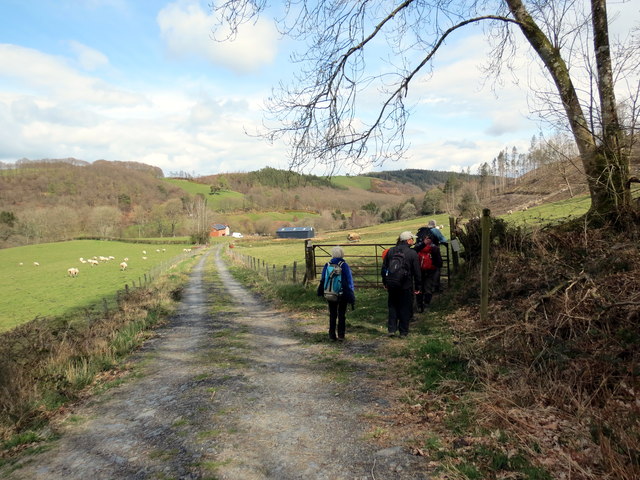
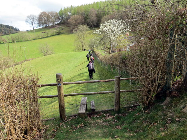
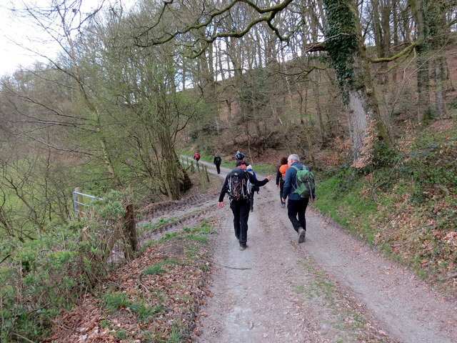
The wood is situated amidst the rolling hills and picturesque landscapes of Montgomeryshire, providing visitors with a serene and tranquil environment to immerse themselves in nature. It boasts a diverse range of tree species, including oak, beech, ash, and birch, which contribute to the vibrant and lush greenery that blankets the area.

Coed Caencoed is not only a haven for nature enthusiasts but also serves as a habitat for various wildlife species. It is home to a variety of birds, such as woodpeckers, owls, and songbirds, making it an ideal spot for birdwatching. Additionally, the wood supports a thriving population of mammals, including deer, badgers, and foxes.

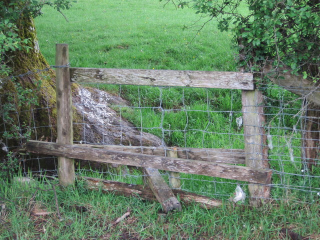
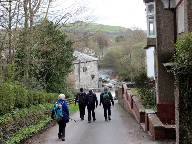
The wood offers a network of well-maintained footpaths and trails, allowing visitors to explore its beauty at their own pace. These paths wind through the trees, offering breathtaking views and opportunities for peaceful walks or invigorating hikes. Along the way, visitors may come across natural landmarks, such as babbling brooks, hidden waterfalls, and enchanting clearings.

Coed Caencoed is managed and preserved by local authorities, ensuring that the wood remains a sustainable and protected natural resource. It serves as an important educational and recreational resource for the local community, providing opportunities for outdoor activities, nature appreciation, and environmental education.

Overall, Coed Caencoed is a captivating wood that showcases the natural beauty of Montgomeryshire. Its diverse flora and fauna, combined with its peaceful ambiance and scenic trails, make it a must-visit destination for nature lovers and those seeking a tranquil escape from the hustle and bustle of everyday life.

If you have any feedback on the listing, please let us know in the comments section below.

Coed Caencoed Images

Images are sourced within 2km of 52.442893/-3.5657895 or Grid Reference SN9383. Thanks to Geograph Open Source API. All images are credited.

Ordnance Survey Flush Bracket S0731 This can be found on the wall of St Idloes Church in Llanidloes.
For more detail see : <span class="nowrap"><a title="http://www.bench-marks.org.uk/bm12516" rel="nofollow ugc noopener" href="http://www.bench-marks.org.uk/bm12516">Link</a><img style="margin-left:2px;" alt="External link" title="External link - shift click to open in new window" src="https://s1.geograph.org.uk/img/external.png" width="10" height="10"/></span>
Ordnance Survey Flush Bracket S0731
This can be found on the wall of St Idloes Church in Llanidloes. For more detail see : LinkExternal link
The Church of St Idloes in Llanidloes Viewed from the south.
The Church of St Idloes in Llanidloes
Viewed from the south.
Afon Dulas, Cwmbelan Near the gauging station the path leaves the river bank.
Afon Dulas, Cwmbelan
Near the gauging station the path leaves the river bank.
Coed Penpenarth Cerddwyr yn dilyn llwybr ceffyl ger Coed Penpenarth.

Walkers following a bridleway near Coed Penpenarth (trans. top of the promontory wood).
Coed Penpenarth
Cerddwyr yn dilyn llwybr ceffyl ger Coed Penpenarth. Walkers following a bridleway near Coed Penpenarth (trans. top of the promontory wood).
Ger Rhyd y Gwreiddyn / Near Rhyd y Gwreiddyn Cerddwyr yn dilyn llwybr cyhoeddus ger Ffarm Rhyd y Gwreiddyn.

Walkers following a public footpath near Rhyd y Gwreiddyn Farm (ford of the stream source).
Ger Rhyd y Gwreiddyn / Near Rhyd y Gwreiddyn
Cerddwyr yn dilyn llwybr cyhoeddus ger Ffarm Rhyd y Gwreiddyn. Walkers following a public footpath near Rhyd y Gwreiddyn Farm (ford of the stream source).
Sticil Cwmeryr Bach / Cwmeryr Bach Stile Sticil wrth ymyl anhedd-dy o'r enw Cwmeryr Bach.

A stile at Cwmeryr Bach (trans. eagle valley)
Sticil Cwmeryr Bach / Cwmeryr Bach Stile
Sticil wrth ymyl anhedd-dy o'r enw Cwmeryr Bach. A stile at Cwmeryr Bach (trans. eagle valley)
Tuag at Lanidloes / Towards Llanidloes Cerddwyr yn dilyn heol ddiwyneb tuag at Lanidloes.

Walkers following an unsurfaced road towards Llanidloes (trans. church of Idloes).
Tuag at Lanidloes / Towards Llanidloes
Cerddwyr yn dilyn heol ddiwyneb tuag at Lanidloes. Walkers following an unsurfaced road towards Llanidloes (trans. church of Idloes).
Cyrraedd Llanidloes / Arriving at Llanidloes Cerddwyr yn cyrraedd Llanidloes.

Walkers arriving at Llanidloes (trans. church of Idloes).
Cyrraedd Llanidloes / Arriving at Llanidloes
Cerddwyr yn cyrraedd Llanidloes. Walkers arriving at Llanidloes (trans. church of Idloes).
A470 at Llanidloes Llandiloes is situated along the A470 and B4518 roads in Powys, within the historic county boundaries of Montgomeryshire. The town’s official website <span class="nowrap"><a title="http://www.llanidloes.com/" rel="nofollow ugc noopener" href="http://www.llanidloes.com/">Link</a><img style="margin-left:2px;" alt="External link" title="External link - shift click to open in new window" src="https://s1.geograph.org.uk/img/external.png" width="10" height="10"/></span>  describes it as “a small town at the heart of Wales, nestling amidst the eastern slopes of the Cambrian Mountains, Llanidloes is at the heart of the ancient medieval kingdom of Arwystli and is one of the great little market towns of Mid Wales, UK and the first town on the River Severn.” The population recorded at the 2011 census was 2,929, of whom 15% were Welsh-speakers. Llanidloes takes its name from the early seventh century Celtic Saint Idloes (Llan-Idloes = the Church of St Idloes), after whom its parish church is named. It received a market charter from the King in 1270.  The present-day street plan follows much of the 13th century grid layout.
A470 at Llanidloes
Llandiloes is situated along the A470 and B4518 roads in Powys, within the historic county boundaries of Montgomeryshire. The town’s official website LinkExternal link describes it as “a small town at the heart of Wales, nestling amidst the eastern slopes of the Cambrian Mountains, Llanidloes is at the heart of the ancient medieval kingdom of Arwystli and is one of the great little market towns of Mid Wales, UK and the first town on the River Severn.” The population recorded at the 2011 census was 2,929, of whom 15% were Welsh-speakers. Llanidloes takes its name from the early seventh century Celtic Saint Idloes (Llan-Idloes = the Church of St Idloes), after whom its parish church is named. It received a market charter from the King in 1270. The present-day street plan follows much of the 13th century grid layout.
Llanidloes, Traffic Calming near the High School Traffic calming measures on Llangurig Road (B4518) near to Llanidloes High School.
Llanidloes, Traffic Calming near the High School
Traffic calming measures on Llangurig Road (B4518) near to Llanidloes High School.
Llanidloes, Llangurig Road Llandiloes is situated along the A470 and B4518 roads in Powys, within the historic county boundaries of Montgomeryshire. The town’s official website <span class="nowrap"><a title="http://www.llanidloes.com/" rel="nofollow ugc noopener" href="http://www.llanidloes.com/">Link</a><img style="margin-left:2px;" alt="External link" title="External link - shift click to open in new window" src="https://s1.geograph.org.uk/img/external.png" width="10" height="10"/></span>  describes it as “a small town at the heart of Wales, nestling amidst the eastern slopes of the Cambrian Mountains, Llanidloes is at the heart of the ancient medieval kingdom of Arwystli and is one of the great little market towns of Mid Wales, UK and the first town on the River Severn.” The population recorded at the 2011 census was 2,929, of whom 15% were Welsh-speakers. Llanidloes takes its name from the early seventh century Celtic Saint Idloes (Llan-Idloes = the Church of St Idloes), after whom its parish church is named. It received a market charter from the King in 1270.  The present-day street plan follows much of the 13th century grid layout.
Llanidloes, Llangurig Road
Llandiloes is situated along the A470 and B4518 roads in Powys, within the historic county boundaries of Montgomeryshire. The town’s official website LinkExternal link describes it as “a small town at the heart of Wales, nestling amidst the eastern slopes of the Cambrian Mountains, Llanidloes is at the heart of the ancient medieval kingdom of Arwystli and is one of the great little market towns of Mid Wales, UK and the first town on the River Severn.” The population recorded at the 2011 census was 2,929, of whom 15% were Welsh-speakers. Llanidloes takes its name from the early seventh century Celtic Saint Idloes (Llan-Idloes = the Church of St Idloes), after whom its parish church is named. It received a market charter from the King in 1270. The present-day street plan follows much of the 13th century grid layout.
Llangurig Road (B4518) Llandiloes is situated along the A470 and B4518 roads in Powys, within the historic county boundaries of Montgomeryshire. The town’s official website <span class="nowrap"><a title="http://www.llanidloes.com/" rel="nofollow ugc noopener" href="http://www.llanidloes.com/">Link</a><img style="margin-left:2px;" alt="External link" title="External link - shift click to open in new window" src="https://s1.geograph.org.uk/img/external.png" width="10" height="10"/></span>  describes it as “a small town at the heart of Wales, nestling amidst the eastern slopes of the Cambrian Mountains, Llanidloes is at the heart of the ancient medieval kingdom of Arwystli and is one of the great little market towns of Mid Wales, UK and the first town on the River Severn.” The population recorded at the 2011 census was 2,929, of whom 15% were Welsh-speakers. Llanidloes takes its name from the early seventh century Celtic Saint Idloes (Llan-Idloes = the Church of St Idloes), after whom its parish church is named. It received a market charter from the King in 1270.  The present-day street plan follows much of the 13th century grid layout.
Llangurig Road (B4518)
Llandiloes is situated along the A470 and B4518 roads in Powys, within the historic county boundaries of Montgomeryshire. The town’s official website LinkExternal link describes it as “a small town at the heart of Wales, nestling amidst the eastern slopes of the Cambrian Mountains, Llanidloes is at the heart of the ancient medieval kingdom of Arwystli and is one of the great little market towns of Mid Wales, UK and the first town on the River Severn.” The population recorded at the 2011 census was 2,929, of whom 15% were Welsh-speakers. Llanidloes takes its name from the early seventh century Celtic Saint Idloes (Llan-Idloes = the Church of St Idloes), after whom its parish church is named. It received a market charter from the King in 1270. The present-day street plan follows much of the 13th century grid layout.
Llanidloes, Smithfield Street During the 17th and 18th centuries, weaving and flannel production developed in the town largely as a cottage industry and the local products were sent to market in Shrewsbury. Towards the end of the eighteenth century, Llanidloes was the largest producer in Montgomeryshire. Some of the three storey houses with brick facades of this period would have housed weaving lofts on the upper storey.
Llanidloes, Smithfield Street
During the 17th and 18th centuries, weaving and flannel production developed in the town largely as a cottage industry and the local products were sent to market in Shrewsbury. Towards the end of the eighteenth century, Llanidloes was the largest producer in Montgomeryshire. Some of the three storey houses with brick facades of this period would have housed weaving lofts on the upper storey.
Llanidloes, The Old Market Hall The half-timbered Old Market Hall stands at the centre of Llanidloes, at the crossing of the four streets of the original medieval town.  Built around 1600, it is the oldest timber-framed market hall, and the only surviving building of this type, in Wales. A weekly market was held on the open cobbled ground floor until well into the twentieth century.  It is typical of market halls of the period in most mid-Wales market towns. Over the years the large and well-lit upper floor room has been used as a wool and flannel market, law court, preachers' hall, flannel store, working men's institute and museum. The slate roof, with overhanging eaves, has a glazed octagonal cupola which once contained the bell that was used to ring the curfew. The cupola is topped by a weathervane dated 1738.

The building is grade I listed (Cadw building id= 8317  <span class="nowrap"><a title="http://historicwales.gov.uk/files/pdf-listed-building.php?ids=25235&lang=ENG" rel="nofollow ugc noopener" href="http://historicwales.gov.uk/files/pdf-listed-building.php?ids=25235&lang=ENG">Link</a><img style="margin-left:2px;" alt="External link" title="External link - shift click to open in new window" src="https://s1.geograph.org.uk/img/external.png" width="10" height="10"/></span>  Historic Wales).
Llanidloes, The Old Market Hall
The half-timbered Old Market Hall stands at the centre of Llanidloes, at the crossing of the four streets of the original medieval town. Built around 1600, it is the oldest timber-framed market hall, and the only surviving building of this type, in Wales. A weekly market was held on the open cobbled ground floor until well into the twentieth century. It is typical of market halls of the period in most mid-Wales market towns. Over the years the large and well-lit upper floor room has been used as a wool and flannel market, law court, preachers' hall, flannel store, working men's institute and museum. The slate roof, with overhanging eaves, has a glazed octagonal cupola which once contained the bell that was used to ring the curfew. The cupola is topped by a weathervane dated 1738. The building is grade I listed (Cadw building id= 8317 LinkExternal link Historic Wales).
Llanidloes, Long Bridge Street Llandiloes is situated along the A470 and B4518 roads in Powys, within the historic county boundaries of Montgomeryshire. The town’s official website <span class="nowrap"><a title="http://www.llanidloes.com/" rel="nofollow ugc noopener" href="http://www.llanidloes.com/">Link</a><img style="margin-left:2px;" alt="External link" title="External link - shift click to open in new window" src="https://s1.geograph.org.uk/img/external.png" width="10" height="10"/></span>  describes it as “a small town at the heart of Wales, nestling amidst the eastern slopes of the Cambrian Mountains, Llanidloes is at the heart of the ancient medieval kingdom of Arwystli and is one of the great little market towns of Mid Wales, UK and the first town on the River Severn.” The population recorded at the 2011 census was 2,929, of whom 15% were Welsh-speakers. Llanidloes takes its name from the early seventh century Celtic Saint Idloes (Llan-Idloes = the Church of St Idloes), after whom its parish church is named. It received a market charter from the King in 1270.  The present-day street plan follows much of the 13th century grid layout.
Llanidloes, Long Bridge Street
Llandiloes is situated along the A470 and B4518 roads in Powys, within the historic county boundaries of Montgomeryshire. The town’s official website LinkExternal link describes it as “a small town at the heart of Wales, nestling amidst the eastern slopes of the Cambrian Mountains, Llanidloes is at the heart of the ancient medieval kingdom of Arwystli and is one of the great little market towns of Mid Wales, UK and the first town on the River Severn.” The population recorded at the 2011 census was 2,929, of whom 15% were Welsh-speakers. Llanidloes takes its name from the early seventh century Celtic Saint Idloes (Llan-Idloes = the Church of St Idloes), after whom its parish church is named. It received a market charter from the King in 1270. The present-day street plan follows much of the 13th century grid layout.
Long Bridge Street, The Old Market Hall The half-timbered Old Market Hall stands at the centre of Llanidloes, at the crossing of the four streets of the original medieval town.  Built around 1600, it is the oldest timber-framed market hall, and the only surviving building of this type, in Wales. A weekly market was held on the open cobbled ground floor until well into the twentieth century.  It is typical of market halls of the period in most mid-Wales market towns. Over the years the large and well-lit upper floor room has been used as a wool and flannel market, law court, preachers' hall, flannel store, working men's institute and museum. The slate roof, with overhanging eaves, has a glazed octagonal cupola which once contained the bell that was used to ring the curfew. The cupola is topped by a weathervane dated 1738.

The building is grade I listed (Cadw building id= 8317  <span class="nowrap"><a title="http://historicwales.gov.uk/files/pdf-listed-building.php?ids=25235&lang=ENG" rel="nofollow ugc noopener" href="http://historicwales.gov.uk/files/pdf-listed-building.php?ids=25235&lang=ENG">Link</a><img style="margin-left:2px;" alt="External link" title="External link - shift click to open in new window" src="https://s1.geograph.org.uk/img/external.png" width="10" height="10"/></span>  Historic Wales).
Long Bridge Street, The Old Market Hall
The half-timbered Old Market Hall stands at the centre of Llanidloes, at the crossing of the four streets of the original medieval town. Built around 1600, it is the oldest timber-framed market hall, and the only surviving building of this type, in Wales. A weekly market was held on the open cobbled ground floor until well into the twentieth century. It is typical of market halls of the period in most mid-Wales market towns. Over the years the large and well-lit upper floor room has been used as a wool and flannel market, law court, preachers' hall, flannel store, working men's institute and museum. The slate roof, with overhanging eaves, has a glazed octagonal cupola which once contained the bell that was used to ring the curfew. The cupola is topped by a weathervane dated 1738. The building is grade I listed (Cadw building id= 8317 LinkExternal link Historic Wales).
Smithfield Street, Llanidloes Llandiloes is situated along the A470 and B4518 roads in Powys, within the historic county boundaries of Montgomeryshire. The town’s official website <span class="nowrap"><a title="http://www.llanidloes.com/" rel="nofollow ugc noopener" href="http://www.llanidloes.com/">Link</a><img style="margin-left:2px;" alt="External link" title="External link - shift click to open in new window" src="https://s1.geograph.org.uk/img/external.png" width="10" height="10"/></span>  describes it as “a small town at the heart of Wales, nestling amidst the eastern slopes of the Cambrian Mountains, Llanidloes is at the heart of the ancient medieval kingdom of Arwystli and is one of the great little market towns of Mid Wales, UK and the first town on the River Severn.” The population recorded at the 2011 census was 2,929, of whom 15% were Welsh-speakers. Llanidloes takes its name from the early seventh century Celtic Saint Idloes (Llan-Idloes = the Church of St Idloes), after whom its parish church is named. It received a market charter from the King in 1270.  The present-day street plan follows much of the 13th century grid layout.
Smithfield Street, Llanidloes
Llandiloes is situated along the A470 and B4518 roads in Powys, within the historic county boundaries of Montgomeryshire. The town’s official website LinkExternal link describes it as “a small town at the heart of Wales, nestling amidst the eastern slopes of the Cambrian Mountains, Llanidloes is at the heart of the ancient medieval kingdom of Arwystli and is one of the great little market towns of Mid Wales, UK and the first town on the River Severn.” The population recorded at the 2011 census was 2,929, of whom 15% were Welsh-speakers. Llanidloes takes its name from the early seventh century Celtic Saint Idloes (Llan-Idloes = the Church of St Idloes), after whom its parish church is named. It received a market charter from the King in 1270. The present-day street plan follows much of the 13th century grid layout.
Pedestrian Crossing on Long Bridge Street Llandiloes is situated along the A470 and B4518 roads in Powys, within the historic county boundaries of Montgomeryshire. The town’s official website <span class="nowrap"><a title="http://www.llanidloes.com/" rel="nofollow ugc noopener" href="http://www.llanidloes.com/">Link</a><img style="margin-left:2px;" alt="External link" title="External link - shift click to open in new window" src="https://s1.geograph.org.uk/img/external.png" width="10" height="10"/></span>  describes it as “a small town at the heart of Wales, nestling amidst the eastern slopes of the Cambrian Mountains, Llanidloes is at the heart of the ancient medieval kingdom of Arwystli and is one of the great little market towns of Mid Wales, UK and the first town on the River Severn.” The population recorded at the 2011 census was 2,929, of whom 15% were Welsh-speakers. Llanidloes takes its name from the early seventh century Celtic Saint Idloes (Llan-Idloes = the Church of St Idloes), after whom its parish church is named. It received a market charter from the King in 1270.  The present-day street plan follows much of the 13th century grid layout.
Pedestrian Crossing on Long Bridge Street
Llandiloes is situated along the A470 and B4518 roads in Powys, within the historic county boundaries of Montgomeryshire. The town’s official website LinkExternal link describes it as “a small town at the heart of Wales, nestling amidst the eastern slopes of the Cambrian Mountains, Llanidloes is at the heart of the ancient medieval kingdom of Arwystli and is one of the great little market towns of Mid Wales, UK and the first town on the River Severn.” The population recorded at the 2011 census was 2,929, of whom 15% were Welsh-speakers. Llanidloes takes its name from the early seventh century Celtic Saint Idloes (Llan-Idloes = the Church of St Idloes), after whom its parish church is named. It received a market charter from the King in 1270. The present-day street plan follows much of the 13th century grid layout.
Show me another place!

Coed Caencoed is located at Grid Ref: SN9383 (Lat: 52.442893, Lng: -3.5657895)

Unitary Authority: Powys

Police Authority: Dyfed Powys

What 3 Words

///restrict.rotations.evoked. Near Llanidloes, Powys

Nearby Locations

Coed Caencoed

Related Wikis

Afon Dulas, Llanidloes

The Afon Dulas is a river in Powys, Wales (Afon is Welsh for river). It is a headwater tributary of the River Severn, which it joins at Llanidloes opposite...

Llanidloes transmitting station

The Llanidloes transmitting station is a broadcasting and telecommunications facility consisting of a self-supporting 23 m lattice mast erected on land...

Llanidloes High School

Llanidloes High School is a state secondary school and sixth form in Llanidloes, Powys. The school had 564 pupils on roll in 2016. It is an English-medium...

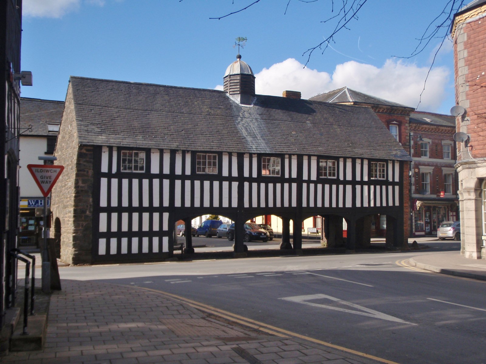
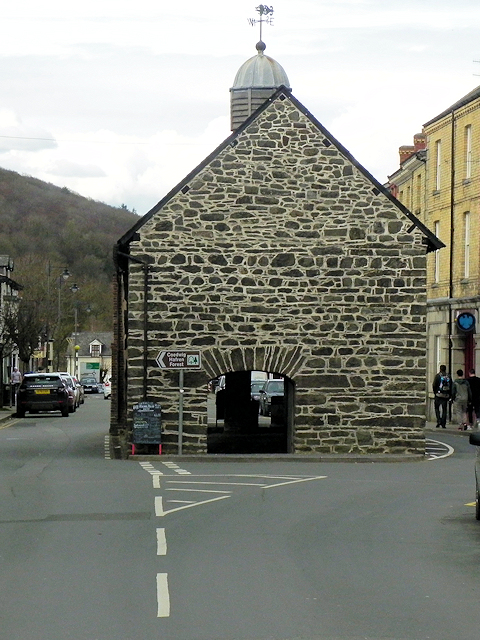
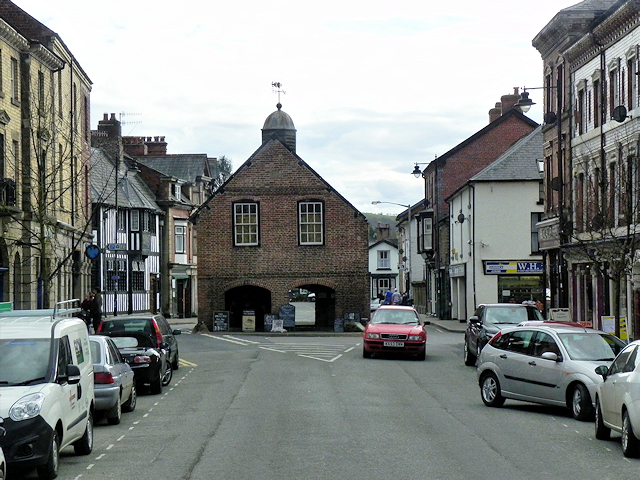
Old Market Hall, Llanidloes

The Old Market Hall is the oldest timber-framed market hall in Llanidloes, Wales, dating to the early 17th century. Until well into the 20th century a...

Llanidloes

Llanidloes (Welsh pronunciation: [ɬanˈɪdlɔɨs]) is a town and community on the A470 and B4518 roads in Powys, within the historic county boundaries of Montgomeryshire...

Llanidloes Town Hall

Llanidloes Town Hall (Welsh: Neuadd y Dref Llanidloes) is a municipal building in Great Oak Street, Llanidloes in Powys, Wales. The structure, which is...

Afon Clywedog

The Afon Clywedog is an upland headwater tributary of the River Severn in Powys, Wales. It is approximately 29 km long and has its source on the flanks...

Llanidloes War Memorial Hospital

Llanidloes War Memorial Hospital (Welsh: Ysbyty Coffa Rhyfel Llanidloes) is a health facility in Eastgate Street, Llanidloes, Powys, Wales. It is managed...

Nearby Amenities

Located within 500m of 52.442893,-3.5657895
Rhiw-Bron-Y-Gelli
Natural: peak
Lat/Long: 52.4403399/-3.5665827
Direction: 190
Generator Method: photovoltaic
Generator Output Electricity: yes
Generator Solar Modules: 18
Generator Source: solar
Generator Type: solar_photovoltaic_panel
Location: roof
Power: generator
Lat/Long: 52.4472985/-3.5666634
The data included in this document is from www.openstreetmap.org. The data is made available under ODbL.

Have you been to Coed Caencoed?

Leave your review of Coed Caencoed below (or comments, questions and feedback).