Coed Cae

Wood, Forest in Merionethshire

Wales

Coed Cae

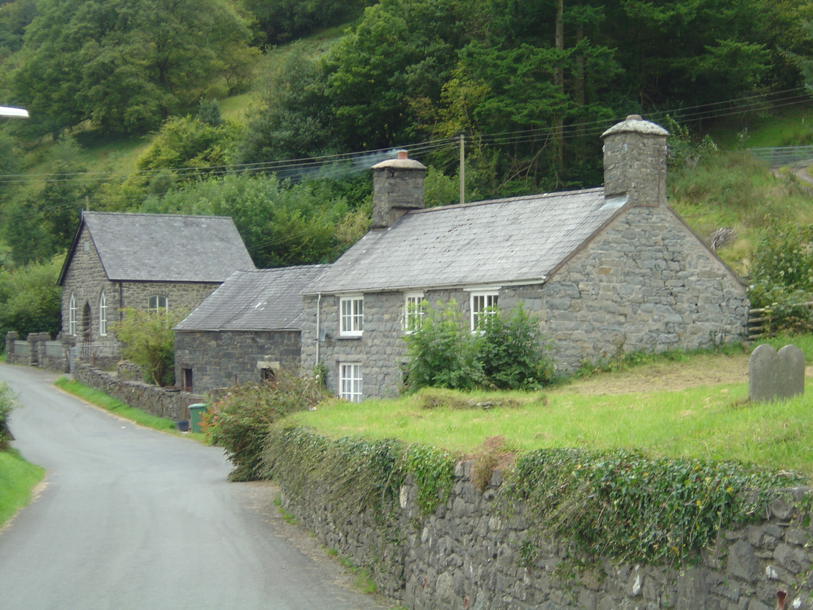
Llanymawddwy chapel
Llanymawddwy chapel Credit: David Purchase

The requested URL returned error: 429 Too Many Requests

If you have any feedback on the listing, please let us know in the comments section below.

Coed Cae Images

Images are sourced within 2km of 52.752106/-3.626154 or Grid Reference SH9018. Thanks to Geograph Open Source API. All images are credited.

Llanymawddwy chapel
Llanymawddwy chapel
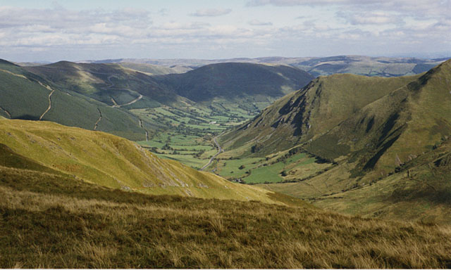
Llanymawddwy The upper Dyfi, surrounded by steep sided flat topped hills.
Llanymawddwy
The upper Dyfi, surrounded by steep sided flat topped hills.
Trees and Pasture near Pennant Wenallt in the distance.
Trees and Pasture near Pennant
Wenallt in the distance.
St Tydecho, Llanymawddwy St Tydecho church in Llanymawddwy in the Dovey valley.
St Tydecho, Llanymawddwy
St Tydecho church in Llanymawddwy in the Dovey valley.
View to Feol y Bryn A field between woods in the Dovey valley with a view beyond to Feol y Bryn with Coed Cochion on the hillside.
View to Feol y Bryn
A field between woods in the Dovey valley with a view beyond to Feol y Bryn with Coed Cochion on the hillside.
Country road approaching Llanymawddwy Country road in the Dyfi/Dovey valley approaching Llanymawddwy.
Country road approaching Llanymawddwy
Country road in the Dyfi/Dovey valley approaching Llanymawddwy.
Llanymawddwy Arwydd pentref Llanymawddwy / Llanymawddwy village sign.
Llanymawddwy
Arwydd pentref Llanymawddwy / Llanymawddwy village sign.
Addoldy Bethesda, Llanymawddwy / Bethesda Chapel, Llanymawddwy Un o'r llefydd i'w addoli yn Llanymawddwy / One of the places to worship in  Llanymawddwy.
Addoldy Bethesda, Llanymawddwy / Bethesda Chapel, Llanymawddwy
Un o'r llefydd i'w addoli yn Llanymawddwy / One of the places to worship in Llanymawddwy.
Llanymawddwy Yr Eglwys yn Llanymawddwy / The Church in Llanymawddwy.
Llanymawddwy
Yr Eglwys yn Llanymawddwy / The Church in Llanymawddwy.
Caeau Beudy Roli / Beudy Roli fields Cwm Pen y Gelli y tu ol i gaeau Beudy Roli / Cwm Pen y Gelli behind Beudy Roli fields
Caeau Beudy Roli / Beudy Roli fields
Cwm Pen y Gelli y tu ol i gaeau Beudy Roli / Cwm Pen y Gelli behind Beudy Roli fields
A daffodil welcome to Llanymawddwy A very healthy crop greets travellers from the south.
A daffodil welcome to Llanymawddwy
A very healthy crop greets travellers from the south.
Ordnance Survey Flush Bracket (S0755) This OS cut mark can be found on the SW face of the church. It marks a point 153.507m above mean sea level.
Ordnance Survey Flush Bracket (S0755)
This OS cut mark can be found on the SW face of the church. It marks a point 153.507m above mean sea level.
Ordnance Survey Cut Mark This OS cut mark can be found on the north parapet of Pont y Pennant. It marks a point 157.891m above mean sea level.
Ordnance Survey Cut Mark
This OS cut mark can be found on the north parapet of Pont y Pennant. It marks a point 157.891m above mean sea level.
St. Tydecho, Llanymawddwy The ancient church of St. Tydecho, Llanymawddwy.
 St. Tydecho established the church at Llanymawddwy in 525. Three churches were consecrated St. Tydecho - Llanymawddwy, Mallwyd and Cemaes. He wrote the first Welsh-Latin dictionary. The area was also the home of Gwylliaid Cochion Mawddwy, the Red Raiders, a ferocious band of people who terrified the local population. They were said to be locals who had rebelled against the new laws in the 16th century. Many were hanged for their crimes.
St. Tydecho, Llanymawddwy
The ancient church of St. Tydecho, Llanymawddwy. St. Tydecho established the church at Llanymawddwy in 525. Three churches were consecrated St. Tydecho - Llanymawddwy, Mallwyd and Cemaes. He wrote the first Welsh-Latin dictionary. The area was also the home of Gwylliaid Cochion Mawddwy, the Red Raiders, a ferocious band of people who terrified the local population. They were said to be locals who had rebelled against the new laws in the 16th century. Many were hanged for their crimes.
Telephone box, postbox and information board, Llanymawddwy
Bethesda Chapel, Llanymawddwy Built 1884
One of 2 churches in Llanymawddwy, the other being St. Tydecho.
<a title="https://www.geograph.org.uk/photo/506671" href="https://www.geograph.org.uk/photo/506671">Link</a>
Bethesda Chapel, Llanymawddwy
Built 1884 One of 2 churches in Llanymawddwy, the other being St. Tydecho. Link
Road into Llanymawddwy This was a drovers' road used for driving cattle and other stock to markets in England.
This was the way to Bwlch-y-Groes and the road to Bala. It was a very spiritual place because drovers and pilgrims needed somewhere to pray before tackling the pass.
They also needed somewhere to rest and at one time there were 7 public houses in the village with names linked to droving.
Road into Llanymawddwy
This was a drovers' road used for driving cattle and other stock to markets in England. This was the way to Bwlch-y-Groes and the road to Bala. It was a very spiritual place because drovers and pilgrims needed somewhere to pray before tackling the pass. They also needed somewhere to rest and at one time there were 7 public houses in the village with names linked to droving.
Walkers on Tap Mawr These two are looking out across the Llanymawddwy valley
Walkers on Tap Mawr
These two are looking out across the Llanymawddwy valley
Show me another place!

Coed Cae is located at Grid Ref: SH9018 (Lat: 52.752106, Lng: -3.626154)

Unitary Authority: Gwynedd

Police Authority: North Wales

What 3 Words

///grouping.flashback.hello. Near Llanuwchllyn, Gwynedd

Nearby Locations

Bryn Mawr Coed Cae

Related Wikis

Llanymawddwy

Llanymawddwy () is a village in the community of Mawddwy in south-east Gwynedd, Wales, which is to the north of the larger village of Dinas Mawddwy, on...

Cywarch

Cywarch (also known as Aber-Cywarch or Aber Cywarch) is a location at the head of Cwm Cywarch in the Snowdonia National Park, in Gwynedd, Wales. Several...

Bwlch y Groes

Bwlch y Groes (translates from Welsh as pass of the cross) is the second highest public road mountain pass in Wales, with a summit altitude of 545 metres...

Afon Cerist

The Afon Cerist is a small river that flows from underneath Craig Portas, the cliffs on the north side of Maesglase mountain, to meet the River Dyfi at...

Nearby Amenities

Located within 500m of 52.752106,-3.626154
Source: npe
Lat/Long: 52.7514326/-3.6328523
Source: npe
Lat/Long: 52.7540431/-3.6286466
Source: npe
Lat/Long: 52.7547314/-3.6259214
Source: npe
Lat/Long: 52.7556924/-3.6246125
The data included in this document is from www.openstreetmap.org. The data is made available under ODbL.

Have you been to Coed Cae?

Leave your review of Coed Cae below (or comments, questions and feedback).