Coed Groen-wen

Wood, Forest in Merionethshire

Wales

Coed Groen-wen

Ucheldre View across to the upland grazing on Ucheldre, viewed here from the B4501.
Ucheldre Credit: Philip Halling

The requested URL returned error: 429 Too Many Requests

If you have any feedback on the listing, please let us know in the comments section below.

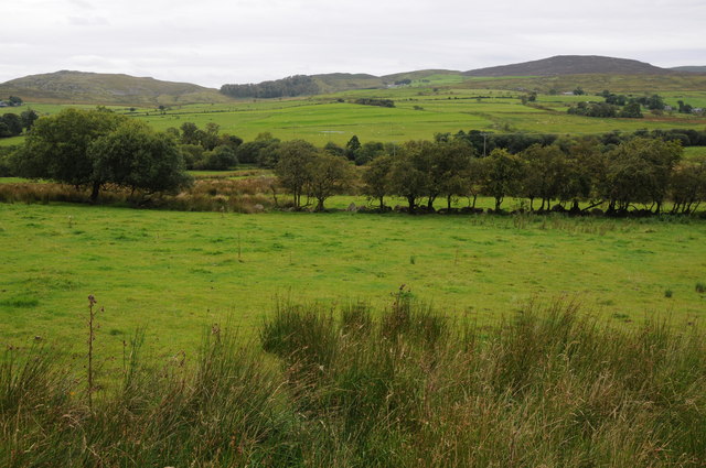
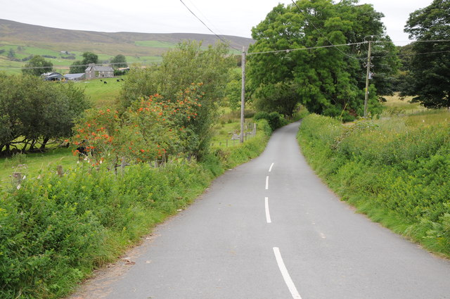
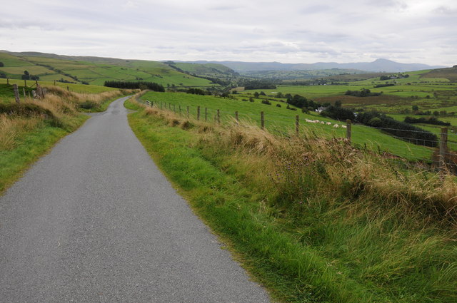
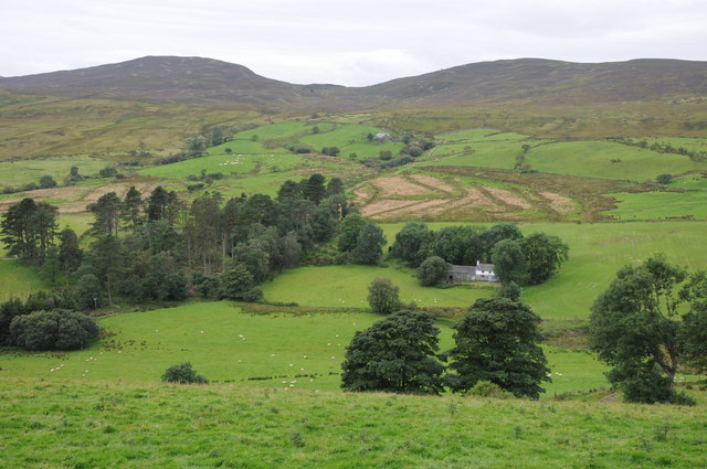
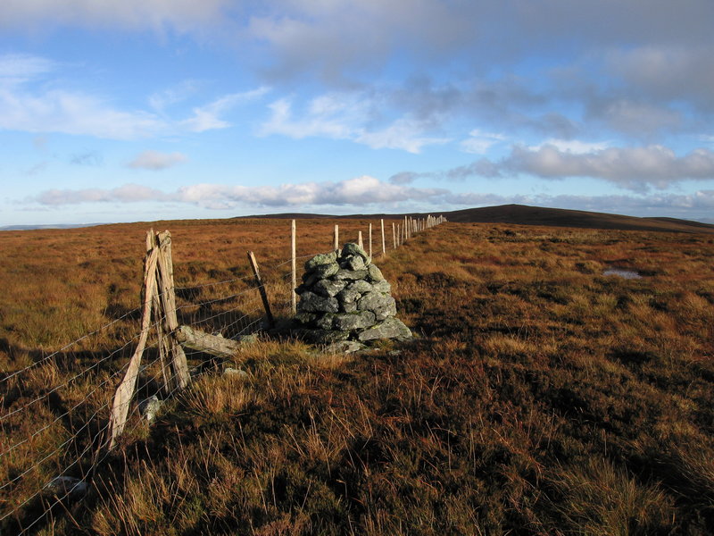
Coed Groen-wen Images

Images are sourced within 2km of 52.983876/-3.6373201 or Grid Reference SH9044. Thanks to Geograph Open Source API. All images are credited.

Ucheldre View across to the upland grazing on Ucheldre, viewed here from the B4501.
Ucheldre
View across to the upland grazing on Ucheldre, viewed here from the B4501.
The B4501 near Gellioedd The B4501 links Bala with the A5 near Cerrigydrudion, here it is pictured near Gellioedd.
The B4501 near Gellioedd
The B4501 links Bala with the A5 near Cerrigydrudion, here it is pictured near Gellioedd.
View to Arenig Fawr View to Arenig Fawr from the B4501 near Hafod-y-Bryn.  Craig yr Hafod can be seen in the middle distance on the right.
View to Arenig Fawr
View to Arenig Fawr from the B4501 near Hafod-y-Bryn. Craig yr Hafod can be seen in the middle distance on the right.
Moel y Gydros Upland grazing on the 521m high Moel y Gydros, viewed from the country road passing over Cadair Benllyn.
Moel y Gydros
Upland grazing on the 521m high Moel y Gydros, viewed from the country road passing over Cadair Benllyn.
Woodland strip Woodland strip on the eastern slopes of Moel y Gydros.
Woodland strip
Woodland strip on the eastern slopes of Moel y Gydros.
Valley near Gydros The Afon Nant Fach flows through this valley near Gydros.
Valley near Gydros
The Afon Nant Fach flows through this valley near Gydros.
View across Cwmtirmynach View across Cwmtirmynach with the Arenigs in the distance.
View across Cwmtirmynach
View across Cwmtirmynach with the Arenigs in the distance.
Road to Cwm Penanner Road to Cwm Penanner, viewed from its junction with the B4501 near Nant-y-cyrtiau.
Road to Cwm Penanner
Road to Cwm Penanner, viewed from its junction with the B4501 near Nant-y-cyrtiau.
View to Graig Ddu View to Graig Ddu and Craig yr Hafod from near Hafod-yr-Esgob.
View to Graig Ddu
View to Graig Ddu and Craig yr Hafod from near Hafod-yr-Esgob.
Cae'r-gerreg View to Graig Ddu and Craig yr Hafod from near Cae'r-gerreg.
Cae'r-gerreg
View to Graig Ddu and Craig yr Hafod from near Cae'r-gerreg.
Road to Bala View down a country road as it passes upland near Cae'r-gerreg, Bala is in the valley in the middle distance and Aran Fawddwy can be seen to the right in the distance.
Road to Bala
View down a country road as it passes upland near Cae'r-gerreg, Bala is in the valley in the middle distance and Aran Fawddwy can be seen to the right in the distance.
Cae-hir View to Graig Ddu and Craig yr Hafod with Cae-hir in the valley near the trees.
Cae-hir
View to Graig Ddu and Craig yr Hafod with Cae-hir in the valley near the trees.
View to Graig Ddu and Craig yr Hafod View to Graig Ddu and Craig yr Hafod view across the upper reaches of Cwmtirmynach.
View to Graig Ddu and Craig yr Hafod
View to Graig Ddu and Craig yr Hafod view across the upper reaches of Cwmtirmynach.
Wood on Moel y Gydros Woodland strip on the western slopes of Moel y Gydros.
Wood on Moel y Gydros
Woodland strip on the western slopes of Moel y Gydros.
Grazing land above Cwm Penanner Upland grazing land above Cwm Penanner, the north slopes of Moel y Gydros can be seen on the right.
Grazing land above Cwm Penanner
Upland grazing land above Cwm Penanner, the north slopes of Moel y Gydros can be seen on the right.
Graig Ddu Summit Cairn The summit cairn at the top of Graig Ddu (Black Rock). Requires a tough tramp over the heather from the northerly right of way to reach it.
Graig Ddu Summit Cairn
The summit cairn at the top of Graig Ddu (Black Rock). Requires a tough tramp over the heather from the northerly right of way to reach it.
Moel y Gydros from the Cwm Penanner road At the foot of Moel y Gydros looking east from the single track road to Cwm Penanner. The smaller summit of Moel Cwm-Main is to the left and a small spruce plantation clings to the hillside on the right.
Moel y Gydros from the Cwm Penanner road
At the foot of Moel y Gydros looking east from the single track road to Cwm Penanner. The smaller summit of Moel Cwm-Main is to the left and a small spruce plantation clings to the hillside on the right.
Moel y Gydros summit panorama looking southwest Looking west from the summit of Moel y Gydros in the direction of Bala. At a maximum elevation of 1713ft (522m) it is modest by Welsh mountain standards but the views it commands are impressive. Aran Benllyn and Aran Fawddwy can be seen in the centre background approx 14 miles distant. Esgeiriau Gwynion, Foel Figenau and Moel-y-Cerrig Duon are among the peaks seen to the left, with the most distant summits being Cadair Idris (24 miles) and Tarren Y Gesail (28 miles) on the right. The unnamed south top is in the foreground.
Moel y Gydros summit panorama looking southwest
Looking west from the summit of Moel y Gydros in the direction of Bala. At a maximum elevation of 1713ft (522m) it is modest by Welsh mountain standards but the views it commands are impressive. Aran Benllyn and Aran Fawddwy can be seen in the centre background approx 14 miles distant. Esgeiriau Gwynion, Foel Figenau and Moel-y-Cerrig Duon are among the peaks seen to the left, with the most distant summits being Cadair Idris (24 miles) and Tarren Y Gesail (28 miles) on the right. The unnamed south top is in the foreground.
Show me another place!

Coed Groen-wen is located at Grid Ref: SH9044 (Lat: 52.983876, Lng: -3.6373201)

Unitary Authority: Gwynedd

Police Authority: North Wales

What 3 Words

///framework.buzzer.airbag. Near Llangwm, Conwy

Nearby Locations

Coed Groen-wen

Related Wikis

Moel y Gydros

Moel y Gydros (English: Bare Hill of Gydros) is a hill located just outside the Snowdonia National Park on the Gwynedd / Conwy border in North Wales. The...

Waun Garnedd-y-filiast

Waun Garnedd-y-filiast is a top of Carnedd y Filiast on the border of the Snowdonia National park near Cerrigydrudion in North Wales. It is part of the...

Carnedd y Filiast (Cerrigydrudion)

Carnedd y Filiast is a mountain near Cerrigydrudion on the border of the Snowdonia National Park, North Wales and is 669 metres (2,195 ft) high. ��2...

Carnedd Llechwedd-llyfn

Carnedd Llechwedd-llyfn is a subsidiary summit of Carnedd y Filiast on the border of Snowdonia National Park in Llandderfel, in Gwynedd. The northern...

Related Videos

Tryweryn fun

bank holiday Monday kayaking on the Tryweryn 29/5/23 fun in the sun in the scorch.

HIGH ROPE TERROR!!

Lily braves the high ropes in Ty Mawr, North Wales.
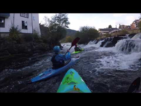
Wales 2018

Our 2018 trip to Wales where we paddled on the River Tryweryn at the Welsh National Whitewater Centre and on the River Dee!

summer time Tryweryn #kayaking #pyranhakayaks #whitewater #nature #fun

bank holiday Monday kayaking on the Tryweryn 29/5/23 fun in the sun in the scorch.

Have you been to Coed Groen-wen?

Leave your review of Coed Groen-wen below (or comments, questions and feedback).