Coed Nant-cyrniog

Wood, Forest in Merionethshire

Wales

Coed Nant-cyrniog

A458 near Mallwyd
A458 near Mallwyd Credit: Steven Brown

Coed Nant-cyrniog is a picturesque woodland area located in the county of Merionethshire in Wales. Covering an approximate area of 100 acres, this beautiful forest is a haven for nature enthusiasts and outdoor adventurers.

The woodland is characterized by its diverse range of tree species, including oak, birch, beech, and pine. These majestic trees create a dense canopy that provides a habitat for various wildlife species, such as birds, insects, and small mammals. The forest floor is covered in a lush carpet of ferns, mosses, and wildflowers, adding to the enchanting atmosphere of the area.

Coed Nant-cyrniog offers a network of well-maintained walking trails, allowing visitors to explore the forest at their own pace. The trails wind through the woodlands, providing stunning views of the surrounding countryside and the nearby river. Nature lovers can immerse themselves in the tranquility of the forest, enjoying the soothing sounds of birdsong and the gentle rustling of leaves.

The woodland is also a popular destination for outdoor activities such as hiking, cycling, and wildlife spotting. The diverse ecosystem of Coed Nant-cyrniog makes it an ideal place for birdwatching, with a variety of species, including woodpeckers, thrushes, and finches, making their home in the forest.

In conclusion, Coed Nant-cyrniog is a magical woodland retreat in Merionethshire. With its diverse range of trees, abundant wildlife, and well-maintained trails, it offers a perfect opportunity to escape the hustle and bustle of city life and reconnect with nature.

If you have any feedback on the listing, please let us know in the comments section below.

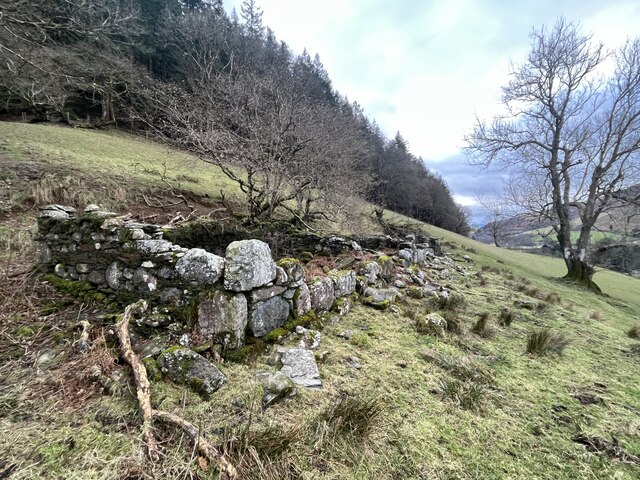
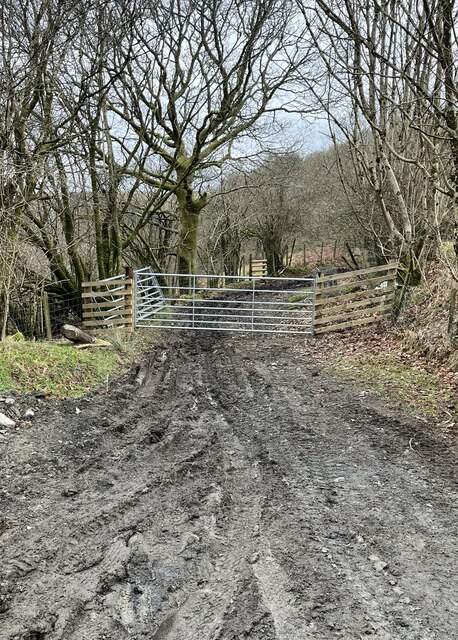
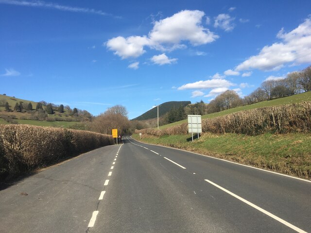
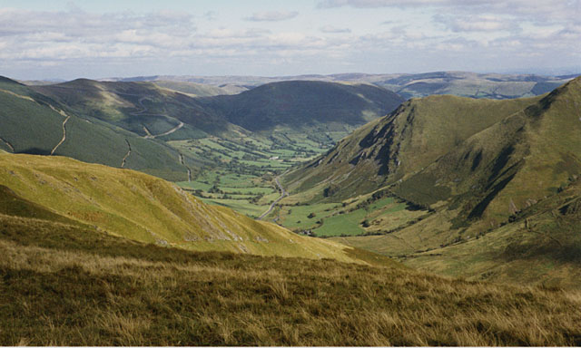
Coed Nant-cyrniog Images

Images are sourced within 2km of 52.70455/-3.6614915 or Grid Reference SH8713. Thanks to Geograph Open Source API. All images are credited.

A458 near Mallwyd
A458 near Mallwyd
Long abandoned A ruined building in a field above the Dyfi valley.
Long abandoned
A ruined building in a field above the Dyfi valley.
Gate on muddy track
Gate on muddy track
A458 near Mallwyd
A458 near Mallwyd
A458 towards Foel
A458 towards Foel
Typeg Bach, Mallwyd Ex Toll House on the South side of the A458 between Dugoed Isaf and Cwm Cewydd.
Originally it would have served the Montgomeryshire (Second District) Turnpike Trust in the 18ᵗʰ & 19ᵗʰ C.

Milestone Society National ID: GWY.MAL
Typeg Bach, Mallwyd
Ex Toll House on the South side of the A458 between Dugoed Isaf and Cwm Cewydd. Originally it would have served the Montgomeryshire (Second District) Turnpike Trust in the 18ᵗʰ & 19ᵗʰ C. Milestone Society National ID: GWY.MAL
The A458 at Mallwyd
The A458 at Mallwyd
Track near Mallwyd
Track near Mallwyd
Cwm-Cewydd
Cwm-Cewydd
Track near Mallwyd
Track near Mallwyd
Moving house near Dugoed Bach on A458 Common sight on roads in the area is the transportation of holiday homes.
Moving house near Dugoed Bach on A458
Common sight on roads in the area is the transportation of holiday homes.
High density of pheasants in steeply sloping field The field is on the west side of the road in Cwm Tafolog south of the bridge over the Afon Dugoed. The density of pheasants in this area is astonishing! They swarm along the road and when a halt was made to take photographs wave after wave flew from the fields on both sides of the road.
High density of pheasants in steeply sloping field
The field is on the west side of the road in Cwm Tafolog south of the bridge over the Afon Dugoed. The density of pheasants in this area is astonishing! They swarm along the road and when a halt was made to take photographs wave after wave flew from the fields on both sides of the road.
Old Milestone by the A458, Dugoed Bach Machynlleth Chamfer by the A458, in parish of Mawddwy (Gwynedd District), Dugoed Bach, Cwm Dugoed, on verge, close to road.

Inscription reads:- : MACHYNLLETH / 13 MILES / MALLWYD / 1½ / (?) OFFICE / 10½ / (WELSHPOOL / 25) :

Surveyed

Milestone Society National ID: MOT_MCWP13.
Old Milestone by the A458, Dugoed Bach
Machynlleth Chamfer by the A458, in parish of Mawddwy (Gwynedd District), Dugoed Bach, Cwm Dugoed, on verge, close to road. Inscription reads:- : MACHYNLLETH / 13 MILES / MALLWYD / 1½ / (?) OFFICE / 10½ / (WELSHPOOL / 25) : Surveyed Milestone Society National ID: MOT_MCWP13.
The Old Packhorse Bridge at Dinas Mawddwy The Packhorse Bridge over the River Dovey was built in the first half of the seventeenth by Dr John Davies rector of the parish
The Old Packhorse Bridge at Dinas Mawddwy
The Packhorse Bridge over the River Dovey was built in the first half of the seventeenth by Dr John Davies rector of the parish
Two bridges over the Dyfi
Mallwyd cemetery Slightly out of the village, and with plenty of space in it. The sun is setting to the left behind the hills lining the west side of the Dyfi valley.
Mallwyd cemetery
Slightly out of the village, and with plenty of space in it. The sun is setting to the left behind the hills lining the west side of the Dyfi valley.
St Tydecho's Church, Mallwyd The tower is carrying the date 1640, but there has been a church on this site since the 6th century.
St Tydecho's Church, Mallwyd
The tower is carrying the date 1640, but there has been a church on this site since the 6th century.
The Brigand's Inn, Mallwyd Evening sun is shining on the hillside behind, but the village is now shaded by the hills to the west.
The Brigand's Inn, Mallwyd
Evening sun is shining on the hillside behind, but the village is now shaded by the hills to the west.
Show me another place!

Coed Nant-cyrniog is located at Grid Ref: SH8713 (Lat: 52.70455, Lng: -3.6614915)

Unitary Authority: Gwynedd

Police Authority: North Wales

What 3 Words

///cassettes.speech.octopus. Near Cwm-Llinau, Powys

Related Wikis

Mallwyd

Mallwyd () is a small village at the most southern end of Gwynedd, Wales, in the Mawddwy community, in the valley of the River Dyfi. It lies on the A470...

Pont Minllyn

Pont Minllyn (also known as Pont-y-Ffinant or Pontrusk Bridge) is a bridge spanning the Afon Dyfi, north of the village of Mallwyd, in Gwynedd, Wales....

Meirion Mill Railway

The Meirion Mill Railway was a narrow gauge railway that operated at Meirion Mill in Dinas Mawddwy, Wales. It only operated for three years from 1975 to...

Afon Cerist

The Afon Cerist is a small river that flows from underneath Craig Portas, the cliffs on the north side of Maesglase mountain, to meet the River Dyfi at...

Nearby Amenities

Located within 500m of 52.70455,-3.6614915
Source: npe
Lat/Long: 52.7030003/-3.6672704
Source: npe
Lat/Long: 52.701492/-3.6634938
Dugoed Isaf
Place: farm
Lat/Long: 52.7020452/-3.6567907
The data included in this document is from www.openstreetmap.org. The data is made available under ODbL.

Have you been to Coed Nant-cyrniog?

Leave your review of Coed Nant-cyrniog below (or comments, questions and feedback).