Burwell

Settlement in Cambridgeshire East Cambridgeshire

England

Burwell

Welcome to Cambridgeshire The county boundary, half way between Exning and Burwell (ahead) - one of the most westerly points in Suffolk. The hump in the road ahead (in <a href="https://www.geograph.org.uk/gridref/TL5966">TL5966</a>) is where there was a bridge over the Cambridge to Mildenhall railway line, which closed in the 1960s.
Welcome to Cambridgeshire Credit: John Sutton

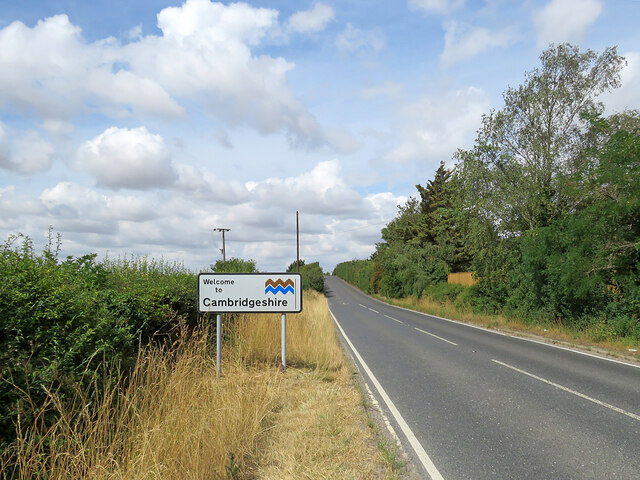
Burwell is a village located in the county of Cambridgeshire, England. Situated approximately 12 miles northeast of the city of Cambridge, it lies on the edge of the fens and is bordered by the River Cam to the south.

With a population of around 6,000 people, Burwell is a thriving community that offers a range of amenities and services. The village has a number of shops, including a supermarket, post office, and several local businesses. It also boasts several pubs and restaurants, providing residents and visitors with a choice of dining and socializing options.

Burwell has a rich history, with evidence of human settlement dating back to the Iron Age. The village is home to St. Mary's Church, a prominent landmark that dates back to the 12th century. The church features a distinctive tower and is known for its beautiful stained glass windows.

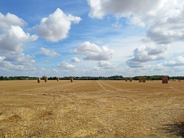
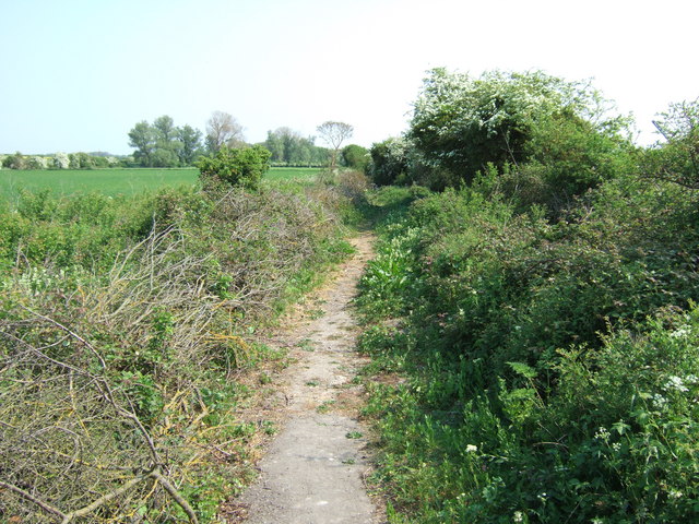
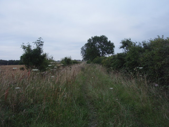
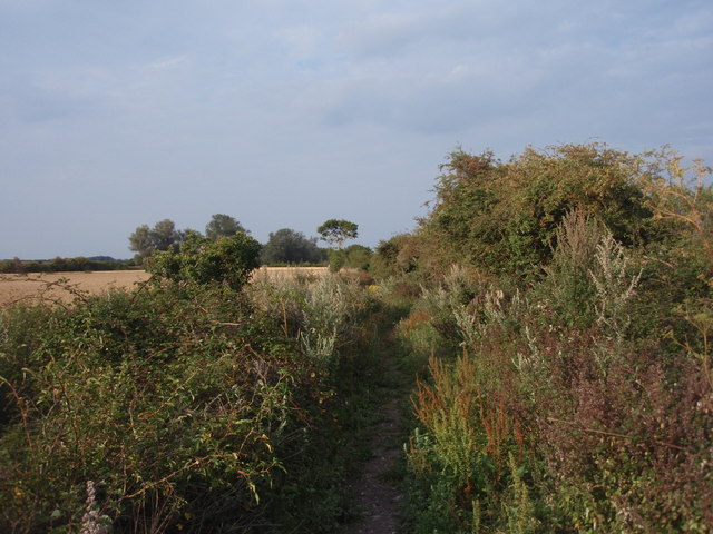
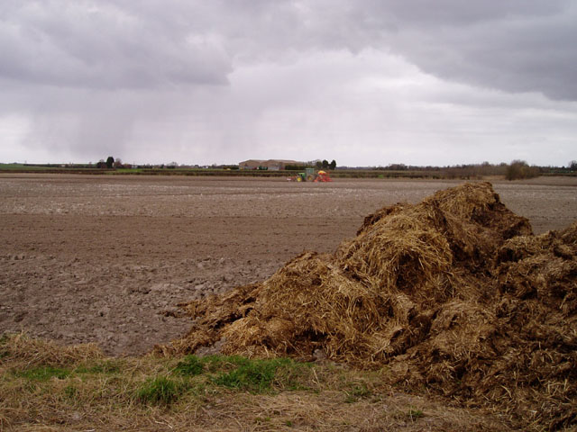
The rural location of Burwell makes it an ideal base for outdoor enthusiasts. The village is surrounded by picturesque countryside, offering opportunities for walking, cycling, and horse riding. The nearby Wicken Fen National Nature Reserve, managed by the National Trust, provides a unique habitat for a variety of wildlife and offers nature trails and birdwatching opportunities.

In terms of education, Burwell has a primary school and a secondary school, ensuring that local children have access to quality education within the village.

Overall, Burwell is a charming village with a strong sense of community, offering a mix of history, amenities, and natural beauty.

If you have any feedback on the listing, please let us know in the comments section below.

Burwell Images

Images are sourced within 2km of 52.275353/0.327468 or Grid Reference TL5866. Thanks to Geograph Open Source API. All images are credited.

Welcome to Cambridgeshire The county boundary, half way between Exning and Burwell (ahead) - one of the most westerly points in Suffolk. The hump in the road ahead (in <a href="https://www.geograph.org.uk/gridref/TL5966">TL5966</a>) is where there was a bridge over the Cambridge to Mildenhall railway line, which closed in the 1960s.
Welcome to Cambridgeshire
The county boundary, half way between Exning and Burwell (ahead) - one of the most westerly points in Suffolk. The hump in the road ahead (in TL5966) is where there was a bridge over the Cambridge to Mildenhall railway line, which closed in the 1960s.
Farm track, barn and high cloud This section of a farm track is shared by the restricted byway from the B1103 west of Burwell to Haycroft Lane (ahead) and on to Landwade. On this fine early-August morning the clouds were fast-moving.
Farm track, barn and high cloud
This section of a farm track is shared by the restricted byway from the B1103 west of Burwell to Haycroft Lane (ahead) and on to Landwade. On this fine early-August morning the clouds were fast-moving.
A restricted byway on the edge of Suffolk This track runs from Landwade to the B1103 between Exning and Burwell (ahead). On a bright August morning the sun was briefly behind a scrap of high cloud.
A restricted byway on the edge of Suffolk
This track runs from Landwade to the B1103 between Exning and Burwell (ahead). On a bright August morning the sun was briefly behind a scrap of high cloud.
A line of trees on the edge of Suffolk The trees on the other side of this narrow field next to a restricted byway line the former course of the Cambridge to Mildenhall railway line, which is also the county boundary hereabouts. The line closed in the 1960s.

In the first week of August the harvest is well advanced in this part of East Anglia.
A line of trees on the edge of Suffolk
The trees on the other side of this narrow field next to a restricted byway line the former course of the Cambridge to Mildenhall railway line, which is also the county boundary hereabouts. The line closed in the 1960s. In the first week of August the harvest is well advanced in this part of East Anglia.
Beechams House and the course of the Mildenhall branch line Beechams House was originally a crossing-keeper's cottage. This is where the lanes from Exning to the top end of Burwell crossed the railway, whose course to Cambridge is ahead, to the left of the tall tree. The line's course is also the boundary between Suffolk (left) and Cambridgeshire for the next three-quarters of a mile or so.
Beechams House and the course of the Mildenhall branch line
Beechams House was originally a crossing-keeper's cottage. This is where the lanes from Exning to the top end of Burwell crossed the railway, whose course to Cambridge is ahead, to the left of the tall tree. The line's course is also the boundary between Suffolk (left) and Cambridgeshire for the next three-quarters of a mile or so.
Plantation and field boundary East of Haycroft Lane in the low chalk hills between Burwell and Newmarket. The lane here is the county boundary and this is the Suffolk side.
Plantation and field boundary
East of Haycroft Lane in the low chalk hills between Burwell and Newmarket. The lane here is the county boundary and this is the Suffolk side.
Bales in harvest time Fields north-east of Haycroft Lane, between Burwell and Exning, on a sunny morning in early August. Harvest is well advanced in this part of East Anglia.
Bales in harvest time
Fields north-east of Haycroft Lane, between Burwell and Exning, on a sunny morning in early August. Harvest is well advanced in this part of East Anglia.
Footpath near Halfway House Halfway between Burwell and Exning
Footpath near Halfway House
Halfway between Burwell and Exning
Haycroft Lane Now a restricted byway, this track was once a link between Burwell and Exning. The photograph was taken in Cambridgeshire, looking into Suffolk.
Haycroft Lane
Now a restricted byway, this track was once a link between Burwell and Exning. The photograph was taken in Cambridgeshire, looking into Suffolk.
Restricted Byway, Exning A restricted byway on the very edge of Suffolk next to the dismantled Cambridge to Mildenhall railway.
Restricted Byway, Exning
A restricted byway on the very edge of Suffolk next to the dismantled Cambridge to Mildenhall railway.
Restricted byway to B1103 On the right, with a farm track on the left.
Restricted byway to B1103
On the right, with a farm track on the left.
Big Hill. Not Looking towards Exning, Nr Newmarket along the B1103. The farm is called Hill Farm. It is near spot height 22m. That's quite a hill round these here parts
Big Hill. Not
Looking towards Exning, Nr Newmarket along the B1103. The farm is called Hill Farm. It is near spot height 22m. That's quite a hill round these here parts
Tractor sowing near Burwell The scene shows evidence of two important industries in this part of Cambridgeshire - arable farming and equestrianism.
Tractor sowing near Burwell
The scene shows evidence of two important industries in this part of Cambridgeshire - arable farming and equestrianism.
Farmland west of Exning, Suffolk These pale, chalky topsoils – Munsell Colour 2.5Y8/1 dry, 2.5Y6/2 moist  – belong to the shallow 'Wantage series' in the national soil classification, 3.42 Grey rendzinas; view NE from near the Burwell Road.
Farmland west of Exning, Suffolk
These pale, chalky topsoils – Munsell Colour 2.5Y8/1 dry, 2.5Y6/2 moist – belong to the shallow 'Wantage series' in the national soil classification, 3.42 Grey rendzinas; view NE from near the Burwell Road.
Halfway House So called because it is half way between the villages of Burwell and Exning.  The county boundary between Suffolk and Cambridgeshire runs along the western edge of the property.
Halfway House
So called because it is half way between the villages of Burwell and Exning. The county boundary between Suffolk and Cambridgeshire runs along the western edge of the property.
Beecham House Formerly a railway crossing keeper’s cottage.  The railway line was opened 2 June 1884, and finally closed 19 April 1965.  The house stood empty for several years but was eventually taken into private ownership and renovated.
Beecham House
Formerly a railway crossing keeper’s cottage. The railway line was opened 2 June 1884, and finally closed 19 April 1965. The house stood empty for several years but was eventually taken into private ownership and renovated.
Border Ahead Cambridgeshire border ahead looking west on the B1103 near to Burwell, Cambridgeshire.
Border Ahead
Cambridgeshire border ahead looking west on the B1103 near to Burwell, Cambridgeshire.
Restricted byway at North End road This restricted byway links the end of North End road with the B1103 between Burwell and Exning. It is used mainly by horse riders, judging by the many hoof marks in the sand.
Restricted byway at North End road
This restricted byway links the end of North End road with the B1103 between Burwell and Exning. It is used mainly by horse riders, judging by the many hoof marks in the sand.
Show me another place!

Burwell is located at Grid Ref: TL5866 (Lat: 52.275353, Lng: 0.327468)

Administrative County: Cambridgeshire

District: East Cambridgeshire

Police Authority: Cambridgeshire

What 3 Words

///spellings.inspected.expired. Near Burwell, Cambridgeshire

Nearby Locations

Pound Hill Burwell

Related Wikis

Burwell, Cambridgeshire

Burwell is a village and civil parish in Cambridgeshire, England, some 10 miles (16 km) north-east of Cambridge. It lies on the south-east edge of the...

Burwell Museum

The Burwell Museum (also known as Burwell Museum and Windmill) is located in Burwell, Cambridgeshire, England. The museum depicts life through the centuries...

Burwell Castle

Burwell Castle was an unfinished medieval enclosure castle in Burwell, Cambridgeshire, England. == Details == Burwell Castle was built near the village...

Burwell railway station

Burwell railway station was on the Cambridge and Mildenhall branch of the Great Eastern Railway. After the closure of the line, the site of Burwell station...

Nearby Amenities

Located within 500m of 52.275353,0.327468
Burwell
Is In: Cambridgeshire, England, UK
Place: village
Wikidata: Q1982669
Lat/Long: 52.2757688/0.3282566
Man Made: windmill
Lat/Long: 52.2728935/0.3293307
Post Office
Burwell Post Office
Addr City: Cambridge
Addr Country: GB
Addr Housenumber: 11
Addr Postcode: CB25 0DU
Addr Street: The Causeway
Addr Village: Burwell
Brand: Post Office
Brand Wikidata: Q1783168
Contact Website: https://www.postoffice.co.uk/branch-finder/0671134/burwell
Fhrs Id: 336471
Opening Hours: Mo-Fr 09:00-17:30; Sa 09:00-12:30
Opening Hours Post Office: Mo-Fr 09:00-17:30; Sa 09:00-12:30
Ref Pol Id: 465
Shop: gift
Source Addr: FHRS Open Data
Lat/Long: 52.2752983/0.3271282
Burwell Museum
Tourism: museum
Wikidata: Q5001046
Lat/Long: 52.2731004/0.3299155
Burwell Sports Centre
Created By: Potlatch 0.10e
Leisure: sports_centre
Sport: multi
Lat/Long: 52.2795378/0.3274979
Fuel
Lat/Long: 52.2771025/0.3281507
Mini Roundabout
Direction: clockwise
Lat/Long: 52.277952/0.3295161
Pub
The Five Bells
Addr Housenumber: 44
Addr Postcode: CB25 0HD
Addr Street: High Street
Fhrs Id: 1105973
Source Addr: FHRS Open Data
Lat/Long: 52.2712636/0.3277123
Post Box
Collection Times: Mo-Fr 16:30; Sa 10:00
Operator: Royal Mail
Operator Wikidata: Q638098
Ref: CB25 248
Lat/Long: 52.2787879/0.3306434
Post Box
Collection Times: Mo-Fr 16:45; Sa 10:15
Operator: Royal Mail
Operator Wikidata: Q638098
Post Box Type: pillar
Ref: CB25 245
Lat/Long: 52.2753016/0.3272095
Bus Stop
Guyatt Court
Bus: yes
Naptan AtcoCode: 0500EBURW002
Naptan Bearing: SE
Naptan BusStopType: CUS
Naptan CommonName: Guyatt Court
Naptan Indicator: near
Naptan Landmark: Guyatt Court
Naptan NaptanCode: cmbdgjta
Naptan ShortCommonName: Guyatt Court
Naptan Street: The Causeway
Naptan Verified: no
Public Transport: platform
Source: naptan_import
Lat/Long: 52.278183/0.3259156
Bus Stop
Bewicks Mead
Bus: yes
Naptan AtcoCode: 0500EBURW005
Naptan Bearing: SW
Naptan BusStopType: CUS
Naptan CommonName: Bewicks Mead
Naptan Indicator: near
Naptan Landmark: Bewicks Mead
Naptan NaptanCode: cmbdgjtj
Naptan ShortCommonName: Bewicks Mead
Naptan Street: Ness Road
Naptan Verified: no
Public Transport: platform
Source: naptan_import
Lat/Long: 52.2765982/0.3278557
Bus Stop
Health Centre
Bus: yes
Naptan AtcoCode: 0500EBURW006
Naptan Bearing: SE
Naptan CommonName: Health Centre
Naptan Indicator: near
Naptan Landmark: Newmarket Road
Naptan NaptanCode: cmbdgjtm
Naptan ShortCommonName: Health Centre
Naptan Street: Newmarket Road
Naptan Verified: no
Public Transport: platform
Source: naptan_import
Lat/Long: 52.2740975/0.3307176
Bus Stop
Bewicks Mead
Bus: yes
Naptan AtcoCode: 0500EBURW008
Naptan Bearing: NE
Naptan CommonName: Bewicks Mead
Naptan Indicator: opp
Naptan Landmark: Bewicks Mead
Naptan NaptanCode: cmbdgjtw
Naptan ShortCommonName: Bewicks Mead
Naptan Street: Ness Road
Naptan Verified: no
Public Transport: platform
Source: naptan_import
Lat/Long: 52.2767431/0.3278046
Bus Stop
Newmarket Road
Bus: yes
Naptan AtcoCode: 0500EBURW009
Naptan Bearing: N
Naptan CommonName: Newmarket Road
Naptan Indicator: opp
Naptan Landmark: Newmarket Road
Naptan NaptanCode: cmbdgjwa
Naptan ShortCommonName: Newmarket Road
Naptan Street: High Street
Naptan Verified: no
Public Transport: platform
Source: naptan_import
Lat/Long: 52.2744552/0.3275381
Bus Stop
Ness Road
Bus: yes
Naptan AtcoCode: 0500EBURW012
Naptan Bearing: SE
Naptan CommonName: Ness Road
Naptan Indicator: near
Naptan Landmark: Ness Road
Naptan NaptanCode: cmbdgjwj
Naptan ShortCommonName: Ness Road
Naptan Street: The Causeway
Naptan Verified: no
Public Transport: platform
Source: naptan_import
Lat/Long: 52.2765398/0.3271635
Bus Stop
Newmarket Road
Bus: yes
Naptan AtcoCode: 0500EBURW013
Naptan Bearing: S
Naptan CommonName: Newmarket Road
Naptan Indicator: near
Naptan Landmark: Newmarket Road
Naptan NaptanCode: cmbdgjwm
Naptan ShortCommonName: Newmarket Road
Naptan Street: High Street
Naptan Verified: no
Public Transport: platform
Source: naptan_import
Lat/Long: 52.2744613/0.3276851
Bus Stop
Health Centre
Bus: yes
Naptan AtcoCode: 0500EBURW019
Naptan Bearing: NW
Naptan BusStopType: CUS
Naptan CommonName: Health Centre
Naptan Indicator: opp
Naptan Landmark: Newmarket Road
Naptan NaptanCode: cmbdgmam
Naptan ShortCommonName: Health Centre
Naptan Street: Newmarket Road
Naptan Verified: no
Public Transport: platform
Source: naptan_import
Lat/Long: 52.2740332/0.3306971
Bus Stop
Hall Lane
Bus: yes
Naptan AtcoCode: 0500EBURW024
Naptan Bearing: S
Naptan CommonName: Hall Lane
Naptan Indicator: opp
Naptan Landmark: Hall Lane
Naptan NaptanCode: cmbdgmdg
Naptan ShortCommonName: Hall Lane
Naptan Street: High Street
Naptan Verified: no
Public Transport: platform
Source: naptan_import
Lat/Long: 52.2731029/0.327262
Bus Stop
Ness Road
Bus: yes
Naptan AtcoCode: 0500EBURW028
Naptan Bearing: NW
Naptan CommonName: Ness Road
Naptan Indicator: opp
Naptan Landmark: Ness Road
Naptan NaptanCode: cmbdgmdt
Naptan ShortCommonName: Ness Road
Naptan Street: The Causeway
Naptan Verified: no
Public Transport: platform
Source: naptan_import
Lat/Long: 52.2767528/0.3268523
Bus Stop
Hall Lane
Bus: yes
Naptan AtcoCode: 0500EBURW031
Naptan Bearing: N
Naptan CommonName: Hall Lane
Naptan Indicator: near
Naptan Landmark: Hall Lane
Naptan NaptanCode: cmbdgmgd
Naptan ShortCommonName: Hall Lane
Naptan Street: High Street
Naptan Verified: no
Public Transport: platform
Source: naptan_import
Lat/Long: 52.2730692/0.3271429
Power: pole
Lat/Long: 52.2771974/0.3222379
Power: pole
Lat/Long: 52.2773533/0.3215137
Power: pole
Lat/Long: 52.2749015/0.3319179
Power: pole
Lat/Long: 52.2741515/0.3331625
Power: pole
Lat/Long: 52.277254/0.3215043
Power: pole
Lat/Long: 52.2749327/0.333656
Power: pole
Lat/Long: 52.2752314/0.3333046
Power: pole
Lat/Long: 52.2773025/0.3220448
Power: pole
Lat/Long: 52.2756499/0.3306895
Power: pole
Lat/Long: 52.2771597/0.3222258
Noexit: yes
Lat/Long: 52.2764959/0.3336997
Crossing
Crossing: uncontrolled
Crossing Ref: zebra
Source: Bing;survey
Lat/Long: 52.2752483/0.3275069
Burwell Museum
Entrance: yes
Lat/Long: 52.2729254/0.3295216
Barber Shop
Shop: hairdresser
Lat/Long: 52.2778313/0.3258493
CentrePeace
Shop: charity
Website: https://www.stmarysburwell.org.uk/centrepeace/centrepeace.php
Lat/Long: 52.2778492/0.3262355
Fast Food
The Best Plaice
Addr Housenumber: 40
Addr Postcode: CB25 0DU
Addr Street: The Causeway
Cuisine: fish_and_chips
Fhrs Id: 336275
Source Addr: FHRS Open Data
Lat/Long: 52.2779883/0.3261421
Waste Basket
Lat/Long: 52.275264/0.3272493
Crossing
Crossing: zebra
Lat/Long: 52.2787122/0.3254754
Kindergarten
Red House Day Nursery
Addr Housenumber: 90
Addr Postcode: CB25 0HD
Addr Street: High Street
Fhrs Id: 1439774
Kindergarten: day_nursery
Source Addr: http://www.redhousedaynursery.co.uk/
Url: http://www.redhousedaynursery.co.uk/
Lat/Long: 52.2748181/0.3278044
Fast Food
Burwell Kebab
Addr Postcode: CB25 0DU
Cuisine: kebab
Fhrs Id: 986772
Kiosk: yes
Source: survey
Lat/Long: 52.2758483/0.3266049
Post Box
Collection Times: Mo-Fr 09:00; Sa 07:00
Operator: Royal Mail
Operator Wikidata: Q638098
Ref: CB25 249
Lat/Long: 52.2768073/0.3307452
Post Box
Collection Times: Mo-Fr 09:00; Sa 07:00
Operator: Royal Mail
Operator Wikidata: Q638098
Ref: CB25 242
Lat/Long: 52.271984/0.3273426
Bench
Backrest: yes
Lat/Long: 52.2750181/0.3274553
Information: board
Tourism: information
Lat/Long: 52.2749401/0.3272697
Burwell War Memorial
Historic: memorial
Lat/Long: 52.2755883/0.3271853
Bench
Backrest: yes
Lat/Long: 52.2785686/0.3254205
Fast Food
Foon Lok Chinese Take-Away
Addr City: Burwell
Addr Housename: Foon Lok
Addr Housenumber: 97
Addr Postcode: CB25 0DU
Addr Street: The Causeway
Cuisine: chinese
Takeaway: only
Lat/Long: 52.2784192/0.3253392
Defibrillator
Emergency: defibrillator
Indoor: no
Postal Code: CB25 0DU
Ref GB The Circuit: 87DE199C-1DD6-4187-8ED2-AE5400D27042
Source Postal Code: ons_uprn_lookup
Lat/Long: 52.2785784/0.3252621
Map
Tourism: information
Lat/Long: 52.2752102/0.3274176
Waste Basket
Lat/Long: 52.2765904/0.3269832
Waste Basket
Lat/Long: 52.2759765/0.3272055
Bench
Lat/Long: 52.2765789/0.3269965
Idina Curtains and Blinds
Addr City: Burwell
Addr Housenumber: 6-8
Addr Postcode: CB25 0DU
Addr Street: The Causeway
Source: https://www.idina.co.uk/contact
Website: https://www.idina.co.uk/contact
Lat/Long: 52.276564/0.3272162
Waste Basket
Lat/Long: 52.2765481/0.3271588
Ryco Optics
Addr City: Burwell
Addr Housename: Rco Optics
Addr Housenumber: 10A
Addr Postcode: CB25 0DU
Addr Street: The Causeway
Website: https://www.rycooptics.co.uk/
Lat/Long: 52.2767266/0.327077
Waste Basket
Lat/Long: 52.2730864/0.3272648
Barrier: cycle_barrier
Material: metal
Lat/Long: 52.2768881/0.3289964
Burwell
Man Made: village_sign
Source: survey
Tourism: artwork
Lat/Long: 52.2749794/0.3273205
Colour: yellow
Inscription: LTS GAS PRESSURE REMOTE MONITORING POINT
Marker: post
Utility: gas
Lat/Long: 52.2782478/0.3298941
Colour: yellow
Inscription: GAS SIZE 180 PRESSURE LP 3.8 (meters away down)
Marker: plate
Utility: gas
Lat/Long: 52.2782348/0.3299354
Colour: yellow
Inscription: GAS SIZE 100 PRESSURE IP 5.1 (meters away down)
Marker: plate
Utility: gas
Lat/Long: 52.2782332/0.3299335
Bench
Lat/Long: 52.2782269/0.3298258
Bicycle Parking
Bicycle Parking: stands
Capacity: 4
Covered: no
Lat/Long: 52.2729665/0.3294163
Telephone
Booth: K6
Covered: booth
Lat/Long: 52.2730006/0.329803
Bench
Lat/Long: 52.2730159/0.3298437
Access: yes
Addr City: Burwell
Addr Housename: Burwell Surgery
Addr Postcode: CB25 0AE
Addr Street: Newmarket Road
Door: sliding
Entrance: main
Level: 0
Wheelchair: yes
Lat/Long: 52.2745541/0.3301467
Pharmacy
Burwell Surgery Dispensary
Addr City: Burwell
Addr Housename: Burwell Surgery
Addr Postcode: CB25 0AE
Addr Street: Newmarket Road
Dispensing: yes
Drive Through: no
Healthcare: pharmacy
Opening Hours: Mo-Fr 08:30-18:00
Operator: Burwell Surgery
Payment American Express: yes
Payment Credit Cards: yes
Payment Debit Cards: yes
Payment Mastercard: yes
Payment Visa: yes
Payment Visa Debit: yes
Lat/Long: 52.274603/0.3301434
The data included in this document is from www.openstreetmap.org. The data is made available under ODbL.

Have you been to Burwell?

Leave your review of Burwell below (or comments, questions and feedback).