Allt Maes-y-bwlch

Wood, Forest in Brecknockshire

Wales

Allt Maes-y-bwlch

Babel village hall A new building it seems in this rural area.
Babel village hall Credit: Neil Owen

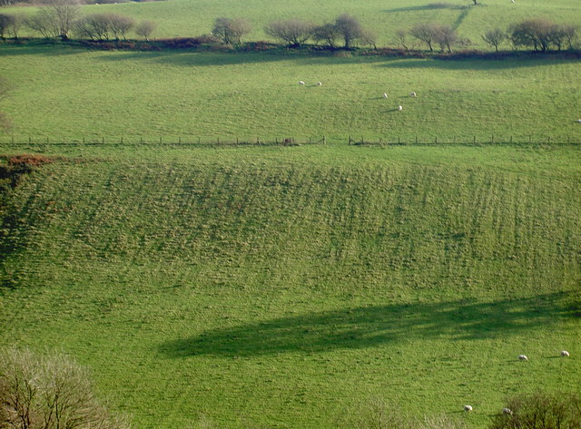
Allt Maes-y-bwlch is a picturesque wood located in Brecknockshire, Wales. Nestled in the heart of the Brecon Beacons National Park, this enchanting forest spans an area of approximately 10 hectares. Its idyllic setting amidst the rolling hills and rugged landscapes of the park makes it a popular destination for nature lovers and outdoor enthusiasts.

The wood is predominantly composed of native broadleaf trees, such as oak, beech, and birch, which create a diverse and vibrant ecosystem. The canopy of the trees provides a shady refuge during the summer months, while the forest floor is adorned with a tapestry of wildflowers and ferns.

Allt Maes-y-bwlch is also home to a variety of wildlife, including red squirrels, badgers, and a plethora of bird species. Birdwatchers can spot common woodland birds such as tits, thrushes, and finches, as well as the occasional sight of raptors soaring high above.

Visitors to the wood can enjoy a network of well-maintained walking trails that meander through its enchanting landscape. These trails cater to all levels of fitness and offer breathtaking views of the surrounding countryside.

Additionally, there are several picnic areas and benches scattered throughout the wood, providing the perfect spot for a leisurely lunch or a moment of tranquility. The peaceful ambiance, coupled with the soothing sounds of nature, make Allt Maes-y-bwlch an ideal retreat for those seeking solace in the great outdoors.

In summary, Allt Maes-y-bwlch is a captivating wood in Brecknockshire, offering a haven of natural beauty and biodiversity. With its stunning scenery, diverse wildlife, and recreational opportunities, it is a must-visit destination for anyone exploring the Brecon Beacons National Park.

If you have any feedback on the listing, please let us know in the comments section below.

Allt Maes-y-bwlch Images

Images are sourced within 2km of 52.001524/-3.6743538 or Grid Reference SN8535. Thanks to Geograph Open Source API. All images are credited.

Babel village hall A new building it seems in this rural area.
Babel village hall
A new building it seems in this rural area.
Late sun on the fields Low sunshine brings out the texture of this field near Allt Craigyrwyddon.
Late sun on the fields
Low sunshine brings out the texture of this field near Allt Craigyrwyddon.
Mynydd Bwlch-y-Groes A drive up sub-Marilyn and trig with Phil Cooper and my Black Mazda 6. Red Flags were flying on this Sunday with a lot of military vehicles on the move which were all left hand drive. Sat Navs useless so glad to have Phil keeping me on the correct bit of narrow road.

Name:Mynydd Bwlch-y-Groes
Hill number:2271
Height:442m / 1450ft
Area:32A: Llandovery to Monmouth
Class:Hu,sMa
Grid ref:SN 86860 35629
Summit feature:trig point: OS measurement
Drop:140m
Col:302m SN891383
Mynydd Bwlch-y-Groes
A drive up sub-Marilyn and trig with Phil Cooper and my Black Mazda 6. Red Flags were flying on this Sunday with a lot of military vehicles on the move which were all left hand drive. Sat Navs useless so glad to have Phil keeping me on the correct bit of narrow road. Name:Mynydd Bwlch-y-Groes Hill number:2271 Height:442m / 1450ft Area:32A: Llandovery to Monmouth Class:Hu,sMa Grid ref:SN 86860 35629 Summit feature:trig point: OS measurement Drop:140m Col:302m SN891383
Farmland around Babel View across farmland at Babel with farms of Glyntywarch and Penrhiw in the middle distance.
Farmland around Babel
View across farmland at Babel with farms of Glyntywarch and Penrhiw in the middle distance.
Farm track at Babel Farm track at Babel providing access to farmland at Babel.
Farm track at Babel
Farm track at Babel providing access to farmland at Babel.
Village Hall at Babel
Field above Maes-y-gwaelod Field above Maes-y-gwaelod to the east of Babel.
Field above Maes-y-gwaelod
Field above Maes-y-gwaelod to the east of Babel.
Trees near Maes-y-gwaelod Tree tops beyond a field near Maes-y-gwaelod to the east of Babel.
Trees near Maes-y-gwaelod
Tree tops beyond a field near Maes-y-gwaelod to the east of Babel.
Country road at Babel Country road in a wooded valley at Babel.
Country road at Babel
Country road in a wooded valley at Babel.
View to Troed-y-rhiw View across the valley to Troed-y-rhiw which is just visible through the bare trees.
View to Troed-y-rhiw
View across the valley to Troed-y-rhiw which is just visible through the bare trees.
Road above Nant Gwennol No through road in a remote Welsh valley above Nant Gwennol.
Road above Nant Gwennol
No through road in a remote Welsh valley above Nant Gwennol.
Llwybr ceffyl ar Fynydd Epynt / Bridleway on Mynydd Epynt Llwybr ceffyl yn agosau at gât ar Fynydd Epynt.

A bridleway approaching a gate on Mynydd Epynt (trans. mountain where horses roam).
Llwybr ceffyl ar Fynydd Epynt / Bridleway on Mynydd Epynt
Llwybr ceffyl yn agosau at gât ar Fynydd Epynt. A bridleway approaching a gate on Mynydd Epynt (trans. mountain where horses roam).
Llwybr ceffyl ar Fynydd Epynt / Bridleway on Mynydd Epynt Llwybr ceffyl yn arwain i lawr o Fynydd Epynt.

A bridleway descending from Mynydd Epynt (trans. mountain where horses roam).
Llwybr ceffyl ar Fynydd Epynt / Bridleway on Mynydd Epynt
Llwybr ceffyl yn arwain i lawr o Fynydd Epynt. A bridleway descending from Mynydd Epynt (trans. mountain where horses roam).
Llwybr ceffyl i Flaen y Cwm / Path to Blaen y Cwm Llwybr ceffyl yn mynd i lawr y waered i gyfeiriad Blaen y Cwm (adfail).

Bridleway descending towards the ruined Blaen y Cwm (trans. head of the valley).
Llwybr ceffyl i Flaen y Cwm / Path to Blaen y Cwm
Llwybr ceffyl yn mynd i lawr y waered i gyfeiriad Blaen y Cwm (adfail). Bridleway descending towards the ruined Blaen y Cwm (trans. head of the valley).
Military road, Sennybridge Training Area
View across Mynydd Bwlch-y-Groes Looking towards the Carmarthenshire Fans.
View across Mynydd Bwlch-y-Groes
Looking towards the Carmarthenshire Fans.
Blaen Y Glyn trig point Blaen Y Glyn triangulation station, flush bracket number S5649.
Blaen Y Glyn trig point
Blaen Y Glyn triangulation station, flush bracket number S5649.
A Quarry In Halfway Forest Disused stone quarry in Halfway forest, position of track can be seen on the other side by its fencing.
A Quarry In Halfway Forest
Disused stone quarry in Halfway forest, position of track can be seen on the other side by its fencing.
Show me another place!

Allt Maes-y-bwlch is located at Grid Ref: SN8535 (Lat: 52.001524, Lng: -3.6743538)

Unitary Authority: Carmarthenshire

Police Authority: Dyfed Powys

What 3 Words

///microchip.essays.assures. Near Llandovery, Carmarthenshire

Related Wikis

Babel, Carmarthenshire

Babel is a village in Carmarthenshire, Wales.

Crychan Forest Tracks

Crychan Forest Tracks is a Site of Special Scientific Interest in Carmarthen & Dinefwr, Wales. It was chosen as a special stage in the British Rally from...

Mynydd Bach Trecastell

Mynydd Bach Trecastell is a hill on the border between the counties of Carmarthenshire and Powys in southwest Wales. It lies within the Black Mountain...

Llandeilo'r-Fan

Llandeilo'r-Fan is a small village located in Powys, Wales. It is located between Llandovery and Brecon. It is very rural and is located in a hilly area...

Trefawr Track

Trefawr Track, a forestry road north of Cwm-coed-Aeron Farm, Llandovery, Wales, is the location of the Global Boundary Stratotype Section and Point (GSSP...

Llywel

Llywel () is a small village located on the A40, about 4 miles (6.4 km) west of Sennybridge in Brecknockshire (currently administered as part of the unitary...

Waun-Ddu

Waun-Ddu is a part of the Mynydd Bach that is a Site of Special Scientific Interest in Carmarthen & Dinefwr, Wales. == See also == List of Sites of Special...

Llandovery transmitting station

The Llandovery transmitting station is a telecommunications facility located to the north of Llandovery and east of Cynghordy, in Carmarthenshire, Wales...

Related Videos

Driving The Tirabad To Llywel Ministry of Defence Road Sennybridge at Dusk Timelapse In Reverse

Driving The Tirabad To Llywel Ministry of Defence Road Sennybridge at Dusk Timelapse In Reverse.

Nearby Amenities

Located within 500m of 52.001524,-3.6743538
Place: farm
Lat/Long: 51.997685/-3.6733668
Place: farm
Lat/Long: 52.0001819/-3.6811559
The data included in this document is from www.openstreetmap.org. The data is made available under ODbL.

Have you been to Allt Maes-y-bwlch?

Leave your review of Allt Maes-y-bwlch below (or comments, questions and feedback).