Nant y Coed

Wood, Forest in Denbighshire

Wales

Nant y Coed
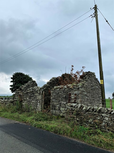
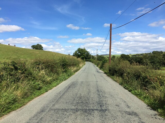
Derelict building opposite Ty'n y Llidiart For the perfectionist, the telegraph pole does lean.
Derelict building opposite Ty'n y Llidiart Credit: Richard Hoare

The requested URL returned error: 429 Too Many Requests

If you have any feedback on the listing, please let us know in the comments section below.

Nant y Coed Images

Images are sourced within 2km of 53.05066/-3.7185671 or Grid Reference SH8451. Thanks to Geograph Open Source API. All images are credited.

Derelict building opposite Ty'n y Llidiart For the perfectionist, the telegraph pole does lean.
Derelict building opposite Ty'n y Llidiart
For the perfectionist, the telegraph pole does lean.
Ty'n y Llidiart In a slightly more sombre background than <a href="https://www.geograph.org.uk/photo/5158536">SH8553 : Ty'n y Llidiart</a>
The property has a date over the entrance of 1849.
Ty'n y Llidiart
In a slightly more sombre background than SH8553 : Ty'n y Llidiart The property has a date over the entrance of 1849.
View from B5113
View from B5113
B4407 near Ysbyty Ifan
B4407 approaching junction with the A5
Ty'n y Maes
Ty'n y Maes
Footpath gate
Footpath gate
Toll House, A5, Hendre-isaf On the South side of the road, labelled Hendre-isaf Gate (Lower Hendre) in 1900 maps. It served the  Shrewsbury to Holyhead Turnpike Trust. There is a reference near the bridge on the other side of the house called Hendre-isaf to an "Old Gate" over the River Conway with an earlier bridge, which was by-passed in Thomas Telford's improvements of 1815-1820. This house dates from then.

Grade II Listed Building Cadwr Nᴼ. 18328 <span class="nowrap"><a title="https://cadwpublic-api.azurewebsites.net/reports/listedbuilding/FullReport?lang=&id=18328" rel="nofollow ugc noopener" href="https://cadwpublic-api.azurewebsites.net/reports/listedbuilding/FullReport?lang=&id=18328">Link</a><img style="margin-left:2px;" alt="External link" title="External link - shift click to open in new window" src="https://s1.geograph.org.uk/img/external.png" width="10" height="10"/></span> - British Listed Buildings - <span class="nowrap"><a title="https://britishlistedbuildings.co.uk/300018328-tyr-peg-ysbyty-ifan#.ZAtKqB_P1PY" rel="nofollow ugc noopener" href="https://britishlistedbuildings.co.uk/300018328-tyr-peg-ysbyty-ifan#.ZAtKqB_P1PY">Link</a><img style="margin-left:2px;" alt="External link" title="External link - shift click to open in new window" src="https://s1.geograph.org.uk/img/external.png" width="10" height="10"/></span>

Milestone Society National ID: CON.PTF01
Toll House, A5, Hendre-isaf
On the South side of the road, labelled Hendre-isaf Gate (Lower Hendre) in 1900 maps. It served the Shrewsbury to Holyhead Turnpike Trust. There is a reference near the bridge on the other side of the house called Hendre-isaf to an "Old Gate" over the River Conway with an earlier bridge, which was by-passed in Thomas Telford's improvements of 1815-1820. This house dates from then. Grade II Listed Building Cadwr Nᴼ. 18328 LinkExternal link - British Listed Buildings - LinkExternal link Milestone Society National ID: CON.PTF01
Gwernhywel-isaf viewed from the A5 Gwernhywel-isaf viewed from the A5 to the west of Pentrefoelas.  The Merddwr flows in the foreground.
Gwernhywel-isaf viewed from the A5
Gwernhywel-isaf viewed from the A5 to the west of Pentrefoelas. The Merddwr flows in the foreground.
The Vale of Conwy The upper reaches of the Vale of Conwy near Pentrefoelas.
The Vale of Conwy
The upper reaches of the Vale of Conwy near Pentrefoelas.
Sheep grazing by the A5
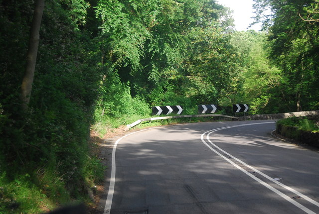
Approaching a sharp bend on the A5 The A5 is a major trunk road that runs 260 miles from London to Holyhead. It follows the course of an old Roman Road (Watling Street).
Wikipedia: <span class="nowrap"><a title="http://en.wikipedia.org/wiki/A5_road_(Great_Britain)" rel="nofollow ugc noopener" href="http://en.wikipedia.org/wiki/A5_road_(Great_Britain)">Link</a><img style="margin-left:2px;" alt="External link" title="External link - shift click to open in new window" src="https://s1.geograph.org.uk/img/external.png" width="10" height="10"/></span>
Approaching a sharp bend on the A5
The A5 is a major trunk road that runs 260 miles from London to Holyhead. It follows the course of an old Roman Road (Watling Street). Wikipedia: LinkExternal link
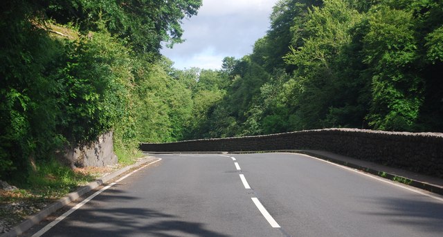
The A5 The A5 is a major trunk road that runs 260 miles from London to Holyhead. It follows the course of an old Roman Road (Watling Street).
Wikipedia: <span class="nowrap"><a title="http://en.wikipedia.org/wiki/A5_road_(Great_Britain)" rel="nofollow ugc noopener" href="http://en.wikipedia.org/wiki/A5_road_(Great_Britain)">Link</a><img style="margin-left:2px;" alt="External link" title="External link - shift click to open in new window" src="https://s1.geograph.org.uk/img/external.png" width="10" height="10"/></span>
The A5
The A5 is a major trunk road that runs 260 miles from London to Holyhead. It follows the course of an old Roman Road (Watling Street). Wikipedia: LinkExternal link
A5 in the Conwy valley The A5 is a major trunk road that runs 260 miles from London to Holyhead. It follows the course of an old Roman Road (Watling Street).
Wikipedia: <span class="nowrap"><a title="http://en.wikipedia.org/wiki/A5_road_(Great_Britain)" rel="nofollow ugc noopener" href="http://en.wikipedia.org/wiki/A5_road_(Great_Britain)">Link</a><img style="margin-left:2px;" alt="External link" title="External link - shift click to open in new window" src="https://s1.geograph.org.uk/img/external.png" width="10" height="10"/></span>
A5 in the Conwy valley
The A5 is a major trunk road that runs 260 miles from London to Holyhead. It follows the course of an old Roman Road (Watling Street). Wikipedia: LinkExternal link
A5, Padog The A5 is a major trunk road that runs 260 miles from London to Holyhead. It follows the course of an old Roman Road (Watling Street).
Wikipedia: <span class="nowrap"><a title="http://en.wikipedia.org/wiki/A5_road_(Great_Britain)" rel="nofollow ugc noopener" href="http://en.wikipedia.org/wiki/A5_road_(Great_Britain)">Link</a><img style="margin-left:2px;" alt="External link" title="External link - shift click to open in new window" src="https://s1.geograph.org.uk/img/external.png" width="10" height="10"/></span>
A5, Padog
The A5 is a major trunk road that runs 260 miles from London to Holyhead. It follows the course of an old Roman Road (Watling Street). Wikipedia: LinkExternal link
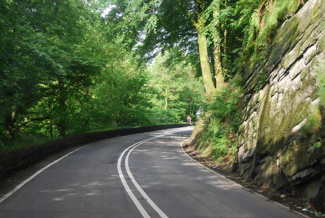
Narrow winding section of the A5 The A5 is a major trunk road that runs 260 miles from London to Holyhead. It follows the course of an old Roman Road (Watling Street).
Wikipedia: <span class="nowrap"><a title="http://en.wikipedia.org/wiki/A5_road_(Great_Britain)" rel="nofollow ugc noopener" href="http://en.wikipedia.org/wiki/A5_road_(Great_Britain)">Link</a><img style="margin-left:2px;" alt="External link" title="External link - shift click to open in new window" src="https://s1.geograph.org.uk/img/external.png" width="10" height="10"/></span>
Narrow winding section of the A5
The A5 is a major trunk road that runs 260 miles from London to Holyhead. It follows the course of an old Roman Road (Watling Street). Wikipedia: LinkExternal link
Road to Voelas Lodge A bridge across the Afon Conwy is visible.
Road to Voelas Lodge
A bridge across the Afon Conwy is visible.
A5, eastbound The A5 is a major trunk road that runs 260 miles from London to Holyhead. It follows the course of an old Roman Road (Watling Street).
Wikipedia: <span class="nowrap"><a title="http://en.wikipedia.org/wiki/A5_road_(Great_Britain)" rel="nofollow ugc noopener" href="http://en.wikipedia.org/wiki/A5_road_(Great_Britain)">Link</a><img style="margin-left:2px;" alt="External link" title="External link - shift click to open in new window" src="https://s1.geograph.org.uk/img/external.png" width="10" height="10"/></span>
A5, eastbound
The A5 is a major trunk road that runs 260 miles from London to Holyhead. It follows the course of an old Roman Road (Watling Street). Wikipedia: LinkExternal link
Show me another place!

Nant y Coed is located at Grid Ref: SH8451 (Lat: 53.05066, Lng: -3.7185671)

Unitary Authority: Conwy

Police Authority: North Wales

What 3 Words

///focal.hits.barrel. Near Betws-y-Coed, Conwy

Related Wikis

Afon Merddwr

Afon Merddwr is a river in the south of the county of Conwy, Wales. It is a tributary of the River Conwy and joins it near Pentrefoelas. It is about 10...

Pentrefoelas

Pentrefoelas is a village and community in Conwy County Borough, Wales. The village lies on the A5 road between Betws-y-Coed to the west and Cerrigydrudion...

Ysbyty Ifan

Ysbyty Ifan (often formerly anglicised as Yspytty Ifan) is a small, historic village and community in the Conwy County Borough of Wales. The population...

Rhiw Llwyd

Rhiw Llwyd is the name of an early medieval Wales lordship which was created in the Kingdom of Gwynedd in the 12th century for Tomas ap Rhodri ab Owain...

Nearby Amenities

Located within 500m of 53.05066,-3.7185671
Created By: Merkaartor 0.12
Lat/Long: 53.0497528/-3.7257921
Created By: Merkaartor 0.12
Lat/Long: 53.0491772/-3.7247541
Created By: Merkaartor 0.12
Lat/Long: 53.0487966/-3.7241533
Created By: Merkaartor 0.12
Lat/Long: 53.0486128/-3.7238046
Created By: Merkaartor 0.12
Lat/Long: 53.0484951/-3.7233942
Created By: Merkaartor 0.12
Lat/Long: 53.0484177/-3.7230723
Created By: Merkaartor 0.12
Lat/Long: 53.0483307/-3.7229221
Created By: Merkaartor 0.12
Lat/Long: 53.048192/-3.7229034
Created By: Merkaartor 0.12
Lat/Long: 53.0480694/-3.7230026
Created By: Merkaartor 0.12
Lat/Long: 53.0477357/-3.723354
The data included in this document is from www.openstreetmap.org. The data is made available under ODbL.

Have you been to Nant y Coed?

Leave your review of Nant y Coed below (or comments, questions and feedback).