Coed Pant Glas

Wood, Forest in Caernarfonshire

Wales

Coed Pant Glas

B4407 near Ysbyty Ifan
B4407 near Ysbyty Ifan Credit: Steven Brown

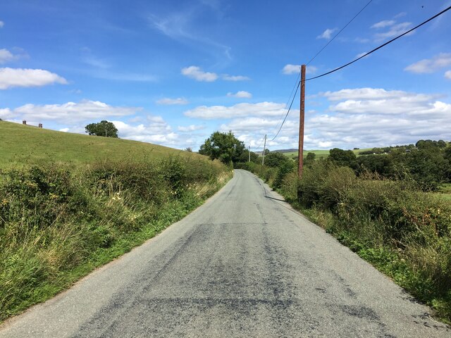
Coed Pant Glas is a picturesque woodland located in Caernarfonshire, Wales. Spread over a vast area, this forest boasts a rich and diverse ecosystem, making it a haven for nature enthusiasts and wildlife lovers alike.

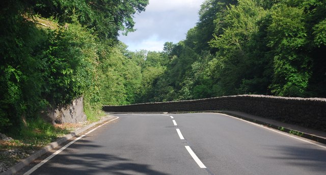
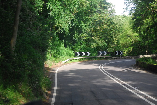
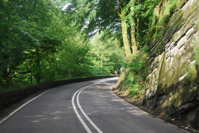
The woodland is characterized by its dense, towering trees, which provide a lush green canopy overhead. Various species of deciduous and coniferous trees, including oak, beech, and pine, are found here, creating a stunning tapestry of colors throughout the seasons. The forest floor is covered in a thick carpet of moss and ferns, adding to its enchanting beauty.

Coed Pant Glas is home to an array of wildlife, including mammals, birds, and insects. Red squirrels can be spotted darting through the treetops, while badgers and foxes are known to roam the forest floor. The woodland is also a haven for birdlife, with species such as woodpeckers, owls, and warblers making their homes here. Nature enthusiasts can often be found exploring the forest, armed with binoculars and cameras, hoping to catch a glimpse of these elusive creatures.

The woodland offers numerous walking trails and paths, allowing visitors to immerse themselves in the tranquility of nature. These trails vary in difficulty and length, catering to both casual strollers and avid hikers. The forest also features picnic areas and benches, providing the perfect spot for visitors to relax and soak in the serene surroundings.

Coed Pant Glas truly is a nature lover's paradise, offering a peaceful retreat from the hustle and bustle of everyday life. Whether it's a leisurely walk or a wildlife-spotting adventure, this enchanting woodland has something to offer for everyone.

If you have any feedback on the listing, please let us know in the comments section below.

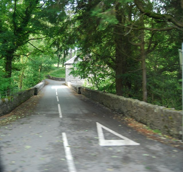
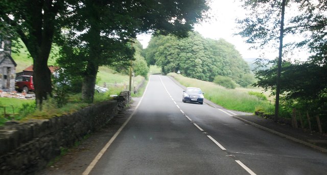
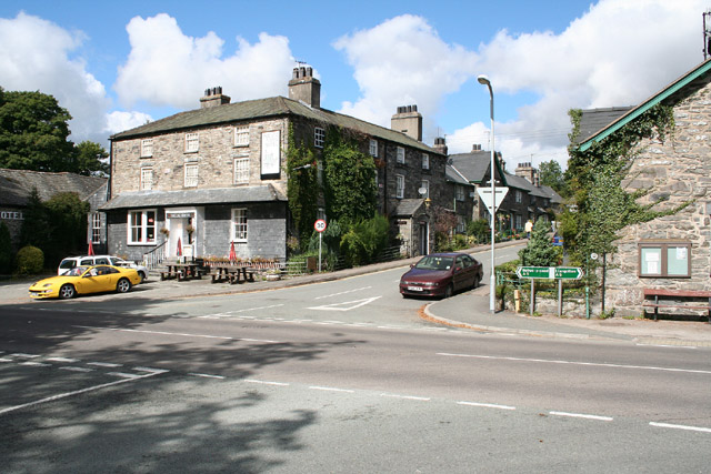
Coed Pant Glas Images

Images are sourced within 2km of 53.040558/-3.7270403 or Grid Reference SH8450. Thanks to Geograph Open Source API. All images are credited.

B4407 near Ysbyty Ifan
B4407 approaching junction with the A5
Footpath gate
Footpath gate
Toll House, A5, Hendre-isaf On the South side of the road, labelled Hendre-isaf Gate (Lower Hendre) in 1900 maps. It served the  Shrewsbury to Holyhead Turnpike Trust. There is a reference near the bridge on the other side of the house called Hendre-isaf to an "Old Gate" over the River Conway with an earlier bridge, which was by-passed in Thomas Telford's improvements of 1815-1820. This house dates from then.

Grade II Listed Building Cadwr Nᴼ. 18328 <span class="nowrap"><a title="https://cadwpublic-api.azurewebsites.net/reports/listedbuilding/FullReport?lang=&id=18328" rel="nofollow ugc noopener" href="https://cadwpublic-api.azurewebsites.net/reports/listedbuilding/FullReport?lang=&id=18328">Link</a><img style="margin-left:2px;" alt="External link" title="External link - shift click to open in new window" src="https://s1.geograph.org.uk/img/external.png" width="10" height="10"/></span> - British Listed Buildings - <span class="nowrap"><a title="https://britishlistedbuildings.co.uk/300018328-tyr-peg-ysbyty-ifan#.ZAtKqB_P1PY" rel="nofollow ugc noopener" href="https://britishlistedbuildings.co.uk/300018328-tyr-peg-ysbyty-ifan#.ZAtKqB_P1PY">Link</a><img style="margin-left:2px;" alt="External link" title="External link - shift click to open in new window" src="https://s1.geograph.org.uk/img/external.png" width="10" height="10"/></span>

Milestone Society National ID: CON.PTF01
Toll House, A5, Hendre-isaf
On the South side of the road, labelled Hendre-isaf Gate (Lower Hendre) in 1900 maps. It served the Shrewsbury to Holyhead Turnpike Trust. There is a reference near the bridge on the other side of the house called Hendre-isaf to an "Old Gate" over the River Conway with an earlier bridge, which was by-passed in Thomas Telford's improvements of 1815-1820. This house dates from then. Grade II Listed Building Cadwr Nᴼ. 18328 LinkExternal link - British Listed Buildings - LinkExternal link Milestone Society National ID: CON.PTF01
Gwernhywel-isaf viewed from the A5 Gwernhywel-isaf viewed from the A5 to the west of Pentrefoelas.  The Merddwr flows in the foreground.
Gwernhywel-isaf viewed from the A5
Gwernhywel-isaf viewed from the A5 to the west of Pentrefoelas. The Merddwr flows in the foreground.
The Vale of Conwy The upper reaches of the Vale of Conwy near Pentrefoelas.
The Vale of Conwy
The upper reaches of the Vale of Conwy near Pentrefoelas.
Sheep grazing by the A5
Approaching a sharp bend on the A5 The A5 is a major trunk road that runs 260 miles from London to Holyhead. It follows the course of an old Roman Road (Watling Street).
Wikipedia: <span class="nowrap"><a title="http://en.wikipedia.org/wiki/A5_road_(Great_Britain)" rel="nofollow ugc noopener" href="http://en.wikipedia.org/wiki/A5_road_(Great_Britain)">Link</a><img style="margin-left:2px;" alt="External link" title="External link - shift click to open in new window" src="https://s1.geograph.org.uk/img/external.png" width="10" height="10"/></span>
Approaching a sharp bend on the A5
The A5 is a major trunk road that runs 260 miles from London to Holyhead. It follows the course of an old Roman Road (Watling Street). Wikipedia: LinkExternal link
The A5 The A5 is a major trunk road that runs 260 miles from London to Holyhead. It follows the course of an old Roman Road (Watling Street).
Wikipedia: <span class="nowrap"><a title="http://en.wikipedia.org/wiki/A5_road_(Great_Britain)" rel="nofollow ugc noopener" href="http://en.wikipedia.org/wiki/A5_road_(Great_Britain)">Link</a><img style="margin-left:2px;" alt="External link" title="External link - shift click to open in new window" src="https://s1.geograph.org.uk/img/external.png" width="10" height="10"/></span>
The A5
The A5 is a major trunk road that runs 260 miles from London to Holyhead. It follows the course of an old Roman Road (Watling Street). Wikipedia: LinkExternal link
A5 in the Conwy valley The A5 is a major trunk road that runs 260 miles from London to Holyhead. It follows the course of an old Roman Road (Watling Street).
Wikipedia: <span class="nowrap"><a title="http://en.wikipedia.org/wiki/A5_road_(Great_Britain)" rel="nofollow ugc noopener" href="http://en.wikipedia.org/wiki/A5_road_(Great_Britain)">Link</a><img style="margin-left:2px;" alt="External link" title="External link - shift click to open in new window" src="https://s1.geograph.org.uk/img/external.png" width="10" height="10"/></span>
A5 in the Conwy valley
The A5 is a major trunk road that runs 260 miles from London to Holyhead. It follows the course of an old Roman Road (Watling Street). Wikipedia: LinkExternal link
A5, Padog The A5 is a major trunk road that runs 260 miles from London to Holyhead. It follows the course of an old Roman Road (Watling Street).
Wikipedia: <span class="nowrap"><a title="http://en.wikipedia.org/wiki/A5_road_(Great_Britain)" rel="nofollow ugc noopener" href="http://en.wikipedia.org/wiki/A5_road_(Great_Britain)">Link</a><img style="margin-left:2px;" alt="External link" title="External link - shift click to open in new window" src="https://s1.geograph.org.uk/img/external.png" width="10" height="10"/></span>
A5, Padog
The A5 is a major trunk road that runs 260 miles from London to Holyhead. It follows the course of an old Roman Road (Watling Street). Wikipedia: LinkExternal link
Narrow winding section of the A5 The A5 is a major trunk road that runs 260 miles from London to Holyhead. It follows the course of an old Roman Road (Watling Street).
Wikipedia: <span class="nowrap"><a title="http://en.wikipedia.org/wiki/A5_road_(Great_Britain)" rel="nofollow ugc noopener" href="http://en.wikipedia.org/wiki/A5_road_(Great_Britain)">Link</a><img style="margin-left:2px;" alt="External link" title="External link - shift click to open in new window" src="https://s1.geograph.org.uk/img/external.png" width="10" height="10"/></span>
Narrow winding section of the A5
The A5 is a major trunk road that runs 260 miles from London to Holyhead. It follows the course of an old Roman Road (Watling Street). Wikipedia: LinkExternal link
Road to Voelas Lodge A bridge across the Afon Conwy is visible.
Road to Voelas Lodge
A bridge across the Afon Conwy is visible.
A5, eastbound The A5 is a major trunk road that runs 260 miles from London to Holyhead. It follows the course of an old Roman Road (Watling Street).
Wikipedia: <span class="nowrap"><a title="http://en.wikipedia.org/wiki/A5_road_(Great_Britain)" rel="nofollow ugc noopener" href="http://en.wikipedia.org/wiki/A5_road_(Great_Britain)">Link</a><img style="margin-left:2px;" alt="External link" title="External link - shift click to open in new window" src="https://s1.geograph.org.uk/img/external.png" width="10" height="10"/></span>
A5, eastbound
The A5 is a major trunk road that runs 260 miles from London to Holyhead. It follows the course of an old Roman Road (Watling Street). Wikipedia: LinkExternal link
A5 approaching the B4407 turning The A5 is a major trunk road that runs 260 miles from London to Holyhead. It follows the course of an old Roman Road (Watling Street).
Wikipedia: <span class="nowrap"><a title="http://en.wikipedia.org/wiki/A5_road_(Great_Britain)" rel="nofollow ugc noopener" href="http://en.wikipedia.org/wiki/A5_road_(Great_Britain)">Link</a><img style="margin-left:2px;" alt="External link" title="External link - shift click to open in new window" src="https://s1.geograph.org.uk/img/external.png" width="10" height="10"/></span>
A5 approaching the B4407 turning
The A5 is a major trunk road that runs 260 miles from London to Holyhead. It follows the course of an old Roman Road (Watling Street). Wikipedia: LinkExternal link
A5, B4407 turning The A5 is a major trunk road that runs 260 miles from London to Holyhead. It follows the course of an old Roman Road (Watling Street).
Wikipedia: <span class="nowrap"><a title="http://en.wikipedia.org/wiki/A5_road_(Great_Britain)" rel="nofollow ugc noopener" href="http://en.wikipedia.org/wiki/A5_road_(Great_Britain)">Link</a><img style="margin-left:2px;" alt="External link" title="External link - shift click to open in new window" src="https://s1.geograph.org.uk/img/external.png" width="10" height="10"/></span>
A5, B4407 turning
The A5 is a major trunk road that runs 260 miles from London to Holyhead. It follows the course of an old Roman Road (Watling Street). Wikipedia: LinkExternal link
Layby, A5 The A5 is a major trunk road that runs 260 miles from London to Holyhead. It follows the course of an old Roman Road (Watling Street).
Wikipedia: <span class="nowrap"><a title="http://en.wikipedia.org/wiki/A5_road_(Great_Britain)" rel="nofollow ugc noopener" href="http://en.wikipedia.org/wiki/A5_road_(Great_Britain)">Link</a><img style="margin-left:2px;" alt="External link" title="External link - shift click to open in new window" src="https://s1.geograph.org.uk/img/external.png" width="10" height="10"/></span>
Layby, A5
The A5 is a major trunk road that runs 260 miles from London to Holyhead. It follows the course of an old Roman Road (Watling Street). Wikipedia: LinkExternal link
A5, Brod-Cadnant The A5 is a major trunk road that runs 260 miles from London to Holyhead. It follows the course of an old Roman Road (Watling Street).
Wikipedia: <span class="nowrap"><a title="http://en.wikipedia.org/wiki/A5_road_(Great_Britain)" rel="nofollow ugc noopener" href="http://en.wikipedia.org/wiki/A5_road_(Great_Britain)">Link</a><img style="margin-left:2px;" alt="External link" title="External link - shift click to open in new window" src="https://s1.geograph.org.uk/img/external.png" width="10" height="10"/></span>
A5, Brod-Cadnant
The A5 is a major trunk road that runs 260 miles from London to Holyhead. It follows the course of an old Roman Road (Watling Street). Wikipedia: LinkExternal link
Show me another place!

Coed Pant Glas is located at Grid Ref: SH8450 (Lat: 53.040558, Lng: -3.7270403)

Unitary Authority: Conwy

Police Authority: North Wales

What 3 Words

///bulk.panoramic.orbited. Near Betws-y-Coed, Conwy

Related Wikis

Afon Merddwr

Afon Merddwr is a river in the south of the county of Conwy, Wales. It is a tributary of the River Conwy and joins it near Pentrefoelas. It is about 10...

Ysbyty Ifan

Ysbyty Ifan (often formerly anglicised as Yspytty Ifan) is a small, historic village and community in the Conwy County Borough of Wales. The population...

Rhiw Llwyd

Rhiw Llwyd is the name of an early medieval Wales lordship which was created in the Kingdom of Gwynedd in the 12th century for Tomas ap Rhodri ab Owain...

Pentrefoelas

Pentrefoelas is a village and community in Conwy County Borough, Wales. The village lies on the A5 road between Betws-y-Coed to the west and Cerrigydrudion...

Conwy Falls

Conwy Falls (Welsh: Rhaeadr y Graig Lwyd) is a waterfall on the River Conwy at Bro Garmon in Conwy County Borough in Wales. The falls and surrounding area...

River Machno

River Machno (Welsh: Afon Machno) is a river in Snowdonia in north-west Wales. It is the first major tributary of the River Conwy, which it joins south...

Penmachno

Penmachno is a village in the isolated upland Machno valley, 4 miles (6 km) south of Betws-y-Coed in the county of Conwy, North Wales. The B4406 road runs...

St Garmon's Church, Capel Garmon

St Garmon's Church, Capel Garmon, is a redundant Anglican parish church in the village of Capel Garmon, Conwy, Wales. The church was restored and reseated...

Nearby Amenities

Located within 500m of 53.040558,-3.7270403
Place: farm
Lat/Long: 53.0418823/-3.730331
The data included in this document is from www.openstreetmap.org. The data is made available under ODbL.

Have you been to Coed Pant Glas?

Leave your review of Coed Pant Glas below (or comments, questions and feedback).