Coed Boch y Rhaeadr

Wood, Forest in Merionethshire

Wales

Coed Boch y Rhaeadr

Old railway formation At the site of an occupation crossing, sheep graze on the old railway near Arenig. I love the way that original railway features are still extant here after its closure over 60 years ago. Standard concrete posts support lineside fencing, and the straining-posts are fabricated from old bullhead rail.
Old railway formation Credit: Jonathan Wilkins

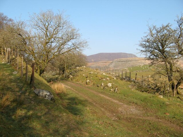
Coed Boch y Rhaeadr is a picturesque woodland located in the county of Merionethshire, Wales. Spread across an area of approximately 150 acres, this enchanting forest is known for its natural beauty and captivating landscapes.

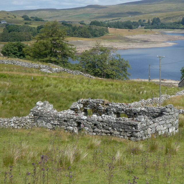
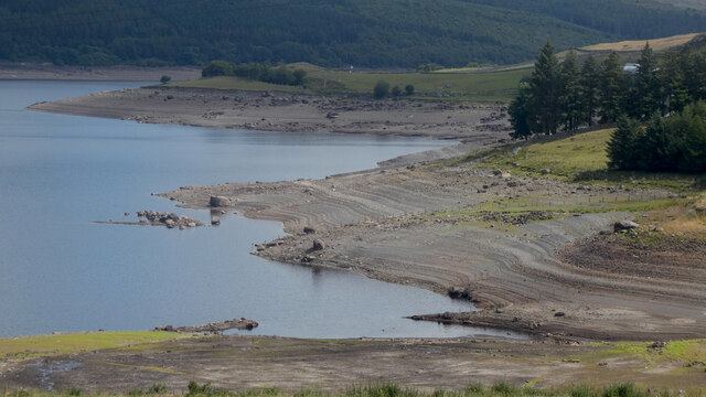
The woodland is situated near the village of Dolgellau, which lies at the foot of the majestic Cadair Idris mountain range. Coed Boch y Rhaeadr is part of the larger Coed y Brenin Forest Park, a popular destination for outdoor enthusiasts and nature lovers.

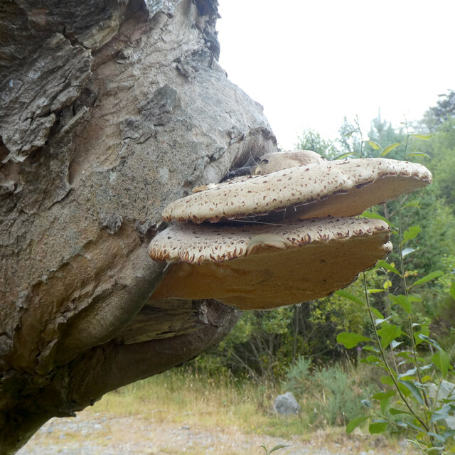
The forest is predominantly composed of native tree species, such as oak, beech, and birch, creating a diverse and vibrant ecosystem. The lush undergrowth and moss-covered rocks add to the enchanting atmosphere of the woodland.

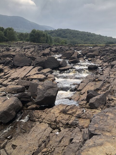
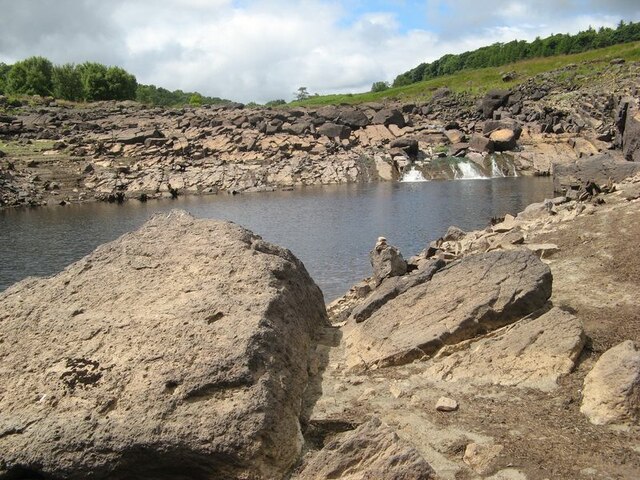
Coed Boch y Rhaeadr offers a range of scenic walking trails, allowing visitors to explore its natural wonders. The paths wind through the forest, passing by babbling brooks and cascading waterfalls. The most prominent feature of the woodland is the Rhaeadr waterfall, which stands at an impressive height of 100 feet. The waterfall provides a breathtaking sight and a peaceful ambiance, making it a favorite spot for photographers and nature enthusiasts.

The forest is also home to a variety of wildlife, including red squirrels, foxes, and a diverse range of bird species. Birdwatchers can enjoy spotting species such as buzzards, woodpeckers, and owls in their natural habitat.

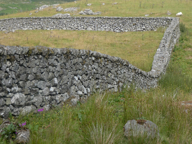
Coed Boch y Rhaeadr offers a tranquil escape from the hustle and bustle of modern life, providing visitors with a chance to immerse themselves in nature's beauty and serenity. Whether it is a leisurely stroll or an adventurous hike, this woodland is a must-visit destination for anyone seeking solace in the lap of nature.

If you have any feedback on the listing, please let us know in the comments section below.

Coed Boch y Rhaeadr Images

Images are sourced within 2km of 52.943109/-3.7241527 or Grid Reference SH8439. Thanks to Geograph Open Source API. All images are credited.

Old railway formation At the site of an occupation crossing, sheep graze on the old railway near Arenig. I love the way that original railway features are still extant here after its closure over 60 years ago. Standard concrete posts support lineside fencing, and the straining-posts are fabricated from old bullhead rail.
Old railway formation
At the site of an occupation crossing, sheep graze on the old railway near Arenig. I love the way that original railway features are still extant here after its closure over 60 years ago. Standard concrete posts support lineside fencing, and the straining-posts are fabricated from old bullhead rail.
Ruined farm structure An enigmatic farm building or sheepfold has fallen into disrepair. The view over pastures to Llyn Celyn are beautiful in the morning light. There is no sound-track, but there were two woodpeckers competing across the hillside from their favourite, most resonant trees. A line of concrete fence posts belonging to the erstwhile GWR branch railway still graces the lineside.
Ruined farm structure
An enigmatic farm building or sheepfold has fallen into disrepair. The view over pastures to Llyn Celyn are beautiful in the morning light. There is no sound-track, but there were two woodpeckers competing across the hillside from their favourite, most resonant trees. A line of concrete fence posts belonging to the erstwhile GWR branch railway still graces the lineside.
Bythynod haearn rhychiog / Corrugated iron cottages
Bythynod haearn rhychiog / Corrugated iron cottages (2)
Defnydd newydd i hen gledren / A new use for an old railway rail This gatepost is right next to the trackbed of the Blaenau Ffestiniog to Bala railway which closed in 1961.
Defnydd newydd i hen gledren / A new use for an old railway rail
This gatepost is right next to the trackbed of the Blaenau Ffestiniog to Bala railway which closed in 1961.
Wal gerrig mewn cyflwr da / A well-maintained stone wall
Waliau cerrig / Stone walls
Gwely rheilffordd Blaenau Ffestiog - Bala / Trackbed of the Blaenau Ffestiniog - Bala railway The trackbed and the embankment have survived in a surprisingly good condition, given that the railway line closed in 1961 and the construction of the Llyn Celyn reservoir has rendered impossible any prospect of it reopening.
Gwely rheilffordd Blaenau Ffestiog - Bala / Trackbed of the Blaenau Ffestiniog - Bala railway
The trackbed and the embankment have survived in a surprisingly good condition, given that the railway line closed in 1961 and the construction of the Llyn Celyn reservoir has rendered impossible any prospect of it reopening.
Adfail ger Llyn Celyn / Ruin near Llyn Celyn
Dwr isel yn Llyn Celyn / Low water in Llyn Celyn
Llyn Arenig Fawr
Llyn Arenig Fawr
Maen hollt / A split boulder
Cyfrwy Cennog / Dryad's Saddle / Cerioporus squamosus
Cyfrwy Cennog / Dryad's Saddle / Cerioporus squamosus (2)
Waliau cerrig / Stone walls (2)
Afon Tryweryn entering Llyn Celyn In the summer months the water in Llyn Celyn is release to maintain flow in the Dee for water extraction. The resulting low lake water level has exposed a rocky channel of small falls as the Tryweryn enters the lake.
Afon Tryweryn entering Llyn Celyn
In the summer months the water in Llyn Celyn is release to maintain flow in the Dee for water extraction. The resulting low lake water level has exposed a rocky channel of small falls as the Tryweryn enters the lake.
Low water, Llyn Celyn With almost unprecedented drought in Wales, Llyn Celyn is at a low level. Here is part of the drowned gorge of the Afon Tryweryn, where a waterfall runs over a geological feature, as a discontinuity makes a prominent slope. The rock here belongs to the Aran Fawddwy Formation, which comprises volcanic rock of Ordovician, Caradoc age. This rock unit extends some distance upstream, and is entirely in accordance with the rough, pock-marked boulders which have been carried by a glacier originating in the uplands to the west.
Low water, Llyn Celyn
With almost unprecedented drought in Wales, Llyn Celyn is at a low level. Here is part of the drowned gorge of the Afon Tryweryn, where a waterfall runs over a geological feature, as a discontinuity makes a prominent slope. The rock here belongs to the Aran Fawddwy Formation, which comprises volcanic rock of Ordovician, Caradoc age. This rock unit extends some distance upstream, and is entirely in accordance with the rough, pock-marked boulders which have been carried by a glacier originating in the uplands to the west.
Dry shore with treestump Low water levels have allowed the shore of the reservoir to dry out, exposing many features of the previous landscape. Here is a treestump originating from the felling of woodland on the historical slope above the Afon Treweryn. All around are large glacial erratic boulders originating in the previous large-scale modification of the terrain we call the Ice Age.
Dry shore with treestump
Low water levels have allowed the shore of the reservoir to dry out, exposing many features of the previous landscape. Here is a treestump originating from the felling of woodland on the historical slope above the Afon Treweryn. All around are large glacial erratic boulders originating in the previous large-scale modification of the terrain we call the Ice Age.
Show me another place!

Coed Boch y Rhaeadr is located at Grid Ref: SH8439 (Lat: 52.943109, Lng: -3.7241527)

Unitary Authority: Gwynedd

Police Authority: North Wales

What 3 Words

///salads.specifies.bookmark. Near Bala, Gwynedd

Related Wikis

Arenig railway station

Arenig railway station stood beneath Arenig Fawr on the Great Western Railway's Bala Ffestiniog Line in Gwynedd, Wales. It served this thinly populated...

Capel Celyn

Capel Celyn was a rural community to the northwest of Bala in Gwynedd, Wales, in the Afon Tryweryn valley. The village and other parts of the valley were...

Capel Celyn Halt railway station

Capel Celyn Halt was a solely passenger railway station which served the rural area of Capel Celyn west of Bala. It was on the Great Western Railway's...

Llyn Arenig Fawr

Llyn Arenig Fawr is a lake and reservoir located near the summit of Arenig Fawr, a mountain in North Wales. The lake's primary purpose is to supply water...

Nearby Amenities

Located within 500m of 52.943109,-3.7241527
Source: npe
Lat/Long: 52.9445471/-3.7230119
Source: npe
Lat/Long: 52.9446733/-3.7246105
Source: npe
Lat/Long: 52.9454103/-3.7221141
Power: tower
Lat/Long: 52.9395248/-3.7199918
Power: tower
Lat/Long: 52.9398994/-3.7268844
Power: tower
Lat/Long: 52.947041/-3.7260889
Power: tower
Lat/Long: 52.9465715/-3.7281006
Foel Bodrenig
Ele: 380
Natural: peak
Wikidata: Q106709866
Lat/Long: 52.9418388/-3.7277307
The data included in this document is from www.openstreetmap.org. The data is made available under ODbL.

Have you been to Coed Boch y Rhaeadr?

Leave your review of Coed Boch y Rhaeadr below (or comments, questions and feedback).