Coed Bryn-bras

Wood, Forest in Caernarfonshire

Wales

Coed Bryn-bras

Toll House, A5, Hendre-isaf On the South side of the road, labelled Hendre-isaf Gate (Lower Hendre) in 1900 maps. It served the  Shrewsbury to Holyhead Turnpike Trust. There is a reference near the bridge on the other side of the house called Hendre-isaf to an "Old Gate" over the River Conway with an earlier bridge, which was by-passed in Thomas Telford's improvements of 1815-1820. This house dates from then.

Grade II Listed Building Cadwr Nᴼ. 18328 <span class="nowrap"><a title="https://cadwpublic-api.azurewebsites.net/reports/listedbuilding/FullReport?lang=&id=18328" rel="nofollow ugc noopener" href="https://cadwpublic-api.azurewebsites.net/reports/listedbuilding/FullReport?lang=&id=18328">Link</a><img style="margin-left:2px;" alt="External link" title="External link - shift click to open in new window" src="https://s1.geograph.org.uk/img/external.png" width="10" height="10"/></span> - British Listed Buildings - <span class="nowrap"><a title="https://britishlistedbuildings.co.uk/300018328-tyr-peg-ysbyty-ifan#.ZAtKqB_P1PY" rel="nofollow ugc noopener" href="https://britishlistedbuildings.co.uk/300018328-tyr-peg-ysbyty-ifan#.ZAtKqB_P1PY">Link</a><img style="margin-left:2px;" alt="External link" title="External link - shift click to open in new window" src="https://s1.geograph.org.uk/img/external.png" width="10" height="10"/></span>

Milestone Society National ID: CON.PTF01
Toll House, A5, Hendre-isaf Credit: David Elis-Williams

Coed Bryn-bras is a woodland area located in Caernarfonshire, a county in northwestern Wales. Situated near the town of Caernarfon, the woodland covers a sprawling area consisting of dense forests and lush greenery. The name "Bryn-bras" translates to "big hill" in English, accurately depicting the elevated terrain on which the woodland is situated.

The woodland is known for its natural beauty and offers visitors a serene and peaceful environment. It is home to a diverse range of flora and fauna, including various species of trees such as oak, birch, and beech, which create a picturesque landscape. The forest floor is adorned with an array of wildflowers, adding splashes of color to the surroundings.

Coed Bryn-bras is a popular destination for nature enthusiasts, hikers, and birdwatchers. The woodland provides numerous walking trails, allowing visitors to explore its wonders at their own pace. As they venture through the forest, visitors may encounter wildlife such as deer, rabbits, and a variety of bird species.

The woodland holds significant historical and cultural value as well. It is believed to have been part of the ancient royal forests of Wales, and remnants of old structures can still be found within its boundaries. These remnants serve as a reminder of the area's rich heritage and attract history enthusiasts.

Coed Bryn-bras offers a tranquil escape from the hustle and bustle of daily life, providing an opportunity to reconnect with nature and immerse oneself in the beauty of Caernarfonshire's woodlands.

If you have any feedback on the listing, please let us know in the comments section below.

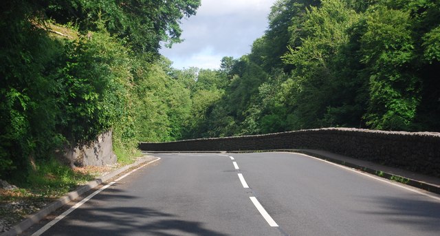
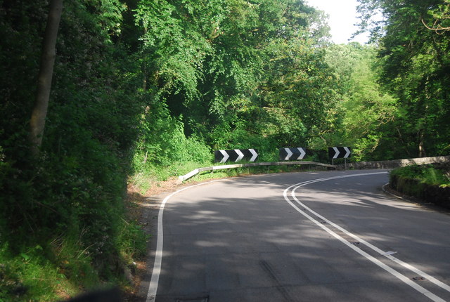
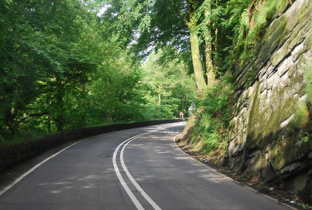
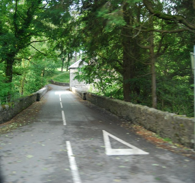
Coed Bryn-bras Images

Images are sourced within 2km of 53.049854/-3.7399593 or Grid Reference SH8351. Thanks to Geograph Open Source API. All images are credited.

Toll House, A5, Hendre-isaf On the South side of the road, labelled Hendre-isaf Gate (Lower Hendre) in 1900 maps. It served the  Shrewsbury to Holyhead Turnpike Trust. There is a reference near the bridge on the other side of the house called Hendre-isaf to an "Old Gate" over the River Conway with an earlier bridge, which was by-passed in Thomas Telford's improvements of 1815-1820. This house dates from then.

Grade II Listed Building Cadwr Nᴼ. 18328 <span class="nowrap"><a title="https://cadwpublic-api.azurewebsites.net/reports/listedbuilding/FullReport?lang=&id=18328" rel="nofollow ugc noopener" href="https://cadwpublic-api.azurewebsites.net/reports/listedbuilding/FullReport?lang=&id=18328">Link</a><img style="margin-left:2px;" alt="External link" title="External link - shift click to open in new window" src="https://s1.geograph.org.uk/img/external.png" width="10" height="10"/></span> - British Listed Buildings - <span class="nowrap"><a title="https://britishlistedbuildings.co.uk/300018328-tyr-peg-ysbyty-ifan#.ZAtKqB_P1PY" rel="nofollow ugc noopener" href="https://britishlistedbuildings.co.uk/300018328-tyr-peg-ysbyty-ifan#.ZAtKqB_P1PY">Link</a><img style="margin-left:2px;" alt="External link" title="External link - shift click to open in new window" src="https://s1.geograph.org.uk/img/external.png" width="10" height="10"/></span>

Milestone Society National ID: CON.PTF01
Toll House, A5, Hendre-isaf
On the South side of the road, labelled Hendre-isaf Gate (Lower Hendre) in 1900 maps. It served the Shrewsbury to Holyhead Turnpike Trust. There is a reference near the bridge on the other side of the house called Hendre-isaf to an "Old Gate" over the River Conway with an earlier bridge, which was by-passed in Thomas Telford's improvements of 1815-1820. This house dates from then. Grade II Listed Building Cadwr Nᴼ. 18328 LinkExternal link - British Listed Buildings - LinkExternal link Milestone Society National ID: CON.PTF01
Bron Ruffydd by the A5 The A5 is a major trunk road that runs 260 miles from London to Holyhead. It follows the course of an old Roman Road (Watling Street).
Wikipedia: <span class="nowrap"><a title="http://en.wikipedia.org/wiki/A5_road_(Great_Britain)" rel="nofollow ugc noopener" href="http://en.wikipedia.org/wiki/A5_road_(Great_Britain)">Link</a><img style="margin-left:2px;" alt="External link" title="External link - shift click to open in new window" src="https://s1.geograph.org.uk/img/external.png" width="10" height="10"/></span>
Bron Ruffydd by the A5
The A5 is a major trunk road that runs 260 miles from London to Holyhead. It follows the course of an old Roman Road (Watling Street). Wikipedia: LinkExternal link
A5, eastbound The A5 is a major trunk road that runs 260 miles from London to Holyhead. It follows the course of an old Roman Road (Watling Street).
Wikipedia: <span class="nowrap"><a title="http://en.wikipedia.org/wiki/A5_road_(Great_Britain)" rel="nofollow ugc noopener" href="http://en.wikipedia.org/wiki/A5_road_(Great_Britain)">Link</a><img style="margin-left:2px;" alt="External link" title="External link - shift click to open in new window" src="https://s1.geograph.org.uk/img/external.png" width="10" height="10"/></span>
A5, eastbound
The A5 is a major trunk road that runs 260 miles from London to Holyhead. It follows the course of an old Roman Road (Watling Street). Wikipedia: LinkExternal link
Tea Bar in a layby, by the A5 The A5 is a major trunk road that runs 260 miles from London to Holyhead. It follows the course of an old Roman Road (Watling Street).
Wikipedia: <span class="nowrap"><a title="http://en.wikipedia.org/wiki/A5_road_(Great_Britain)" rel="nofollow ugc noopener" href="http://en.wikipedia.org/wiki/A5_road_(Great_Britain)">Link</a><img style="margin-left:2px;" alt="External link" title="External link - shift click to open in new window" src="https://s1.geograph.org.uk/img/external.png" width="10" height="10"/></span>
Tea Bar in a layby, by the A5
The A5 is a major trunk road that runs 260 miles from London to Holyhead. It follows the course of an old Roman Road (Watling Street). Wikipedia: LinkExternal link
A5, Nebo turning The A5 is a major trunk road that runs 260 miles from London to Holyhead. It follows the course of an old Roman Road (Watling Street).
Wikipedia: <span class="nowrap"><a title="http://en.wikipedia.org/wiki/A5_road_(Great_Britain)" rel="nofollow ugc noopener" href="http://en.wikipedia.org/wiki/A5_road_(Great_Britain)">Link</a><img style="margin-left:2px;" alt="External link" title="External link - shift click to open in new window" src="https://s1.geograph.org.uk/img/external.png" width="10" height="10"/></span>
A5, Nebo turning
The A5 is a major trunk road that runs 260 miles from London to Holyhead. It follows the course of an old Roman Road (Watling Street). Wikipedia: LinkExternal link
Farmland by the A5
Farmland by the A5
Sheep grazing by the A5
Approaching a sharp bend on the A5 The A5 is a major trunk road that runs 260 miles from London to Holyhead. It follows the course of an old Roman Road (Watling Street).
Wikipedia: <span class="nowrap"><a title="http://en.wikipedia.org/wiki/A5_road_(Great_Britain)" rel="nofollow ugc noopener" href="http://en.wikipedia.org/wiki/A5_road_(Great_Britain)">Link</a><img style="margin-left:2px;" alt="External link" title="External link - shift click to open in new window" src="https://s1.geograph.org.uk/img/external.png" width="10" height="10"/></span>
Approaching a sharp bend on the A5
The A5 is a major trunk road that runs 260 miles from London to Holyhead. It follows the course of an old Roman Road (Watling Street). Wikipedia: LinkExternal link
The A5 The A5 is a major trunk road that runs 260 miles from London to Holyhead. It follows the course of an old Roman Road (Watling Street).
Wikipedia: <span class="nowrap"><a title="http://en.wikipedia.org/wiki/A5_road_(Great_Britain)" rel="nofollow ugc noopener" href="http://en.wikipedia.org/wiki/A5_road_(Great_Britain)">Link</a><img style="margin-left:2px;" alt="External link" title="External link - shift click to open in new window" src="https://s1.geograph.org.uk/img/external.png" width="10" height="10"/></span>
The A5
The A5 is a major trunk road that runs 260 miles from London to Holyhead. It follows the course of an old Roman Road (Watling Street). Wikipedia: LinkExternal link
A5 in the Conwy valley The A5 is a major trunk road that runs 260 miles from London to Holyhead. It follows the course of an old Roman Road (Watling Street).
Wikipedia: <span class="nowrap"><a title="http://en.wikipedia.org/wiki/A5_road_(Great_Britain)" rel="nofollow ugc noopener" href="http://en.wikipedia.org/wiki/A5_road_(Great_Britain)">Link</a><img style="margin-left:2px;" alt="External link" title="External link - shift click to open in new window" src="https://s1.geograph.org.uk/img/external.png" width="10" height="10"/></span>
A5 in the Conwy valley
The A5 is a major trunk road that runs 260 miles from London to Holyhead. It follows the course of an old Roman Road (Watling Street). Wikipedia: LinkExternal link
A5, Padog The A5 is a major trunk road that runs 260 miles from London to Holyhead. It follows the course of an old Roman Road (Watling Street).
Wikipedia: <span class="nowrap"><a title="http://en.wikipedia.org/wiki/A5_road_(Great_Britain)" rel="nofollow ugc noopener" href="http://en.wikipedia.org/wiki/A5_road_(Great_Britain)">Link</a><img style="margin-left:2px;" alt="External link" title="External link - shift click to open in new window" src="https://s1.geograph.org.uk/img/external.png" width="10" height="10"/></span>
A5, Padog
The A5 is a major trunk road that runs 260 miles from London to Holyhead. It follows the course of an old Roman Road (Watling Street). Wikipedia: LinkExternal link
Narrow winding section of the A5 The A5 is a major trunk road that runs 260 miles from London to Holyhead. It follows the course of an old Roman Road (Watling Street).
Wikipedia: <span class="nowrap"><a title="http://en.wikipedia.org/wiki/A5_road_(Great_Britain)" rel="nofollow ugc noopener" href="http://en.wikipedia.org/wiki/A5_road_(Great_Britain)">Link</a><img style="margin-left:2px;" alt="External link" title="External link - shift click to open in new window" src="https://s1.geograph.org.uk/img/external.png" width="10" height="10"/></span>
Narrow winding section of the A5
The A5 is a major trunk road that runs 260 miles from London to Holyhead. It follows the course of an old Roman Road (Watling Street). Wikipedia: LinkExternal link
Road to Voelas Lodge A bridge across the Afon Conwy is visible.
Road to Voelas Lodge
A bridge across the Afon Conwy is visible.
A5, eastbound The A5 is a major trunk road that runs 260 miles from London to Holyhead. It follows the course of an old Roman Road (Watling Street).
Wikipedia: <span class="nowrap"><a title="http://en.wikipedia.org/wiki/A5_road_(Great_Britain)" rel="nofollow ugc noopener" href="http://en.wikipedia.org/wiki/A5_road_(Great_Britain)">Link</a><img style="margin-left:2px;" alt="External link" title="External link - shift click to open in new window" src="https://s1.geograph.org.uk/img/external.png" width="10" height="10"/></span>
A5, eastbound
The A5 is a major trunk road that runs 260 miles from London to Holyhead. It follows the course of an old Roman Road (Watling Street). Wikipedia: LinkExternal link
A5 approaching the B4407 turning The A5 is a major trunk road that runs 260 miles from London to Holyhead. It follows the course of an old Roman Road (Watling Street).
Wikipedia: <span class="nowrap"><a title="http://en.wikipedia.org/wiki/A5_road_(Great_Britain)" rel="nofollow ugc noopener" href="http://en.wikipedia.org/wiki/A5_road_(Great_Britain)">Link</a><img style="margin-left:2px;" alt="External link" title="External link - shift click to open in new window" src="https://s1.geograph.org.uk/img/external.png" width="10" height="10"/></span>
A5 approaching the B4407 turning
The A5 is a major trunk road that runs 260 miles from London to Holyhead. It follows the course of an old Roman Road (Watling Street). Wikipedia: LinkExternal link
Padog: postbox № LL24 66 and phone The telephone box and postbox stand on the A5. The postbox, strapped to a telegraph pole, is emptied at 12:30 on weekday afternoons and an hour and a half earlier on Saturdays.
Padog: postbox № LL24 66 and phone
The telephone box and postbox stand on the A5. The postbox, strapped to a telegraph pole, is emptied at 12:30 on weekday afternoons and an hour and a half earlier on Saturdays.
Old Milestone Milestone on the A.5 near to Glan Conwy, Conwy for overall view see <a title="https://www.geograph.org.uk/photo/4304443" href="https://www.geograph.org.uk/photo/4304443">Link</a>
Old Milestone
Milestone on the A.5 near to Glan Conwy, Conwy for overall view see Link
Holyhead 50 Milestone next to the wall on the A.5 near to Glan Conwy, Conwy for close up view see <a title="https://www.geograph.org.uk/photo/4304438" href="https://www.geograph.org.uk/photo/4304438">Link</a>
Holyhead 50
Milestone next to the wall on the A.5 near to Glan Conwy, Conwy for close up view see Link
Show me another place!

Coed Bryn-bras is located at Grid Ref: SH8351 (Lat: 53.049854, Lng: -3.7399593)

Unitary Authority: Conwy

Police Authority: North Wales

What 3 Words

///kennels.sour.radiates. Near Betws-y-Coed, Conwy

Nearby Locations

Coed Bryn-bras Padog

Related Wikis

Rhiw Llwyd

Rhiw Llwyd is the name of an early medieval Wales lordship which was created in the Kingdom of Gwynedd in the 12th century for Tomas ap Rhodri ab Owain...

Afon Merddwr

Afon Merddwr is a river in the south of the county of Conwy, Wales. It is a tributary of the River Conwy and joins it near Pentrefoelas. It is about 10...

Ysbyty Ifan

Ysbyty Ifan (often formerly anglicised as Yspytty Ifan) is a small, historic village and community in the Conwy County Borough of Wales. The population...

Conwy Falls

Conwy Falls (Welsh: Rhaeadr y Graig Lwyd) is a waterfall on the River Conwy at Bro Garmon in Conwy County Borough in Wales. The falls and surrounding area...

River Machno

River Machno (Welsh: Afon Machno) is a river in Snowdonia in north-west Wales. It is the first major tributary of the River Conwy, which it joins south...

Pentrefoelas

Pentrefoelas is a village and community in Conwy County Borough, Wales. The village lies on the A5 road between Betws-y-Coed to the west and Cerrigydrudion...

St Garmon's Church, Capel Garmon

St Garmon's Church, Capel Garmon, is a redundant Anglican parish church in the village of Capel Garmon, Conwy, Wales. The church was restored and reseated...

Bro Garmon

Bro Garmon is a sparsely populated community in Conwy County Borough, in Wales. It is located on the eastern side of the Conwy Valley, stretching from...

Nearby Amenities

Located within 500m of 53.049854,-3.7399593
Created By: Merkaartor 0.12
Lat/Long: 53.0478243/-3.7459087
Created By: Merkaartor 0.12
Lat/Long: 53.0470955/-3.7455653
Place: farm
Lat/Long: 53.0481646/-3.7409096
The data included in this document is from www.openstreetmap.org. The data is made available under ODbL.

Have you been to Coed Bryn-bras?

Leave your review of Coed Bryn-bras below (or comments, questions and feedback).