Coed Bryn-turnoriad

Wood, Forest in Merionethshire

Wales

Coed Bryn-turnoriad

War memorial Mosquito engine
War memorial Mosquito engine Credit: Steven Brown

The requested URL returned error: 429 Too Many Requests

If you have any feedback on the listing, please let us know in the comments section below.

Coed Bryn-turnoriad Images

Images are sourced within 2km of 52.792816/-3.7437859 or Grid Reference SH8223. Thanks to Geograph Open Source API. All images are credited.

War memorial Mosquito engine
A494 east of Rhydymain
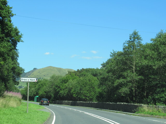
The A494 north at turning for Drws y Nant
Y Bwthyn, near Dolgellau Toll Plate on Y Bwthyn (the Cottager), a former Toll House on the A494 between Dolgellau and Bala near Afon Mynach. Built about 1796/8 it served the Bala District Turnpike Trust in the 18/19th C. The Toll house is <a href="https://www.geograph.org.uk/photo/7566778">SH8324 : Y Bwthyn, near Dolgellau</a>.

Listed Building CADW Nᴼ 16046 <span class="nowrap"><a title="https://cadwpublic-api.azurewebsites.net/reports/listedbuilding/FullReport?lang=&id=16046" rel="nofollow ugc noopener" href="https://cadwpublic-api.azurewebsites.net/reports/listedbuilding/FullReport?lang=&id=16046">Link</a><img style="margin-left:2px;" alt="External link" title="External link - shift click to open in new window" src="https://s1.geograph.org.uk/img/external.png" width="10" height="10"/></span>

Milestone Society National ID: GWY.RYM2
Y Bwthyn, near Dolgellau
Toll Plate on Y Bwthyn (the Cottager), a former Toll House on the A494 between Dolgellau and Bala near Afon Mynach. Built about 1796/8 it served the Bala District Turnpike Trust in the 18/19th C. The Toll house is SH8324 : Y Bwthyn, near Dolgellau. Listed Building CADW Nᴼ 16046 LinkExternal link Milestone Society National ID: GWY.RYM2
Y Bwthyn, near Dolgellau Y Bwthyn (the Cottager), former Toll House on the A494 between Dolgellau and Bala near Afon Mynach. Built about 1796/8 it served the Bala District Turnpike Trust in the 18/19th C. The Toll Plate is <a href="https://www.geograph.org.uk/photo/7566774">SH8324 : Y Bwthyn, near Dolgellau</a>.

Listed Building CADW Nᴼ 16046 <span class="nowrap"><a title="https://cadwpublic-api.azurewebsites.net/reports/listedbuilding/FullReport?lang=&id=16046" rel="nofollow ugc noopener" href="https://cadwpublic-api.azurewebsites.net/reports/listedbuilding/FullReport?lang=&id=16046">Link</a><img style="margin-left:2px;" alt="External link" title="External link - shift click to open in new window" src="https://s1.geograph.org.uk/img/external.png" width="10" height="10"/></span>

Milestone Society National ID: GWY.RYM
Y Bwthyn, near Dolgellau
Y Bwthyn (the Cottager), former Toll House on the A494 between Dolgellau and Bala near Afon Mynach. Built about 1796/8 it served the Bala District Turnpike Trust in the 18/19th C. The Toll Plate is SH8324 : Y Bwthyn, near Dolgellau. Listed Building CADW Nᴼ 16046 LinkExternal link Milestone Society National ID: GWY.RYM
Phone box in Pont Fronwydd
Lay by on the bend
Lay by on the bend
A494 south from Pont Fronwydd
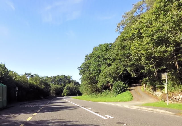
Bus stop at Wenallt entrance
Retaining wall alongside A494
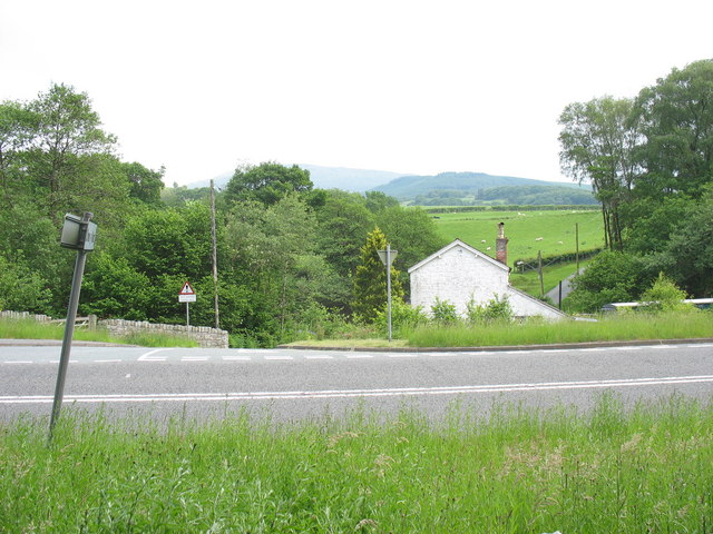
Drws-y-Nant railway station (site), Gwynedd Opened in 1868 by the Bala & Dolgelly Railway, soon to become part of the Great Western Railway, this station closed in 1965 and the line was lifted.
View north across the trackbed. The line ran left to right behind the white house, where there was a level crossing. The platforms were (and still are) to the right, whilst to the left, the A494  now runs on the formation of the railway.
Drws-y-Nant railway station (site), Gwynedd
Opened in 1868 by the Bala & Dolgelly Railway, soon to become part of the Great Western Railway, this station closed in 1965 and the line was lifted. View north across the trackbed. The line ran left to right behind the white house, where there was a level crossing. The platforms were (and still are) to the right, whilst to the left, the A494 now runs on the formation of the railway.
Ordnance Survey Cut Mark This OS cut mark can be found on the front of the old Toll House (Cott y Bwthyn). It marks a point 177.433
Ordnance Survey Cut Mark
This OS cut mark can be found on the front of the old Toll House (Cott y Bwthyn). It marks a point 177.433
Ordnance Survey 1GL Bolt This OS Bolt can be found on the front of the Old Tavern Hotel which is now a private house. It marks a point 165.448m above mean sea level.
Ordnance Survey 1GL Bolt
This OS Bolt can be found on the front of the Old Tavern Hotel which is now a private house. It marks a point 165.448m above mean sea level.
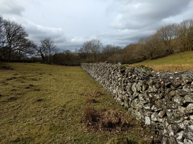
Solid wall at Benglog
The Afon Eiddon above the ford
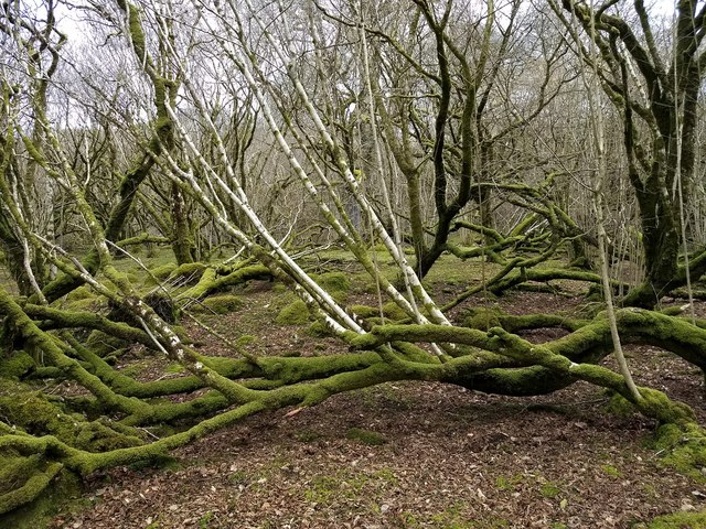
Natural tree sculptures in Allt y Benglog NNR
The northern entrance to Allt y Benglog NNR
There's lots to know about Allt y Benglog Nature Reserve
Show me another place!

Coed Bryn-turnoriad is located at Grid Ref: SH8223 (Lat: 52.792816, Lng: -3.7437859)

Unitary Authority: Gwynedd

Police Authority: North Wales

What 3 Words

///reserving.truffles.wider. Near Llanuwchllyn, Gwynedd

Related Wikis

Drws-y-Nant railway station

Drws-y-Nant railway station (Pron: Droos-a-Nant) in Gwynedd, Wales, was formerly a station on the Ruabon to Barmouth line. The station had two platforms...

Drws-y-Nant

Drws-y-Nant is a village in Gwynedd, Wales. It was formerly served by the Drws-y-Nant railway station but this closed in 1965.

Allt y Benglog National Nature Reserve

Allt y Benglog is a small national nature reserve near Dolgellau in Wales.Its position on the lower slopes of Rhobell Fawr, one of north Wales’ extinct...

Wnion Halt railway station

Wnion Halt (Pron: Oon-y'n) in Gwynedd, Wales, was on the Ruabon to Barmouth line. The station was situated in a narrow part of the Wnion Valley next to...

Nearby Amenities

Located within 500m of 52.792816,-3.7437859
Source: npe
Lat/Long: 52.7932371/-3.7495545
Source: npe
Lat/Long: 52.7940545/-3.7474374
Source: npe
Lat/Long: 52.7956081/-3.746763
Source: npe
Lat/Long: 52.7966534/-3.7439596
The data included in this document is from www.openstreetmap.org. The data is made available under ODbL.

Have you been to Coed Bryn-turnoriad?

Leave your review of Coed Bryn-turnoriad below (or comments, questions and feedback).