Burton

Settlement in Hampshire

England

Burton

River Avon, Christchurch Waterworks, 1957
River Avon, Christchurch Waterworks, 1957 Credit: Mike Searle

Burton is a small village located in the county of Hampshire, England. Situated in the South Downs National Park, it is surrounded by picturesque countryside and offers a peaceful and idyllic setting for residents and visitors alike.

The village itself is home to a close-knit community, with a population of around 500 people. It boasts a number of historic buildings, including the 12th-century St. Mary's Church, which is a prominent feature of the village's landscape. The church is known for its beautiful stained glass windows and impressive architecture.

Burton also has a village hall, which serves as a hub for community events and gatherings. It provides a space for various activities, including meetings, classes, and social events, fostering a sense of camaraderie among locals.

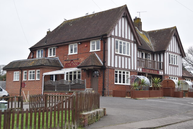
Despite its small size, Burton offers amenities for its residents, including a local pub, The Swan Inn, which serves traditional British cuisine and is a popular spot for locals and tourists to enjoy a meal or a drink. Additionally, there is a small convenience store that caters to the daily needs of residents.

The village is surrounded by rolling hills and stunning landscapes, making it a popular destination for outdoor enthusiasts. It offers numerous walking and cycling routes, allowing visitors to explore the natural beauty of the South Downs.

Overall, Burton is a charming village that offers a peaceful and scenic retreat from the hustle and bustle of city life. With its rich history, close-knit community, and stunning surroundings, it is a place that captures the essence of rural England.

If you have any feedback on the listing, please let us know in the comments section below.
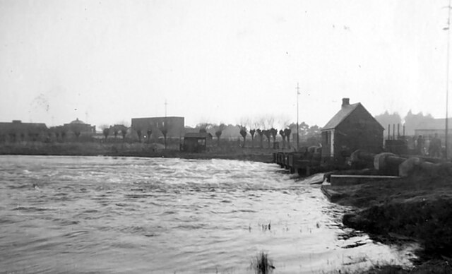
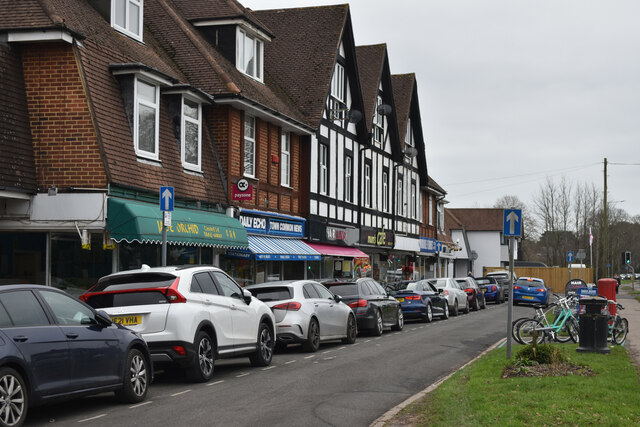
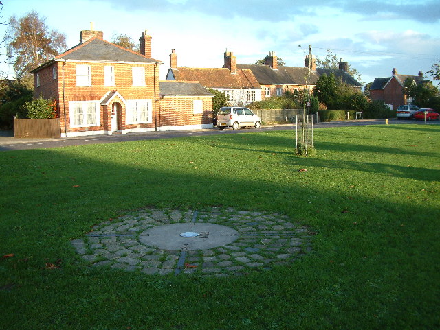
Burton Images

Images are sourced within 2km of 50.751797/-1.7684798 or Grid Reference SZ1694. Thanks to Geograph Open Source API. All images are credited.

River Avon, Christchurch Waterworks, 1957
Millhams Street, Christchurch Millhams Street, in the town of Christchurch.  This street is just off Christchurch High Street.
Millhams Street, Christchurch
Millhams Street, in the town of Christchurch. This street is just off Christchurch High Street.
Millhams Street, Christchurch Millhams Street is a residential street close to the centre of Christchurch.
Millhams Street, Christchurch
Millhams Street is a residential street close to the centre of Christchurch.
Pine needles Hillside and path deep in pine needles on St. Catherine’s Hill.
Pine needles
Hillside and path deep in pine needles on St. Catherine’s Hill.
Former gravel working, St. Catherine’s Hill
View over former gravel working, St. Catherine’s Hill
Parade of shops at Fairmile
View across Coward’s Marsh
Depth marker and drainage ditch on Coward’s Marsh The marker stands where a track crosses the ditch and presumably provides some reassurance when the whole area is under water. Judging from a nearby spot height, the red figure “4” indicates 4 metres above sea level.
Depth marker and drainage ditch on Coward’s Marsh
The marker stands where a track crosses the ditch and presumably provides some reassurance when the whole area is under water. Judging from a nearby spot height, the red figure “4” indicates 4 metres above sea level.
Cygnet in drainage ditch, Coward’s Marsh
Track on Coward’s Marsh
Avon Valley from St. Catherine’s Hill The high land in the far distance is the Isle of Wight.
Avon Valley from St. Catherine’s Hill
The high land in the far distance is the Isle of Wight.
Equestrian properties seen from St. Catherine's Hill
Paddocks and woodland below St. Catherine's Hill
Burton Farm
Burton Farm
The Oak Inn public house
Footbridge over drainage ditch in marshland west of Burton
Drainage ditches on marshland west of Burton
Show me another place!

Burton is located at Grid Ref: SZ1694 (Lat: 50.751797, Lng: -1.7684798)

Unitary Authority: Bournemouth, Christchurch and Poole

Police Authority: Dorset

What 3 Words

///stowing.lays.stones. Near Christchurch, Dorset

Nearby Locations

Burton

Related Wikis

Burton, Dorset

Burton is a village in the civil parish of Burton and Winkton, administered (since April 2019) as part of the Bournemouth, Christchurch and Poole unitary...

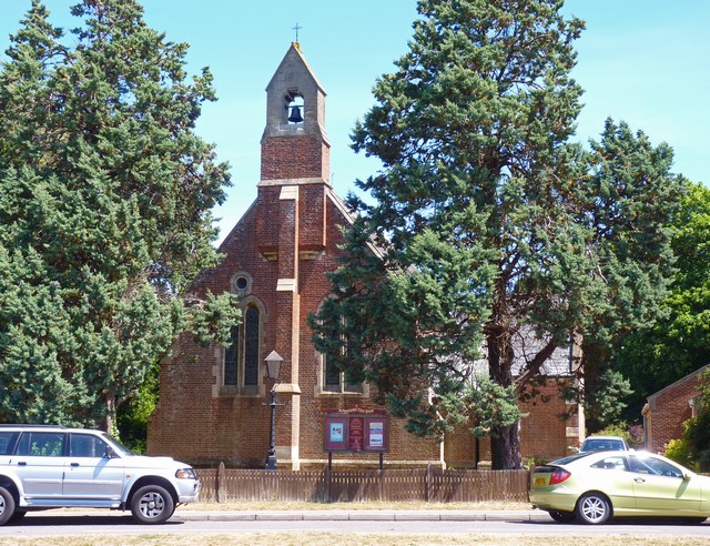
St Luke's Church, Burton

St. Luke's Church is a Church of England parish church in Burton, Dorset, England. It was designed by Benjamin Ferrey & Son and opened in 1875. The church...

Homefield School

Homefield School (closed Feb. 10, 2005) was a school for boys and girls age four to 18 in Winkton, Dorset, England. The school occupied a large, cream...

Winkton, Dorset

Winkton is a hamlet in the historic county of Hampshire and the ceremonial county of Dorset, England. Together with the village of Burton, it is part of...

Nearby Amenities

Located within 500m of 50.751797,-1.7684798
Barrier: stile
Lat/Long: 50.7513879/-1.7745479
Barrier: cycle_barrier
Lat/Long: 50.7532992/-1.7699143
Post Office
Burton Post Office
Addr City: 3
Addr Housenumber: 115
Addr Postcode: BH23 7JN
Addr Street: Salisbury Road
Branch: Burton
Brand: Post Office
Brand Wikidata: Q1783168
Check Date: 2020-02-20
Contact Website: https://www.postoffice.co.uk/branch-finder/173508x/burton
Ref Pol Id: 4753
Lat/Long: 50.7521655/-1.7648531
Post Box
Operator: Royal Mail
Operator Wikidata: Q638098
Post Box Type: pillar
Ref: BH23 38
Ref GB Uprn: 10015387377
Royal Cypher: GR
Royal Cypher Wikidata: Q33102273
Lat/Long: 50.7522362/-1.7649554
Burton Green News & Stores
Shop: convenience
Lat/Long: 50.7521648/-1.7647192
Booth: K6
Removed Amenity: telephone
Lat/Long: 50.7522402/-1.7650404
Brook End
Stars: 5
Tourism: chalet
Lat/Long: 50.7513596/-1.7726754
Booth: K6
Removed Amenity: telephone
Lat/Long: 50.7521148/-1.7734184
Burton
Place: village
Lat/Long: 50.7521005/-1.7691184
Generator Method: photovoltaic
Generator Output Electricity: yes
Generator Source: solar
Generator Type: solar_photovoltaic_panel
Location: roof
Power: generator
Lat/Long: 50.7546015/-1.7644839
Generator Method: photovoltaic
Generator Output Electricity: yes
Generator Source: solar
Generator Type: solar_photovoltaic_panel
Location: roof
Power: generator
Lat/Long: 50.7545701/-1.7645536
Generator Method: photovoltaic
Generator Output Electricity: yes
Generator Source: solar
Generator Type: solar_photovoltaic_panel
Location: roof
Power: generator
Lat/Long: 50.7518294/-1.7724661
Generator Method: photovoltaic
Generator Output Electricity: yes
Generator Source: solar
Generator Type: solar_photovoltaic_panel
Location: roof
Power: generator
Lat/Long: 50.7518466/-1.7727263
Generator Method: photovoltaic
Generator Output Electricity: yes
Generator Source: solar
Generator Type: solar_photovoltaic_panel
Location: roof
Power: generator
Lat/Long: 50.7517099/-1.7722864
Generator Method: photovoltaic
Generator Output Electricity: yes
Generator Source: solar
Generator Type: solar_photovoltaic_panel
Location: roof
Power: generator
Lat/Long: 50.7531929/-1.772041
Generator Method: photovoltaic
Generator Output Electricity: yes
Generator Source: solar
Generator Type: solar_photovoltaic_panel
Location: roof
Power: generator
Lat/Long: 50.7531997/-1.7721483
Generator Method: photovoltaic
Generator Output Electricity: yes
Generator Source: solar
Generator Type: solar_photovoltaic_panel
Location: roof
Power: generator
Lat/Long: 50.7529333/-1.772497
Generator Method: photovoltaic
Generator Output Electricity: yes
Generator Source: solar
Generator Type: solar_photovoltaic_panel
Location: roof
Power: generator
Lat/Long: 50.7529028/-1.7721429
Generator Method: photovoltaic
Generator Output Electricity: yes
Generator Source: solar
Generator Type: solar_photovoltaic_panel
Location: roof
Power: generator
Lat/Long: 50.7532184/-1.772226
Generator Method: photovoltaic
Generator Output Electricity: yes
Generator Source: solar
Generator Type: solar_photovoltaic_panel
Location: roof
Power: generator
Lat/Long: 50.7542145/-1.770142
Generator Method: photovoltaic
Generator Output Electricity: yes
Generator Source: solar
Generator Type: solar_photovoltaic_panel
Location: roof
Power: generator
Lat/Long: 50.754206/-1.7700427
Generator Method: photovoltaic
Generator Output Electricity: yes
Generator Source: solar
Generator Type: solar_photovoltaic_panel
Location: roof
Power: generator
Lat/Long: 50.7541907/-1.7698335
Generator Method: photovoltaic
Generator Output Electricity: yes
Generator Source: solar
Generator Type: solar_photovoltaic_panel
Location: roof
Power: generator
Lat/Long: 50.7554498/-1.7701634
Generator Method: photovoltaic
Generator Output Electricity: yes
Generator Source: solar
Generator Type: solar_photovoltaic_panel
Location: roof
Power: generator
Lat/Long: 50.7550986/-1.770032
Generator Method: photovoltaic
Generator Output Electricity: yes
Generator Source: solar
Generator Type: solar_photovoltaic_panel
Location: roof
Power: generator
Lat/Long: 50.7550595/-1.7691737
Generator Method: photovoltaic
Generator Output Electricity: yes
Generator Source: solar
Generator Type: solar_photovoltaic_panel
Location: roof
Power: generator
Lat/Long: 50.7552598/-1.7680472
Generator Method: photovoltaic
Generator Output Electricity: yes
Generator Source: solar
Generator Type: solar_photovoltaic_panel
Location: roof
Power: generator
Lat/Long: 50.7500586/-1.7661562
Generator Method: photovoltaic
Generator Output Electricity: yes
Generator Source: solar
Generator Type: solar_photovoltaic_panel
Location: roof
Power: generator
Lat/Long: 50.7498074/-1.7663708
Generator Method: photovoltaic
Generator Output Electricity: yes
Generator Source: solar
Generator Type: solar_photovoltaic_panel
Location: roof
Power: generator
Lat/Long: 50.7501214/-1.7658987
Generator Method: photovoltaic
Generator Output Electricity: yes
Generator Source: solar
Generator Type: solar_photovoltaic_panel
Location: roof
Power: generator
Lat/Long: 50.7498074/-1.7662689
Generator Method: photovoltaic
Generator Output Electricity: yes
Generator Source: solar
Generator Type: solar_photovoltaic_panel
Location: roof
Power: generator
Lat/Long: 50.7505178/-1.7643283
Generator Method: photovoltaic
Generator Output Electricity: yes
Generator Source: solar
Generator Type: solar_photovoltaic_panel
Location: roof
Power: generator
Lat/Long: 50.75064/-1.7641271
Generator Method: photovoltaic
Generator Output Electricity: yes
Generator Source: solar
Generator Type: solar_photovoltaic_panel
Location: roof
Power: generator
Lat/Long: 50.7525483/-1.7741087
Bicycle Rental
Salisbury Road
Bicycle Rental: dropoff_point
Capacity: 6
Email: support@beryl.cc
Fee: yes
Name Signed: no
Network: Beryl - Bournemouth Poole Christchurch
Official Name: Salisbury Road
Operator: Beryl
Operator Wikidata: Q106575369
Payment App: yes
Payment App Android: cc.beryl.basis
Payment App Ios: 1386768364
Payment Cash: no
Payment Credit Cards: no
Payment Cryptocurrencies: no
Payment Debit Cards: no
Payment Electronic Purses: no
Phone: +44 20 3003 5044
Ref Gbfs: beryl_bcp:2112
Rental: city_bike
Website: https://beryl.cc/scheme/bournemouth-christchurch-and-poole
Lat/Long: 50.7501297/-1.7632869
Bus Stop
Burton Green
Bus: yes
Naptan AtcoCode: 1200POA10961
Naptan Bearing: SE
Naptan CommonName: Burton Green
Naptan Indicator: opp
Naptan NaptanCode: dordjpmp
Naptan PlusbusZoneRef: BOMO
Naptan Street: Salisbury Road
Naptan Verified: no
Public Transport: platform
Lat/Long: 50.7529226/-1.7651711
Bus Stop
Burton Green
Bus: yes
Naptan AtcoCode: 1200POA10962
Naptan Bearing: NW
Naptan CommonName: Burton Green
Naptan Indicator: NW-bound
Naptan NaptanCode: dordjpmj
Naptan PlusbusZoneRef: BOMO
Naptan Street: Salisbury Road
Naptan Verified: no
Public Transport: platform
Lat/Long: 50.7529701/-1.7653857
Bus Stop
Bodowen Road
Bus: yes
Naptan AtcoCode: 1200DOA91239
Naptan Bearing: N
Naptan BusStopType: CUS
Naptan CommonName: Bodowen Road
Naptan Indicator: N-bound
Naptan NaptanCode: dordtpdw
Naptan Verified: no
Public Transport: platform
Lat/Long: 50.7502812/-1.7635202
Bus Stop
Burton, The Oak Inn
Bus: yes
Naptan AtcoCode: 1200POA10959
Naptan Bearing: W
Naptan CommonName: The Oak Inn
Naptan Indicator: W-bound
Naptan NaptanCode: dordjptd
Naptan PlusbusZoneRef: BOMO
Naptan Street: Martins Hill Lane
Naptan Verified: no
Public Transport: platform
Lat/Long: 50.7483534/-1.7639454
Bus Stop
Burton, The Oak Inn
Bus: yes
Naptan AtcoCode: 1200POA10960
Naptan Bearing: E
Naptan CommonName: The Oak Inn
Naptan Indicator: E-bound
Naptan NaptanCode: dordjptg
Naptan PlusbusZoneRef: BOMO
Naptan Street: Martins Hill Lane
Naptan Verified: no
Public Transport: platform
Lat/Long: 50.7484399/-1.7638488
Bus Stop
Gordon Way
Bus: yes
Naptan AtcoCode: 1200POA10958
Naptan Bearing: SW
Naptan CommonName: Gordon Way
Naptan Indicator: SW-bound
Naptan NaptanCode: dordjpma
Naptan PlusbusZoneRef: BOMO
Naptan Street: Martins Hill Lane
Naptan Verified: no
Public Transport: platform
Lat/Long: 50.7476448/-1.7679821
Bus Stop
Gordon Way
Bus: yes
Naptan AtcoCode: 1200POA10957
Naptan Bearing: NE
Naptan CommonName: Gordon Way
Naptan Indicator: opp
Naptan NaptanCode: dordjpjw
Naptan PlusbusZoneRef: BOMO
Naptan Street: Martins Hill Lane
Naptan Verified: no
Public Transport: platform
Lat/Long: 50.7476983/-1.7681336
Bus Stop
Footners Lane
Bus: yes
Naptan AtcoCode: 1200POA11060
Naptan Bearing: S
Naptan CommonName: Footners Lane
Naptan Indicator: S-bound
Naptan NaptanCode: dordjpap
Naptan PlusbusZoneRef: BOMO
Naptan Street: Stony Lane
Naptan Verified: no
Public Transport: platform
Lat/Long: 50.7500335/-1.7723782
Bus Stop
Burnham Road
Bus: yes
Naptan AtcoCode: 1200POA10970
Naptan Bearing: S
Naptan CommonName: Burnham Road
Naptan Indicator: S-bound
Naptan NaptanCode: dordjpag
Naptan PlusbusZoneRef: BOMO
Naptan Street: Stony Lane
Naptan Verified: no
Public Transport: platform
Lat/Long: 50.7537872/-1.7742504
Bus Stop
Burton Hall Place
Bus: yes
Naptan AtcoCode: 1200POA10963
Naptan Bearing: N
Naptan CommonName: Burton Hall Place
Naptan Indicator: N-bound
Naptan NaptanCode: dordjpmd
Naptan PlusbusZoneRef: BOMO
Naptan Street: Salisbury Road
Naptan Verified: no
Public Transport: platform
Lat/Long: 50.755384/-1.7665525
Bus Stop
Bodowen Road
Bus: yes
Naptan AtcoCode: 1200DOA91236
Naptan Bearing: S
Naptan CommonName: Bodowen Road
Naptan Indicator: nr
Naptan NaptanCode: dordtpdm
Naptan Street: Salisbury Road
Naptan Verified: no
Public Transport: platform
Lat/Long: 50.750305/-1.7633647
Bus Stop
Burnham Road
Bus: yes
Naptan AtcoCode: 1200POA10971
Naptan Bearing: N
Naptan CommonName: Burnham Road
Naptan Indicator: opp
Naptan NaptanCode: dordjmwt
Naptan PlusbusZoneRef: BOMO
Naptan Street: Stony Lane
Naptan Verified: no
Public Transport: platform
Lat/Long: 50.7537677/-1.7743544
Bus Stop
Barlands Close
Bus: yes
Naptan AtcoCode: 1200POA10972
Naptan Bearing: N
Naptan CommonName: Barlands Close
Naptan Indicator: opp
Naptan NaptanCode: dordjpdg
Naptan PlusbusZoneRef: BOMO
Naptan Street: Pittmore Road
Naptan Verified: no
Public Transport: platform
Lat/Long: 50.7533664/-1.7718324
Bus Stop
Barlands Close
Bus: yes
Naptan AtcoCode: 1200POZ00748
Naptan Bearing: S
Naptan BusStopType: CUS
Naptan CommonName: Barlands Close
Naptan Indicator: S-bound
Naptan NaptanCode: dordmdjt
Naptan PlusbusZoneRef: BOMO
Naptan Street: Pittmore Road
Naptan Verified: no
Public Transport: platform
Lat/Long: 50.7533061/-1.7716286
Bus Stop
Heathlands Close
Bus: yes
Naptan AtcoCode: 1200POA10974
Naptan Bearing: E
Naptan CommonName: Heathlands Close
Naptan Indicator: E-bound
Naptan NaptanCode: dordjpjt
Naptan PlusbusZoneRef: BOMO
Naptan Street: Moorcroft Avenue
Naptan Verified: no
Public Transport: platform
Lat/Long: 50.7542534/-1.7684066
Bus Stop
Heathlands Close
Bus: yes
Naptan AtcoCode: 1200POZ00747
Naptan Bearing: W
Naptan BusStopType: CUS
Naptan CommonName: Heathlands Close
Naptan Indicator: opp
Naptan NaptanCode: dordmdjp
Naptan PlusbusZoneRef: BOMO
Naptan Street: Moorcroft Avenue
Naptan Verified: no
Public Transport: platform
Lat/Long: 50.7541762/-1.7683549
Bus Stop
Burton Hall Place
Bus: yes
Naptan AtcoCode: 1200POA10964
Naptan Bearing: S
Naptan CommonName: Burton Hall Place
Naptan Indicator: S-bound
Naptan NaptanCode: dordjpmg
Naptan PlusbusZoneRef: BOMO
Naptan Street: Salisbury Road
Naptan Verified: no
Public Transport: platform
Lat/Long: 50.7558811/-1.7662025
Ford: yes
Lat/Long: 50.7514647/-1.7741366
The data included in this document is from www.openstreetmap.org. The data is made available under ODbL.

Have you been to Burton?

Leave your review of Burton below (or comments, questions and feedback).