Coed Craig Glanconwy

Wood, Forest in Caernarfonshire

Wales

Coed Craig Glanconwy

Fairy Glen, Near Betws-Y-Coed The River Conwy flows through a narrow gorge.
Fairy Glen, Near Betws-Y-Coed Credit: Brian Deegan

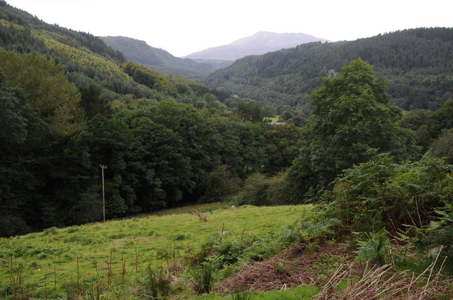
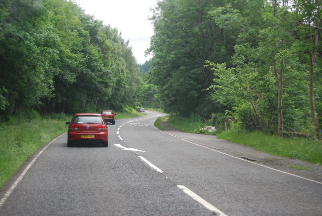
Coed Craig Glanconwy is a picturesque wood located in Caernarfonshire, Wales. Situated near the town of Caernarfon, this forested area covers approximately 200 acres and is a popular destination for nature enthusiasts and hikers alike.

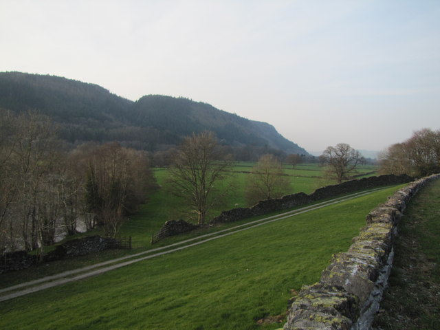
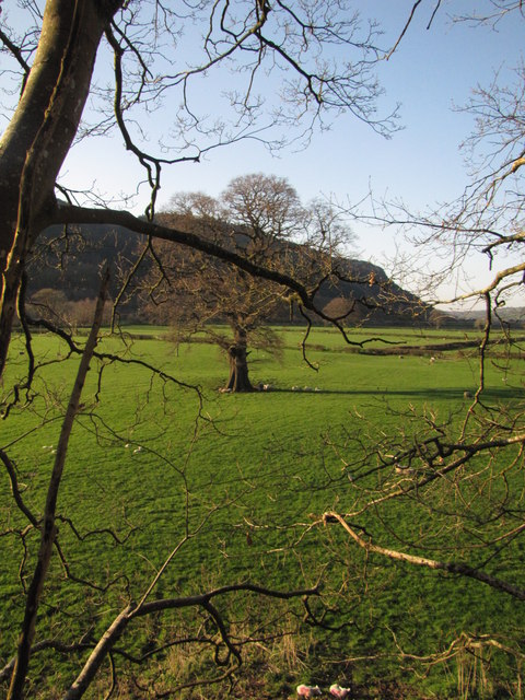
The wood is predominantly made up of native tree species, including oak, beech, and birch. These majestic trees create a dense canopy, providing shade and shelter for a diverse range of flora and fauna. The forest floor is adorned with an array of wildflowers, ferns, and mosses, adding to the natural beauty of the area.

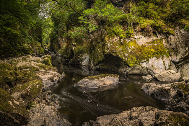
Tranquil streams meander through the wood, their gentle babbling sounds creating a peaceful ambiance. These waterways are home to various aquatic creatures, including fish and amphibians. The forest is also a haven for numerous bird species, making it a paradise for birdwatchers. Visitors may spot the likes of woodpeckers, owls, and thrushes.

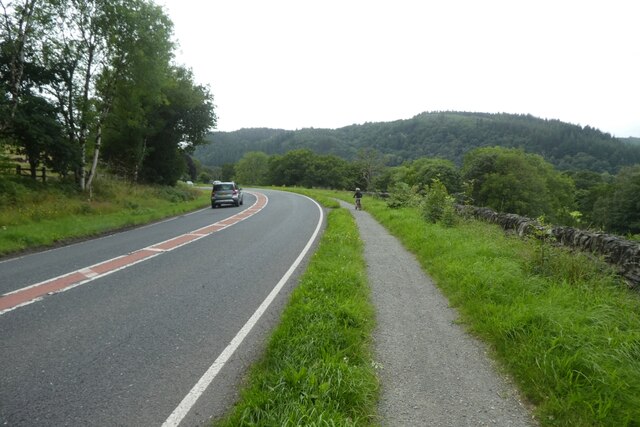
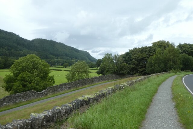
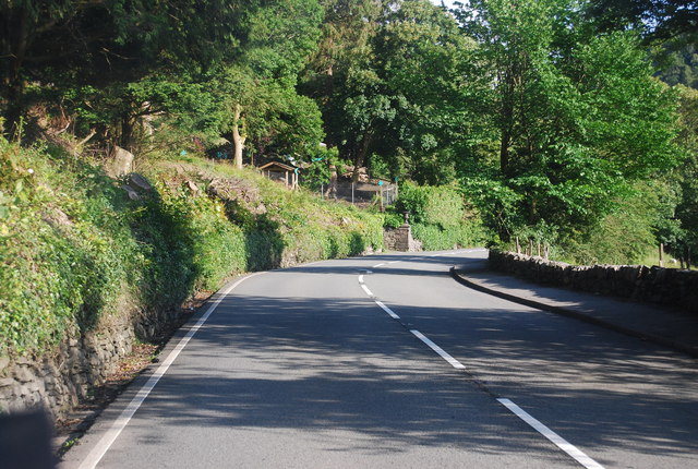
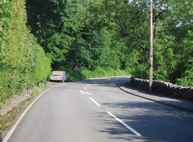
Coed Craig Glanconwy offers a network of well-maintained trails, allowing visitors to explore the wood at their leisure. Whether on foot or by bike, these trails offer breathtaking views and the opportunity to immerse oneself in the serene surroundings. There are also picnic areas dotted throughout the wood, providing a perfect spot to relax and enjoy the tranquility.

Managed by local conservation organizations, Coed Craig Glanconwy is dedicated to preserving the natural ecosystem and promoting biodiversity. It offers educational programs and events to raise awareness about the importance of forests and their role in sustaining a healthy environment.

In conclusion, Coed Craig Glanconwy is a stunning woodland that offers a peaceful retreat in the heart of Caernarfonshire. With its diverse flora and fauna, well-maintained trails, and commitment to conservation, it is a must-visit destination for nature lovers and those seeking a respite from the bustle of everyday life.

If you have any feedback on the listing, please let us know in the comments section below.

Coed Craig Glanconwy Images

Images are sourced within 2km of 53.081106/-3.8008367 or Grid Reference SH7955. Thanks to Geograph Open Source API. All images are credited.

Fairy Glen, Near Betws-Y-Coed The River Conwy flows through a narrow gorge.
Fairy Glen, Near Betws-Y-Coed
The River Conwy flows through a narrow gorge.
A5 near Betws-y-Coed The A5 heading north, almost at Betws-y-Coed, just past Bron-haul.
A5 near Betws-y-Coed
The A5 heading north, almost at Betws-y-Coed, just past Bron-haul.
Path beside the A470 Looking along the A470 towards Betws-y-Coed.
Path beside the A470
Looking along the A470 towards Betws-y-Coed.
Footpath beside the A470 Running alongside the A470 near Betws-y-Coed.
Footpath beside the A470
Running alongside the A470 near Betws-y-Coed.
Conwy Valley
Conwy Valley
Park Hill Guest House / Gwesty Bryn Parc, Betws-y-Coed
Above the Conwy valley The Conwy valley viewed from the A5 to the south of Betws-y-coed.
Above the Conwy valley
The Conwy valley viewed from the A5 to the south of Betws-y-coed.
A5 at Bron-haul The A5 is a major trunk road that runs 260 miles from London to Holyhead. It follows the course of an old Roman Road (Watling Street).
Wikipedia: <span class="nowrap"><a title="http://en.wikipedia.org/wiki/A5_road_(Great_Britain)" rel="nofollow ugc noopener" href="http://en.wikipedia.org/wiki/A5_road_(Great_Britain)">Link</a><img style="margin-left:2px;" alt="External link" title="External link - shift click to open in new window" src="https://s1.geograph.org.uk/img/external.png" width="10" height="10"/></span>
A5 at Bron-haul
The A5 is a major trunk road that runs 260 miles from London to Holyhead. It follows the course of an old Roman Road (Watling Street). Wikipedia: LinkExternal link
A5 near Dinas Mawr The A5 is a major trunk road that runs 260 miles from London to Holyhead. It follows the course of an old Roman Road (Watling Street).
Wikipedia: <span class="nowrap"><a title="http://en.wikipedia.org/wiki/A5_road_(Great_Britain)" rel="nofollow ugc noopener" href="http://en.wikipedia.org/wiki/A5_road_(Great_Britain)">Link</a><img style="margin-left:2px;" alt="External link" title="External link - shift click to open in new window" src="https://s1.geograph.org.uk/img/external.png" width="10" height="10"/></span>
A5 near Dinas Mawr
The A5 is a major trunk road that runs 260 miles from London to Holyhead. It follows the course of an old Roman Road (Watling Street). Wikipedia: LinkExternal link
Sharp bend, A5 The A5 is a major trunk road that runs 260 miles from London to Holyhead. It follows the course of an old Roman Road (Watling Street).
Wikipedia: <span class="nowrap"><a title="http://en.wikipedia.org/wiki/A5_road_(Great_Britain)" rel="nofollow ugc noopener" href="http://en.wikipedia.org/wiki/A5_road_(Great_Britain)">Link</a><img style="margin-left:2px;" alt="External link" title="External link - shift click to open in new window" src="https://s1.geograph.org.uk/img/external.png" width="10" height="10"/></span>
Sharp bend, A5
The A5 is a major trunk road that runs 260 miles from London to Holyhead. It follows the course of an old Roman Road (Watling Street). Wikipedia: LinkExternal link
The Silver Fountain
The Silver Fountain
A470, southbound The A470(T) is a major long-distance road in Wales, from Cardiff on the south coast to Llandudno on the north coast. It is 186 miles long, with a tortuous route through the country's mountainous central region, including the Brecon Beacons and Snowdonia National Park.
Wikipedia: <span class="nowrap"><a title="http://en.wikipedia.org/wiki/A470_road" rel="nofollow ugc noopener" href="http://en.wikipedia.org/wiki/A470_road">Link</a><img style="margin-left:2px;" alt="External link" title="External link - shift click to open in new window" src="https://s1.geograph.org.uk/img/external.png" width="10" height="10"/></span>
A470, southbound
The A470(T) is a major long-distance road in Wales, from Cardiff on the south coast to Llandudno on the north coast. It is 186 miles long, with a tortuous route through the country's mountainous central region, including the Brecon Beacons and Snowdonia National Park. Wikipedia: LinkExternal link
Dyffryn Lledr / The Lledr Valley
Terfyn y goedwig / The forest edge
Betws-y-coed: postbox № LL24 67, Rhyd-y-creuau This small postbox is in a lay-by on the A470, one of those lay-bys which was probably the original course of the road which has subsequently been straightened. The scene behind is of a large pile of logs which await removal; I drove along here the following day and much of the pile had been removed.
Betws-y-coed: postbox № LL24 67, Rhyd-y-creuau
This small postbox is in a lay-by on the A470, one of those lay-bys which was probably the original course of the road which has subsequently been straightened. The scene behind is of a large pile of logs which await removal; I drove along here the following day and much of the pile had been removed.
Deilen gron / Navelwort / Umbilicus rupestris
Afon Conwy floodplain
Show me another place!

Coed Craig Glanconwy is located at Grid Ref: SH7955 (Lat: 53.081106, Lng: -3.8008367)

Unitary Authority: Conwy

Police Authority: North Wales

What 3 Words

///bolt.highlighted.popular. Near Betws-y-Coed, Conwy

Nearby Locations

Coed Craig Glanconwy

Related Wikis

River Llugwy

River Llugwy (Welsh: Afon Llugwy) is a tributary of the River Conwy, and has its source at Ffynnon Llugwy, a lake in the Carneddau range of mountains in...

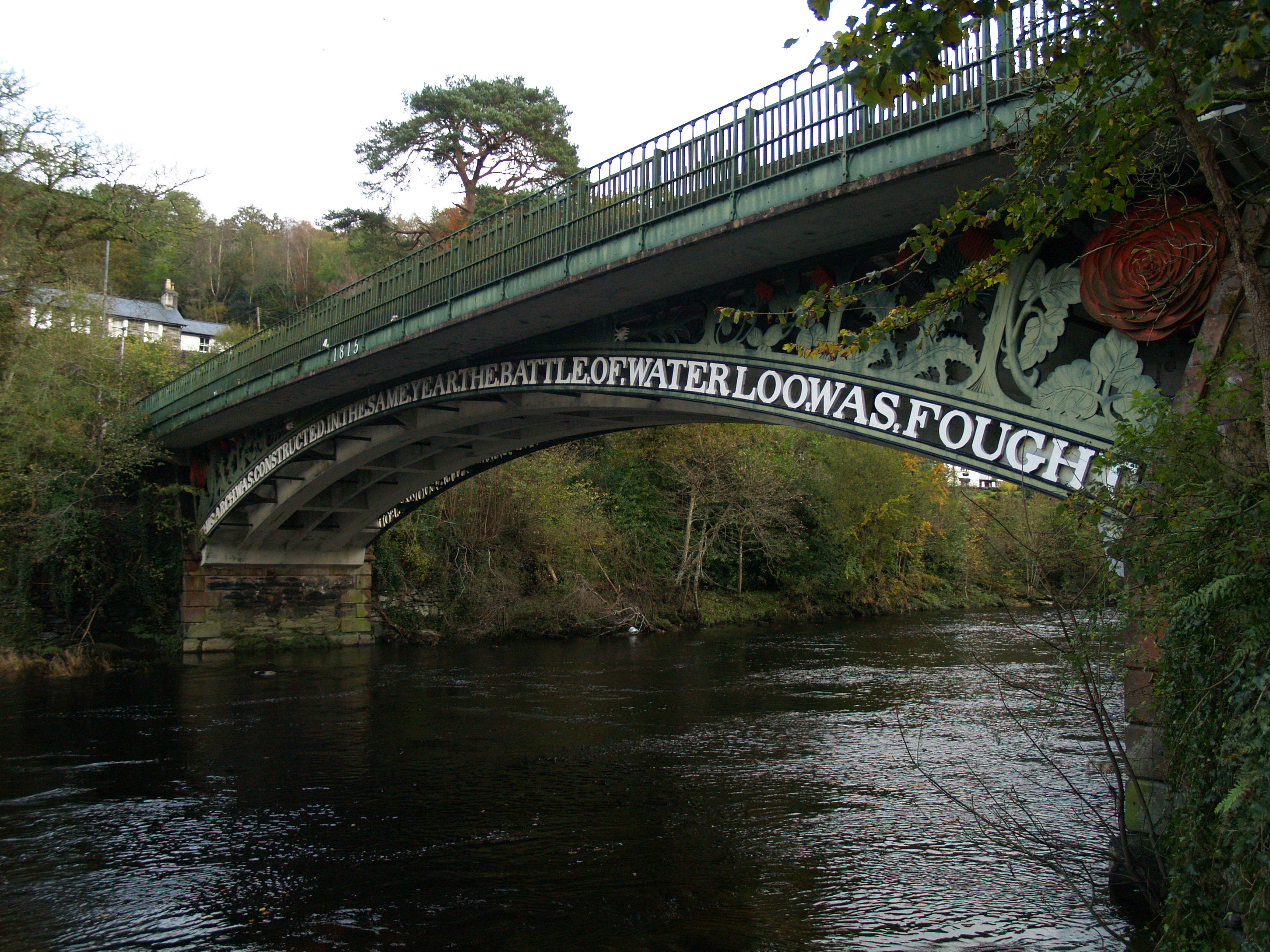
Waterloo Bridge, Betws-y-Coed

Waterloo Bridge (Welsh: Pont Waterloo) is an early cast iron bridge, spanning the River Conwy at Betws-y-Coed, in Conwy county borough, north-west Wales...

St Mary's Church, Betws-y-Coed

St Mary's Church, Betws-y-Coed, is in the village of Betws-y-Coed, Conwy, Wales. It is an active Anglican parish church of the Church in Wales, in the...
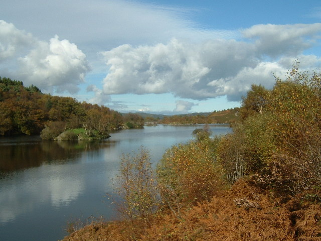
Llyn Elsi

Llyn Elsi is a lake located above the village of Betws-y-coed in the Snowdonia National Park in North Wales. It is a reservoir providing water for the...

Nearby Amenities

Located within 500m of 53.081106,-3.8008367
Parking
Lat/Long: 53.0836117/-3.7968681
Craig-Y-Dderwen
Addr City: Betws-y-Coed
Addr Country: GB
Addr Postcode: LL24 0AS
Fhrs Authority: Conwy
Fhrs Id: 61308
Fhrs Local Authority Id: 13451
Name En: Craig Y Dderwen Riverside Hotel
Stars: 4
Tourism: hotel
Lat/Long: 53.0834412/-3.7966003
Parking
Parking: surface
Source: gps_survey
Lat/Long: 53.0834742/-3.7944955
Ford: yes
Lat/Long: 53.0847385/-3.8004629
Hiking: yes
Information: guidepost
Source: GPS survey
Tourism: information
Lat/Long: 53.0830096/-3.8056657
35O
Hiking: yes
Information: guidepost
Source: GPS survey
Tourism: information
Lat/Long: 53.0846851/-3.8035387
The data included in this document is from www.openstreetmap.org. The data is made available under ODbL.

Have you been to Coed Craig Glanconwy?

Leave your review of Coed Craig Glanconwy below (or comments, questions and feedback).