Ffridd y Castell

Wood, Forest in Merionethshire

Wales

Ffridd y Castell

'To The Quarry' A landscape image of part of the former Gorseddau Slate Quarry, at Cwmsystradllyn.
Taken from part of the former tramway, that linked it to Ynys-Y-Pandy Slate Mill.
The former tramway path this side of the gate, local stone built retaining wall. Providing a lead in to the image, and view of the remaining slate waste beyond.
'To The Quarry' Credit: D M Wilmot

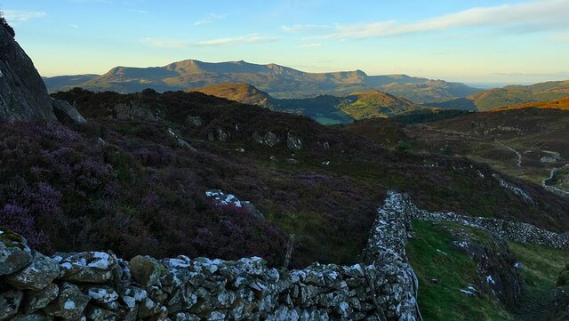
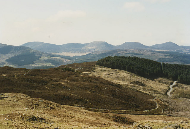
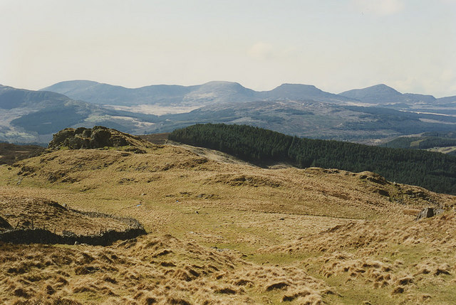
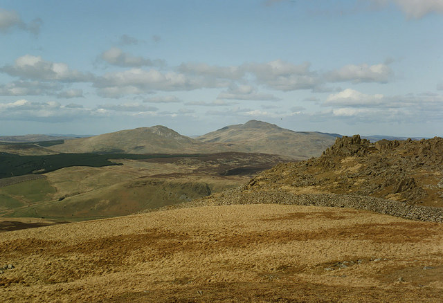
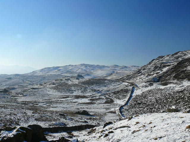
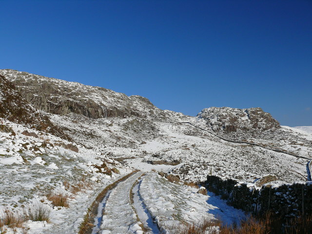
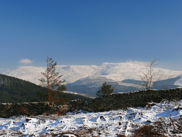
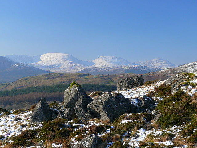
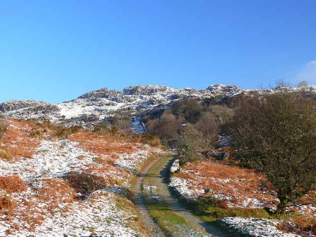
Ffridd y Castell, located in Merionethshire, is a stunning wood and forest area renowned for its natural beauty and diverse wildlife. Spanning an area of approximately 100 hectares, it is nestled in the heart of the Welsh countryside, offering visitors a tranquil and picturesque escape from the hustle and bustle of everyday life.

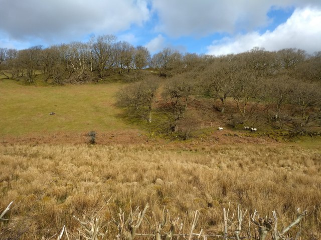
The wood is home to a variety of tree species, including oak, beech, and birch, which create a lush and vibrant canopy. The forest floor is adorned with a rich carpet of native plants and wildflowers, adding to the area's charm and biodiversity.

Ffridd y Castell is also a haven for wildlife enthusiasts. The wood provides a habitat for numerous species of birds, such as buzzards, woodpeckers, and warblers, making it a perfect spot for birdwatching. Additionally, the forest supports a range of mammals, including foxes, badgers, and squirrels, which can often be spotted exploring their natural habitat.

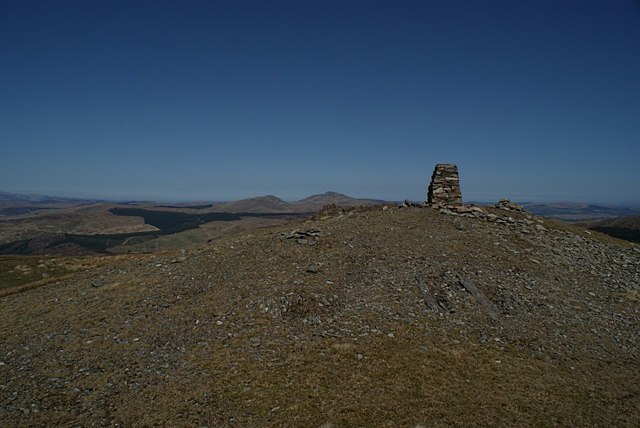
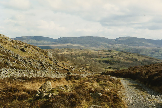
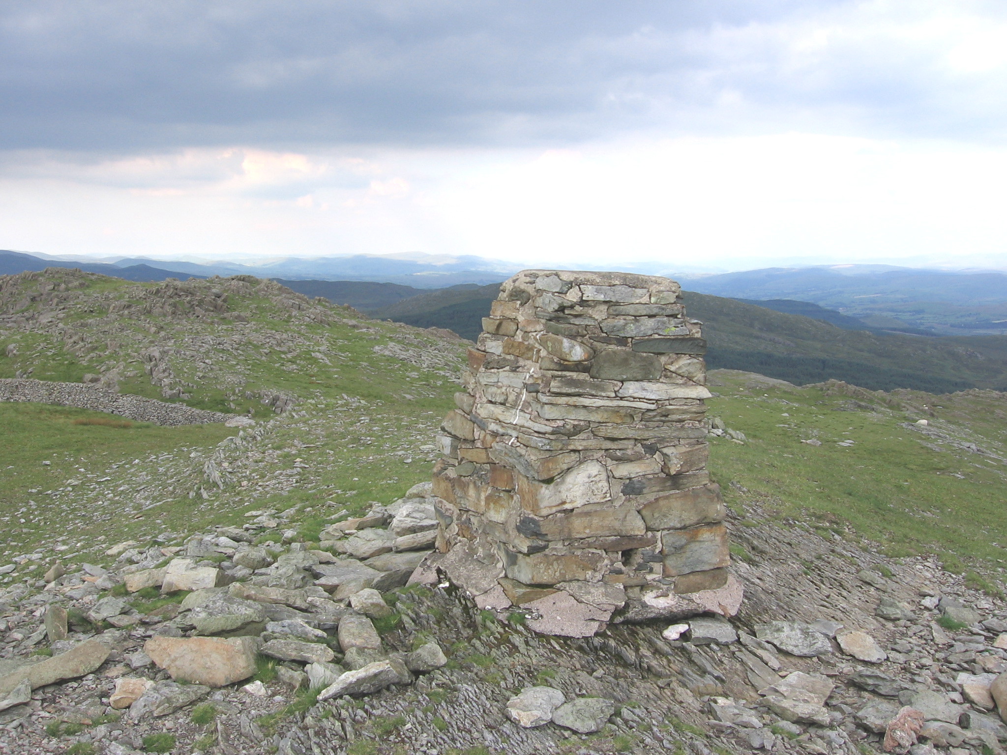
Visitors to Ffridd y Castell can enjoy a range of activities, such as walking and hiking along the well-maintained trails that wind through the wood. These paths offer breathtaking views of the surrounding countryside and allow visitors to immerse themselves in the peaceful ambiance of the forest.

Overall, Ffridd y Castell in Merionethshire is a captivating wood and forest area that offers a unique opportunity to connect with nature and appreciate the beauty of the Welsh landscape. Whether you are a nature lover, hiker, or simply seeking serenity, this enchanting destination is sure to leave a lasting impression.

If you have any feedback on the listing, please let us know in the comments section below.

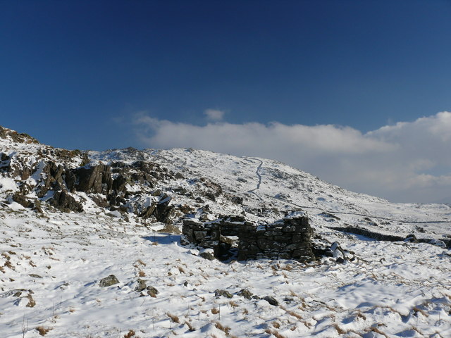
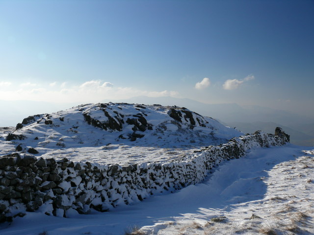
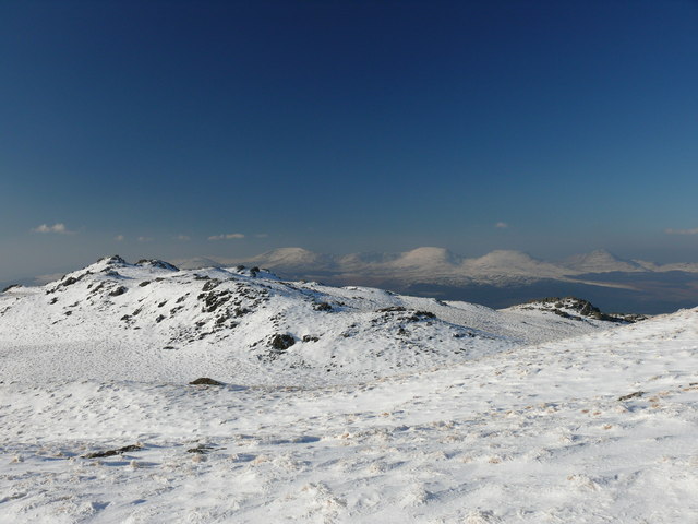
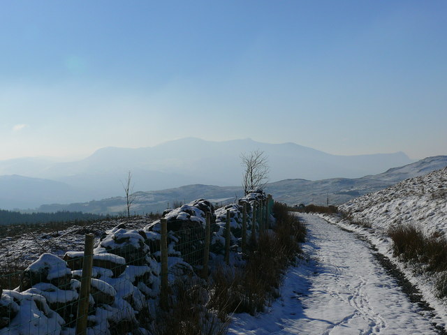
Ffridd y Castell Images

Images are sourced within 2km of 52.798739/-3.8045878 or Grid Reference SH7823. Thanks to Geograph Open Source API. All images are credited.

'To The Quarry' A landscape image of part of the former Gorseddau Slate Quarry, at Cwmsystradllyn.
Taken from part of the former tramway, that linked it to Ynys-Y-Pandy Slate Mill.
The former tramway path this side of the gate, local stone built retaining wall. Providing a lead in to the image, and view of the remaining slate waste beyond.
'To The Quarry'
A landscape image of part of the former Gorseddau Slate Quarry, at Cwmsystradllyn. Taken from part of the former tramway, that linked it to Ynys-Y-Pandy Slate Mill. The former tramway path this side of the gate, local stone built retaining wall. Providing a lead in to the image, and view of the remaining slate waste beyond.
Wall defining the south-west ridge of Rhobell Fawr The path down the south-west ridge of Rhobell Fawr follows this wall to Bwlch Goriwared.
Here on the lower slopes, the wall divides the hillside into the colourful heather on the eastern side and coarse grasses to the west. The Cadair ridge is in the background.
Wall defining the south-west ridge of Rhobell Fawr
The path down the south-west ridge of Rhobell Fawr follows this wall to Bwlch Goriwared. Here on the lower slopes, the wall divides the hillside into the colourful heather on the eastern side and coarse grasses to the west. The Cadair ridge is in the background.
Woodland, fields and bog Near to the track to Benglog.
Woodland, fields and bog
Near to the track to Benglog.
Summit of Rhobell Fawr The summit of the mountain with Arenig Fawr in the background
Summit of Rhobell Fawr
The summit of the mountain with Arenig Fawr in the background
Southern approach to Bwlch Goriwared The old drove road climbs up to the pass. Waun Oer is the highest of the hills on the horizon.
Southern approach to Bwlch Goriwared
The old drove road climbs up to the pass. Waun Oer is the highest of the hills on the horizon.
The north side of Bwlch Goriwared A mixture of heather-covered hillside and better grazing, through which the old drove road to Bwlch Goriwared climbs.
The north side of Bwlch Goriwared
A mixture of heather-covered hillside and better grazing, through which the old drove road to Bwlch Goriwared climbs.
View west from near Ffynnon Shôn Looking down the lower part of the long western approach to Rhobell Fawr in the direction of Bwlch Goriwared. The distinctive rocky knoll on the left can be seen from below in <a href="https://www.geograph.org.uk/photo/671999">SH7624 : Hillside east of Bwlch Goriwared</a>. The Rhinogydd form the horizon.
View west from near Ffynnon Shôn
Looking down the lower part of the long western approach to Rhobell Fawr in the direction of Bwlch Goriwared. The distinctive rocky knoll on the left can be seen from below in SH7624 : Hillside east of Bwlch Goriwared. The Rhinogydd form the horizon.
View towards Arenig Fawr from Rhobell Fawr A grassy plateau on the north side of the summit contrasts with the other generally rough and rocky terrain around. In the distance, Moel Llyfnant can be seen to the left of Arenig Fawr.
View towards Arenig Fawr from Rhobell Fawr
A grassy plateau on the north side of the summit contrasts with the other generally rough and rocky terrain around. In the distance, Moel Llyfnant can be seen to the left of Arenig Fawr.
Rhobell Fawr, Eryri / Snowdonia Edrych tuag at gopa Rhobell Fawr / Looking towards the summit of Rhobell Fawr
Rhobell Fawr, Eryri / Snowdonia
Edrych tuag at gopa Rhobell Fawr / Looking towards the summit of Rhobell Fawr
Llethrau Rhobell Fawr / Slopes of Rhobell Fawr Adfeilion ger Ffynnon Shon / Ruins near Ffynnon Shon.
Llethrau Rhobell Fawr / Slopes of Rhobell Fawr
Adfeilion ger Ffynnon Shon / Ruins near Ffynnon Shon.
Rhobell Fawr Uwchben Ffridd Graig Wen / Above Ffridd Graig Wen.
Rhobell Fawr
Uwchben Ffridd Graig Wen / Above Ffridd Graig Wen.
Rhobell Fawr Golygfa islaw i'r copa gyda'r Rhinogydd yn y cefndir / A view below the summit with the Rhinogs in the background.
Rhobell Fawr
Golygfa islaw i'r copa gyda'r Rhinogydd yn y cefndir / A view below the summit with the Rhinogs in the background.
Trac ger Fforest Cae'r Defaid / Track near Cae'r Defaid Forest Yn edrych i lawr trac gyda Cadair Idris yn y pellter / Looking down a track with Cadair Idris in the distance.
Trac ger Fforest Cae'r Defaid / Track near Cae'r Defaid Forest
Yn edrych i lawr trac gyda Cadair Idris yn y pellter / Looking down a track with Cadair Idris in the distance.
Graig Fach Llethrau isaf Rhobell Fawr / Lower slopes of Rhobell Fawr.
Graig Fach
Llethrau isaf Rhobell Fawr / Lower slopes of Rhobell Fawr.
Graig Fach Trac a llwybr cyhoeddu ar lethrau isaf Rhobell Fawr / Track and public footpath on the lower slopes of Rhobell Fawr.
Graig Fach
Trac a llwybr cyhoeddu ar lethrau isaf Rhobell Fawr / Track and public footpath on the lower slopes of Rhobell Fawr.
Ffridd y Castell Wal derfyn i fforest sy wedi cael ei chwympo gydag Aran Fawddwy yn y cefndir / Boundary wall of a forest that has been felled with Aran Fawddwy in the background.
Ffridd y Castell
Wal derfyn i fforest sy wedi cael ei chwympo gydag Aran Fawddwy yn y cefndir / Boundary wall of a forest that has been felled with Aran Fawddwy in the background.
Cerrig mawr yn y grug / Large rocks among the heather Golygfa o'r Rhinogydd (Y Llethr, Rhinog Fach a Rhinog Fawr) / A view of the Rhinogs (Y Llethr, Rhinog Fach a Rhinog Fawr).
Cerrig mawr yn y grug / Large rocks among the heather
Golygfa o'r Rhinogydd (Y Llethr, Rhinog Fach a Rhinog Fawr) / A view of the Rhinogs (Y Llethr, Rhinog Fach a Rhinog Fawr).
Bwlch Goriwared Dechrau ar y ffordd i fyny i Fwlch Goriwared / Starting on the way up Bwlch Goriwared.
Bwlch Goriwared
Dechrau ar y ffordd i fyny i Fwlch Goriwared / Starting on the way up Bwlch Goriwared.
Show me another place!

Ffridd y Castell is located at Grid Ref: SH7823 (Lat: 52.798739, Lng: -3.8045878)

Unitary Authority: Gwynedd

Police Authority: North Wales

What 3 Words

///crouch.hillsides.myself. Near Dolgellau, Gwynedd

Related Wikis

Rhobell Fawr

Rhobell Fawr is the site of an ancient volcano that was active during the Early Ordovician period in the Arenig range within the Snowdonia National Park...

Allt y Benglog National Nature Reserve

Allt y Benglog is a small national nature reserve near Dolgellau in Wales.Its position on the lower slopes of Rhobell Fawr, one of north Wales’ extinct...

Brithdir and Llanfachreth

Brithdir and Llanfachreth is a community in the county of Gwynedd, Wales, near Dolgellau, and is 93.1 miles (149.8 km) from Cardiff and 178.4 miles (287...

Wnion Halt railway station

Wnion Halt (Pron: Oon-y'n) in Gwynedd, Wales, was on the Ruabon to Barmouth line. The station was situated in a narrow part of the Wnion Valley next to...

Nearby Amenities

Located within 500m of 52.798739,-3.8045878
The data included in this document is from www.openstreetmap.org. The data is made available under ODbL.

Have you been to Ffridd y Castell?

Leave your review of Ffridd y Castell below (or comments, questions and feedback).