Allt Serth

Wood, Forest in Cardiganshire

Wales

Allt Serth

Croesi grid gwartheg / Crossing a cattle grid Heol fach wledig yn croesi grid gwartheg yng Nghwm Camddwr.

A small country road crossing a cattle grid in Cwm Camddwr (trans. winding river valley).
Croesi grid gwartheg / Crossing a cattle grid Credit: Alan Richards

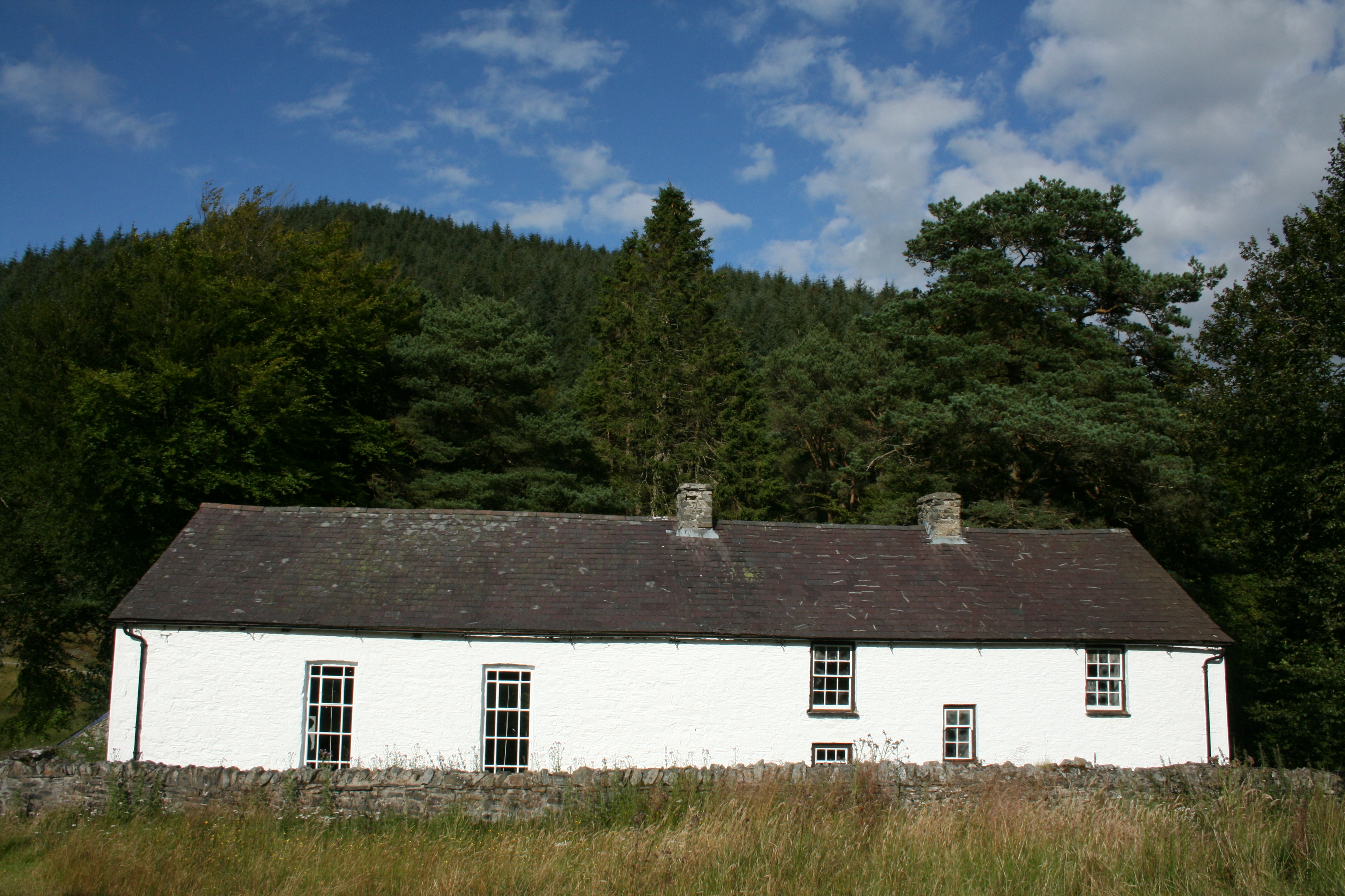
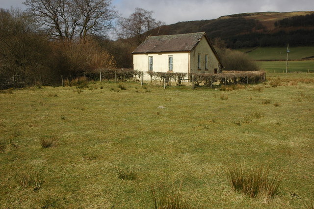
Allt Serth is a picturesque woodland located in Cardiganshire, Wales. Covering an area of approximately 100 acres, it is a haven for nature enthusiasts and avid hikers. The woodland is characterized by its diverse and dense collection of trees, including oak, beech, and ash, creating a lush and vibrant environment.

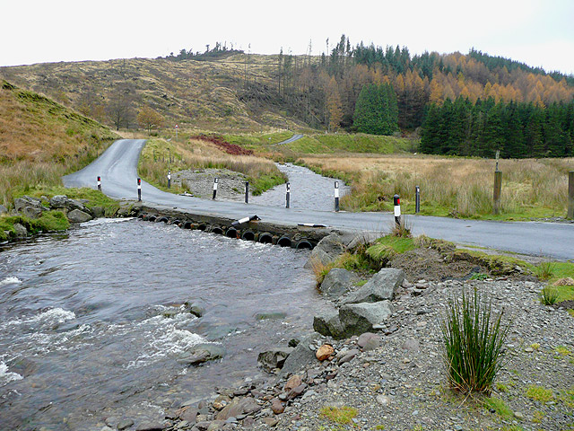
The terrain of Allt Serth is undulating, with gentle slopes and valleys, providing visitors with breathtaking views of the surrounding countryside. A network of well-maintained trails crisscrosses the woodland, allowing visitors to explore its beauty at their own pace. These trails cater to various skill levels, making Allt Serth suitable for both beginners and experienced hikers.

The woodland is home to a wide range of wildlife, including numerous bird species, such as woodpeckers, owls, and finches. Small mammals, like rabbits and squirrels, can also be spotted scurrying through the undergrowth. Moreover, Allt Serth is known for its rich flora, with carpets of wildflowers decorating the forest floor during the spring and summer months.

Allt Serth is not only a natural gem but also offers historical significance. Ruins of an ancient iron age fort can be found within the woodland, adding an element of intrigue and fascination for history enthusiasts.

The tranquil and serene ambiance of Allt Serth makes it an ideal destination for those seeking solace in nature. Whether it's a leisurely stroll, a family picnic, or an adventurous hike, Allt Serth has something to offer for everyone.

If you have any feedback on the listing, please let us know in the comments section below.

Allt Serth Images

Images are sourced within 2km of 52.179566/-3.785203 or Grid Reference SN7854. Thanks to Geograph Open Source API. All images are credited.

Croesi grid gwartheg / Crossing a cattle grid Heol fach wledig yn croesi grid gwartheg yng Nghwm Camddwr.

A small country road crossing a cattle grid in Cwm Camddwr (trans. winding river valley).
Croesi grid gwartheg / Crossing a cattle grid
Heol fach wledig yn croesi grid gwartheg yng Nghwm Camddwr. A small country road crossing a cattle grid in Cwm Camddwr (trans. winding river valley).
Cwm Camddwr Cerddwyr yn dilyn heol fach wledig yng Nghwm Camddwr.

Walkers following a minor country road in Cwm Camddwr (trans. winding river valley).
Cwm Camddwr
Cerddwyr yn dilyn heol fach wledig yng Nghwm Camddwr. Walkers following a minor country road in Cwm Camddwr (trans. winding river valley).
Heol i Soar y Mynydd / Road to Soar y Mynydd Hen heol ddiwyneb yn mynd i lawr y waered i gyfeiriad Capel Soar y Mynydd.

An old unsurfaced road descending the hill towards Capel Soar y Mynydd (trans. Soar Chapel of the mountain).
Heol i Soar y Mynydd / Road to Soar y Mynydd
Hen heol ddiwyneb yn mynd i lawr y waered i gyfeiriad Capel Soar y Mynydd. An old unsurfaced road descending the hill towards Capel Soar y Mynydd (trans. Soar Chapel of the mountain).
Bryn-brith Gweddillion anhedd-dy angysbell ar rostir o'r enw Bryn-brith.

The remains of Bryn-brith (trans. mottled hill), a remote property on moorland.
Bryn-brith
Gweddillion anhedd-dy angysbell ar rostir o'r enw Bryn-brith. The remains of Bryn-brith (trans. mottled hill), a remote property on moorland.
Tuag at Gefn Isaf / Towards Cefn Isaf Llwybr yn dilyn ffens derfyn goedwigaeth i lawr at Nant y Graig a lan tua Chefn Isaf.

A path descends along a forestry boundary fence towards Nant y Graig (trans. rock stream) and upwards towards Cefn Isaf (trans. lower ridge).
Tuag at Gefn Isaf / Towards Cefn Isaf
Llwybr yn dilyn ffens derfyn goedwigaeth i lawr at Nant y Graig a lan tua Chefn Isaf. A path descends along a forestry boundary fence towards Nant y Graig (trans. rock stream) and upwards towards Cefn Isaf (trans. lower ridge).
Gât fach ar rostir / Small gate on moorland Gât fach ar rostir uwchben Ffarm Maesglas.

A small gate on moorland above Maesglas Farm (trans. green field).
Gât fach ar rostir / Small gate on moorland
Gât fach ar rostir uwchben Ffarm Maesglas. A small gate on moorland above Maesglas Farm (trans. green field).
Llwybr ar rostir / Moorland path Llwybr yn croesi rostir ger Maesglas.

A path crosses moorland near Maesglas (trans. green field).
Llwybr ar rostir / Moorland path
Llwybr yn croesi rostir ger Maesglas. A path crosses moorland near Maesglas (trans. green field).
Carreg gwarts fach ar rostir / A small quartz stone on moorland Carreg gwarts fach unig ar rostir uwchben Nant Maes-glas.  Mae'n bosib ei bod yn hen nod terfyn.

A small solitary quartz stone on moorland above Nant Maes-glas (trans. green field stream).  It's possible that the stone is an old boundary marker.
Carreg gwarts fach ar rostir / A small quartz stone on moorland
Carreg gwarts fach unig ar rostir uwchben Nant Maes-glas. Mae'n bosib ei bod yn hen nod terfyn. A small solitary quartz stone on moorland above Nant Maes-glas (trans. green field stream). It's possible that the stone is an old boundary marker.
Coed a rhostir / Trees and moorland Nodwedd cyffredin iawn yn y parthau hyn yw cymysgedd o blanhigfeydd conifferaidd a rhostiroedd. 

A common feature in these parts is a mixture of conifer plantations and moorlands.
Coed a rhostir / Trees and moorland
Nodwedd cyffredin iawn yn y parthau hyn yw cymysgedd o blanhigfeydd conifferaidd a rhostiroedd. A common feature in these parts is a mixture of conifer plantations and moorlands.
Gât fach ar rostir / A small gate on moorland Gât fach ar rostir sy'n ffinio planhigfa gonifferiadd.

A small gate on moorland bordering a conifer plantation.
Gât fach ar rostir / A small gate on moorland
Gât fach ar rostir sy'n ffinio planhigfa gonifferiadd. A small gate on moorland bordering a conifer plantation.
Rhostir a choedwigaeth / Moorland and forestry Nodwedd cyffredin yn y parthau hyn yw rhostiroedd a phlanhigfeydd conifferaidd.

A common feature in these parts  is a lot a moorland and conifer plantations.
Rhostir a choedwigaeth / Moorland and forestry
Nodwedd cyffredin yn y parthau hyn yw rhostiroedd a phlanhigfeydd conifferaidd. A common feature in these parts is a lot a moorland and conifer plantations.
Cwm Camddwr in Ceredigion Looking north from the forestry road near Soar-y-Mynydd. 550 metres away, above centre in the image, are some trees marking the site of the long abandoned settlement at Nant-y-Graig. On the right is part of the huge Tywi Forest. The Afon Camddwr flows towards the camera.
Cwm Camddwr in Ceredigion
Looking north from the forestry road near Soar-y-Mynydd. 550 metres away, above centre in the image, are some trees marking the site of the long abandoned settlement at Nant-y-Graig. On the right is part of the huge Tywi Forest. The Afon Camddwr flows towards the camera.
Hill pasture near the Afon Camddwr in Ceredigion Looking east-north-east towards the Camddwr valley and Tywi Forest.
Hill pasture near the Afon Camddwr in Ceredigion
Looking east-north-east towards the Camddwr valley and Tywi Forest.
Hill pasture near the Afon Camddwr in Ceredigion Looking east-north-east towards the Camddwr valley and Tywi Forest.
Hill pasture near the Afon Camddwr in Ceredigion
Looking east-north-east towards the Camddwr valley and Tywi Forest.
Afon Camddwr and tracks by Soar-y-Mynydd, Ceredigion The chapel is past the woodland on the left, and that stony forestry road leads into the Tywi Forest at Dalarwen. Uphill and off steeply to the right is the former drover's road to Llanddewi-Brefi. The lower road to the right is a gated stony road to a patch of forest reaching Cefn Isaf.
Afon Camddwr and tracks by Soar-y-Mynydd, Ceredigion
The chapel is past the woodland on the left, and that stony forestry road leads into the Tywi Forest at Dalarwen. Uphill and off steeply to the right is the former drover's road to Llanddewi-Brefi. The lower road to the right is a gated stony road to a patch of forest reaching Cefn Isaf.
Afon Camddwr and tracks by Soar-y-Mynydd, Ceredigion The chapel is past the woodland on the left, and that stony forestry road leads into the Tywi Forest at Dalarwen. Uphill and off steeply to the right is the former drover's road to Llanddewi-Brefi. The lower road to the right across the river is a gated stony road to a patch of forest reaching Cefn Isaf. The road in the foreground joins a mountain road to Tregaron, off to the right.
Afon Camddwr and tracks by Soar-y-Mynydd, Ceredigion
The chapel is past the woodland on the left, and that stony forestry road leads into the Tywi Forest at Dalarwen. Uphill and off steeply to the right is the former drover's road to Llanddewi-Brefi. The lower road to the right across the river is a gated stony road to a patch of forest reaching Cefn Isaf. The road in the foreground joins a mountain road to Tregaron, off to the right.
Forestry road on Esgair Gors, Ceredigion Part of the open access mighty Tywi Forest plantation. The land drops steeply to the right, down Nant-yr-Hafdre to the Afon Tywi.
Forestry road on Esgair Gors, Ceredigion
Part of the open access mighty Tywi Forest plantation. The land drops steeply to the right, down Nant-yr-Hafdre to the Afon Tywi.
Show me another place!

Allt Serth is located at Grid Ref: SN7854 (Lat: 52.179566, Lng: -3.785203)

Unitary Authority: Ceredigion

Police Authority: Dyfed Powys

What 3 Words

///pebbles.widest.campsites. Near Abergwesyn, Powys

Nearby Locations

Esgair Ganol Allt Serth

Related Wikis

Soar y mynydd

Soar-y-mynydd or Soar y mynydd is a Calvinist Methodist chapel near the eastern extremity of the large parish of Llanddewi Brefi, Ceredigion. It is claimed...

Camddwr

For the tributary of the River Wye, see Camddwr, Wye and for the tributary of the River Teifi, see Camddwr, Teifi.The Camddwr is a significant right-bank...

Llyn Brianne

Llyn Brianne is a man-made lake or reservoir in the headwaters of the River Towy in Wales. == Construction == The reservoir was constructed by Wimpey Construction...

Nant Irfon National Nature Reserve

Nant Irfon National Nature Reserve is a national nature reserve located high in the hills above the Afon Irfon valley near the village of Abergwesyn in...

Vicarage Meadows

Vicarage Meadows is a Site of Special Scientific Interest near Abergwesyn, Powys, Wales. The 3.6 hectares (8.9 acres) site, located close to the Nant Irfon...

Abergwesyn

Abergwesyn is a village in the Welsh county of Powys, in mid-Wales, at the start of the Abergwesyn valley and at the confluence of the Afon Irfon and the...

Afon Irfon

Afon Irfon (the River Irfon) is a river in Powys, Wales. It flows from the upper slopes of Bryn Garw in the Cambrian Mountains, through the Abergwesyn...

River Towy

The River Towy (Welsh: Afon Tywi, IPA: [ˈtəwɪ]) is one of the longest rivers flowing entirely within Wales. Its total length is 120 km (75 mi). It is noted...

Have you been to Allt Serth?

Leave your review of Allt Serth below (or comments, questions and feedback).