Burthorpe

Settlement in Suffolk West Suffolk

England

Burthorpe

Burthorpe: Two detached houses in Papeley Meadow
Burthorpe: Two detached houses in Papeley Meadow Credit: Michael Garlick

Burthorpe is a small village located in Suffolk, England. It is situated near the larger town of Bury St. Edmunds and is surrounded by picturesque countryside. The village is known for its quaint and charming atmosphere, with traditional thatched-roof cottages lining the streets.

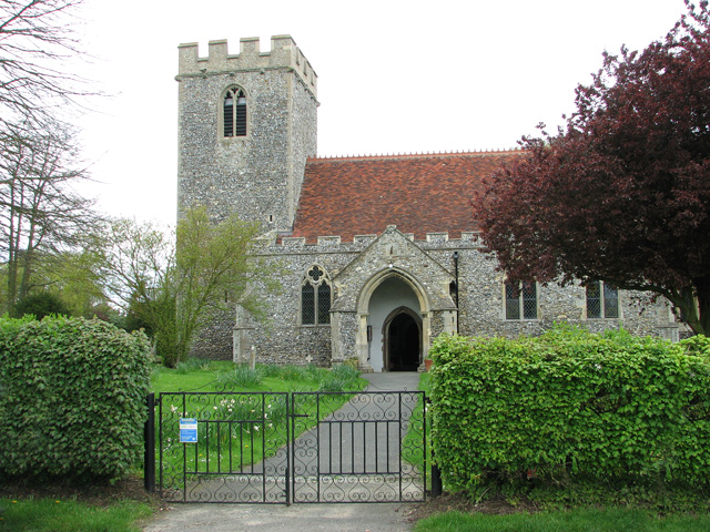
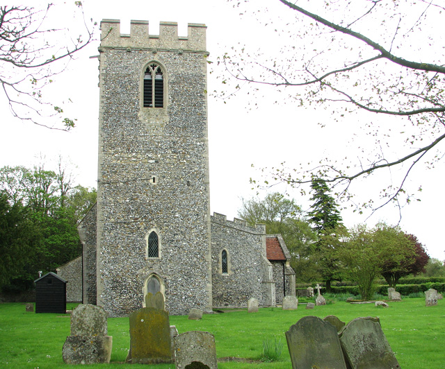
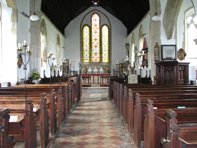
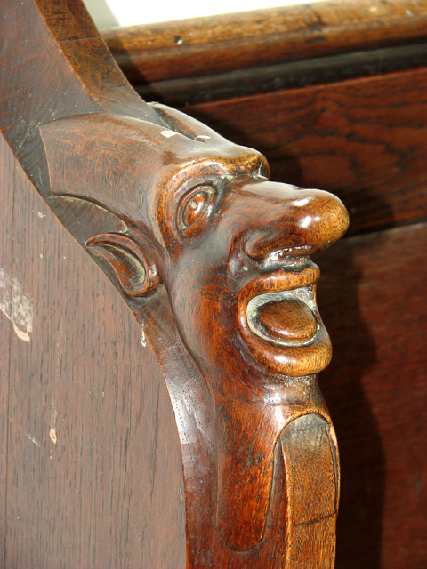
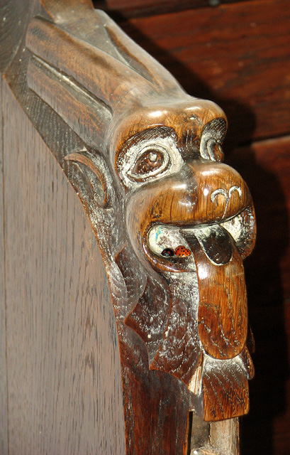
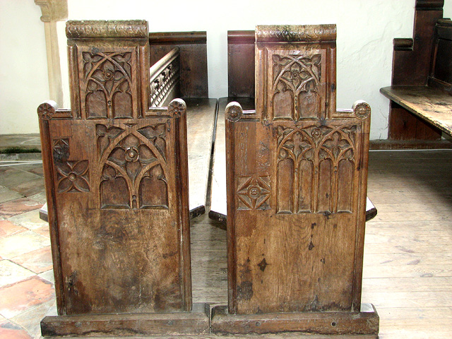
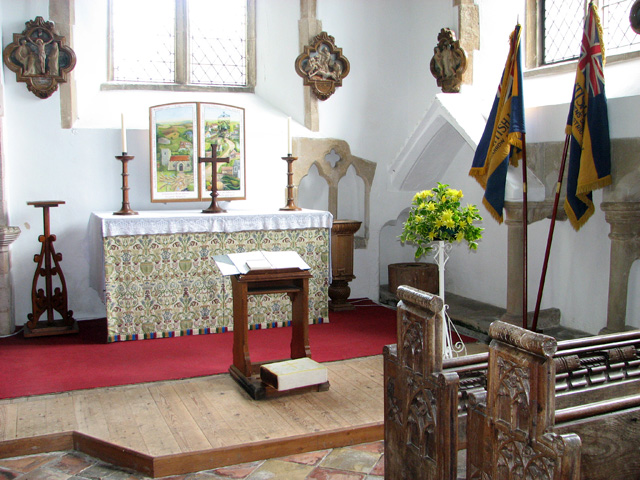
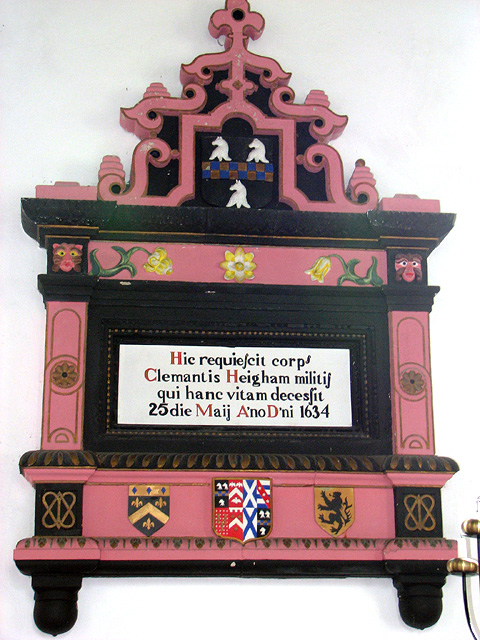
Burthorpe is home to a tight-knit community of residents who take pride in their village and its history. The local church, St. Mary's, is a focal point of the village and dates back to the medieval period. The village also has a primary school, village hall, and a small number of shops and businesses that serve the local population.

The surrounding area offers many opportunities for outdoor activities, including walking, cycling, and horseback riding. The nearby Thetford Forest is a popular destination for nature lovers and outdoor enthusiasts.

Overall, Burthorpe is a peaceful and idyllic village that offers a true taste of rural England. Its friendly residents and beautiful surroundings make it a charming place to visit or call home.

If you have any feedback on the listing, please let us know in the comments section below.
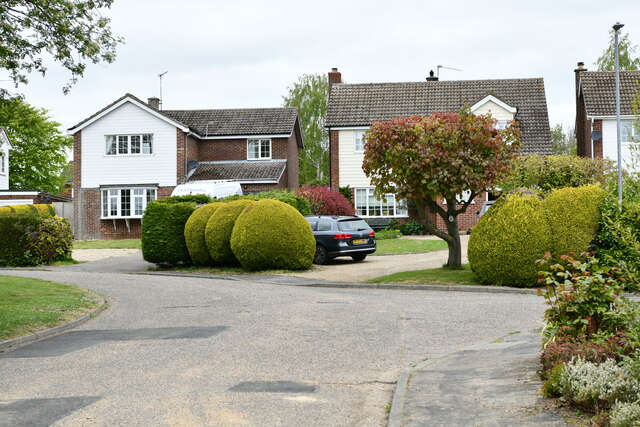
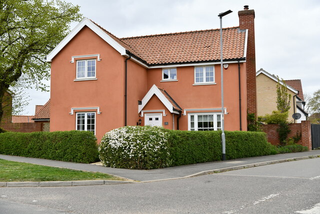
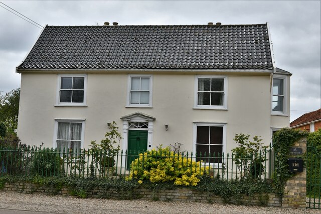
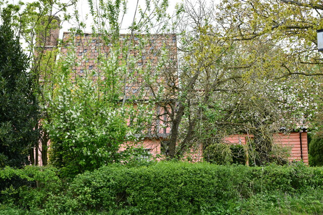
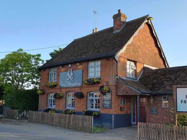
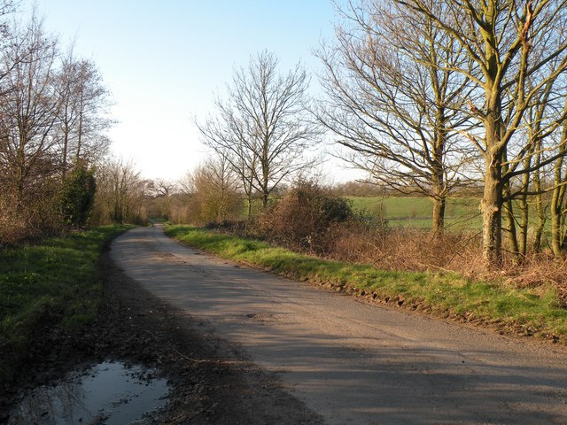
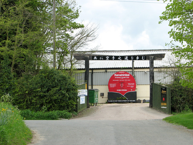
Burthorpe Images

Images are sourced within 2km of 52.245901/0.59503754 or Grid Reference TL7764. Thanks to Geograph Open Source API. All images are credited.

Burthorpe: Two detached houses in Papeley Meadow
Barrow: 46 The Green
Barrow: 16 The Green
Barrow: Denham End Farm
Barrow: Crop
Barrow: Crop
The Three Horseshoes, Barrow
Part of Brockley Lane
The entrance to Church Farm It no longer appears to be a farm.
The entrance to Church Farm
It no longer appears to be a farm.
The church of All Saints in Barrow For more information go to: <a title="https://www.geograph.org.uk/photo/1916055" href="https://www.geograph.org.uk/photo/1916055">Link</a>.
The church of All Saints in Barrow
For more information go to: Link.
The church of All Saints in Barrow For more information go to: <a title="https://www.geograph.org.uk/photo/1916055" href="https://www.geograph.org.uk/photo/1916055">Link</a>.
The church of All Saints in Barrow
For more information go to: Link.
The church of All Saints in Barrow View east. For an exterior view see > <a title="https://www.geograph.org.uk/photo/2930644" href="https://www.geograph.org.uk/photo/2930644">Link</a>. For more information go to: <a title="https://www.geograph.org.uk/photo/1916055" href="https://www.geograph.org.uk/photo/1916055">Link</a>.
The church of All Saints in Barrow
View east. For an exterior view see > Link. For more information go to: Link.
The church of All Saints in Barrow Medieval carved poppyhead. For an exterior view see > <a title="https://www.geograph.org.uk/photo/2930644" href="https://www.geograph.org.uk/photo/2930644">Link</a>. For more information go to: <a title="https://www.geograph.org.uk/photo/1916055" href="https://www.geograph.org.uk/photo/1916055">Link</a>.
The church of All Saints in Barrow
Medieval carved poppyhead. For an exterior view see > Link. For more information go to: Link.
The church of All Saints in Barrow Medieval carved bench elbow. For an exterior view see > <a title="https://www.geograph.org.uk/photo/2930644" href="https://www.geograph.org.uk/photo/2930644">Link</a>. For more information go to: <a title="https://www.geograph.org.uk/photo/1916055" href="https://www.geograph.org.uk/photo/1916055">Link</a>.
The church of All Saints in Barrow
Medieval carved bench elbow. For an exterior view see > Link. For more information go to: Link.
The church of All Saints in Barrow Medieval carved bench elbow. Three ladybirds are resting in the creatures mouth. For an exterior view see > <a title="https://www.geograph.org.uk/photo/2930644" href="https://www.geograph.org.uk/photo/2930644">Link</a>. For more information go to: <a title="https://www.geograph.org.uk/photo/1916055" href="https://www.geograph.org.uk/photo/1916055">Link</a>.
The church of All Saints in Barrow
Medieval carved bench elbow. Three ladybirds are resting in the creatures mouth. For an exterior view see > Link. For more information go to: Link.
The church of All Saints in Barrow Carved medieval benches. For an exterior view see > <a title="https://www.geograph.org.uk/photo/2930644" href="https://www.geograph.org.uk/photo/2930644">Link</a>. For more information go to: <a title="https://www.geograph.org.uk/photo/1916055" href="https://www.geograph.org.uk/photo/1916055">Link</a>.
The church of All Saints in Barrow
Carved medieval benches. For an exterior view see > Link. For more information go to: Link.
The church of All Saints in Barrow The south aisle altar. For an exterior view see > <a title="https://www.geograph.org.uk/photo/2930644" href="https://www.geograph.org.uk/photo/2930644">Link</a>. For more information go to: <a title="https://www.geograph.org.uk/photo/1916055" href="https://www.geograph.org.uk/photo/1916055">Link</a>.
The church of All Saints in Barrow
The south aisle altar. For an exterior view see > Link. For more information go to: Link.
The church of All Saints in Barrow C17 wall monument. For an exterior view see > <a title="https://www.geograph.org.uk/photo/2930644" href="https://www.geograph.org.uk/photo/2930644">Link</a>. For more information go to: <a title="https://www.geograph.org.uk/photo/1916055" href="https://www.geograph.org.uk/photo/1916055">Link</a>.
The church of All Saints in Barrow
C17 wall monument. For an exterior view see > Link. For more information go to: Link.
Show me another place!

Burthorpe is located at Grid Ref: TL7764 (Lat: 52.245901, Lng: 0.59503754)

Administrative County: Suffolk

District: West Suffolk

Police Authority: Suffolk

What 3 Words

///weaved.parading.upgrading. Near Bury St Edmunds, Suffolk

Nearby Locations

Burthorpe

Related Wikis

Barrow, Suffolk

Barrow is a village and civil parish in the West Suffolk district of Suffolk, England, about eight miles west of Bury St Edmunds. According to Eilert Ekwall...

Great Saxham

Great Saxham is a village and former civil parish, now in the parish of The Saxhams, in the West Suffolk district, in the county of Suffolk, England. The...

Saxham Hall

Great Saxham Hall is a two-storey Palladian house situated at Great Saxham, just outside Bury St Edmunds in Suffolk, England. It is a Grade II* listed...

The Saxhams

The Saxhams is a civil parish in the West Suffolk district of Suffolk in eastern England. Located around two miles west of Bury St Edmunds, the parish...

Nearby Amenities

Located within 500m of 52.245901,0.59503754
Burthorpe
Created By: Potlatch 0.9c
Is In: Suffolk
Place: village
Lat/Long: 52.2465935/0.5931226
Post Box
Brand: Royal Mail
Brand Wikidata: Q638098
Collection Times: Mo-Fr 16:00; Sa 11:00
Drive Through: no
Operator: Royal Mail
Operator Wikidata: Q638098
Post Box Type: lamp
Ref: IP29 2078
Royal Cypher: EIIR
Royal Cypher Wikidata: Q33102113
Lat/Long: 52.2458674/0.5942225
Bus Stop
Sharpes Hill
Bus: yes
Naptan AtcoCode: 390051208
Naptan Bearing: NE
Naptan BusStopType: CUS
Naptan CommonName: Sharpes Hill
Naptan Indicator: adj
Naptan Landmark: Sharpes Hill
Naptan NaptanCode: sufjpmtw
Naptan Street: Bury Road
Naptan Verified: no
Public Transport: platform
Shelter: yes
Source: naptan_import
Lat/Long: 52.2443048/0.5925557
Bus Stop
Sharpes Hill
Bus: yes
Naptan AtcoCode: 390051209
Naptan Bearing: SW
Naptan BusStopType: CUS
Naptan CommonName: Sharpes Hill
Naptan Indicator: opp
Naptan Landmark: Sharpes Hill
Naptan NaptanCode: sufjpmwa
Naptan Street: Bury Road
Naptan Verified: no
Public Transport: platform
Shelter: no
Source: naptan_import
Lat/Long: 52.2441534/0.5926492
Bus Stop
opp Papeley Meadow
Bus: yes
Naptan AtcoCode: 390051222
Naptan Bearing: W
Naptan BusStopType: CUS
Naptan CommonName: opp Papeley Meadow
Naptan Indicator: opp
Naptan Landmark: Papeley Meadow
Naptan NaptanCode: sufjtjda
Naptan Street: Bury Rd
Naptan Verified: no
Public Transport: platform
Shelter: no
Source: naptan_import
Lat/Long: 52.2441498/0.5944509
Bus Stop
Papeley Meadow
Bus: yes
Naptan AtcoCode: 390051223
Naptan Bearing: E
Naptan BusStopType: CUS
Naptan CommonName: Papeley Meadow
Naptan Indicator: adj
Naptan Landmark: Papeley Meadow
Naptan NaptanCode: sufjtjdg
Naptan Street: Bury Rd
Naptan Verified: no
Public Transport: platform
Shelter: yes
Source: naptan_import
Lat/Long: 52.24426/0.5948525
Power: pole
Lat/Long: 52.2468926/0.5940772
Power: pole
Lat/Long: 52.2451879/0.5903194
Power: pole
Lat/Long: 52.2457447/0.5924651
Power: pole
Lat/Long: 52.2474657/0.6014559
Power: pole
Lat/Long: 52.2474575/0.5965287
Power: pole
Lat/Long: 52.2460222/0.593538
Power: pole
Lat/Long: 52.2475281/0.5966065
Power: pole
Lat/Long: 52.2454835/0.591454
Power: pole
Lat/Long: 52.2471274/0.5939672
Power: pole
Lat/Long: 52.2471819/0.5966957
Power: pole
Lat/Long: 52.2469369/0.5936882
Power: pole
Lat/Long: 52.2446427/0.5882299
Power: pole
Lat/Long: 52.2492444/0.5963978
Power: pole
Lat/Long: 52.2470322/0.5942622
Power: pole
Lat/Long: 52.2473138/0.5953981
Power: pole
Lat/Long: 52.2473672/0.599868
Power: pole
Lat/Long: 52.2483902/0.596518
Power: pole
Lat/Long: 52.2471028/0.5954102
Power: pole
Lat/Long: 52.2472736/0.5982963
The data included in this document is from www.openstreetmap.org. The data is made available under ODbL.

Have you been to Burthorpe?

Leave your review of Burthorpe below (or comments, questions and feedback).