Coed Dolgarrog

Wood, Forest in Caernarfonshire

Wales

Coed Dolgarrog

Rowan berries Brightly-coloured berries remind us that the summer is slipping away.
Rowan berries Credit: Jonathan Wilkins

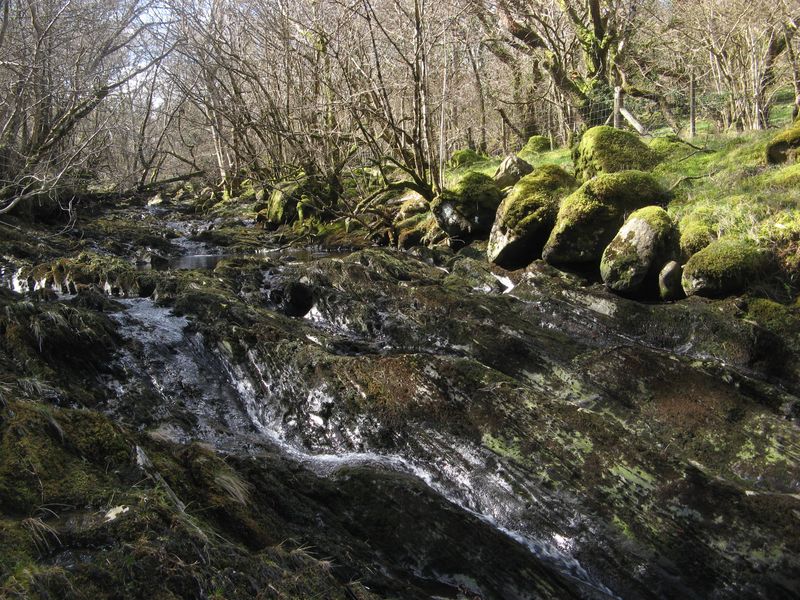
Coed Dolgarrog is a picturesque woodland located in Caernarfonshire, Wales. With its idyllic surroundings and rich biodiversity, it is a popular destination for nature enthusiasts and hikers alike. The name "Coed Dolgarrog" translates to "Wood, Forest" in English, which aptly describes its dense cover of trees and vegetation.

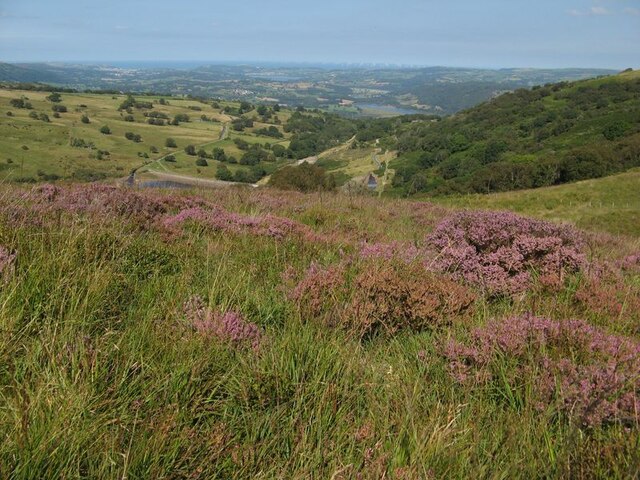
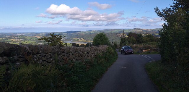
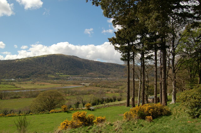
The woodland is situated in the Snowdonia National Park, a renowned protected area known for its stunning landscapes and diverse wildlife. Coed Dolgarrog spans over an area of approximately 500 hectares, encompassing a variety of habitats such as ancient woodlands, wetlands, and upland areas. This diversity supports a wide range of flora and fauna, making it a haven for botanists and ornithologists.

Visitors to Coed Dolgarrog can explore its numerous walking trails that wind through the woodland, offering breathtaking views of the surrounding mountains and valleys. The trails vary in difficulty, catering to both casual strollers and seasoned hikers. Along the way, one can encounter various species of trees including oak, beech, and birch, as well as a vibrant array of wildflowers during the spring and summer months.

Wildlife enthusiasts will be delighted by the chance to spot some of the woodland's inhabitants, which include red squirrels, badgers, and a wide variety of bird species such as buzzards, woodpeckers, and warblers. The woodland also provides a vital habitat for endangered species like the lesser horseshoe bat and the pine marten.

Coed Dolgarrog offers a tranquil escape into nature, providing a perfect setting for outdoor activities, wildlife observation, or simply enjoying the beauty of the Welsh countryside.

If you have any feedback on the listing, please let us know in the comments section below.

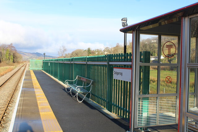
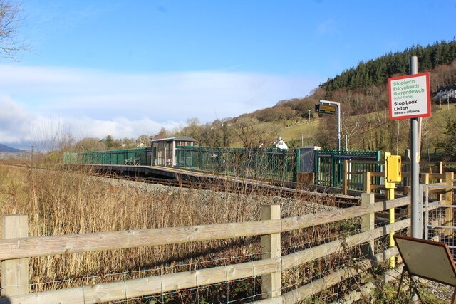
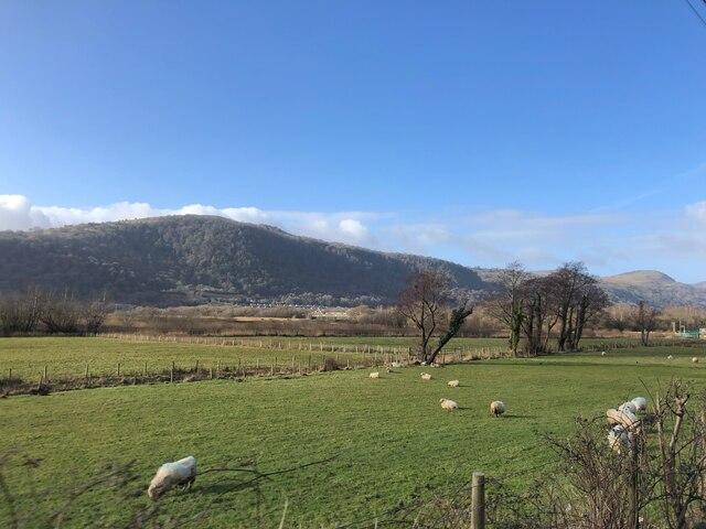
Coed Dolgarrog Images

Images are sourced within 2km of 53.182462/-3.8437226 or Grid Reference SH7666. Thanks to Geograph Open Source API. All images are credited.

Rowan berries Brightly-coloured berries remind us that the summer is slipping away.
Rowan berries
Brightly-coloured berries remind us that the summer is slipping away.
Heathery pasture Rough pasture high above the Afon Porth-llwyd and Coedty Reservoir, with a distant view of the Conwy valley. I do not often visit such locations in summer, so the scene is unusually green. Wind turbines are also just visible, far offshore.
Heathery pasture
Rough pasture high above the Afon Porth-llwyd and Coedty Reservoir, with a distant view of the Conwy valley. I do not often visit such locations in summer, so the scene is unusually green. Wind turbines are also just visible, far offshore.
Enigmatic structure A ruined building lies near to the upper water level of the Coedty Reservoir. It appears to be shown on old maps and pre-dates the reservoir but is not named, though it was approached by a track from the now-vanished dwelling named Coed-ty-bach which was adjacent to the tramway. Particularly strange are the large, polished flagstones on the north side of the walls.
Enigmatic structure
A ruined building lies near to the upper water level of the Coedty Reservoir. It appears to be shown on old maps and pre-dates the reservoir but is not named, though it was approached by a track from the now-vanished dwelling named Coed-ty-bach which was adjacent to the tramway. Particularly strange are the large, polished flagstones on the north side of the walls.
Glacial erratic boulder A large glacial erratic boulder lying on the shore of Coedty Reservoir. Low water level permitted an approach to this large boulder, which is regularly submerged when water is more plentiful. There are others, further out, which indicate that the water is not very deep over much of the extent of the reservoir. The dam with its tipping gates is well displayed.
Glacial erratic boulder
A large glacial erratic boulder lying on the shore of Coedty Reservoir. Low water level permitted an approach to this large boulder, which is regularly submerged when water is more plentiful. There are others, further out, which indicate that the water is not very deep over much of the extent of the reservoir. The dam with its tipping gates is well displayed.
Single track road near Rowlyn Isa We were held up here by a van in a ditch so took the opportunity to take the above photograph.
Single track road near Rowlyn Isa
We were held up here by a van in a ditch so took the opportunity to take the above photograph.
View from Plas Maenan over the Afon Conwy A view from the terrace of the Plas Maenan Hotel towards Dolgarrog.  The bridge over the Afon (River) Conwy is in the centre of the picture.  This bridge once carried a railway branch from Dolgarrog Station to the aluminium works.  The rail tracks were removed in the 1960's and the bridge now carries water mains and a currently closed footpath.
View from Plas Maenan over the Afon Conwy
A view from the terrace of the Plas Maenan Hotel towards Dolgarrog. The bridge over the Afon (River) Conwy is in the centre of the picture. This bridge once carried a railway branch from Dolgarrog Station to the aluminium works. The rail tracks were removed in the 1960's and the bridge now carries water mains and a currently closed footpath.
Rusty rails to Llandudno Junction As seen from Dolgarrog station.
The reason?
No regular trains have passed by since before 8 January. Flooding etc has caused yet another issue for this scenic railway line to Blaenau Ffestiniog to close on numerous occasions. <a href="https://www.geograph.org.uk/photo/7085730">SH7866 : Information board at Dolgarrog station</a>
Viewed from the apparent safety of the footpath crossing.
Rusty rails to Llandudno Junction
As seen from Dolgarrog station. The reason? No regular trains have passed by since before 8 January. Flooding etc has caused yet another issue for this scenic railway line to Blaenau Ffestiniog to close on numerous occasions. SH7866 : Information board at Dolgarrog station Viewed from the apparent safety of the footpath crossing.
Former track area to the aluminium factory Seen to the left of the existing track.
In 1916 a short branch line was opened from the Conwy Valley railway, east of the river. It made a sharp turn through almost 180 degrees to cross the river and run along the valley to the factory. From the entrance gate, sidings fanned out into seven areas of the factory.
- History points <span class="nowrap"><a title="https://historypoints.org/index.php?page=the-dolgarrog-railway)" rel="nofollow ugc noopener" href="https://historypoints.org/index.php?page=the-dolgarrog-railway)">Link</a><img style="margin-left:2px;" alt="External link" title="External link - shift click to open in new window" src="https://s1.geograph.org.uk/img/external.png" width="10" height="10"/></span>
It was here the railway joined the line to Llandudno Junction.
Former track area to the aluminium factory
Seen to the left of the existing track. In 1916 a short branch line was opened from the Conwy Valley railway, east of the river. It made a sharp turn through almost 180 degrees to cross the river and run along the valley to the factory. From the entrance gate, sidings fanned out into seven areas of the factory. - History points LinkExternal link It was here the railway joined the line to Llandudno Junction.
Information board at Dolgarrog station Deals with Covid rules and the announcement of a replacement bus service.
The Conwy Valley Line which runs between Blaenau Ffestiniog and Llandudno did not reopen on 28 January as expected, and a bus replacement service will operate until further notice.

The line, which runs from Blaenau Ffestiniog to Llandudno, had closed again on Tuesday, 19 January following flood damage caused by Storm Christoph. This is coupled with staff shortages.
Information board at Dolgarrog station
Deals with Covid rules and the announcement of a replacement bus service. The Conwy Valley Line which runs between Blaenau Ffestiniog and Llandudno did not reopen on 28 January as expected, and a bus replacement service will operate until further notice. The line, which runs from Blaenau Ffestiniog to Llandudno, had closed again on Tuesday, 19 January following flood damage caused by Storm Christoph. This is coupled with staff shortages.
Shelter and seat at Dolgarrog station
Dolgarrog station viewed from the footpath The footpath is signed as 'closed'. The reason being about 200 metres behind the photographer is a bridge <a href="https://www.geograph.org.uk/photo/3744648">SH7866 : Dolgarrog bridge viewed south westwards</a> across the river which is closed for safety reasons.
Moves are in hand to have the bridge repaired. In theory this must be the only village which has a station but it cannot be reached unless a long circuitous route is taken by road.
Equally it is a station without a village.
Dolgarrog station viewed from the footpath
The footpath is signed as 'closed'. The reason being about 200 metres behind the photographer is a bridge SH7866 : Dolgarrog bridge viewed south westwards across the river which is closed for safety reasons. Moves are in hand to have the bridge repaired. In theory this must be the only village which has a station but it cannot be reached unless a long circuitous route is taken by road. Equally it is a station without a village.
Rough ground beside footpath from Dolgarrog station It was in this area a short branch line was opened from the Conwy Valley railway, east of the river. It made a sharp turn through almost 180 degrees to cross the river and run along the valley to the aluminium works factory. From the entrance gate, sidings fanned out into seven areas of the factory.
There are no visible signs of the old railway it having been lifted in 1965.
Rough ground beside footpath from Dolgarrog station
It was in this area a short branch line was opened from the Conwy Valley railway, east of the river. It made a sharp turn through almost 180 degrees to cross the river and run along the valley to the aluminium works factory. From the entrance gate, sidings fanned out into seven areas of the factory. There are no visible signs of the old railway it having been lifted in 1965.
Footpath to Dolgarrog station Currently closed as the bridge <a href="https://www.geograph.org.uk/photo/3744648">SH7866 : Dolgarrog bridge viewed south westwards</a> about 200 metres behind the photographer is closed for safety reasons.
The path does however lead to the Afon Conwy. A popular spot for dog walkers.
Footpath to Dolgarrog station
Currently closed as the bridge SH7866 : Dolgarrog bridge viewed south westwards about 200 metres behind the photographer is closed for safety reasons. The path does however lead to the Afon Conwy. A popular spot for dog walkers.
View to Dolgarrog from the A470 At the centre of the photo is Dolgarrog Bridge which used to carry a branch line from the Aluminium works across the Afon Conwy to join with the Conwy Valley line. The line closed and the railway dismantled, it now carries two large water pipes and a footpath.
View to Dolgarrog from the A470
At the centre of the photo is Dolgarrog Bridge which used to carry a branch line from the Aluminium works across the Afon Conwy to join with the Conwy Valley line. The line closed and the railway dismantled, it now carries two large water pipes and a footpath.
Conwy Valley A wide, flat valley, prone to flooding. The fence across the middle of the photo shows the path of the Llandudno to Blaenau Ffestiniog railway line which has had to close several times in the last few years due to damage caused by flooding.
Conwy Valley
A wide, flat valley, prone to flooding. The fence across the middle of the photo shows the path of the Llandudno to Blaenau Ffestiniog railway line which has had to close several times in the last few years due to damage caused by flooding.
Peaceful cows Cows with their young calves are enjoying the spring sunshine on the rough meadows adjacent to the railway and A470 by Dolgarrog Station. Compare with a previous view during preparation for railway works: <a href="https://www.geograph.org.uk/photo/6533287">SH7866 : Access to the railway</a>.
Peaceful cows
Cows with their young calves are enjoying the spring sunshine on the rough meadows adjacent to the railway and A470 by Dolgarrog Station. Compare with a previous view during preparation for railway works: SH7866 : Access to the railway.
Dolgarrog bridge A view from the riverside at a low state of tide.
Dolgarrog bridge
A view from the riverside at a low state of tide.
Afon Conwy A view of the river at a low tide level with reeds and mudbanks.
Afon Conwy
A view of the river at a low tide level with reeds and mudbanks.
Show me another place!

Coed Dolgarrog is located at Grid Ref: SH7666 (Lat: 53.182462, Lng: -3.8437226)

Unitary Authority: Conwy

Police Authority: North Wales

What 3 Words

///outwit.atlas.refuses. Near Llanrwst, Conwy

Nearby Locations

Coed Dolgarrog

Related Wikis

Eigiau Tramway

The Eigiau Tramway might refer to the Eigiau Quarry Tramway or to the Eigiau Reservoir Tramway. == Eigiau Quarry Tramway == The Eigiau Quarry Tramway was...

Coed Dolgarrog National Nature Reserve

Coed Dolgarrog National Nature Reserve is a nature reserve which covers the steep western side of the Conwy Valley, outside the village of Dolgarrog, around...

Cedryn Quarry Tramway

The Cedryn Quarry Tramway (later largely used as the route of the Eigiau Tramway) was an industrial narrow gauge railway that connected the slate quarries...

Nod Glas Formation

The Nod Glas Formation (also known as the Nod Glas Black Shale, the Cadnant Shale, the Penarwel Mudstones or just Nod Glas) is an Ordovician lithostratigraphic...

Nearby Amenities

Located within 500m of 53.182462,-3.8437226
Power: pole
Lat/Long: 53.1832241/-3.8370997
Power: pole
Lat/Long: 53.1828678/-3.8379418
Pub
Lat/Long: 53.1807663/-3.8371019
Power: substation
Lat/Long: 53.18568/-3.841103
Post Box
Collection Times: Mo-Fr 09:00; Sa 07:00
Operator: Royal Mail
Post Box Mounting: pier
Post Box Type: lamp
Ref: LL32 37D
Royal Cypher: EIIR
Royal Cypher Wikidata: Q33102113
Lat/Long: 53.1851838/-3.8408207
Direction: WSW
Generator Method: photovoltaic
Generator Output Electricity: yes
Generator Solar Modules: 8
Generator Source: solar
Generator Type: solar_photovoltaic_panel
Location: roof
Power: generator
Lat/Long: 53.1840012/-3.8402259
Direction: ESE
Generator Method: photovoltaic
Generator Output Electricity: yes
Generator Solar Modules: 8
Generator Source: solar
Generator Type: solar_photovoltaic_panel
Location: roof
Power: generator
Lat/Long: 53.1840229/-3.8401495
Direction: WSW
Generator Method: photovoltaic
Generator Output Electricity: yes
Generator Solar Modules: 7
Generator Source: solar
Generator Type: solar_photovoltaic_panel
Location: roof
Power: generator
Lat/Long: 53.1867569/-3.8418326
The data included in this document is from www.openstreetmap.org. The data is made available under ODbL.

Have you been to Coed Dolgarrog?

Leave your review of Coed Dolgarrog below (or comments, questions and feedback).