Coed Nant-uchaf
Wood, Forest in Caernarfonshire
Wales
Coed Nant-uchaf

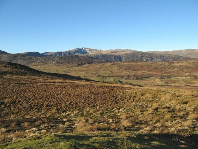
Coed Nant-uchaf is a picturesque woodland located in Caernarfonshire, Wales. With its lush greenery and diverse wildlife, it is a haven for nature lovers and outdoor enthusiasts. The woodland covers an area of approximately 500 acres and is nestled within the Snowdonia National Park, offering visitors stunning views of the surrounding mountains.
The woodland is predominantly made up of native Welsh tree species, including oak, birch, and rowan, which create a rich and vibrant ecosystem. The dense canopy provides a tranquil and shady environment, perfect for leisurely walks and hikes. There are well-maintained paths and trails throughout the woodland, allowing visitors to explore its hidden corners and discover its natural beauty.
Coed Nant-uchaf is home to a variety of wildlife, including red squirrels, otters, and numerous bird species. Birdwatchers can spot woodpeckers, buzzards, and even the elusive peregrine falcon. The woodland also boasts a diverse range of plant life, with carpets of bluebells and wildflowers adding bursts of color to the landscape during the spring and summer months.
Aside from its natural wonders, Coed Nant-uchaf also has historical significance. The area is scattered with remnants of old mining activities, providing a glimpse into its industrial past. Visitors can explore the ruins of old mine buildings and learn about the area's mining heritage.
Overall, Coed Nant-uchaf is a captivating woodland that offers a tranquil escape from the hustle and bustle of everyday life. Whether you are seeking a peaceful walk, wildlife spotting, or a glimpse into Wales' industrial history, this woodland is sure to delight visitors of all ages.
If you have any feedback on the listing, please let us know in the comments section below.
Coed Nant-uchaf Images
Images are sourced within 2km of 53.144823/-3.8539371 or Grid Reference SH7662. Thanks to Geograph Open Source API. All images are credited.


Coed Nant-uchaf is located at Grid Ref: SH7662 (Lat: 53.144823, Lng: -3.8539371)
Unitary Authority: Conwy
Police Authority: North Wales
What 3 Words
///acoustics.carrots.essential. Near Llanrwst, Conwy
Nearby Locations
Related Wikis
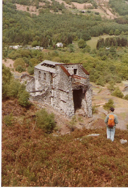
Klondyke mill
Klondyke Mill was an ore processing mill on the edge of the Gwydir Forest, near Trefriw, north Wales. Constructed in 1900, the mill was built to receive...

Cefn Cyfarwydd
Cefn Cyfarwydd is a ridge in Conwy county borough, north Wales. It is located above the village of Trefriw on the western side of the Conwy valley, and...

Llyn Geirionydd
Llyn Geirionydd lies in a valley in North Wales where the northern edge of the Gwydyr Forest meets the lower slopes of the Carneddau mountains. The lake...

River Geirionydd
The River Geirionydd (Afon Geirionydd in Welsh) is a river in Snowdonia, North Wales. It is a tributary of the River Crafnant (Afon Crafnant), which flows...
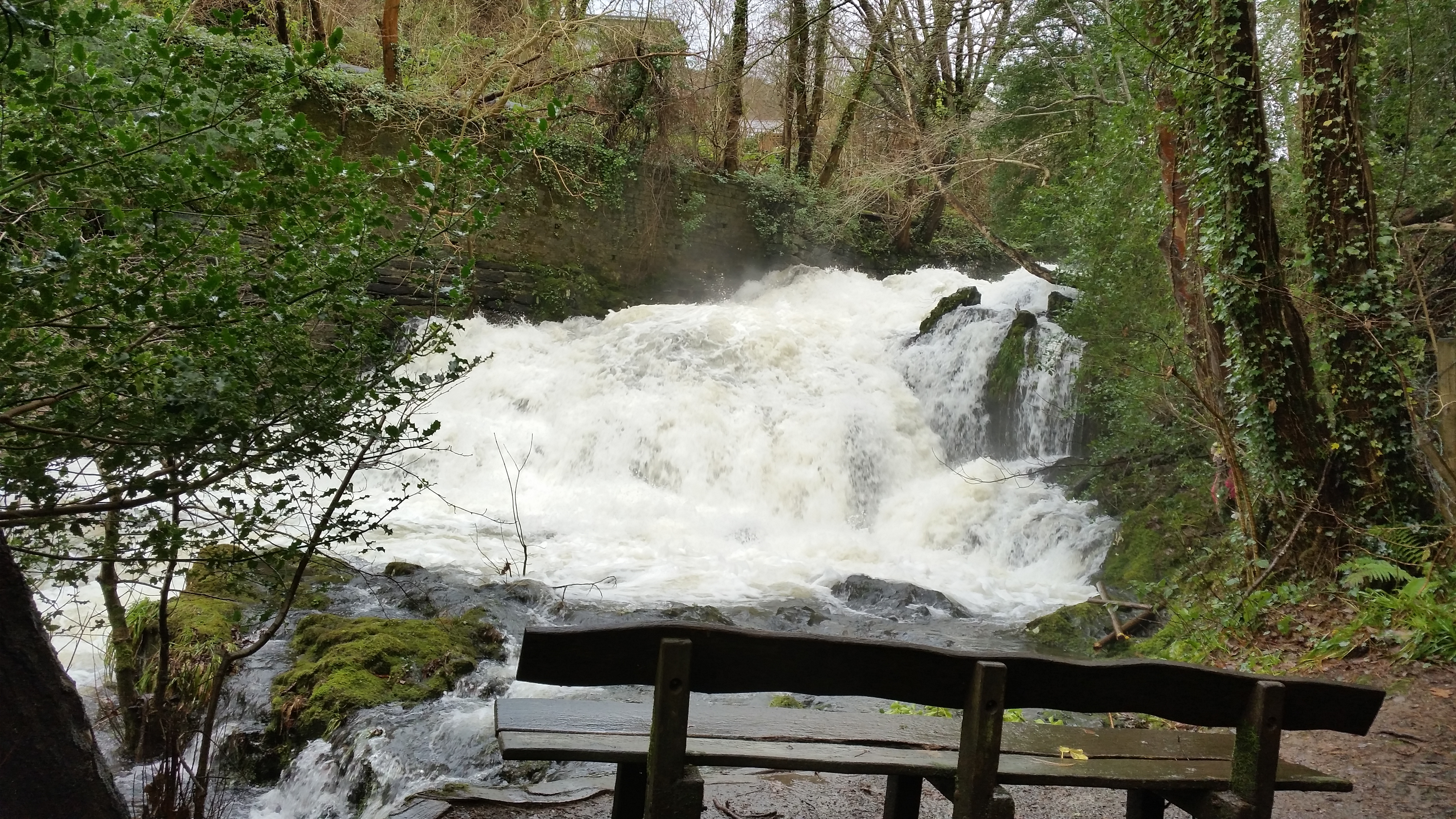
Fairy Falls, Trefriw
The Fairy Falls (Welsh: Rhaeadr y Tylwyth Teg) is a waterfall in the village of Trefriw, north Wales. The falls are on the river Crafnant which has its...
Afon Crafnant
The Afon Crafnant (English: River Crafnant) is a tributary of the River Conwy (Afon Conwy in Welsh), which is the main river of the Conwy valley in north...
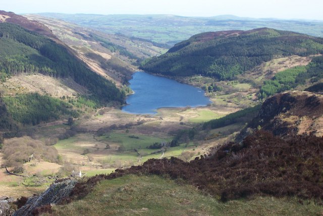
Llyn Crafnant
Llyn Crafnant is a lake that lies in a valley in Wales where the northern edge of the Gwydir Forest meets the lower slopes of the Carneddau mountains and...
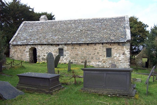
Llanrhychwyn
Llanrhychwyn is a hamlet in Conwy county borough, Wales. It lies in the Conwy valley, less than a mile south of Trefriw, and a mile north-west of Llanrwst...
Nearby Amenities
Located within 500m of 53.144823,-3.8539371Have you been to Coed Nant-uchaf?
Leave your review of Coed Nant-uchaf below (or comments, questions and feedback).