Coed Cae-cocyn

Wood, Forest in Merionethshire

Wales

Coed Cae-cocyn

Wall defining the south-west ridge of Rhobell Fawr The path down the south-west ridge of Rhobell Fawr follows this wall to Bwlch Goriwared.
Here on the lower slopes, the wall divides the hillside into the colourful heather on the eastern side and coarse grasses to the west. The Cadair ridge is in the background.
Wall defining the south-west ridge of Rhobell Fawr Credit: Vivien and Geoff Crowder

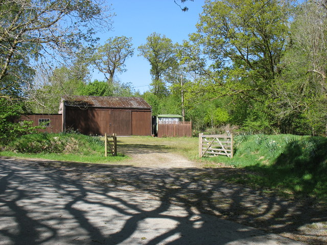
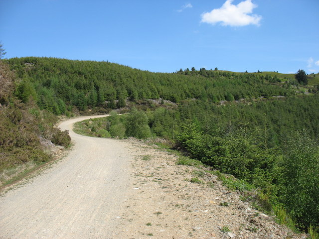
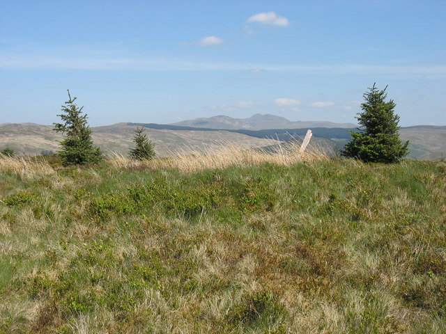
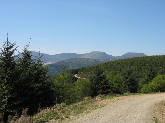
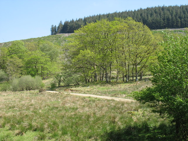
Coed Cae-cocyn, located in Merionethshire, is a picturesque woodland area known for its natural beauty and rich biodiversity. Covering an area of approximately 500 hectares, this ancient forest is a haven for nature enthusiasts and those seeking tranquility in a serene natural environment.

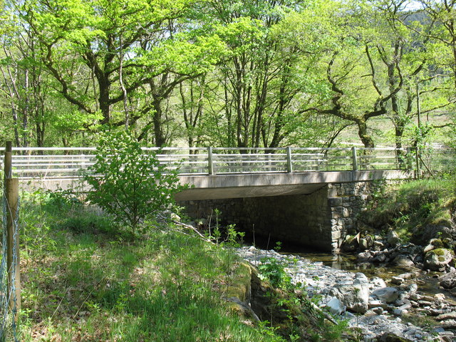
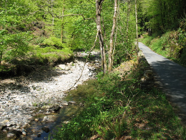
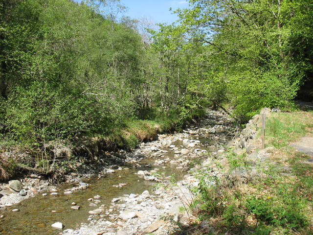
The woodland is predominantly composed of native broadleaf species, including oak, birch, and rowan trees, which create a dense and lush canopy. The forest floor is carpeted with a variety of wildflowers, such as bluebells and primroses, adding color and vibrancy to the landscape.

Coed Cae-cocyn is home to an array of wildlife, making it an important ecological site. Red squirrels can be spotted darting between the trees, while a diverse range of bird species, including woodpeckers and tawny owls, can be heard and seen throughout the forest. The area is also home to several mammals, including badgers, foxes, and deer.

Visitors to Coed Cae-cocyn can explore the forest via a network of well-maintained footpaths and trails, allowing them to immerse themselves in the natural surroundings. The woodland offers a peaceful retreat, ideal for walking, jogging, or simply enjoying a picnic amidst the tranquil setting.

Given its natural significance, Coed Cae-cocyn is also a designated Site of Special Scientific Interest (SSSI), ensuring its preservation and protection for generations to come. The forest is managed by local conservation organizations, which work tirelessly to maintain its ecological balance and promote sustainable practices.

Overall, Coed Cae-cocyn is a captivating woodland, offering a unique opportunity to connect with nature and experience the beauty of Merionethshire's natural landscapes.

If you have any feedback on the listing, please let us know in the comments section below.

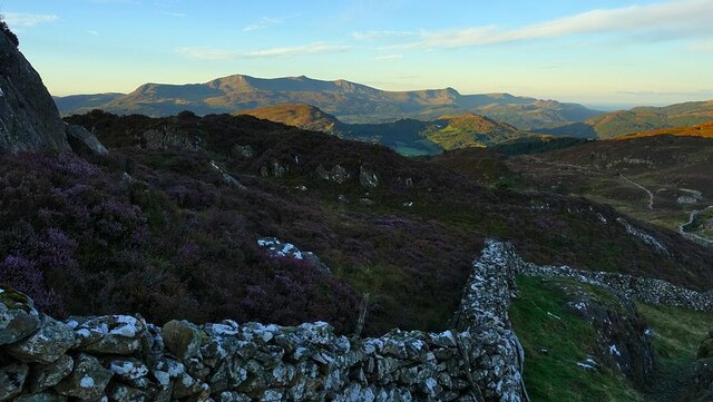
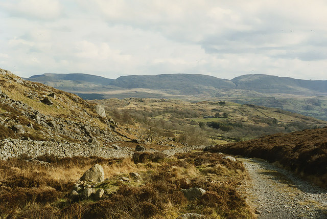
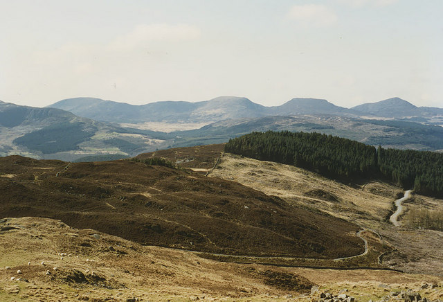
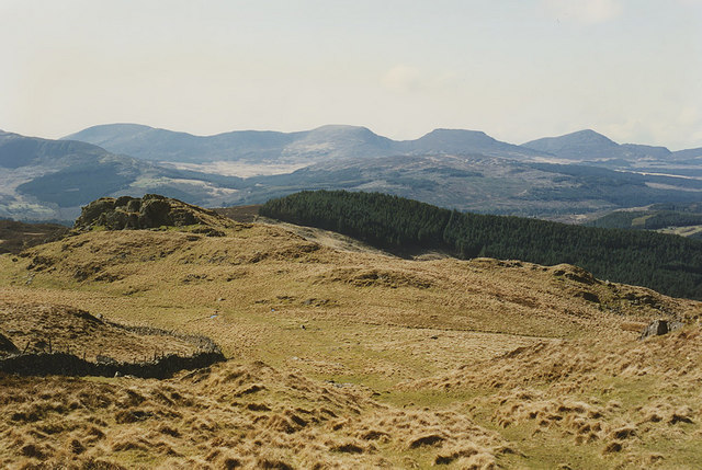
Coed Cae-cocyn Images

Images are sourced within 2km of 52.813936/-3.8487838 or Grid Reference SH7525. Thanks to Geograph Open Source API. All images are credited.

Wall defining the south-west ridge of Rhobell Fawr The path down the south-west ridge of Rhobell Fawr follows this wall to Bwlch Goriwared.
Here on the lower slopes, the wall divides the hillside into the colourful heather on the eastern side and coarse grasses to the west. The Cadair ridge is in the background.
Wall defining the south-west ridge of Rhobell Fawr
The path down the south-west ridge of Rhobell Fawr follows this wall to Bwlch Goriwared. Here on the lower slopes, the wall divides the hillside into the colourful heather on the eastern side and coarse grasses to the west. The Cadair ridge is in the background.
Southern approach to Bwlch Goriwared The old drove road climbs up to the pass. Waun Oer is the highest of the hills on the horizon.
Southern approach to Bwlch Goriwared
The old drove road climbs up to the pass. Waun Oer is the highest of the hills on the horizon.
The north side of Bwlch Goriwared A mixture of heather-covered hillside and better grazing, through which the old drove road to Bwlch Goriwared climbs.
The north side of Bwlch Goriwared
A mixture of heather-covered hillside and better grazing, through which the old drove road to Bwlch Goriwared climbs.
View west from near Ffynnon Shôn Looking down the lower part of the long western approach to Rhobell Fawr in the direction of Bwlch Goriwared. The distinctive rocky knoll on the left can be seen from below in <a href="https://www.geograph.org.uk/photo/671999">SH7624 : Hillside east of Bwlch Goriwared</a>. The Rhinogydd form the horizon.
View west from near Ffynnon Shôn
Looking down the lower part of the long western approach to Rhobell Fawr in the direction of Bwlch Goriwared. The distinctive rocky knoll on the left can be seen from below in SH7624 : Hillside east of Bwlch Goriwared. The Rhinogydd form the horizon.
Near Dolfrwynog
Near Dolfrwynog
A track in the Coed-y-Brenin forest The approach to climb Moel Hafodowen.
A track in the Coed-y-Brenin forest
The approach to climb Moel Hafodowen.
Information board in the Coed-y-Brenin forest This information board and the one adjacent to it (shown in <a href="https://www.geograph.org.uk/photo/2471360">SH7526 : Information board in the Coed-y-Brenin forest</a>) seem particularly ambitious, but I wonder how many people ever see them.
Information board in the Coed-y-Brenin forest
This information board and the one adjacent to it (shown in SH7526 : Information board in the Coed-y-Brenin forest) seem particularly ambitious, but I wonder how many people ever see them.
Information board in the Coed-y-Brenin forest This information board and the one adjacent to it (shown in <a href="https://www.geograph.org.uk/photo/2471351">SH7526 : Information board in the Coed-y-Brenin forest</a>) seem particularly ambitious, but I wonder how many people ever see them.
Information board in the Coed-y-Brenin forest
This information board and the one adjacent to it (shown in SH7526 : Information board in the Coed-y-Brenin forest) seem particularly ambitious, but I wonder how many people ever see them.
The summit of Moel Hafodowen
A track in the Coed-y-Brenin forest The Rhinogs (rough walking indeed!) make a pleasing backdrop to this photo.
A track in the Coed-y-Brenin forest
The Rhinogs (rough walking indeed!) make a pleasing backdrop to this photo.
Waiting for the post! The sight of this postbox made me wonder if I had been transported from Wales to Bavaria! (However I have subsequently learnt that this particular postbox is Swedish.)
Waiting for the post!
The sight of this postbox made me wonder if I had been transported from Wales to Bavaria! (However I have subsequently learnt that this particular postbox is Swedish.)
Coed Cae-cocyn from Dolydd
Road bridge over Afon Wen at Dolydd The road downstream along the east side of the Afon Wen, heading for Dolgellau, is one of many narrow lanes in this part of Wales
Road bridge over Afon Wen at Dolydd
The road downstream along the east side of the Afon Wen, heading for Dolgellau, is one of many narrow lanes in this part of Wales
The Afon Wen valley Rivers were pretty dry in the spring of 2011.
The Afon Wen valley
Rivers were pretty dry in the spring of 2011.
The Afon Wen Rivers in this part of Wales were pretty low in the spring of 2011.
The Afon Wen
Rivers in this part of Wales were pretty low in the spring of 2011.
View across to Cader Idris Range Glorious view of the full Cader Idris Range
View across to Cader Idris Range
Glorious view of the full Cader Idris Range
Coed-y-Brenin Forest A view of the Forestry commission land.
Coed-y-Brenin Forest
A view of the Forestry commission land.
Coed-y-Brenin Porphyry Cu-Mo Deposit - Phyllic Zone Porphyry copper deposits are of a major economic importance due to the high tonnage (but often low grades) of copper, molybdenum and gold. This deposit contains 200Mt of ore at 0.3% Cu with some Mo and Au. It would be economic only through opencasting, which I can't see happening any time soon!

A process that made PCDs economic was developed in the area, at Glasdir copper mine SE of here. <a href="https://www.geograph.org.uk/photo/3392787">SH7422 : Glasdir Copper Mine</a> <span class="nowrap"><a title="http://en.wikipedia.org/wiki/Bingham_Canyon_Mine" rel="nofollow ugc noopener" href="http://en.wikipedia.org/wiki/Bingham_Canyon_Mine">Link</a><img style="margin-left:2px;" alt="External link" title="External link - shift click to open in new window" src="https://s1.geograph.org.uk/img/external.png" width="10" height="10"/></span>

Hydrothermal and magmatic fluids circulate to create alteration zones. The ore is usually hosted in the outer edge of the stock. 

Potassic zone, usually an igneous stock (volcanic magma chamber). 
Can be rich in secondary orthoclase, quartz, biotite and chlorite/sericite. 

Phyllic zone, altered host rocks. In this case volcanics and sediments.
Pyrite-rich (10-15%), quartz, sericite, chlorite and illite. 

+/- Argillic zone. Varies in size, clay alteration. 

Propylitic zone, always present. Lightly altered with pyrite, chlorite, quartz, carbonates and epidote. 

This shows the phyllic zone. The pyrite has oxidised to produce the red stained colour.
Coed-y-Brenin Porphyry Cu-Mo Deposit - Phyllic Zone
Porphyry copper deposits are of a major economic importance due to the high tonnage (but often low grades) of copper, molybdenum and gold. This deposit contains 200Mt of ore at 0.3% Cu with some Mo and Au. It would be economic only through opencasting, which I can't see happening any time soon! A process that made PCDs economic was developed in the area, at Glasdir copper mine SE of here. SH7422 : Glasdir Copper Mine LinkExternal link Hydrothermal and magmatic fluids circulate to create alteration zones. The ore is usually hosted in the outer edge of the stock. Potassic zone, usually an igneous stock (volcanic magma chamber). Can be rich in secondary orthoclase, quartz, biotite and chlorite/sericite. Phyllic zone, altered host rocks. In this case volcanics and sediments. Pyrite-rich (10-15%), quartz, sericite, chlorite and illite. +/- Argillic zone. Varies in size, clay alteration. Propylitic zone, always present. Lightly altered with pyrite, chlorite, quartz, carbonates and epidote. This shows the phyllic zone. The pyrite has oxidised to produce the red stained colour.
Show me another place!

Coed Cae-cocyn is located at Grid Ref: SH7525 (Lat: 52.813936, Lng: -3.8487838)

Unitary Authority: Gwynedd

Police Authority: North Wales

What 3 Words

///overjoyed.buckling.spines. Near Bronaber, Gwynedd

Related Wikis

Merionethshire

Until 1974, Merionethshire or Merioneth (Welsh: Meirionnydd or Sir Feirionnydd) was an administrative county in the north-west of Wales, later classed...

Pistyll Cain

Pistyll Cain, also written as Pistill Cain and Pistill Y Caen, is a renowned waterfall in Meirionnydd (Sir Feirionnydd) in north Wales. It lies north-east...

Ganllwyd

Ganllwyd is a small village and community in southern Gwynedd, Wales. It lies in the Snowdonia National Park to the north of Dolgellau. A470 passes through...

Dolmelynllyn Estate

Dolmelynllyn Estate is an area of farmland, woodland and parkland near the village of Ganllwyd in southern Gwynedd, Wales. It is owned by the National...

Related Videos

Hiking to forest bothey , Love it here as it’s miles from civilisation.

Hiking to forest bothey , Love it here as it's miles from civilisation. Plenty of space if you turn up & there are other people staying.

The Precipice Walk - with Bob, Alan & Bill

March 25th 2019. We are heading to Talsarnau for our what is now and annual few days away in North Wales. Last evening we ...

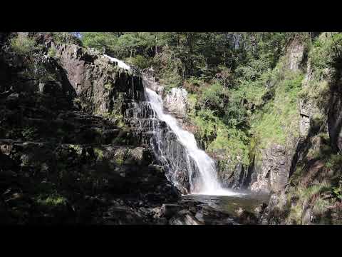
Pistyll Cain Waterfall at Coed y Brenin Forest Park

After a very exhausting and scenic walk at Coed y Brenin we can to the very beautiful Pistyll Cain Waterfall.

Nearby Amenities

Located within 500m of 52.813936,-3.8487838
Ford: yes
Lat/Long: 52.8134766/-3.8413892
Power: pole
Lat/Long: 52.8130109/-3.8560121
Power: pole
Lat/Long: 52.8182224/-3.8478291
Power: pole
Lat/Long: 52.8179566/-3.8488671
Power: pole
Lat/Long: 52.8177111/-3.8526471
Power: pole
Lat/Long: 52.8175372/-3.8504245
Direction: 165
Generator Method: photovoltaic
Generator Output Electricity: yes
Generator Solar Modules: 2
Generator Source: solar
Generator Type: solar_photovoltaic_panel
Location: roof
Power: generator
Lat/Long: 52.8129793/-3.8547635
Direction: 165
Generator Method: photovoltaic
Generator Output Electricity: yes
Generator Solar Modules: 6
Generator Source: solar
Generator Type: solar_photovoltaic_panel
Location: roof
Power: generator
Lat/Long: 52.8129712/-3.8548064
Direction: 165
Generator Method: photovoltaic
Generator Output Electricity: yes
Generator Solar Modules: 6
Generator Source: solar
Generator Type: solar_photovoltaic_panel
Location: roof
Power: generator
Lat/Long: 52.8129606/-3.8548654
Direction: 165
Generator Method: photovoltaic
Generator Output Electricity: yes
Generator Solar Modules: 6
Generator Source: solar
Generator Type: solar_photovoltaic_panel
Location: roof
Power: generator
Lat/Long: 52.8129497/-3.8549191
Direction: 185
Generator Method: photovoltaic
Generator Output Electricity: yes
Generator Solar Modules: 16
Generator Source: solar
Generator Type: solar_photovoltaic_panel
Location: roof
Power: generator
Lat/Long: 52.8159605/-3.8439006
Crossing
Lat/Long: 52.8110837/-3.8529435
The data included in this document is from www.openstreetmap.org. The data is made available under ODbL.

Have you been to Coed Cae-cocyn?

Leave your review of Coed Cae-cocyn below (or comments, questions and feedback).