Allt Cwar-mawr

Wood, Forest in Carmarthenshire

Wales

Allt Cwar-mawr

Heol ger Llwynmeredydd / A road near Llwynmeredydd Heol fach ger Ffarm Llwynmeredydd.

A minor road near Llwynmeredydd Farm (trans. Meredydd's grove).
Heol ger Llwynmeredydd / A road near Llwynmeredydd Credit: Alan Richards

Allt Cwar-mawr is a woodland area located in Carmarthenshire, Wales. Covering an expansive area, it is known for its lush greenery and diverse range of flora and fauna. The woodland is situated within the Brechfa Forest, adding to its natural beauty and charm.

The woodland is home to a variety of tree species, including oak, beech, and birch, which create a vibrant and picturesque landscape throughout the year. The dense canopy provides a sheltered habitat for numerous woodland creatures, such as squirrels, badgers, and a rich variety of bird species, including woodpeckers and owls.

Allt Cwar-mawr is a popular destination for nature lovers and outdoor enthusiasts alike. The woodland offers a network of well-maintained walking trails, allowing visitors to explore the area and immerse themselves in its natural wonders. These trails are suitable for all levels of fitness, catering to both casual strollers and avid hikers.

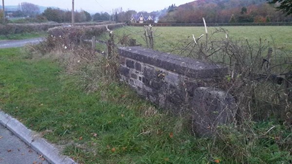
The woodland also boasts a rich history, with remnants of ancient settlements and archaeological sites scattered throughout. These historical features add an additional layer of intrigue and fascination to the area, making it a perfect destination for those interested in both nature and history.

Allt Cwar-mawr, Carmarthenshire offers a serene and peaceful environment, away from the hustle and bustle of city life. Its breathtaking beauty and diverse ecosystem make it a must-visit destination for anyone seeking a tranquil escape and an opportunity to connect with nature.

If you have any feedback on the listing, please let us know in the comments section below.

Allt Cwar-mawr Images

Images are sourced within 2km of 51.962682/-3.8161474 or Grid Reference SN7530. Thanks to Geograph Open Source API. All images are credited.

Heol ger Llwynmeredydd / A road near Llwynmeredydd Heol fach ger Ffarm Llwynmeredydd.

A minor road near Llwynmeredydd Farm (trans. Meredydd's grove).
Heol ger Llwynmeredydd / A road near Llwynmeredydd
Heol fach ger Ffarm Llwynmeredydd. A minor road near Llwynmeredydd Farm (trans. Meredydd's grove).
Y Gaer, Castell Waunberllan A moated site near Myddfai.  Post Medieval. 

<span class="nowrap"><a title="https://coflein.gov.uk/en/site/304633?term=Myddfai&pg=3" rel="nofollow ugc noopener" href="https://coflein.gov.uk/en/site/304633?term=Myddfai&pg=3">Link</a><img style="margin-left:2px;" alt="External link" title="External link - shift click to open in new window" src="https://s1.geograph.org.uk/img/external.png" width="10" height="10"/></span>
Y Gaer, Castell Waunberllan
A moated site near Myddfai. Post Medieval. LinkExternal link
Footpath up to Nelson Cottage Footpath and track up to Nelson Cottage
Footpath up to Nelson Cottage
Footpath and track up to Nelson Cottage
Roadside quarry in Bran valley Visible just over a gate where an unmarked public right of way heads off towards Cilgwyn Wood.
Roadside quarry in Bran valley
Visible just over a gate where an unmarked public right of way heads off towards Cilgwyn Wood.
A4069 near Cwmgwyn Farm
Ordnance Survey Flush Bracket 908 This can be found on the wall of one of the private dwellings at Cilgwyn Manor Farm.
For more detail see : <span class="nowrap"><a title="http://www.bench-marks.org.uk/bm10023" rel="nofollow ugc noopener" href="http://www.bench-marks.org.uk/bm10023">Link</a><img style="margin-left:2px;" alt="External link" title="External link - shift click to open in new window" src="https://s1.geograph.org.uk/img/external.png" width="10" height="10"/></span>
Ordnance Survey Flush Bracket 908
This can be found on the wall of one of the private dwellings at Cilgwyn Manor Farm. For more detail see : LinkExternal link
Woodland setting for Cilgwyn Platform Triangulation Pillar Looking westward.
Woodland setting for Cilgwyn Platform Triangulation Pillar
Looking westward.
Ordnance Survey Flush Bracket 909 This can be found on the parapet of Pont-Pwll-defaid.
For more detail see : <span class="nowrap"><a title="http://www.bench-marks.org.uk/bm10024" rel="nofollow ugc noopener" href="http://www.bench-marks.org.uk/bm10024">Link</a><img style="margin-left:2px;" alt="External link" title="External link - shift click to open in new window" src="https://s1.geograph.org.uk/img/external.png" width="10" height="10"/></span>
Ordnance Survey Flush Bracket 909
This can be found on the parapet of Pont-Pwll-defaid. For more detail see : LinkExternal link
Ordnance Survey Flush Bracket 911 This can be found on the wall of a cottage - a private dwelling - at Ynys-wen.
For more detail see : <span class="nowrap"><a title="http://www.bench-marks.org.uk/bm10026" rel="nofollow ugc noopener" href="http://www.bench-marks.org.uk/bm10026">Link</a><img style="margin-left:2px;" alt="External link" title="External link - shift click to open in new window" src="https://s1.geograph.org.uk/img/external.png" width="10" height="10"/></span>
Ordnance Survey Flush Bracket 911
This can be found on the wall of a cottage - a private dwelling - at Ynys-wen. For more detail see : LinkExternal link
Ger Penrock / Near Penrock Cerddwyr newydd adael yr A4069 ac yn mynd i gyfeiriad Penrock.

Walkers having just left the A4069 and heading in the direction of Penrock.
Ger Penrock / Near Penrock
Cerddwyr newydd adael yr A4069 ac yn mynd i gyfeiriad Penrock. Walkers having just left the A4069 and heading in the direction of Penrock.
Ger Penrock / Near Penrock Cerddwyr yn dilyn trac ger Penrock Cottage.

Walkers following  a track near Penrock Cottage.
Ger Penrock / Near Penrock
Cerddwyr yn dilyn trac ger Penrock Cottage. Walkers following a track near Penrock Cottage.
Old Boundary Marker near A4069 junction, Llandovery Parish Parish Boundary Marker by the UC road, in parish of Llandovery (Carmarthenshire District), immediately South of junction with A4069, beside bridge parapet.

Surveyed

Milestone Society National ID: CAM_DOV01pb
Old Boundary Marker near A4069 junction, Llandovery Parish
Parish Boundary Marker by the UC road, in parish of Llandovery (Carmarthenshire District), immediately South of junction with A4069, beside bridge parapet. Surveyed Milestone Society National ID: CAM_DOV01pb
Boundary Stone with OS Cut Mark The OS cut mark on the boundary stone marks a point 64.352m above mean sea level.
Boundary Stone with OS Cut Mark
The OS cut mark on the boundary stone marks a point 64.352m above mean sea level.
Ordnance Survey Rivet This OS rivet can be found on the steps in front of the Forestry Houses. It marks a point 83.292m above mean sea level.
Ordnance Survey Rivet
This OS rivet can be found on the steps in front of the Forestry Houses. It marks a point 83.292m above mean sea level.
Ordnance Survey Cut Mark This OS cut mark can be found on the milk stand at Caegwyn Farm. It marks a point 97.939m above mean sea level.
Ordnance Survey Cut Mark
This OS cut mark can be found on the milk stand at Caegwyn Farm. It marks a point 97.939m above mean sea level.
Capel Bethania
Capel Bethania
Remains of Water Tank
Ordnance Survey Flush Bracket (G2978) This OS Flush Bracket can be found on the house north side of the road. It marks a point 150.957m above mean sea level.
Ordnance Survey Flush Bracket (G2978)
This OS Flush Bracket can be found on the house north side of the road. It marks a point 150.957m above mean sea level.
Show me another place!

Allt Cwar-mawr is located at Grid Ref: SN7530 (Lat: 51.962682, Lng: -3.8161474)

Unitary Authority: Carmarthenshire

Police Authority: Dyfed Powys

What 3 Words

///laptops.chainsaw.bootleg. Near Llandovery, Carmarthenshire

Related Wikis

Llwynywermod

Llwynywermod (Welsh: Llwynywermwd; Welsh pronunciation: [ɬʊi̯n.ə.wɛr.mʊd]), also known as Llwynywormwood, is an estate owned by the Duchy of Cornwall,...

Afon Brân

The Afon Brân is a tributary of the River Towy (or Welsh Afon Tywi) in mid Wales. Its headwaters rise in Irfon Forest in the northeastern corner of Carmarthenshire...

Myddfai

Myddfai () is a small village and community in Carmarthenshire, Wales. It is situated south of Llandovery in the Brecon Beacons, and has a population...

St Michael's Church, Myddfai

St Michael's Church is the Anglican parish church for the parish of Myddfai, south of Llandovery, in Carmarthenshire, Wales. The present building dates...

Related Videos

Rainy morning in Wales - Countryside sounds

Calm rain and soft birdsong in the Welsh countryside. This spring season I wanted to record a local dawn chorus that was ...

Fording the Afon Clydach & Nant yr Hiddi Near Myddfai in Carmarthenshire

These two fords are located on an unmade road south of Myddfai in Carmarthenshire. The first is Afon Clydach and the second its ...

Myddfai - Ffordd Aber-triphlwyf (ORPA, E-W)

Route information: NGR Start: SN765288 NGR Finish: SN755280 USRN Road Number: 47203431 (U9006) & 47203442 (U9007) ...

Nearby Amenities

Located within 500m of 51.962682,-3.8161474
The data included in this document is from www.openstreetmap.org. The data is made available under ODbL.

Have you been to Allt Cwar-mawr?

Leave your review of Allt Cwar-mawr below (or comments, questions and feedback).