Coed-y-wigfa

Wood, Forest in Glamorgan

Wales

Coed-y-wigfa

Location Of Long Gone Farm Building You can just make out the wall lines in the long vegetation.
Location Of Long Gone Farm Building Credit: Adrian Dust

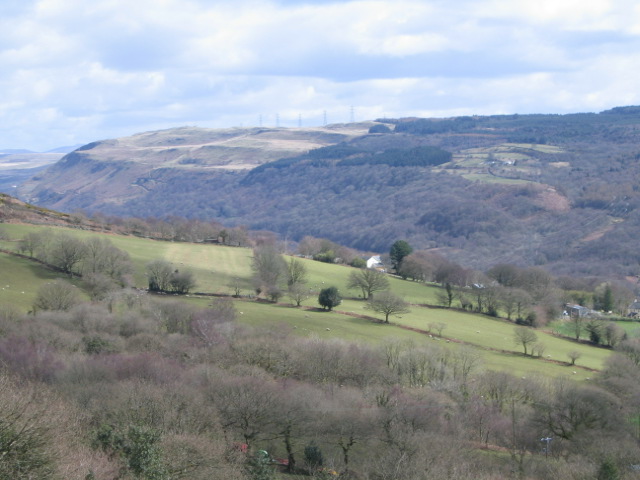
Coed-y-wigfa, located in Glamorgan, Wales, is a picturesque woodland area renowned for its natural beauty and rich biodiversity. Covering an area of approximately 100 acres, it is a popular destination for nature enthusiasts, hikers, and birdwatchers alike.

The woodland is characterized by a diverse range of flora and fauna, with a mix of deciduous and coniferous trees dotting the landscape. Oak, beech, and birch trees dominate the area, providing a lush and vibrant canopy throughout the year. The forest floor is adorned with a variety of wildflowers, ferns, and mosses, creating a stunning visual spectacle.

Coed-y-wigfa is home to an abundance of wildlife, with numerous bird species finding refuge in its dense vegetation. Visitors can spot common woodland birds such as robins, tits, and thrushes, as well as the occasional sighting of rarer species like woodpeckers and owls. The area is also known to support a thriving population of small mammals, including foxes, badgers, and squirrels.

Traversing through Coed-y-wigfa is made easy by a network of well-maintained footpaths and trails, allowing visitors to explore the woodland at their own pace. The tranquil atmosphere and peaceful surroundings make it an ideal spot for a leisurely stroll or a family picnic.

Coed-y-wigfa's idyllic location, combined with its natural splendor and abundant wildlife, make it a must-visit destination for anyone seeking a tranquil retreat in the heart of Glamorgan.

If you have any feedback on the listing, please let us know in the comments section below.

Coed-y-wigfa Images

Images are sourced within 2km of 51.725908/-3.8130107 or Grid Reference SN7404. Thanks to Geograph Open Source API. All images are credited.

Location Of Long Gone Farm Building You can just make out the wall lines in the long vegetation.
Location Of Long Gone Farm Building
You can just make out the wall lines in the long vegetation.
Reconstructed Culvert
Pontardawe farm produce shop Pontardawe farm produce shop, located in a shed and horse box. Selling local meat, eggs and milk.
Pontardawe farm produce shop
Pontardawe farm produce shop, located in a shed and horse box. Selling local meat, eggs and milk.
Cilybebyll Church Cilybebyll Church Saint John the Evangelist, Church Road, Cilybebyll. Formerly in West Glamorgan, now Neath Port Talbot.
Cilybebyll Church
Cilybebyll Church Saint John the Evangelist, Church Road, Cilybebyll. Formerly in West Glamorgan, now Neath Port Talbot.
Woodland track Mynydd Marchywel.
Woodland track
Mynydd Marchywel.
Rhos Ebenezer Chapel and monkey-puzzle tree at Rhos on the A474 between Neath and Pontardawe. Looking NNW.
Rhos
Ebenezer Chapel and monkey-puzzle tree at Rhos on the A474 between Neath and Pontardawe. Looking NNW.
Cilybebyll Church St John the Evangelist's church at Cilybebyll (the Roman "retreat of the tents").
Cilybebyll Church
St John the Evangelist's church at Cilybebyll (the Roman "retreat of the tents").
Signpost at Rhos, near Pontardawe No "roughly" here! The distance to Cilybebyll is one mile one and a quarter furlongs (2,035 yards) precisely...
Signpost at Rhos, near Pontardawe
No "roughly" here! The distance to Cilybebyll is one mile one and a quarter furlongs (2,035 yards) precisely...
View Across Tawe Valley To Gellinudd A typical view across a South Wales valley.  Steep slopes, meandering river, new road in the valley bottom, small farms, birch woodland, straggling village and coniferous planting and moorland on the plateau surface.
View Across Tawe Valley To Gellinudd
A typical view across a South Wales valley. Steep slopes, meandering river, new road in the valley bottom, small farms, birch woodland, straggling village and coniferous planting and moorland on the plateau surface.
How Green Was My Valley ? Looking across the Tawe Valley between Pontardawe and Ystalyfera.  The east side of the valley had numerous mines which have been hidden by the subsequent planting.  Tareni Gleision farm still survives in its clearing.  The electricity pylons march across the skyline of Varteg Hill.
How Green Was My Valley ?
Looking across the Tawe Valley between Pontardawe and Ystalyfera. The east side of the valley had numerous mines which have been hidden by the subsequent planting. Tareni Gleision farm still survives in its clearing. The electricity pylons march across the skyline of Varteg Hill.
Swing bridge  over canal. This is not marked on the ordnance survey map and is some kind of water drainage or control system harnessing water from stream.
Swing bridge over canal.
This is not marked on the ordnance survey map and is some kind of water drainage or control system harnessing water from stream.
Ynsmeudwy Bridge over canal
Weir This geograph is marked on the map as a weir but it is a disused lock with restored lock keeper's hut.
Weir
This geograph is marked on the map as a weir but it is a disused lock with restored lock keeper's hut.
Weir on Cwm Du river in Ynysmeudwy-Cilmaengwyn
Renewing Lamp-posts On The A4067 Exact location can be seen via the Hv electricity wires/pylons. Road was re-surfaced earlier in 2007.
Renewing Lamp-posts On The A4067
Exact location can be seen via the Hv electricity wires/pylons. Road was re-surfaced earlier in 2007.
Plas Farm - Converted Outbuildings Now Swansea Valley Holiday Cottages
Plas Farm - Converted Outbuildings
Now Swansea Valley Holiday Cottages
Ynysmeudwy / Cilmaengwyn roundabout At this roundabout the old Swansea Valley road, the B4603, meets the newer route of the A4067 between Pontardawe and Ystalyfera. Beyond the bridge over the Swansea Canal, ahead, lie Ynysmeudwy to the left and Cilmaengwyn to the right.
Ynysmeudwy / Cilmaengwyn roundabout
At this roundabout the old Swansea Valley road, the B4603, meets the newer route of the A4067 between Pontardawe and Ystalyfera. Beyond the bridge over the Swansea Canal, ahead, lie Ynysmeudwy to the left and Cilmaengwyn to the right.
The A4067 approaching Godre'r-graig
Show me another place!

Coed-y-wigfa is located at Grid Ref: SN7404 (Lat: 51.725908, Lng: -3.8130107)

Unitary Authority: Neath Port Talbot

Police Authority: South Wales

What 3 Words

///disprove.left.meal. Near Crynant, Neath Port Talbot

Related Wikis

Cilybebyll

Cilybebyll is both a village and a community in the Neath Port Talbot County Borough, Wales. It includes the villages of Alltwen, Fforest Gôch, Gellinudd...
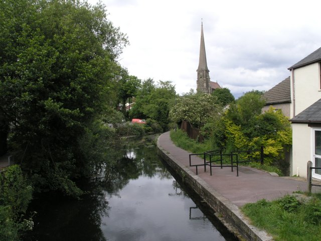
Swansea Canal

The Swansea Canal (Welsh: Camlas Abertawe) was a canal constructed by the Swansea Canal Navigation Company between 1794 and 1798, running for 16.5 miles...

Tarenni Colliery

The Tarenni Colliery (Welsh: Gloddfa Tarenni) and its associated workings, are a series of coal mines and pits located between the villages of Godre'r...

Pontardawe television relay station

The Pontardawe television relay station was originally built in 1974/1975 as a relay for UHF analogue television. It consists of a 45 m self-supporting...

Nearby Amenities

Located within 500m of 51.725908,-3.8130107
Cilybebyll
Place: hamlet
Source: npe
Lat/Long: 51.7269637/-3.8200024
Power: pole
Lat/Long: 51.7243665/-3.8196024
Power: pole
Lat/Long: 51.7258743/-3.8190566
Power: pole
Lat/Long: 51.726548/-3.8160083
Power: pole
Lat/Long: 51.7270481/-3.8137525
Power: pole
Lat/Long: 51.7282277/-3.8125509
Power: pole
Lat/Long: 51.7293009/-3.811411
The data included in this document is from www.openstreetmap.org. The data is made available under ODbL.

Have you been to Coed-y-wigfa?

Leave your review of Coed-y-wigfa below (or comments, questions and feedback).