Coed Maes-mawr

Wood, Forest in Caernarfonshire

Wales

Coed Maes-mawr

West shore footpath approaching Llyn Geirionydd The path leads north north east from Ty Newydd and is a little damp at first, but gets progressively higher and drier as it heads down the llyn.
West shore footpath approaching Llyn Geirionydd Credit: Andy Waddington

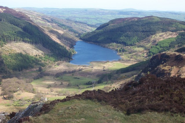
Coed Maes-mawr is a picturesque woodland located in Caernarfonshire, a historic county in northwest Wales. Covering an area of approximately 100 hectares, the woodland is nestled within the Snowdonia National Park, offering breathtaking views of the surrounding mountainous landscape.

The forest is primarily composed of native tree species, including oak, birch, rowan, and willow, creating a diverse and vibrant ecosystem. The dense canopy provides a haven for a variety of wildlife, including numerous bird species, mammals, and insects.

Visitors to Coed Maes-mawr can enjoy a range of recreational activities, such as hiking, birdwatching, and nature photography. There are well-maintained trails that meander through the woodland, allowing visitors to explore its natural beauty at their own pace. The tranquil atmosphere and peaceful ambiance make it an ideal spot for those seeking solitude and tranquility.

The woodland is also of historical and cultural significance, with evidence of human activity dating back centuries. Ruins of ancient settlements and burial sites can be found within the forest, offering a glimpse into the area's rich past.

Coed Maes-mawr is easily accessible, with nearby parking facilities and public transport links. It is a popular destination for both locals and tourists alike, offering a chance to connect with nature and immerse oneself in the stunning beauty of the Welsh countryside.

If you have any feedback on the listing, please let us know in the comments section below.

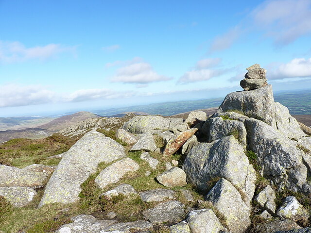
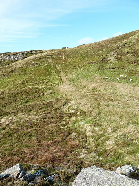
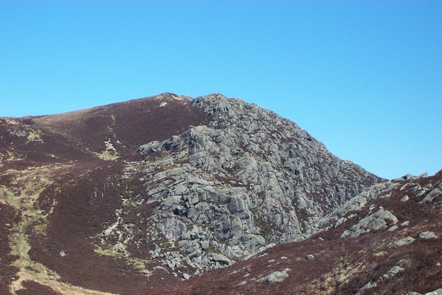
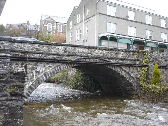
Coed Maes-mawr Images

Images are sourced within 2km of 53.123361/-3.8832472 or Grid Reference SH7460. Thanks to Geograph Open Source API. All images are credited.

West shore footpath approaching Llyn Geirionydd The path leads north north east from Ty Newydd and is a little damp at first, but gets progressively higher and drier as it heads down the llyn.
West shore footpath approaching Llyn Geirionydd
The path leads north north east from Ty Newydd and is a little damp at first, but gets progressively higher and drier as it heads down the llyn.
Hot dogs cooling off in Llyn Crafnant Access to a small beach enables dogs to become refreshed during their walk, and less muddy than in some of the spots they choose.
Hot dogs cooling off in Llyn Crafnant
Access to a small beach enables dogs to become refreshed during their walk, and less muddy than in some of the spots they choose.
Looking across boggy ground at the head of Llyn Crafnant
Bridleway towards Blaen-y-nant The bridleway climbs away from Blaen-y-nant to pass between Castell y Gywnt and Clogwyn Mannod on its way to Capel Curig, passing through the Cwn Glas Crafnant National Nature Reserve.
Bridleway towards Blaen-y-nant
The bridleway climbs away from Blaen-y-nant to pass between Castell y Gywnt and Clogwyn Mannod on its way to Capel Curig, passing through the Cwn Glas Crafnant National Nature Reserve.
A small pool on the northern ridge of Creigiau Gleision One of several such peaty pools in hollows on the ridge.
A small pool on the northern ridge of Creigiau Gleision
One of several such peaty pools in hollows on the ridge.
Summit cairn on Creigiau Gleision in 2023 The size & shape of the cairn seems to vary a little from year to year, as stones are added or rearranged by the few passing walkers that come up here. In the past it's been photographed as <a href="https://www.geograph.org.uk/photo/205473">SH7261 : Creigiau Gleision summit</a> in 2006 and <a href="https://www.geograph.org.uk/photo/2870545">SH7261 : Summit, Creigiau Gleision</a> in 2012.
Summit cairn on Creigiau Gleision in 2023
The size & shape of the cairn seems to vary a little from year to year, as stones are added or rearranged by the few passing walkers that come up here. In the past it's been photographed as SH7261 : Creigiau Gleision summit in 2006 and SH7261 : Summit, Creigiau Gleision in 2012.
Northwest from the summit of Creigiau Gleision Looking across the trench containing Llyn Cowlyd, too far below to be seen from this exact point, with the steep eastern face of Pen Llithrig y Wrach visible on the left and the northern Carneddau hills beyond.
Northwest from the summit of Creigiau Gleision
Looking across the trench containing Llyn Cowlyd, too far below to be seen from this exact point, with the steep eastern face of Pen Llithrig y Wrach visible on the left and the northern Carneddau hills beyond.
Creigiau Gleision from the south A view back towards the summit from the footpath crossing a flat peaty area.
Creigiau Gleision from the south
A view back towards the summit from the footpath crossing a flat peaty area.
View over Llethr Gwyn up to Ogwen Llethr Gwyn is the boggy moorland in the foreground, but the real interest here is a view to the bigger hills around Llyn Ogwen, where Gallt yr Ogof, the Glyderau, Tryfan and Mynydd Perfedd are seen about 3 or 4 miles to the west.
View over Llethr Gwyn up to Ogwen
Llethr Gwyn is the boggy moorland in the foreground, but the real interest here is a view to the bigger hills around Llyn Ogwen, where Gallt yr Ogof, the Glyderau, Tryfan and Mynydd Perfedd are seen about 3 or 4 miles to the west.
Towards Pen Llithrig y Wrach from Craiglwyn
Southwards from Craiglwyn A view over the moorlands to the south of the small hill Craiglwyn, with Craig Wen in <a href="https://www.geograph.org.uk/gridref/SH7260">SH7260</a> most prominent in the middle distance.
Southwards from Craiglwyn
A view over the moorlands to the south of the small hill Craiglwyn, with Craig Wen in SH7260 most prominent in the middle distance.
Boulders and grass on the summit of Craiglwyn The small pile of stones on the right marks the true summit, but there's little to choose between that and 2 or 3 other high spots.
Boulders and grass on the summit of Craiglwyn
The small pile of stones on the right marks the true summit, but there's little to choose between that and 2 or 3 other high spots.
Collapsed wall across a gully The line of rushes running lower-right to upper-left marks a ruined (post-medieval?) low wall that once ran across this gully, but has now pretty much sunk into the vegetation. It is recorded by Gwynedd Archaeological Trust at <span class="nowrap"><a title="https://coflein.gov.uk/en/site/534073/" rel="nofollow ugc noopener" href="https://coflein.gov.uk/en/site/534073/">Link</a><img style="margin-left:2px;" alt="External link" title="External link - shift click to open in new window" src="https://s1.geograph.org.uk/img/external.png" width="10" height="10"/></span> but little detail has been noted. It looks like the same feature which is visible in <a href="https://www.geograph.org.uk/photo/6660877">SH7260 : The col between Craig Wen and Moel Ddefaid</a>, also as a line of rushes and a change of vegetation colour, in the middle distance, above the heads of the two lead walkers.
Collapsed wall across a gully
The line of rushes running lower-right to upper-left marks a ruined (post-medieval?) low wall that once ran across this gully, but has now pretty much sunk into the vegetation. It is recorded by Gwynedd Archaeological Trust at LinkExternal link but little detail has been noted. It looks like the same feature which is visible in SH7260 : The col between Craig Wen and Moel Ddefaid, also as a line of rushes and a change of vegetation colour, in the middle distance, above the heads of the two lead walkers.
The crag below Craiglwyn There's probably some scrambling to be had here; whether it's ever been developed for proper climbing is less likely, although there may be some short routes to be had.
The crag below Craiglwyn
There's probably some scrambling to be had here; whether it's ever been developed for proper climbing is less likely, although there may be some short routes to be had.
View west towards Ogwen A fine view up the valley of the Afon Llugwy towards the hills around Llyn Ogwen
View west towards Ogwen
A fine view up the valley of the Afon Llugwy towards the hills around Llyn Ogwen
Craggy outcrop on the south side of Moel Ddefaid
Moorland on the west side of Craig Wen
Downhill from Craig Wen towards Crimpiau
Show me another place!

Coed Maes-mawr is located at Grid Ref: SH7460 (Lat: 53.123361, Lng: -3.8832472)

Unitary Authority: Conwy

Police Authority: North Wales

What 3 Words

///opera.blown.riddle. Near Llanrwst, Conwy

Nearby Locations

Coed Maes-mawr Coed y Fron

Related Wikis

Craiglwyn

Craiglwyn is a top of Creigiau Gleision in Snowdonia, Wales, near Capel Curig. It lies at the south end of the Creigiau Gleision ridge, and offers good...

Afon Crafnant

The Afon Crafnant (English: River Crafnant) is a tributary of the River Conwy (Afon Conwy in Welsh), which is the main river of the Conwy valley in north...

Llyn Crafnant

Llyn Crafnant is a lake that lies in a valley in Wales where the northern edge of the Gwydir Forest meets the lower slopes of the Carneddau mountains and...
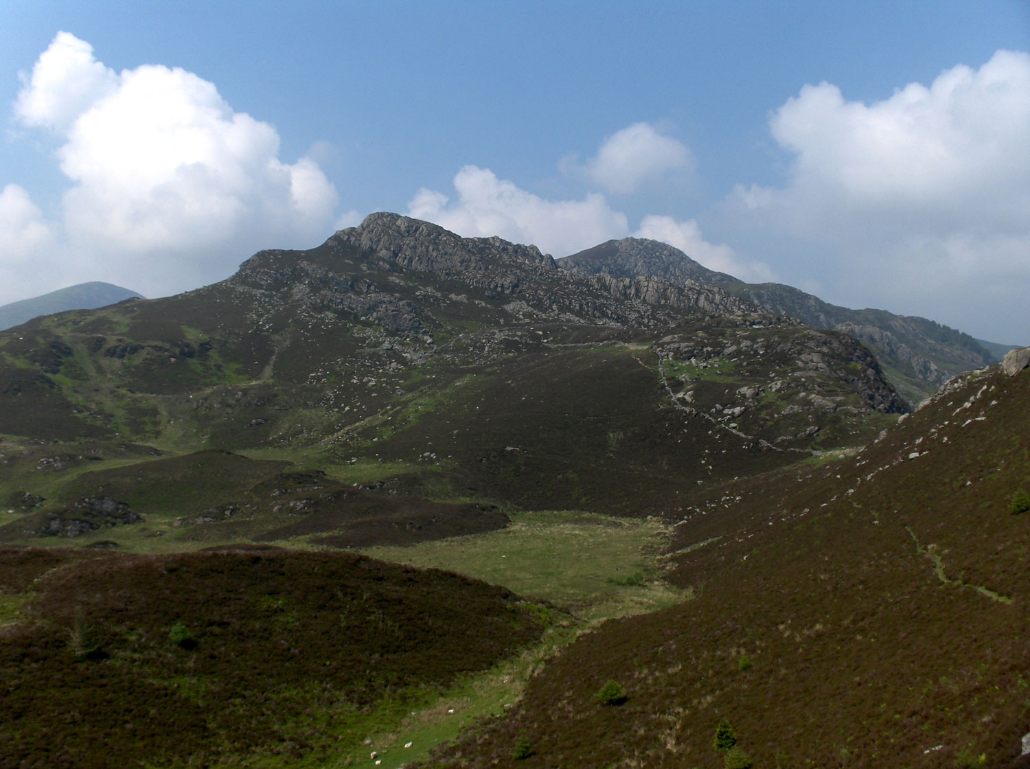
Creigiau Gleision

Creigiau Gleision is a mountain in Snowdonia, Wales, near Capel Curig. It is the easternmost of the high Carneddau and is separated from the others by...

Nearby Amenities

Located within 500m of 53.123361,-3.8832472
Natural: cave_entrance
Lat/Long: 53.1237136/-3.8808061
The data included in this document is from www.openstreetmap.org. The data is made available under ODbL.

Have you been to Coed Maes-mawr?

Leave your review of Coed Maes-mawr below (or comments, questions and feedback).