Coed Ceunant-mawr

Wood, Forest in Merionethshire

Wales

Coed Ceunant-mawr

Cricket nets On the riverside playing fields, Dolgellau.
Cricket nets Credit: John H Darch

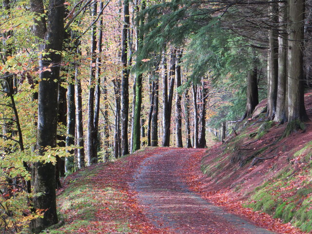
Coed Ceunant-mawr is a picturesque woodland located in Merionethshire, situated in the beautiful region of North Wales. With an approximate area of 200 acres, this enchanting forest is nestled within the Ceunant-mawr gorge, which adds to its unique charm.

The woodland is predominantly composed of native tree species, including oak, ash, birch, and rowan, creating a diverse and vibrant ecosystem. The lush undergrowth is home to a variety of flora, such as bluebells, wild garlic, and ferns, which bloom throughout the seasons, adding a burst of color to the landscape.

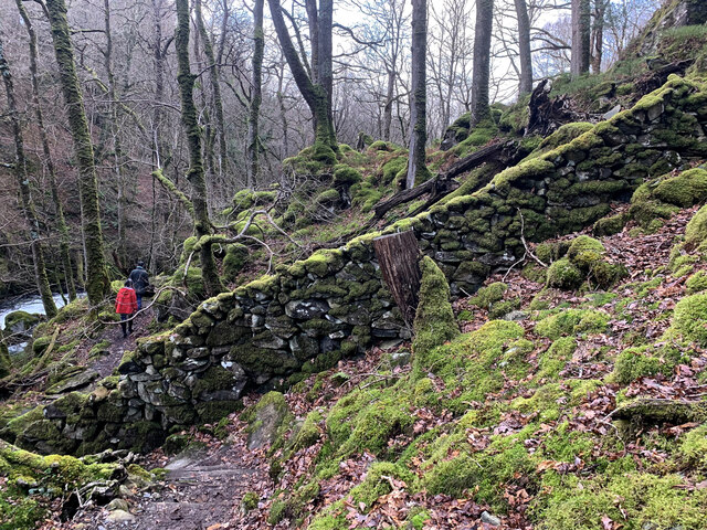
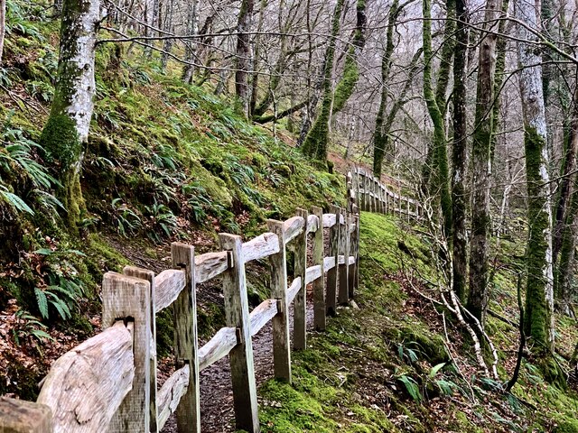
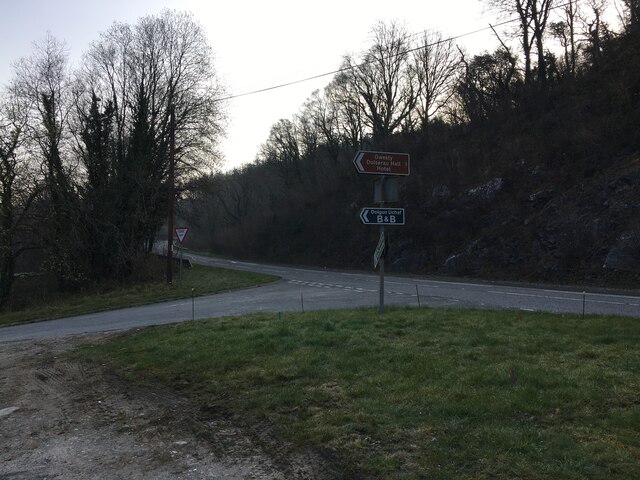
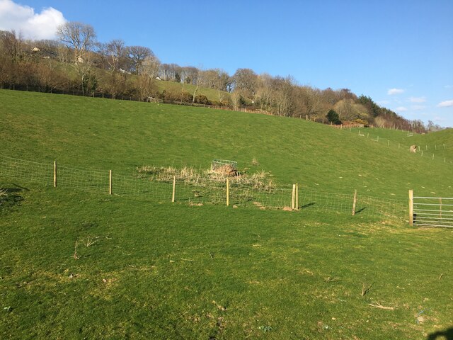
Coed Ceunant-mawr boasts a network of well-maintained walking trails, allowing visitors to explore the forest at their own pace. These trails lead to stunning viewpoints, providing breathtaking vistas of the surrounding countryside, including the nearby mountains of Snowdonia National Park.

The woodland is teeming with wildlife, making it a haven for nature enthusiasts. Red squirrels can often be spotted darting through the trees, while buzzards and other birds of prey soar overhead. The river that runs through the gorge is home to a variety of fish, including salmon and trout, attracting anglers from far and wide.

Coed Ceunant-mawr also holds historical significance, with remnants of ancient settlements and stone structures scattered throughout the forest. These remnants offer a glimpse into the area's rich past and add an air of mystery to the woodland.

Overall, Coed Ceunant-mawr is a captivating destination that offers visitors a chance to immerse themselves in the beauty of nature, explore its diverse wildlife, and soak up the tranquility of this idyllic woodland setting.

If you have any feedback on the listing, please let us know in the comments section below.

Coed Ceunant-mawr Images

Images are sourced within 2km of 52.739824/-3.8672726 or Grid Reference SH7417. Thanks to Geograph Open Source API. All images are credited.

Cricket nets On the riverside playing fields, Dolgellau.
Cricket nets
On the riverside playing fields, Dolgellau.
EuroSpar car park in Dolgellau
St Mary's Church, Dolgellau
Beechwood House, Dolgellau Cocktail bar close to Dolgellau bridge.
Beechwood House, Dolgellau
Cocktail bar close to Dolgellau bridge.
Llywbr uwchben afon Clywedog / Track above the Torrent Walk
Llwybr newydd, Llwybr y Torrent A wonderful new path has been opened on the opposite side of the Afon Clywedog from the longstanding Torrent Walk. Here it meets and crosses an old wall of the Caerynwch estate.
Llwybr newydd, Llwybr y Torrent
A wonderful new path has been opened on the opposite side of the Afon Clywedog from the longstanding Torrent Walk. Here it meets and crosses an old wall of the Caerynwch estate.
Llwybr newydd, Llwybr y Torrent The new track of the Torrent Walk, with some beautiful fencing.
Llwybr newydd, Llwybr y Torrent
The new track of the Torrent Walk, with some beautiful fencing.
Connecting bus services in Eldon Square, Dolgellau Services for Towyn, Aberangell and (tucked behind), Aberystwyth. All of these routes are operated by the Machynlleth based Lloyds Coaches. The Aberystwyth service is running under the TrawsCymru banner between Bangor and Aberystwyth, but is operated by Lloyds.

Lloyds Coaches operate from the old Crosville depot at Machynlleth, but also has a garage at Dolgellau.
Connecting bus services in Eldon Square, Dolgellau
Services for Towyn, Aberangell and (tucked behind), Aberystwyth. All of these routes are operated by the Machynlleth based Lloyds Coaches. The Aberystwyth service is running under the TrawsCymru banner between Bangor and Aberystwyth, but is operated by Lloyds. Lloyds Coaches operate from the old Crosville depot at Machynlleth, but also has a garage at Dolgellau.
A TrawsCymru T3 service at Dolgellau The T3 service runs from Barmouth to Wrexham via Dolgellau, Bala, Corwen, Llangollen and Ruabon. It replicates the old railway route which connected those towns but was closed in 1965.
A TrawsCymru T3 service at Dolgellau
The T3 service runs from Barmouth to Wrexham via Dolgellau, Bala, Corwen, Llangollen and Ruabon. It replicates the old railway route which connected those towns but was closed in 1965.
St David's Hospice charity shop In Eldon Square, Dolgellau.
St David's Hospice charity shop
In Eldon Square, Dolgellau.
Underpass beneath the A470 road Leading from Dolgellau to Coleg Meirion Dwyfor and Pen-y-coed.
Underpass beneath the A470 road
Leading from Dolgellau to Coleg Meirion Dwyfor and Pen-y-coed.
Afon Wnion looking downstream A smaller stream joins the river here on the left, but appears to be unnamed by the OS. Its source is high up on the slopes of Cadair Idris.
Afon Wnion looking downstream
A smaller stream joins the river here on the left, but appears to be unnamed by the OS. Its source is high up on the slopes of Cadair Idris.
By Dolgellau sports field Looking up towards Cadair Idris which is enveloped in mist.
By Dolgellau sports field
Looking up towards Cadair Idris which is enveloped in mist.
A TrawsCymru T2 service for Aberystwyth Standing in Eldon Square.
A TrawsCymru T2 service for Aberystwyth
Standing in Eldon Square.
The climb out of Dolgellau A steep pull uphill from the town centre on Cader Road.
The climb out of Dolgellau
A steep pull uphill from the town centre on Cader Road.
Road junction at the west of Dolgellau Straight on for Tywyn, to the left for Cader.
Road junction at the west of Dolgellau
Straight on for Tywyn, to the left for Cader.
Road junction near Dolgellau
Field near Dolgellau Mart
Show me another place!

Coed Ceunant-mawr is located at Grid Ref: SH7417 (Lat: 52.739824, Lng: -3.8672726)

Unitary Authority: Gwynedd

Police Authority: North Wales

What 3 Words

///measuring.vent.ventures. Near Dolgellau, Gwynedd

Related Wikis

Dolgelley power station

Dolgelley or Dolgellau power station was a combined diesel and hydroelectric generating station. It provided electricity to the town of Dolgellau, Gwynedd...

Ysgol y Gader

Ysgol y Gader was a bilingual comprehensive school for pupils aged 11–16 that served the town of Dolgellau and the surrounding area in South Meirionnydd...

Dolgellau and Barmouth Hospital

Dolgellau and Barmouth Hospital (Welsh: Ysbyty Dolgellau ac Abermaw) is a health facility in Dolgellau, Gwynedd, Wales. It is managed by the Betsi Cadwaladr...

Our Lady of Seven Sorrows Church, Dolgellau

Our Lady of Sorrows Church or its full name Our Lady of Seven Sorrows Church is a Roman Catholic parish church in Dolgellau, Gwynedd. It was built in 1966...

County Hall, Dolgellau

County Hall (Welsh: Neuadd y Sir Dolgellau) is a municipal building in Smithfield Street, Dolgellau, Gwynedd, Wales. The structure, which was the headquarters...
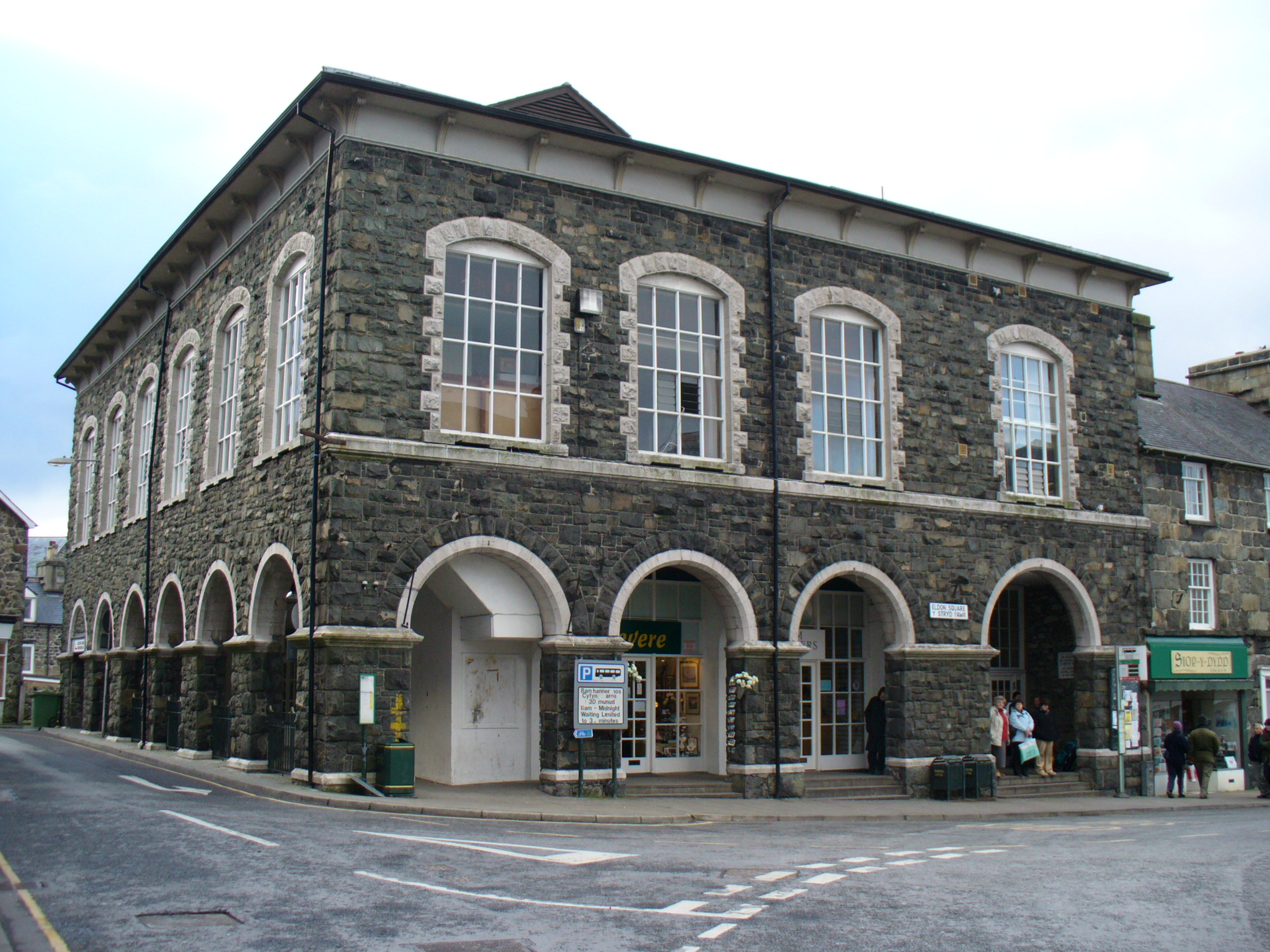
Neuadd Idris

The Old Market Hall (Welsh: Neuadd Idris) is a municipal building in Eldon Square, Dolgellau, Gwynedd, Wales. The structure, which is now the home to the...

Dolgellau

Dolgellau (Welsh: [dɔlˈɡɛɬaɨ] ) is a town and community in Gwynedd, north-west Wales, lying on the River Wnion, a tributary of the River Mawddach. It was...

Dolgellau railway station

Dolgellau railway station (Welsh pronunciation: [dɔlˈɡɛɬaɨ]) in Gwynedd, North Wales, was a station on the Ruabon to Barmouth line, originally the terminus...

Nearby Amenities

Located within 500m of 52.739824,-3.8672726
Barrier: cattle_grid
Source: GPS survey
Lat/Long: 52.7374405/-3.8720511
Designation: public_bridleway
Horse: designated
Lat/Long: 52.7389809/-3.8637996
Power: pole
Lat/Long: 52.7422321/-3.8717367
Power: pole
Lat/Long: 52.7427947/-3.8707364
Material: wood
Power: pole
Lat/Long: 52.7437123/-3.869116
Material: wood
Power: pole
Lat/Long: 52.7440041/-3.8681179
Material: wood
Power: pole
Lat/Long: 52.7441688/-3.866465
Power: pole
Lat/Long: 52.741188/-3.8724226
Power: pole
Lat/Long: 52.7407524/-3.8723374
Power: pole
Lat/Long: 52.7396208/-3.8721416
Power: pole
Lat/Long: 52.7386566/-3.8719755
Power: pole
Lat/Long: 52.7377312/-3.8715029
Power: pole
Lat/Long: 52.7358174/-3.8705971
Power: pole
Lat/Long: 52.7374629/-3.871376
Power: pole
Lat/Long: 52.7366191/-3.8709758
Power: pole
Lat/Long: 52.7420426/-3.872559
Material: wood
Power: pole
Lat/Long: 52.7432503/-3.8699273
Hiking: yes
Information: guidepost
Source: GPS survey
Tourism: information
Lat/Long: 52.7369137/-3.8636738
Hiking: yes
Information: guidepost
Source: GPS survey
Tourism: information
Lat/Long: 52.7372709/-3.8659054
Barrier: stile
Source: GPS survey
Stile: ladder
Lat/Long: 52.7369364/-3.8634324
Barrier: stile
Source: GPS survey
Lat/Long: 52.7369786/-3.8630596
Barrier: entrance
Source: GPS survey
Lat/Long: 52.737344/-3.8611525
Power: substation
Lat/Long: 52.742047/-3.873152
Location Transition: yes
Power: pole
Lat/Long: 52.7424317/-3.8700843
Power: pole
Lat/Long: 52.7426931/-3.8689122
Power: pole
Lat/Long: 52.7422709/-3.8658276
Power: pole
Lat/Long: 52.7418293/-3.8643336
Power: pole
Lat/Long: 52.7417952/-3.8632554
Power: pole
Lat/Long: 52.7416961/-3.861005
Barrier: stile
Stile: ladder
Lat/Long: 52.7388289/-3.8638841
Hiking: yes
Information: guidepost
Tourism: information
Lat/Long: 52.7389703/-3.863844
Hiking: yes
Information: route_marker
Tourism: information
Lat/Long: 52.7377396/-3.8658938
Hiking: yes
Information: route_marker
Tourism: information
Lat/Long: 52.7374421/-3.8660192
Barrier: stile
Stile: ladder
Lat/Long: 52.7379825/-3.8650642
The data included in this document is from www.openstreetmap.org. The data is made available under ODbL.

Have you been to Coed Ceunant-mawr?

Leave your review of Coed Ceunant-mawr below (or comments, questions and feedback).