Coed Ffridd-marian-du

Wood, Forest in Merionethshire

Wales

Coed Ffridd-marian-du

The Precipice Walk The Precipice Walk as it heads clockwise from the south. The recommended route for the walk is anti-clockwise as it offers better views south west along the valley. The Precipice Walk is not a public footpath but a private walk over part of the Nannau estate, which dates back to the twelfth century. The public have been allowed to use the walk by the estate since 1890 on the understanding that they observe the country code, follow the route indicated and use the proper access.
The Precipice Walk Credit: Jeff Buck

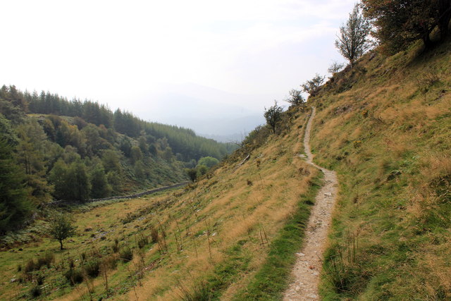
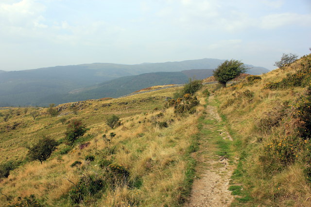
Coed Ffridd-marian-du, located in Merionethshire, Wales, is a captivating woodland area renowned for its natural beauty and diverse ecosystem. Covering an area of approximately 200 acres, the forest is nestled within the picturesque Snowdonia National Park.

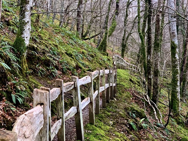
The woodland is characterized by its dense and mature canopy, comprising a mixture of deciduous and coniferous trees. Towering oaks, beeches, and sweet chestnuts dominate the landscape, providing a rich habitat for an array of flora and fauna. The forest floor is adorned with a carpet of wildflowers, including bluebells, wood sorrel, and primroses, adding bursts of color to the scene.

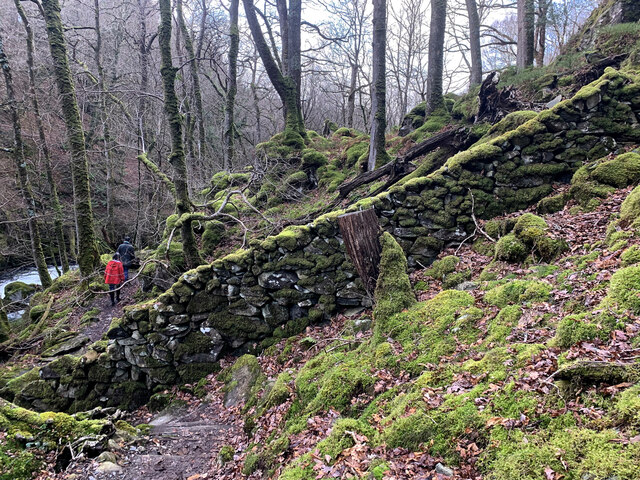
Coed Ffridd-marian-du is intersected by several babbling streams, which not only enhance the overall beauty of the forest but also support a thriving aquatic ecosystem. These streams are home to various species of fish, including trout, and provide a vital water source for the surrounding wildlife.

The forest is a haven for numerous bird species, such as woodpeckers, owls, and red kites. Visitors may spot small mammals like badgers, foxes, and squirrels, as they navigate through the undergrowth.

For nature enthusiasts, Coed Ffridd-marian-du offers a plethora of walking trails, allowing visitors to explore the woodland's enchanting corners. These trails vary in difficulty, catering to different levels of fitness and abilities.

The woodland is managed by local authorities, ensuring its preservation and sustainability for future generations. Coed Ffridd-marian-du stands as a testament to the beauty and importance of natural spaces within the Merionethshire region.

If you have any feedback on the listing, please let us know in the comments section below.

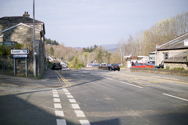
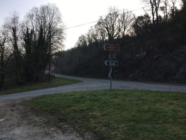
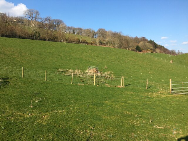
Coed Ffridd-marian-du Images

Images are sourced within 2km of 52.748751/-3.8701288 or Grid Reference SH7318. Thanks to Geograph Open Source API. All images are credited.

The Precipice Walk The Precipice Walk as it heads clockwise from the south. The recommended route for the walk is anti-clockwise as it offers better views south west along the valley. The Precipice Walk is not a public footpath but a private walk over part of the Nannau estate, which dates back to the twelfth century. The public have been allowed to use the walk by the estate since 1890 on the understanding that they observe the country code, follow the route indicated and use the proper access.
The Precipice Walk
The Precipice Walk as it heads clockwise from the south. The recommended route for the walk is anti-clockwise as it offers better views south west along the valley. The Precipice Walk is not a public footpath but a private walk over part of the Nannau estate, which dates back to the twelfth century. The public have been allowed to use the walk by the estate since 1890 on the understanding that they observe the country code, follow the route indicated and use the proper access.
Llwybr newydd, Llwybr y Torrent A wonderful new path has been opened on the opposite side of the Afon Clywedog from the longstanding Torrent Walk. Here it meets and crosses an old wall of the Caerynwch estate.
Llwybr newydd, Llwybr y Torrent
A wonderful new path has been opened on the opposite side of the Afon Clywedog from the longstanding Torrent Walk. Here it meets and crosses an old wall of the Caerynwch estate.
Llwybr newydd, Llwybr y Torrent The new track of the Torrent Walk, with some beautiful fencing.
Llwybr newydd, Llwybr y Torrent
The new track of the Torrent Walk, with some beautiful fencing.
Connecting bus services in Eldon Square, Dolgellau Services for Towyn, Aberangell and (tucked behind), Aberystwyth. All of these routes are operated by the Machynlleth based Lloyds Coaches. The Aberystwyth service is running under the TrawsCymru banner between Bangor and Aberystwyth, but is operated by Lloyds.

Lloyds Coaches operate from the old Crosville depot at Machynlleth, but also has a garage at Dolgellau.
Connecting bus services in Eldon Square, Dolgellau
Services for Towyn, Aberangell and (tucked behind), Aberystwyth. All of these routes are operated by the Machynlleth based Lloyds Coaches. The Aberystwyth service is running under the TrawsCymru banner between Bangor and Aberystwyth, but is operated by Lloyds. Lloyds Coaches operate from the old Crosville depot at Machynlleth, but also has a garage at Dolgellau.
A TrawsCymru T3 service at Dolgellau The T3 service runs from Barmouth to Wrexham via Dolgellau, Bala, Corwen, Llangollen and Ruabon. It replicates the old railway route which connected those towns but was closed in 1965.
A TrawsCymru T3 service at Dolgellau
The T3 service runs from Barmouth to Wrexham via Dolgellau, Bala, Corwen, Llangollen and Ruabon. It replicates the old railway route which connected those towns but was closed in 1965.
St David's Hospice charity shop In Eldon Square, Dolgellau.
St David's Hospice charity shop
In Eldon Square, Dolgellau.
Underpass beneath the A470 road Leading from Dolgellau to Coleg Meirion Dwyfor and Pen-y-coed.
Underpass beneath the A470 road
Leading from Dolgellau to Coleg Meirion Dwyfor and Pen-y-coed.
Afon Wnion on the approach to Dolgellau Afon Wnion is the largest tributary of Afon Mawddach which it joins in the vicinity of Llanelltyd at <a href="https://www.geograph.org.uk/gridref/SH711189">SH711189</a>. The lowest kilometre or so is tidal.
Afon Wnion on the approach to Dolgellau
Afon Wnion is the largest tributary of Afon Mawddach which it joins in the vicinity of Llanelltyd at SH711189. The lowest kilometre or so is tidal.
Afon Wnion looking downstream A smaller stream joins the river here on the left, but appears to be unnamed by the OS. Its source is high up on the slopes of Cadair Idris.
Afon Wnion looking downstream
A smaller stream joins the river here on the left, but appears to be unnamed by the OS. Its source is high up on the slopes of Cadair Idris.
By Dolgellau sports field Looking up towards Cadair Idris which is enveloped in mist.
By Dolgellau sports field
Looking up towards Cadair Idris which is enveloped in mist.
A TrawsCymru T2 service for Aberystwyth Standing in Eldon Square.
A TrawsCymru T2 service for Aberystwyth
Standing in Eldon Square.
The climb out of Dolgellau A steep pull uphill from the town centre on Cader Road.
The climb out of Dolgellau
A steep pull uphill from the town centre on Cader Road.
Road junction at the west of Dolgellau Straight on for Tywyn, to the left for Cader.
Road junction at the west of Dolgellau
Straight on for Tywyn, to the left for Cader.
Road junction near Dolgellau
Field near Dolgellau Mart
Footpath leading to the footbridge over Afon Wnion And thence to the Mawddach Trail/Cross Britain Way.
Footpath leading to the footbridge over Afon Wnion
And thence to the Mawddach Trail/Cross Britain Way.
On the footbridge over Afon Wnion The underpass will take you under the A470 road. To the left for cycle route 8 for the Mawddach Trail to Barmouth.
On the footbridge over Afon Wnion
The underpass will take you under the A470 road. To the left for cycle route 8 for the Mawddach Trail to Barmouth.
Show me another place!

Coed Ffridd-marian-du is located at Grid Ref: SH7318 (Lat: 52.748751, Lng: -3.8701288)

Unitary Authority: Gwynedd

Police Authority: North Wales

What 3 Words

///patio.wreck.storm. Near Dolgellau, Gwynedd

Related Wikis

Ysgol y Gader

Ysgol y Gader was a bilingual comprehensive school for pupils aged 11–16 that served the town of Dolgellau and the surrounding area in South Meirionnydd...

Dolgellau railway station

Dolgellau railway station (Welsh pronunciation: [dɔlˈɡɛɬaɨ]) in Gwynedd, North Wales, was a station on the Ruabon to Barmouth line, originally the terminus...

County Hall, Dolgellau

County Hall (Welsh: Neuadd y Sir Dolgellau) is a municipal building in Smithfield Street, Dolgellau, Gwynedd, Wales. The structure, which was the headquarters...

Dolgellau transmitting station

The Dolgellau transmitting station is a broadcasting and telecommunications facility located on a hill about 1 km north of the town of Dolgellau, in Gwynedd...

Nearby Amenities

Located within 500m of 52.748751,-3.8701288
Created By: POI Editor
Source: npe
Lat/Long: 52.7452185/-3.8676192
Source: npe
Lat/Long: 52.7468978/-3.8659255
Source: npe
Lat/Long: 52.7481823/-3.863635
Power: pole
Lat/Long: 52.7492973/-3.8765156
Power: pole
Lat/Long: 52.7487034/-3.8756396
Power: pole
Lat/Long: 52.7487232/-3.8754866
Power: pole
Lat/Long: 52.7493111/-3.8763396
Power: pole
Lat/Long: 52.7498725/-3.8771515
Power: pole
Lat/Long: 52.7501141/-3.8691016
Power: pole
Lat/Long: 52.7507306/-3.8691427
Power: pole
Lat/Long: 52.7516544/-3.8691985
Power: pole
Lat/Long: 52.7524788/-3.8692484
Power: pole
Lat/Long: 52.7530277/-3.869495
Direction: S
Generator Method: photovoltaic
Generator Output Electricity: yes
Generator Solar Modules: 16
Generator Source: solar
Generator Type: solar_photovoltaic_panel
Location: roof
Power: generator
Lat/Long: 52.7490377/-3.8734599
Direction: 175
Generator Method: photovoltaic
Generator Output Electricity: yes
Generator Solar Modules: 11
Generator Source: solar
Generator Type: solar_photovoltaic_panel
Location: roof
Power: generator
Lat/Long: 52.7486228/-3.8734813
Direction: SSE
Generator Method: photovoltaic
Generator Output Electricity: yes
Generator Solar Modules: 16
Generator Source: solar
Generator Type: solar_photovoltaic_panel
Location: roof
Power: generator
Lat/Long: 52.748605/-3.8751403
Direction: 175
Generator Method: photovoltaic
Generator Output Electricity: yes
Generator Solar Modules: 2
Generator Source: solar
Generator Type: solar_photovoltaic_panel
Location: roof
Power: generator
Lat/Long: 52.7482125/-3.8746125
Direction: 175
Generator Method: photovoltaic
Generator Output Electricity: yes
Generator Solar Modules: 14
Generator Source: solar
Generator Type: solar_photovoltaic_panel
Location: roof
Power: generator
Lat/Long: 52.7482174/-3.874697
Bench
Material: wood
Lat/Long: 52.7478711/-3.8751791
The data included in this document is from www.openstreetmap.org. The data is made available under ODbL.

Have you been to Coed Ffridd-marian-du?

Leave your review of Coed Ffridd-marian-du below (or comments, questions and feedback).