Burrington

Settlement in Herefordshire

England

Burrington

Track to new House
Track to new House Credit: N Chadwick

Burrington is a small village located in Herefordshire, England. It is situated in a rural area surrounded by rolling green hills and picturesque countryside. The village is home to a close-knit community of residents who often participate in local events and activities.

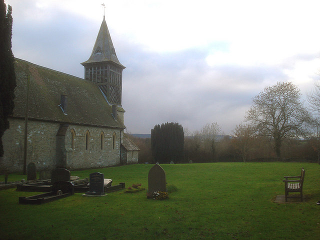
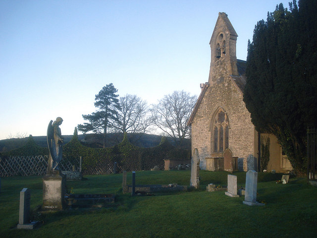
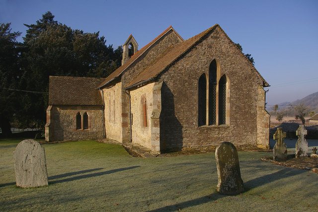
Burrington has a quaint village hall that hosts various gatherings and meetings, as well as a small church that serves as a focal point for the community. The village also has a traditional pub where locals and visitors can enjoy a drink or a meal.

The surrounding area offers plenty of opportunities for outdoor activities such as hiking, cycling, and horseback riding. The nearby Herefordshire countryside is known for its stunning natural beauty and is popular with nature enthusiasts and outdoor enthusiasts.

Overall, Burrington is a peaceful and charming village that offers a tranquil escape from the hustle and bustle of city life. Its idyllic setting and sense of community make it a desirable place to live or visit for those seeking a slower pace of life.

If you have any feedback on the listing, please let us know in the comments section below.

Burrington Images

Images are sourced within 2km of 52.343093/-2.8197025 or Grid Reference SO4471. Thanks to Geograph Open Source API. All images are credited.

Track to new House
Track to new House
Mortimer (Bringewood) Forest The Mortimer Forest is the name given to the remnant of a Saxon Hunting forest on the Shropshire / Herefordshire border near Ludlow (Bringewood Forest). It is owned and managed by the Forestry Commission, who invented the name. The forest has car parks, information boards and trails.  The underlying rocks are Upper Silurian and the forest is the type site for these rocks (the Ludlovian).
Mortimer (Bringewood) Forest
The Mortimer Forest is the name given to the remnant of a Saxon Hunting forest on the Shropshire / Herefordshire border near Ludlow (Bringewood Forest). It is owned and managed by the Forestry Commission, who invented the name. The forest has car parks, information boards and trails. The underlying rocks are Upper Silurian and the forest is the type site for these rocks (the Ludlovian).
Track to New House
Track to New House
Heading to New House
A field of Maize on the edge of Bringewood Maize is a cereal crop, indigenous to the Americas. In Britain it is usually called corn. <span class="nowrap"><a title="http://en.wikipedia.org/wiki/Maize" rel="nofollow ugc noopener" href="http://en.wikipedia.org/wiki/Maize">Link</a><img style="margin-left:2px;" alt="External link" title="External link - shift click to open in new window" src="https://s1.geograph.org.uk/img/external.png" width="10" height="10"/></span>
A field of Maize on the edge of Bringewood
Maize is a cereal crop, indigenous to the Americas. In Britain it is usually called corn. LinkExternal link
Maize near New House
Track heading to New House
Barn near New House
Barn near New House
New House
New House
Fire damaged building, New House These are the remains of the Bringewood Hotel.
Fire damaged building, New House
These are the remains of the Bringewood Hotel.
Track near New House
New House
New House
Pond near New House
Pond near New House
Tree by the track, New House
Bringewood (Mortimer) Forest The Mortimer Forest is the name given to the remnant of a Saxon Hunting forest on the Shropshire / Herefordshire border near Ludlow (Bringewood Forest). It is owned and managed by the Forestry Commission, who invented the name. The forest has car parks, information boards and trails.  The underlying rocks are Upper Silurian and the forest is the type site for these rocks (the Ludlovian).
Bringewood (Mortimer) Forest
The Mortimer Forest is the name given to the remnant of a Saxon Hunting forest on the Shropshire / Herefordshire border near Ludlow (Bringewood Forest). It is owned and managed by the Forestry Commission, who invented the name. The forest has car parks, information boards and trails. The underlying rocks are Upper Silurian and the forest is the type site for these rocks (the Ludlovian).
Small woodland near New House
Small valley near New House
Gateway on the footpath to Burrington
Show me another place!

Burrington is located at Grid Ref: SO4471 (Lat: 52.343093, Lng: -2.8197025)

Unitary Authority: County of Herefordshire

Police Authority: West Mercia

What 3 Words

///notes.enchanted.reverted. Near Burrington, Herefordshire

Nearby Locations

Burrington

Related Wikis

Burrington, Herefordshire

Burrington is a small village and civil parish in the far north of Herefordshire, England. It is part of the Leintwardine group of parishes and shares...

Elton, Herefordshire

Elton is a hamlet and civil parish in the far north of Herefordshire. It is situated on the Wigmore to Ludlow road. The village is northeast of Leinthall...

Pipe Aston

Pipe Aston is a small village and civil parish in the far north of Herefordshire, close to the border with Shropshire. It has a population of about 24...

Downton, Herefordshire

Downton is a civil parish in Herefordshire, located in the north of the county and containing the village of Downton-on-the-Rock. It is part of the Leintwardine...

Nearby Amenities

Located within 500m of 52.343093,-2.8197025
Burrington
Place: village
Wikidata: Q3784129
Lat/Long: 52.3443063/-2.8187977
Entrance: yes
Lat/Long: 52.3440915/-2.8201784
Post Box
Post Box Type: wall
Ref: SY8 7
Royal Cypher: VR
Royal Cypher Wikidata: Q33102356
Lat/Long: 52.3466146/-2.8185185
Barrier: stile
Source: survey
Lat/Long: 52.3394018/-2.8161559
Barrier: stile
Source: survey
Lat/Long: 52.3393412/-2.8161934
Cast Iron Grave Slabs
Historic: memorial
Source: survey
Lat/Long: 52.3441172/-2.8198667
Bench
Source: survey
Lat/Long: 52.3443359/-2.8197674
Grit Bin
Source: survey
Lat/Long: 52.3460711/-2.8186624
Grit Bin
Source: survey
Lat/Long: 52.3446677/-2.8188515
Information: board
Source: survey
Tourism: information
Lat/Long: 52.3436305/-2.8193839
Grit Bin
Source: survey
Lat/Long: 52.3436223/-2.8193879
Amenity Disused: phone
Source: survey
Lat/Long: 52.3436395/-2.8193758
Grit Bin
Source: survey
Lat/Long: 52.3430709/-2.8198707
Barrier: stile
Source: survey
Lat/Long: 52.3437263/-2.8240013
Barrier: stile
Source: survey
Lat/Long: 52.3436887/-2.8217784
Barrier: stile
Source: survey
Lat/Long: 52.3440555/-2.8207638
Barrier: stile
Lat/Long: 52.3419285/-2.8135
Barrier: stile
Lat/Long: 52.3421703/-2.8142975
The data included in this document is from www.openstreetmap.org. The data is made available under ODbL.

Have you been to Burrington?

Leave your review of Burrington below (or comments, questions and feedback).