Allt Fedw

Wood, Forest in Cardiganshire

Wales

Allt Fedw

Vale of Rheidol Railway: Aberffrwd
Vale of Rheidol Railway: Aberffrwd Credit: Gareth James

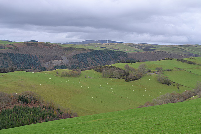
Allt Fedw, located in Cardiganshire, is a notable woodland area rich with natural beauty and diverse flora and fauna. This enchanting forest spans across a vast area, providing a serene and picturesque atmosphere for visitors to immerse themselves in. The name "Allt Fedw" translates to "Wood, Forest" in English, which aptly describes the landscape that awaits exploration.

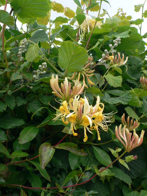
The woodland is characterized by its dense canopy of deciduous and coniferous trees, creating a lush and vibrant environment. Towering oak, beech, and ash trees dominate the landscape, offering shelter to a wide variety of wildlife. Visitors can expect to encounter numerous bird species, including woodpeckers, owls, and various songbirds, as well as small mammals like squirrels and rabbits.

A network of well-maintained trails winds through Allt Fedw, allowing visitors to explore the forest at their own pace. These paths offer stunning views of the surrounding countryside and meandering streams that add to the tranquility of the area. The forest floor is adorned with an array of wildflowers and ferns, creating a colorful tapestry during the warmer months.

Allt Fedw is a haven for nature enthusiasts and provides opportunities for activities such as hiking, birdwatching, and photography. The forest is particularly enchanting during autumn when the leaves change color, painting the landscape with vibrant hues of red, orange, and gold.

With its captivating beauty, diverse wildlife, and peaceful ambiance, Allt Fedw is truly a gem in the heart of Cardiganshire, inviting visitors to connect with nature and escape the hustle and bustle of everyday life.

If you have any feedback on the listing, please let us know in the comments section below.

Allt Fedw Images

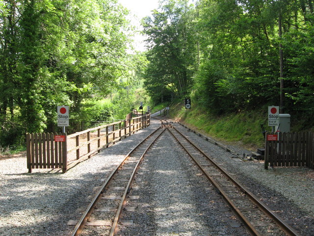
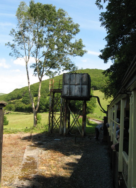
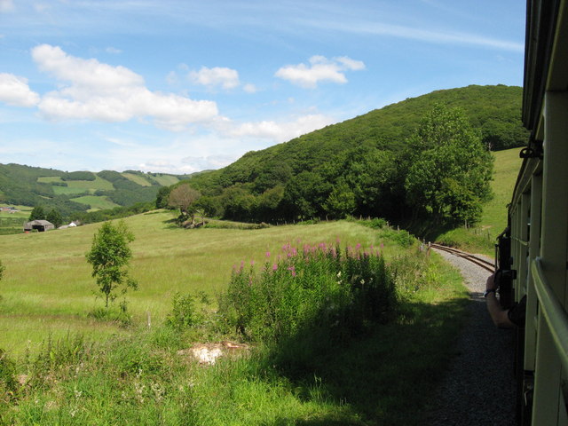
Images are sourced within 2km of 52.375197/-3.9322834 or Grid Reference SN6876. Thanks to Geograph Open Source API. All images are credited.

Vale of Rheidol Railway: Aberffrwd
Vale of Rheidol Railway: taking on water at Nantyronen
Vale of Rheidol railway near Nantyronen
View from the A4120 towards Plynlimon Looking over sloping fields and the forested  gash of Cwm Rheidol to the distant mountain. Taken in December, after an unusually mild Autumn.
View from the A4120 towards Plynlimon
Looking over sloping fields and the forested gash of Cwm Rheidol to the distant mountain. Taken in December, after an unusually mild Autumn.
Pisgah viewed from the top of Pant Da Wood Pant Da Nature Reserve is managed by the Wildlife Trust of South and West Wales. 

Pant Da Wood lies about one and a half miles from Capel Bangor, beside the minor road which runs through Cwm Rheidol, and it is part of the extensive area of south-facing woodland to be found in the valley. The reserve was established in the 1980s and at that time an area of larch, planted in the 1950s, was felled and replanted with oak. In earlier times the wood was used to coppice oak and some coppice stools survive. Other species, including rowan, silver birch and beech, are also to be found.

Most of the reserve lies in the north-west corner of square <a href="https://www.geograph.org.uk/gridref/SN6778">SN6778</a> but it just extends into the south west of <a href="https://www.geograph.org.uk/gridref/SN6779">SN6779</a>. The entrance to the site is to be found at GR <a href="https://www.geograph.org.uk/gridref/SN67087879">SN67087879</a>, beside the Cwm Rheidol Road, and the northern extent is at GR <a href="https://www.geograph.org.uk/gridref/SN67067902">SN67067902</a>. The path through the reserve climbs some 100 metres over a straight distance of about 280 metres, so some zigzagging has been created so as to ease the walking gradient.

In addition to the trees, bramble and bracken scrub has been allowed to develop and this has encouraged a diversity of woodland birds. Badger sets are also to be found here.

The reserve is bordered by Ffynnon-wen and Troedrhiwlas farms and there is no public access to the site, other than from the entrance mentioned above.

In 2003 a previously unknown hill fort was discovered, by aerial survey, on the hill above Pant Da wood.

In 2007, a memorial viewpoint was constructed in the reserve to commemorate Nancy Kirk, a lecturer in geology at Aberystwyth University, who died in 2005. The memorial consists of a bench and a slate table and is set at the highest point of the reserve, where some fine views of the Rheidol Valley are to be had.

Links:
South and West Wales Wildlife Trust page <span class="nowrap"><a title="http://www.welshwildlife.org/nature-reserve/pant-da-rheidol-valley-ceredigion/" rel="nofollow ugc noopener" href="http://www.welshwildlife.org/nature-reserve/pant-da-rheidol-valley-ceredigion/">Link</a><img style="margin-left:2px;" alt="External link" title="External link - shift click to open in new window" src="https://s1.geograph.org.uk/img/external.png" width="10" height="10"/></span>
RCAHMW page <span class="nowrap"><a title="http://www.coflein.gov.uk/en/site/308517/details/PANT+DA+WOOD/" rel="nofollow ugc noopener" href="http://www.coflein.gov.uk/en/site/308517/details/PANT+DA+WOOD/">Link</a><img style="margin-left:2px;" alt="External link" title="External link - shift click to open in new window" src="https://s1.geograph.org.uk/img/external.png" width="10" height="10"/></span>
Nancy Kirk <span class="nowrap"><a title="http://abergeologists.net/wp/2005/12/03/nancy-kirk-1916-2005/" rel="nofollow ugc noopener" href="http://abergeologists.net/wp/2005/12/03/nancy-kirk-1916-2005/">Link</a><img style="margin-left:2px;" alt="External link" title="External link - shift click to open in new window" src="https://s1.geograph.org.uk/img/external.png" width="10" height="10"/></span>
Pisgah viewed from the top of Pant Da Wood
Pant Da Nature Reserve is managed by the Wildlife Trust of South and West Wales. Pant Da Wood lies about one and a half miles from Capel Bangor, beside the minor road which runs through Cwm Rheidol, and it is part of the extensive area of south-facing woodland to be found in the valley. The reserve was established in the 1980s and at that time an area of larch, planted in the 1950s, was felled and replanted with oak. In earlier times the wood was used to coppice oak and some coppice stools survive. Other species, including rowan, silver birch and beech, are also to be found. Most of the reserve lies in the north-west corner of square SN6778 but it just extends into the south west of SN6779. The entrance to the site is to be found at GR SN67087879, beside the Cwm Rheidol Road, and the northern extent is at GR SN67067902. The path through the reserve climbs some 100 metres over a straight distance of about 280 metres, so some zigzagging has been created so as to ease the walking gradient. In addition to the trees, bramble and bracken scrub has been allowed to develop and this has encouraged a diversity of woodland birds. Badger sets are also to be found here. The reserve is bordered by Ffynnon-wen and Troedrhiwlas farms and there is no public access to the site, other than from the entrance mentioned above. In 2003 a previously unknown hill fort was discovered, by aerial survey, on the hill above Pant Da wood. In 2007, a memorial viewpoint was constructed in the reserve to commemorate Nancy Kirk, a lecturer in geology at Aberystwyth University, who died in 2005. The memorial consists of a bench and a slate table and is set at the highest point of the reserve, where some fine views of the Rheidol Valley are to be had. Links: South and West Wales Wildlife Trust page LinkExternal link RCAHMW page LinkExternal link Nancy Kirk LinkExternal link
The Rheidol valley on Christmas Day 2011 Mild, but drizzle blankets the valley. It will shortly clear, to allow those looking for fresh air before the Christmas Day feast to get out for a walk in the dry, but will return before too long.
The Rheidol valley on Christmas Day 2011
Mild, but drizzle blankets the valley. It will shortly clear, to allow those looking for fresh air before the Christmas Day feast to get out for a walk in the dry, but will return before too long.
Grazing amongst the trees A south-facing sloping field, gathering what warmth there is from a low sun, on a fine but cold January day.
Grazing amongst the trees
A south-facing sloping field, gathering what warmth there is from a low sun, on a fine but cold January day.
Cottages in Cwm Rheidol On the minor road along the valley floor, between Nantyronen and Aberffrwd. A telephoto shot taken from Pisgah. In the field behind, two cart horses enjoy the January sun.
Cottages in Cwm Rheidol
On the minor road along the valley floor, between Nantyronen and Aberffrwd. A telephoto shot taken from Pisgah. In the field behind, two cart horses enjoy the January sun.
Cwm Rheidol in January A fine cold day, on the end of a mild, damp period.
Cwm Rheidol in January
A fine cold day, on the end of a mild, damp period.
Pisgah viewed from Pant Da Nature Reserve Pant Da Nature Reserve is managed by the Wildlife Trust of South and West Wales. 

Pant Da Wood lies about one and a half miles from Capel Bangor, beside the minor road which runs through Cwm Rheidol, and it is part of the extensive area of south-facing woodland to be found in the valley. The reserve was established in the 1980s and at that time an area of larch, planted in the 1950s, was felled and replanted with oak. In earlier times the wood was used to coppice oak and some coppice stools survive. Other species, including rowan, silver birch and beech, are also to be found.

Most of the reserve lies in the north-west corner of square <a href="https://www.geograph.org.uk/gridref/SN6778">SN6778</a> but it just extends into the south west of <a href="https://www.geograph.org.uk/gridref/SN6779">SN6779</a>. The entrance to the site is to be found at GR <a href="https://www.geograph.org.uk/gridref/SN67087879">SN67087879</a>, beside the Cwm Rheidol Road, and the northern extent is at GR <a href="https://www.geograph.org.uk/gridref/SN67067902">SN67067902</a>. The path through the reserve climbs some 100 metres over a straight distance of about 280 metres, so some zigzagging has been created so as to ease the walking gradient.

In addition to the trees, bramble and bracken scrub has been allowed to develop and this has encouraged a diversity of woodland birds. Badger sets are also to be found here.

The reserve is bordered by Ffynnon-wen and Troedrhiwlas farms and there is no public access to the site, other than from the entrance mentioned above.

In 2003 a previously unknown hill fort was discovered, by aerial survey, on the hill above Pant Da wood.

In 2007, a memorial viewpoint was constructed in the reserve to commemorate Nancy Kirk, a lecturer in geology at Aberystwyth University, who died in 2005. The memorial consists of a bench and a slate table and is set at the highest point of the reserve, where some fine views of the Rheidol Valley are to be had.

Links:
South and West Wales Wildlife Trust page <span class="nowrap"><a title="http://www.welshwildlife.org/nature-reserve/pant-da-rheidol-valley-ceredigion/" rel="nofollow ugc noopener" href="http://www.welshwildlife.org/nature-reserve/pant-da-rheidol-valley-ceredigion/">Link</a><img style="margin-left:2px;" alt="External link" title="External link - shift click to open in new window" src="https://s1.geograph.org.uk/img/external.png" width="10" height="10"/></span>
RCAHMW page <span class="nowrap"><a title="http://www.coflein.gov.uk/en/site/308517/details/PANT+DA+WOOD/" rel="nofollow ugc noopener" href="http://www.coflein.gov.uk/en/site/308517/details/PANT+DA+WOOD/">Link</a><img style="margin-left:2px;" alt="External link" title="External link - shift click to open in new window" src="https://s1.geograph.org.uk/img/external.png" width="10" height="10"/></span>
Nancy Kirk <span class="nowrap"><a title="http://abergeologists.net/wp/2005/12/03/nancy-kirk-1916-2005/" rel="nofollow ugc noopener" href="http://abergeologists.net/wp/2005/12/03/nancy-kirk-1916-2005/">Link</a><img style="margin-left:2px;" alt="External link" title="External link - shift click to open in new window" src="https://s1.geograph.org.uk/img/external.png" width="10" height="10"/></span>
Pisgah viewed from Pant Da Nature Reserve
Pant Da Nature Reserve is managed by the Wildlife Trust of South and West Wales. Pant Da Wood lies about one and a half miles from Capel Bangor, beside the minor road which runs through Cwm Rheidol, and it is part of the extensive area of south-facing woodland to be found in the valley. The reserve was established in the 1980s and at that time an area of larch, planted in the 1950s, was felled and replanted with oak. In earlier times the wood was used to coppice oak and some coppice stools survive. Other species, including rowan, silver birch and beech, are also to be found. Most of the reserve lies in the north-west corner of square SN6778 but it just extends into the south west of SN6779. The entrance to the site is to be found at GR SN67087879, beside the Cwm Rheidol Road, and the northern extent is at GR SN67067902. The path through the reserve climbs some 100 metres over a straight distance of about 280 metres, so some zigzagging has been created so as to ease the walking gradient. In addition to the trees, bramble and bracken scrub has been allowed to develop and this has encouraged a diversity of woodland birds. Badger sets are also to be found here. The reserve is bordered by Ffynnon-wen and Troedrhiwlas farms and there is no public access to the site, other than from the entrance mentioned above. In 2003 a previously unknown hill fort was discovered, by aerial survey, on the hill above Pant Da wood. In 2007, a memorial viewpoint was constructed in the reserve to commemorate Nancy Kirk, a lecturer in geology at Aberystwyth University, who died in 2005. The memorial consists of a bench and a slate table and is set at the highest point of the reserve, where some fine views of the Rheidol Valley are to be had. Links: South and West Wales Wildlife Trust page LinkExternal link RCAHMW page LinkExternal link Nancy Kirk LinkExternal link
Pisgah viewed from Pant Da Woods Pant Da Nature Reserve is managed by the Wildlife Trust of South and West Wales. 

Pant Da Wood lies about one and a half miles from Capel Bangor, beside the minor road which runs through Cwm Rheidol, and it is part of the extensive area of south-facing woodland to be found in the valley. The reserve was established in the 1980s and at that time an area of larch, planted in the 1950s, was felled and replanted with oak. In earlier times the wood was used to coppice oak and some coppice stools survive. Other species, including rowan, silver birch and beech, are also to be found.

Most of the reserve lies in the north-west corner of square <a href="https://www.geograph.org.uk/gridref/SN6778">SN6778</a> but it just extends into the south west of <a href="https://www.geograph.org.uk/gridref/SN6779">SN6779</a>. The entrance to the site is to be found at GR <a href="https://www.geograph.org.uk/gridref/SN67087879">SN67087879</a>, beside the Cwm Rheidol Road, and the northern extent is at GR <a href="https://www.geograph.org.uk/gridref/SN67067902">SN67067902</a>. The path through the reserve climbs some 100 metres over a straight distance of about 280 metres, so some zigzagging has been created so as to ease the walking gradient.

In addition to the trees, bramble and bracken scrub has been allowed to develop and this has encouraged a diversity of woodland birds. Badger sets are also to be found here.

The reserve is bordered by Ffynnon-wen and Troedrhiwlas farms and there is no public access to the site, other than from the entrance mentioned above.

In 2003 a previously unknown hill fort was discovered, by aerial survey, on the hill above Pant Da wood.

In 2007, a memorial viewpoint was constructed in the reserve to commemorate Nancy Kirk, a lecturer in geology at Aberystwyth University, who died in 2005. The memorial consists of a bench and a slate table and is set at the highest point of the reserve, where some fine views of the Rheidol Valley are to be had.

Links:
South and West Wales Wildlife Trust page <span class="nowrap"><a title="http://www.welshwildlife.org/nature-reserve/pant-da-rheidol-valley-ceredigion/" rel="nofollow ugc noopener" href="http://www.welshwildlife.org/nature-reserve/pant-da-rheidol-valley-ceredigion/">Link</a><img style="margin-left:2px;" alt="External link" title="External link - shift click to open in new window" src="https://s1.geograph.org.uk/img/external.png" width="10" height="10"/></span>
RCAHMW page <span class="nowrap"><a title="http://www.coflein.gov.uk/en/site/308517/details/PANT+DA+WOOD/" rel="nofollow ugc noopener" href="http://www.coflein.gov.uk/en/site/308517/details/PANT+DA+WOOD/">Link</a><img style="margin-left:2px;" alt="External link" title="External link - shift click to open in new window" src="https://s1.geograph.org.uk/img/external.png" width="10" height="10"/></span>
Nancy Kirk <span class="nowrap"><a title="http://abergeologists.net/wp/2005/12/03/nancy-kirk-1916-2005/" rel="nofollow ugc noopener" href="http://abergeologists.net/wp/2005/12/03/nancy-kirk-1916-2005/">Link</a><img style="margin-left:2px;" alt="External link" title="External link - shift click to open in new window" src="https://s1.geograph.org.uk/img/external.png" width="10" height="10"/></span>
Pisgah viewed from Pant Da Woods
Pant Da Nature Reserve is managed by the Wildlife Trust of South and West Wales. Pant Da Wood lies about one and a half miles from Capel Bangor, beside the minor road which runs through Cwm Rheidol, and it is part of the extensive area of south-facing woodland to be found in the valley. The reserve was established in the 1980s and at that time an area of larch, planted in the 1950s, was felled and replanted with oak. In earlier times the wood was used to coppice oak and some coppice stools survive. Other species, including rowan, silver birch and beech, are also to be found. Most of the reserve lies in the north-west corner of square SN6778 but it just extends into the south west of SN6779. The entrance to the site is to be found at GR SN67087879, beside the Cwm Rheidol Road, and the northern extent is at GR SN67067902. The path through the reserve climbs some 100 metres over a straight distance of about 280 metres, so some zigzagging has been created so as to ease the walking gradient. In addition to the trees, bramble and bracken scrub has been allowed to develop and this has encouraged a diversity of woodland birds. Badger sets are also to be found here. The reserve is bordered by Ffynnon-wen and Troedrhiwlas farms and there is no public access to the site, other than from the entrance mentioned above. In 2003 a previously unknown hill fort was discovered, by aerial survey, on the hill above Pant Da wood. In 2007, a memorial viewpoint was constructed in the reserve to commemorate Nancy Kirk, a lecturer in geology at Aberystwyth University, who died in 2005. The memorial consists of a bench and a slate table and is set at the highest point of the reserve, where some fine views of the Rheidol Valley are to be had. Links: South and West Wales Wildlife Trust page LinkExternal link RCAHMW page LinkExternal link Nancy Kirk LinkExternal link
Farm Buildings, Maes y Glyn This old barn has a new roof.
Farm Buildings, Maes y Glyn
This old barn has a new roof.
Stream near Maes y Glyn in the Rheidol Valley
Yr Hen Ysgol, Aberffrwd Converted school in the Rheidol valley. The house sits on a fork in the road, the lower road descending to the Rheidol reservoir, while the upper one eventually joins the Aberystwyth to Devil's Bridge road.
Yr Hen Ysgol, Aberffrwd
Converted school in the Rheidol valley. The house sits on a fork in the road, the lower road descending to the Rheidol reservoir, while the upper one eventually joins the Aberystwyth to Devil's Bridge road.
Aberffrwd chapel (Calvinist) The chapel was built in 1802, but has now been converted to a family home.
Aberffrwd chapel (Calvinist)
The chapel was built in 1802, but has now been converted to a family home.
Abernant Farm, Cwm Rheidol
The graveyard at Aberffrwd Chapel
Honeysuckle in the hedgerow, Vale of Rheidol
Show me another place!

Allt Fedw is located at Grid Ref: SN6876 (Lat: 52.375197, Lng: -3.9322834)

Unitary Authority: Ceredigion

Police Authority: Dyfed Powys

What 3 Words

///clocking.duplicity.centuries. Near Llanilar, Ceredigion

Nearby Locations

Allt Fedw

Related Wikis

Ceredigion (Senedd constituency)

Ceredigion is a constituency of the Senedd. It elects one Member of the Senedd by the first past the post method of election. It is also one of eight constituencies...

Pisgah, Ceredigion

Pisgah, Ceredigion is a hamlet in the community of Melindwr, Ceredigion, Wales, which is 70.2 miles (113 km) from Cardiff and 173.3 miles (278.8 km) from...

Nantyronen railway station

Nantyronen railway station is a railway station serving Nantyronen in Ceredigion in Mid-Wales. It is an intermediate station and request stop on the preserved...

Aberffrwd railway station

Aberffrwd railway station is a railway station serving Aberffrwd in Ceredigion in Mid-Wales, and is an intermediate stop on the preserved Vale of Rheidol...

Have you been to Allt Fedw?

Leave your review of Allt Fedw below (or comments, questions and feedback).