Burrells

Settlement in Westmorland Eden

England

Burrells

The Eden valley south of Appleby The characteristic red sandstone of Westmorland can be seen in the colour of the soil of a recently ploughed field.
The Eden valley south of Appleby Credit: Stephen Craven

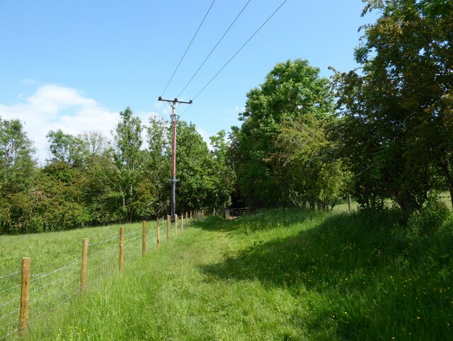
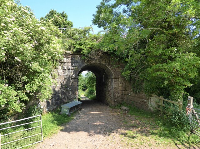
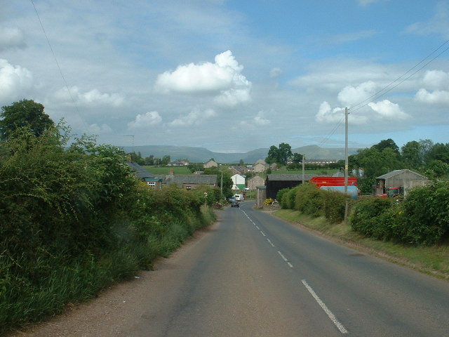
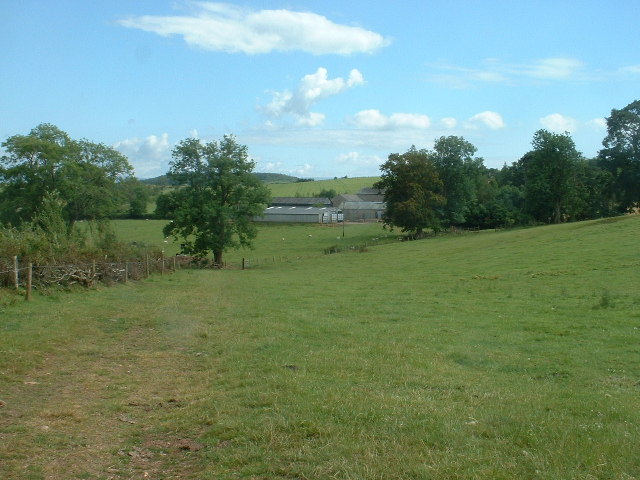
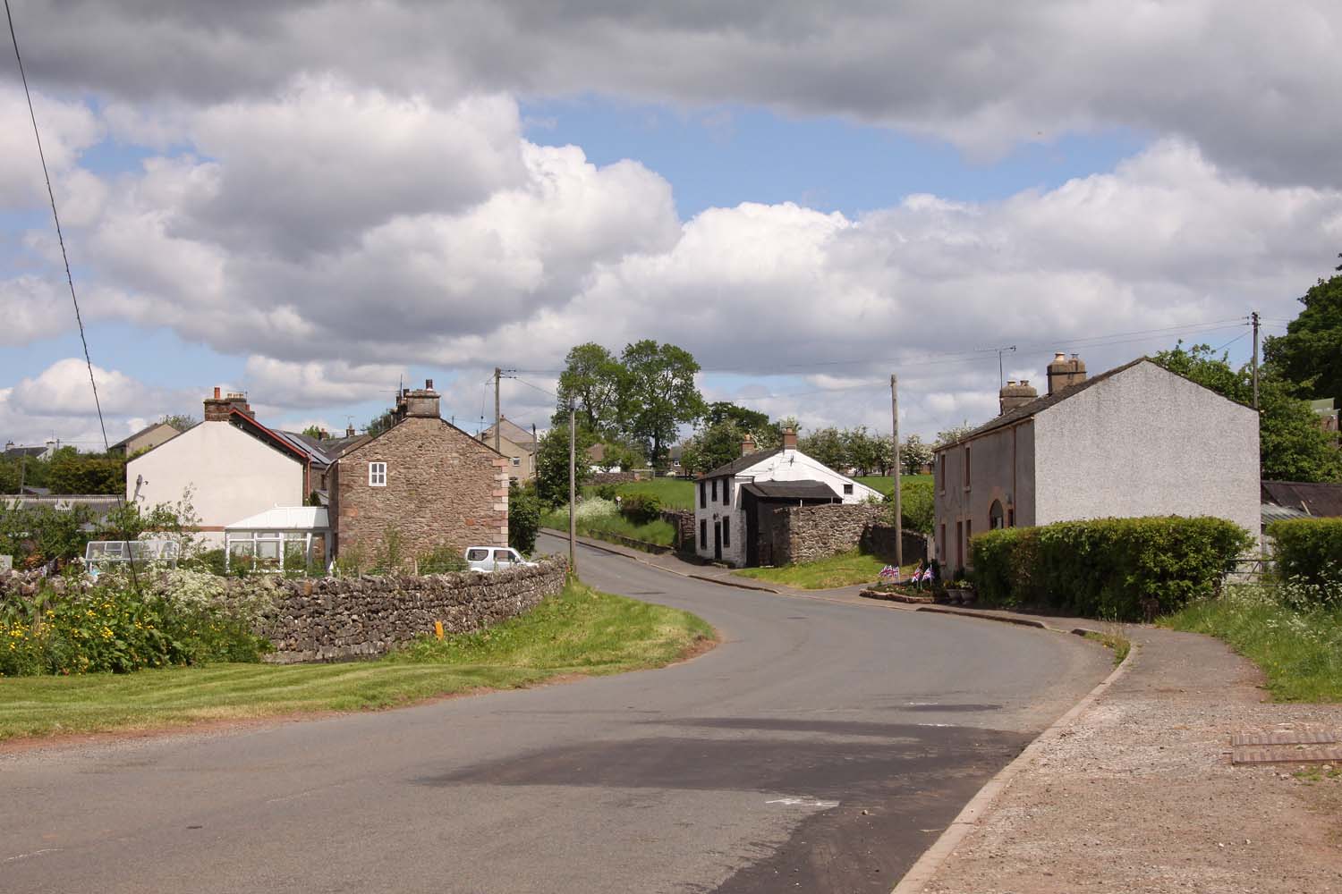
Burrells is a small village located in the county of Westmorland in the North West of England. Nestled amidst picturesque countryside, this charming rural settlement is renowned for its tranquility and natural beauty. Burrells is situated approximately 10 miles south of the bustling town of Kendal and is surrounded by rolling hills and lush green fields.

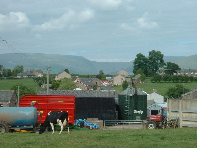
The village is home to a close-knit community, with a population of around 200 residents. The quaint stone houses and cottages that line the streets contribute to the village's idyllic ambiance. Burrells boasts a traditional village pub, The Green Lion, which serves as a social hub for locals and visitors alike.

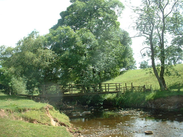
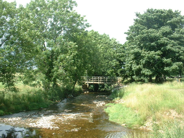
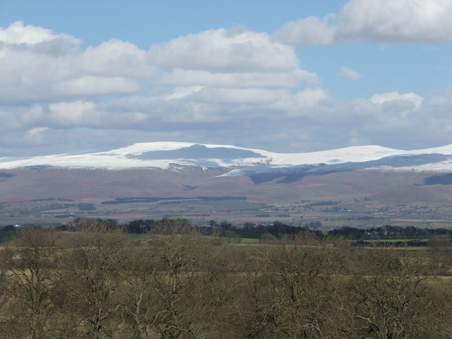
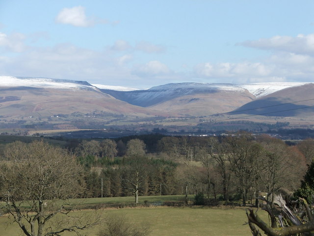
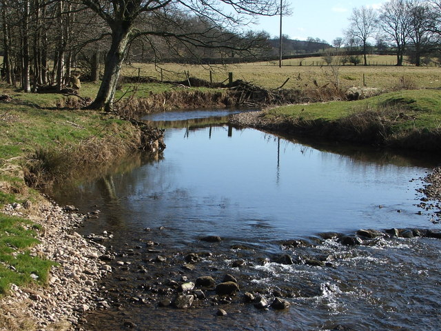
Nature enthusiasts are drawn to Burrells due to its proximity to the stunning Lake District National Park. The village serves as a base for hikers, cyclists, and walkers who wish to explore the nearby fells and trails. The beautiful River Mint flows through the village, offering opportunities for fishing and leisurely strolls along its banks.

Despite its small size, Burrells has a rich history. The village church, St. Mary's, dates back to the 12th century and is a notable landmark. The churchyard contains ancient gravestones, providing a glimpse into the village's past.

Overall, Burrells is a peaceful and picturesque village, offering a retreat from the hustle and bustle of city life. Its natural surroundings, community spirit, and historical charm make it a popular destination for those seeking solace in the heart of the English countryside.

If you have any feedback on the listing, please let us know in the comments section below.
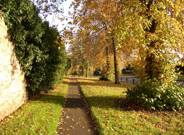
Burrells Images

Images are sourced within 2km of 54.558758/-2.494794 or Grid Reference NY6818. Thanks to Geograph Open Source API. All images are credited.

The Eden valley south of Appleby The characteristic red sandstone of Westmorland can be seen in the colour of the soil of a recently ploughed field.
The Eden valley south of Appleby
The characteristic red sandstone of Westmorland can be seen in the colour of the soil of a recently ploughed field.
Footpath near Ormside Hall Bridge This is the public footpath from Appleby to Great Ormside.  Beyond the gate the footpath passes under the Settle to Carlisle railway (see photograph <a href="https://www.geograph.org.uk/photo/6973171">NY6917 : Ormside Hall Bridge</a>).
Footpath near Ormside Hall Bridge
This is the public footpath from Appleby to Great Ormside. Beyond the gate the footpath passes under the Settle to Carlisle railway (see photograph NY6917 : Ormside Hall Bridge).
Ormside Hall Bridge Bridge number 230, Ormside Hall Bridge carries the Settle to Carlisle railway over a farm track and the public footpath from Appleby to Great Ormside.
Ormside Hall Bridge
Bridge number 230, Ormside Hall Bridge carries the Settle to Carlisle railway over a farm track and the public footpath from Appleby to Great Ormside.
Ordnance Survey 1GL Bolt This OS bolt can be found on the east face of St Michael's Church. It marks a point 142.838m above mean sea level.
Ordnance Survey 1GL Bolt
This OS bolt can be found on the east face of St Michael's Church. It marks a point 142.838m above mean sea level.
Ordnance Survey Cut Mark This OS cut mark can be found on the building NE side of Scattergate. It marks a point 145.460m above mean sea level.
Ordnance Survey Cut Mark
This OS cut mark can be found on the building NE side of Scattergate. It marks a point 145.460m above mean sea level.
Ordnance Survey Cut Mark This OS cut mark can be found on the wall SW side of the road junction. It marks a point 168.155m above mean sea level.
Ordnance Survey Cut Mark
This OS cut mark can be found on the wall SW side of the road junction. It marks a point 168.155m above mean sea level.
Ordnance Survey Cut Mark This OS cut mark can be found on the north face of the railway bridge. It marks a point 158.005m above mean sea level.
Ordnance Survey Cut Mark
This OS cut mark can be found on the north face of the railway bridge. It marks a point 158.005m above mean sea level.
Appleby Castle Caesar's Tower at Appleby Castle built it is thought on the site of a Roman tower.
Appleby Castle
Caesar's Tower at Appleby Castle built it is thought on the site of a Roman tower.
Footbridge on Hoff Beck, near Appleby
Footbridge, Hoff Beck at Hoff, near Appleby Hoff Village, and the pub, are just beyond the trees.
Footbridge, Hoff Beck at Hoff, near Appleby
Hoff Village, and the pub, are just beyond the trees.
Burrells Village, near Appleby Looking north
Burrells Village, near Appleby
Looking north
Burrells Village, near Appleby Looking north. The deep incut of High Cup Nick is visible on the horizon
Burrells Village, near Appleby
Looking north. The deep incut of High Cup Nick is visible on the horizon
Lookingflatt Farm, near Hoff Looking east
Lookingflatt Farm, near Hoff
Looking east
Pennines from brackenslack
High Cup Nick with light dusting of snow
Hoff Beck
Hoff Beck
Margarets Way, Appleby-in-Westmorland
Verge, Scattergate, Appleby This is the road to Orton, behind the castle.  Part of the wall around the castle grounds is on the left.
Verge, Scattergate, Appleby
This is the road to Orton, behind the castle. Part of the wall around the castle grounds is on the left.
Show me another place!

Burrells is located at Grid Ref: NY6818 (Lat: 54.558758, Lng: -2.494794)

Administrative County: Cumbria

District: Eden

Police Authority: Cumbria

What 3 Words

///lecturing.comments.riches. Near Appleby-in-Westmorland, Cumbria

Nearby Locations

Burrells

Related Wikis

Burrells

Burrells is a hamlet in the Eden District, in the English county of Cumbria. Burrells is located on the B6260 Road in between the town of Appleby-in-Westmorland...

Hoff, Cumbria

Hoff is a hamlet and civil parish in the Eden district of the county of Cumbria, England. At the 2001 census the parish had a population of 189, decreasing...
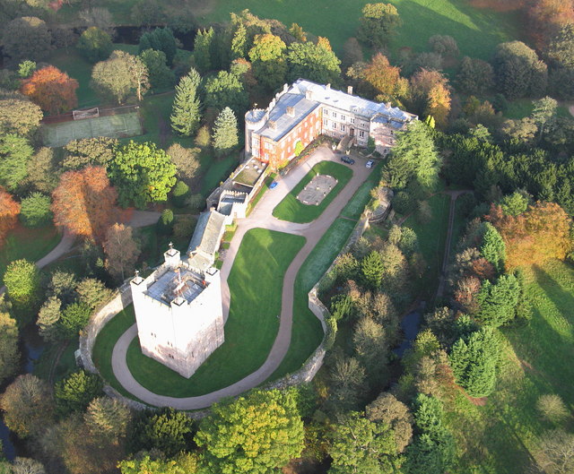
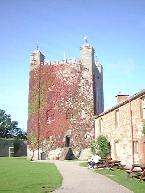
Appleby Castle

Appleby Castle is in the town of Appleby-in-Westmorland overlooking the River Eden (grid reference NY685200). It consists of a 12th-century castle keep...

Moot Hall, Appleby-in-Westmorland

The Moot Hall is a municipal building in Boroughgate, Appleby-in-Westmorland, Cumbria, England. The building, which is currently used as the meeting place...

Nearby Amenities

Located within 500m of 54.558758,-2.494794
Bus Stop
Crossroad
Bench: yes
Covered: no
Naptan AtcoCode: 090074071042
Naptan Bearing: N
Naptan CommonName: Crossroad
Naptan Indicator: opp
Naptan Landmark: junction with B6260
Naptan NaptanCode: cumdadgd
Naptan Street: A685
Naptan Verified: no
Shelter: no
Source: naptan_import
Lat/Long: 54.5610631/-2.494365
Post Box
Post Box Type: lamp
Ref: CA16 71
Source: survey
Lat/Long: 54.5580101/-2.4975936
Telephone
Defibrillator
Booth: KX100
Covered: booth
Defibrillator Location: inside old phone box in Burrells
Emergency: defibrillator
Man Made: telephone_box
Source: survey
Lat/Long: 54.5610447/-2.4943849
Bench
Lat/Long: 54.5611259/-2.4944043
Burrells
Place: hamlet
Wikidata: Q5000412
Lat/Long: 54.5588504/-2.4957214
Shelter
Shelter Type: public_transport
Lat/Long: 54.5611929/-2.4941252
Shelter
Shelter Type: public_transport
Lat/Long: 54.5580471/-2.4974869
Power: pole
Lat/Long: 54.5613397/-2.4898095
Power: pole
Lat/Long: 54.5613488/-2.4898688
Power: pole
Lat/Long: 54.5619118/-2.4921823
Power: pole
Lat/Long: 54.5614841/-2.4941162
Power: pole
Lat/Long: 54.5609579/-2.4949051
Power: pole
Lat/Long: 54.5608684/-2.4950693
Power: pole
Lat/Long: 54.5600005/-2.4954825
Power: pole
Lat/Long: 54.5587725/-2.4880477
Power: pole
Lat/Long: 54.5595063/-2.4892005
Power: pole
Lat/Long: 54.5604763/-2.4895604
Power: pole
Lat/Long: 54.5623532/-2.4902307
Power: pole
Lat/Long: 54.5575812/-2.5016538
Power: pole
Lat/Long: 54.5581946/-2.5005485
Power: pole
Lat/Long: 54.5588654/-2.499279
Power: pole
Lat/Long: 54.5598984/-2.4974302
Power: pole
Lat/Long: 54.5604396/-2.4961172
Power: pole
Lat/Long: 54.5594499/-2.4982329
Power: pole
Lat/Long: 54.5589869/-2.4980966
Power: pole
Lat/Long: 54.5583047/-2.4978692
The data included in this document is from www.openstreetmap.org. The data is made available under ODbL.

Have you been to Burrells?

Leave your review of Burrells below (or comments, questions and feedback).