Allt Bryn-têg

Wood, Forest in Carmarthenshire

Wales

Allt Bryn-têg

Allt Cwm-dyfiog Llwybr cyhoeddus yn gadael y trac yn Allt Cwm-dyfiog.

A public footpath exits the track at Allt Cwm-dyfiog.
Allt Cwm-dyfiog Credit: Alan Richards

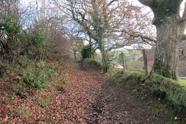
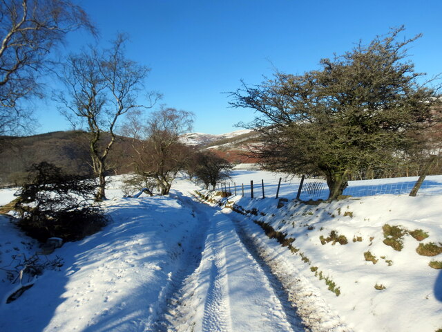
Allt Bryn-têg is a picturesque woodland area located in Carmarthenshire, Wales. The name translates to "Wood, Forest" in Welsh, which aptly describes the natural beauty and lush greenery found in this region.

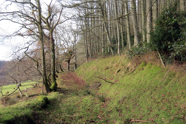
Covering an expansive area of land, Allt Bryn-têg is home to a diverse range of flora and fauna, making it an ideal destination for nature enthusiasts and wildlife lovers. The woodland is predominantly composed of deciduous trees, including oak, beech, and ash, which create a stunning canopy of foliage during the spring and summer months.

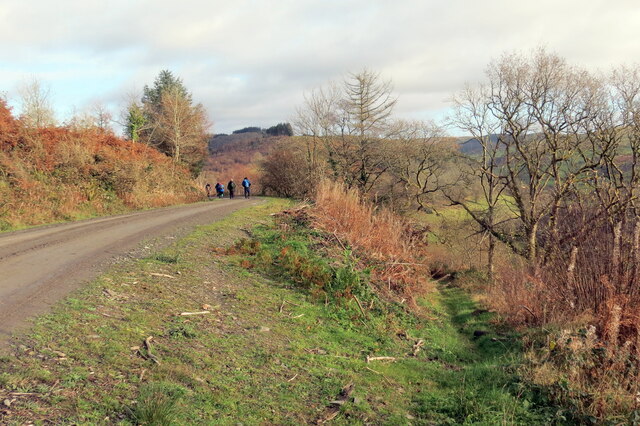
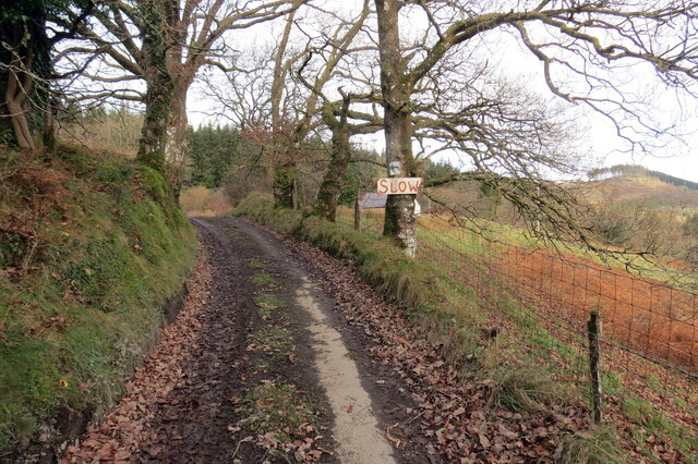
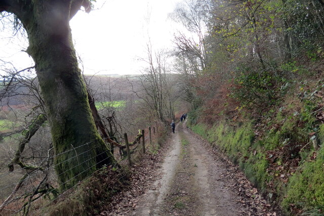
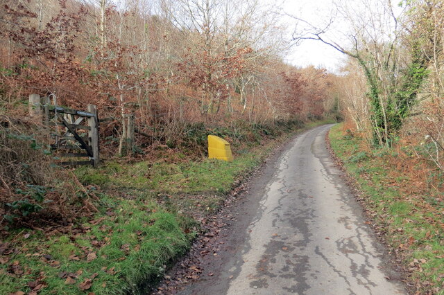
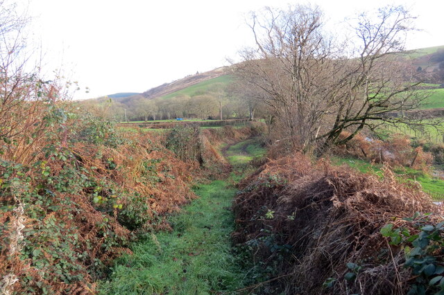
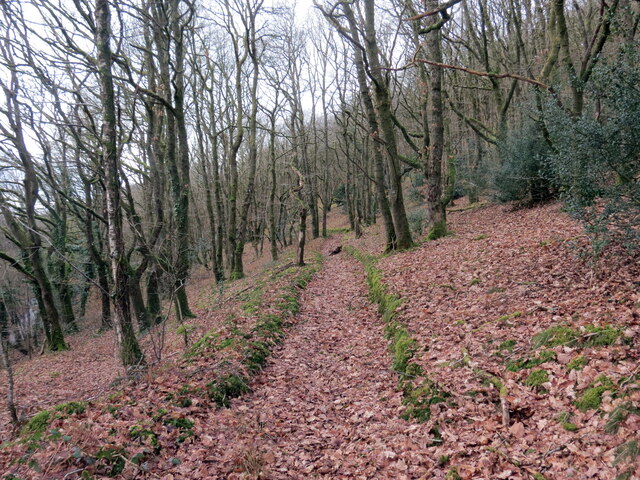
The forest is crisscrossed by a network of well-maintained footpaths and trails, allowing visitors to explore the area and take in its breathtaking scenery. One of the highlights of Allt Bryn-têg is a small stream that flows through the woodland, providing a tranquil setting for picnics or moments of reflection.

The woodland is also a haven for wildlife, with numerous species of birds, mammals, and insects calling it home. It is not uncommon to spot red squirrels, deer, and a variety of bird species, including woodpeckers and owls, while traversing the trails.

Allt Bryn-têg is not only a natural paradise but also holds historical significance. The woodland has played a role in local folklore and is said to be the site of ancient Celtic rituals. Today, it continues to be a cherished destination for locals and tourists alike, offering a peaceful and rejuvenating escape from the hustle and bustle of everyday life.

If you have any feedback on the listing, please let us know in the comments section below.

Allt Bryn-têg Images

Images are sourced within 2km of 52.07604/-3.92272 or Grid Reference SN6843. Thanks to Geograph Open Source API. All images are credited.
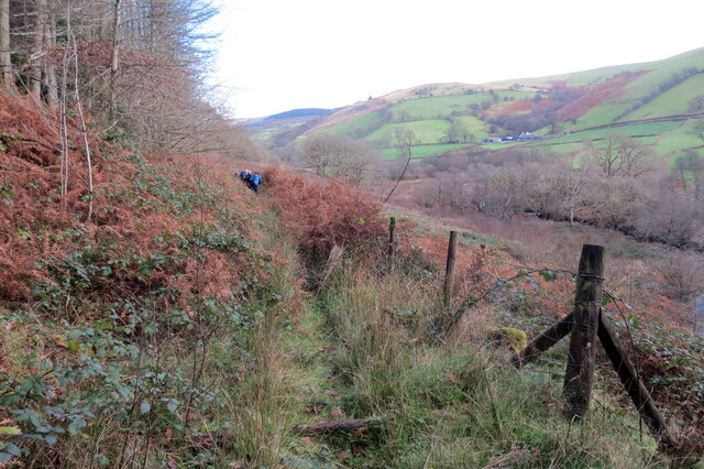
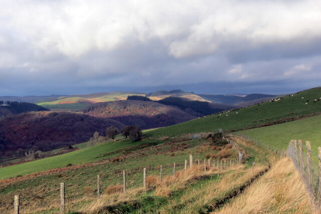
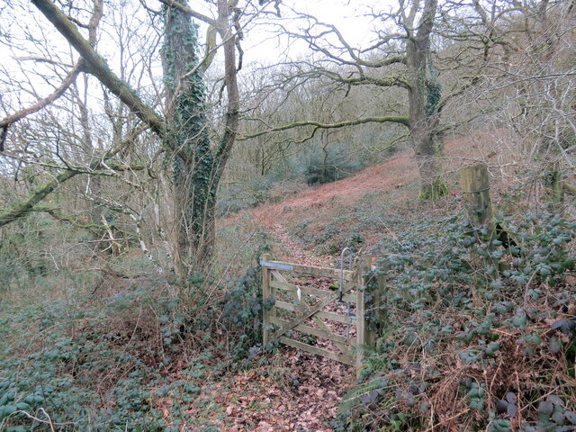
Allt Cwm-dyfiog Llwybr cyhoeddus yn gadael y trac yn Allt Cwm-dyfiog.

A public footpath exits the track at Allt Cwm-dyfiog.
Allt Cwm-dyfiog
Llwybr cyhoeddus yn gadael y trac yn Allt Cwm-dyfiog. A public footpath exits the track at Allt Cwm-dyfiog.
Heol ger Bwlch-y-gilwen / Road near Bwlch-y-gilwen Heol fach ger anhedd-dy o'r enw Bwlch-y-gilwen.

A minor road near a property known as Bwlch-y-gilwen (trans. white nook pass)
Heol ger Bwlch-y-gilwen / Road near Bwlch-y-gilwen
Heol fach ger anhedd-dy o'r enw Bwlch-y-gilwen. A minor road near a property known as Bwlch-y-gilwen (trans. white nook pass)
Heol yn Allt Bwlch-y-gilwen / A road at Allt Bwlch-y-gilwen Heol fach yn mynd i lawr y waered yn Allt Bwlch-y-gilwen.

A minor road descending the hill at Allt Bwlch-y-gilwen (trans. fair nook pass).
Heol yn Allt Bwlch-y-gilwen / A road at Allt Bwlch-y-gilwen
Heol fach yn mynd i lawr y waered yn Allt Bwlch-y-gilwen. A minor road descending the hill at Allt Bwlch-y-gilwen (trans. fair nook pass).
Llwybr Allt Bwlch-y-gelain / Allt Bwlch-y-gelain Llwybr yn gadael yr heol fach o dan Allt Bwlch-y-gilwen.

A path exits the road beneath Allt Bwlch-y-gilwen.
Llwybr Allt Bwlch-y-gelain / Allt Bwlch-y-gelain
Llwybr yn gadael yr heol fach o dan Allt Bwlch-y-gilwen. A path exits the road beneath Allt Bwlch-y-gilwen.
Llwybr Aber-Mangoed / Aber-Mangoed path Llwybr yn mynd i gyfeiriad Ffarm Aber-Mangoed.

A path heading in the direction of Aber-Mangoed Farm.
 (trans. confluence of the Mangoed stream).
Llwybr Aber-Mangoed / Aber-Mangoed path
Llwybr yn mynd i gyfeiriad Ffarm Aber-Mangoed. A path heading in the direction of Aber-Mangoed Farm. (trans. confluence of the Mangoed stream).
Llwybr Aber-Mangoed / Aber-Mangoed path Llwybr yn mynd i gyfeiriad Ffarm Aber-Mangoed.

A path heading towards Aber-Mangoed Farm (trans. confluence of the Mangoed stream).
Llwybr Aber-Mangoed / Aber-Mangoed path
Llwybr yn mynd i gyfeiriad Ffarm Aber-Mangoed. A path heading towards Aber-Mangoed Farm (trans. confluence of the Mangoed stream).
Llwybr Aber-Mangoed / Aber-Mangoed path Cerddwyr yn dilyn llwybr o dan Allt Aber-Mangoed.

Walkers following a path below Allt Aber-Mangoed (trans. wooded slope near the confluence of the Mangoed stream).
Llwybr Aber-Mangoed / Aber-Mangoed path
Cerddwyr yn dilyn llwybr o dan Allt Aber-Mangoed. Walkers following a path below Allt Aber-Mangoed (trans. wooded slope near the confluence of the Mangoed stream).
Llwybr ger Ffarm Brynteg / Path near Brynteg Farm Llwybr yn agosau at yr heol ger Ffarm Brynteg.

A path approaches the road near Brynteg Farm (trans. fairhill).
Llwybr ger Ffarm Brynteg / Path near Brynteg Farm
Llwybr yn agosau at yr heol ger Ffarm Brynteg. A path approaches the road near Brynteg Farm (trans. fairhill).
Hen heol i Gwmcothi  / Old road to Cwmcothi Hen heol sy wedi ei hisraddio i lwybr troed yn mynd i lawr y waered i gyfeiriad Cwmcothi.

An old road now downgraded to a footpath descends the hill towards Cwmcothi (trans. Cothi valley).
Hen heol i Gwmcothi / Old road to Cwmcothi
Hen heol sy wedi ei hisraddio i lwybr troed yn mynd i lawr y waered i gyfeiriad Cwmcothi. An old road now downgraded to a footpath descends the hill towards Cwmcothi (trans. Cothi valley).
Llwyr ger Glan Meddyg / Path near Glan Meddyg Heol fynedfa a llwybr cyhoeddus ger Ffarm Glan Meddyg.

An access road and public footpath near Glan Meddyg Farm (trans. bank of the ?physician's stream).
Llwyr ger Glan Meddyg / Path near Glan Meddyg
Heol fynedfa a llwybr cyhoeddus ger Ffarm Glan Meddyg. An access road and public footpath near Glan Meddyg Farm (trans. bank of the ?physician's stream).
Tuag at Gwm Cothi / Towards Cwm Cothi Llwybr troed cyhoeddus yn mynd i lawr y waered tuag ay Gwm Cothi.

A public footpath descending towards Cwm Cothi (trans. [river] Cothi valley).
Tuag at Gwm Cothi / Towards Cwm Cothi
Llwybr troed cyhoeddus yn mynd i lawr y waered tuag ay Gwm Cothi. A public footpath descending towards Cwm Cothi (trans. [river] Cothi valley).
Pont dros Afon Cothi / Bridge over Afon Cothi Heol fach wledig yn croesi pont sy'n rhychwantu Afon Cothi.

A minor rural road crosses a bridge spanning Afon Cothi.
Pont dros Afon Cothi / Bridge over Afon Cothi
Heol fach wledig yn croesi pont sy'n rhychwantu Afon Cothi. A minor rural road crosses a bridge spanning Afon Cothi.
Cwrt y Cadno Cyrraedd pentre bach gwledig Cwrt y Cadno. 

Entering the little rural village of Cwrt y Cadno (trans. Court of the fox).
Cwrt y Cadno
Cyrraedd pentre bach gwledig Cwrt y Cadno. Entering the little rural village of Cwrt y Cadno (trans. Court of the fox).
Tuat at Gwrt y Cadno / Towards Cwrt y Cadno Heol fach wledig yn mynd i gyfeiriad pentre bach Cwrt y Cadno.

A minor rural road heading towards the little village of Cwrt y Cadno (trans. court of the fox).
Tuat at Gwrt y Cadno / Towards Cwrt y Cadno
Heol fach wledig yn mynd i gyfeiriad pentre bach Cwrt y Cadno. A minor rural road heading towards the little village of Cwrt y Cadno (trans. court of the fox).
Llwybr ceffyl ger Pentwyn / A bridleway near Pentwyn Llwybr ceffyl ger Ffarm Pentwyn yn dringo i gyfeiriad Mynydd Mallaen.

A bridleway near Pentwyn Farm (trans. top of the hillock) ascends towards Mynydd Mallaen (trans. mountain of Llaen's plain).
Llwybr ceffyl ger Pentwyn / A bridleway near Pentwyn
Llwybr ceffyl ger Ffarm Pentwyn yn dringo i gyfeiriad Mynydd Mallaen. A bridleway near Pentwyn Farm (trans. top of the hillock) ascends towards Mynydd Mallaen (trans. mountain of Llaen's plain).
Llwybr i Gwrt y Cadno / Path to Cwrt y Cadno Llwybr ceffyl yn mynd i lawr y waered i gyfeiriad pentre bach Cwrty Cadno.

A bridleway descends the hill in the direction of the little village of Cwrt y Cadno (trans. court of the fox).
Llwybr i Gwrt y Cadno / Path to Cwrt y Cadno
Llwybr ceffyl yn mynd i lawr y waered i gyfeiriad pentre bach Cwrty Cadno. A bridleway descends the hill in the direction of the little village of Cwrt y Cadno (trans. court of the fox).
Llwybr ceffyl Allt Dinbeth / Allt Dinbeth bridleway Llwybr ceffyl ar droed Allt Dinbeth.

A bridleway at the foot of Allt Dinbeth (trans. wooded hill of ?_____ fort).
Llwybr ceffyl Allt Dinbeth / Allt Dinbeth bridleway
Llwybr ceffyl ar droed Allt Dinbeth. A bridleway at the foot of Allt Dinbeth (trans. wooded hill of ?_____ fort).
Show me another place!

Allt Bryn-têg is located at Grid Ref: SN6843 (Lat: 52.07604, Lng: -3.92272)

Unitary Authority: Carmarthenshire

Police Authority: Dyfed Powys

What 3 Words

///sending.reworked.mining. Near Llansawel, Carmarthenshire

Nearby Locations

Allt Bryn-têg

Related Wikis

Cynwyl Gaeo

Cynwyl Gaeo is a parish and community located in rural Carmarthenshire, Wales, near the boundary with Ceredigion, in the upper Cothi valley about halfway...

Dolaucothi Estate

The Dolaucothi Estate (also Dolaucothy) is situated about 1 mile (1.6 km) north-west of the village of Caio up the Cothi Valley in the community of Cynwyl...

Ffarmers

Ffarmers is a village near Lampeter, in the north of Carmarthenshire, Wales. It was named after the old "Farmers' Arms" public house, which is now closed...

Caio, Carmarthenshire

Caio (or Caeo) is a village in the county of Carmarthenshire, south-west Wales, sited near to the Dolaucothi Gold Mines. == Location == It is located between...

Nearby Amenities

Located within 500m of 52.07604,-3.92272
Place: farm
Lat/Long: 52.0745175/-3.9192478
Ford: yes
Lat/Long: 52.0722381/-3.9212405
The data included in this document is from www.openstreetmap.org. The data is made available under ODbL.

Have you been to Allt Bryn-têg?

Leave your review of Allt Bryn-têg below (or comments, questions and feedback).