Allt Troed-rhiw-gelli-fawr

Wood, Forest in Carmarthenshire

Wales

Allt Troed-rhiw-gelli-fawr

Heol ger Bwlch-y-gilwen / Road near Bwlch-y-gilwen Heol fach ger anhedd-dy o'r enw Bwlch-y-gilwen.

A minor road near a property known as Bwlch-y-gilwen (trans. white nook pass)
Heol ger Bwlch-y-gilwen / Road near Bwlch-y-gilwen Credit: Alan Richards

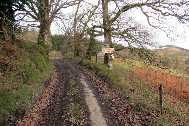
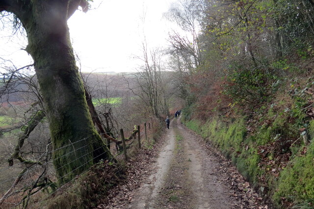
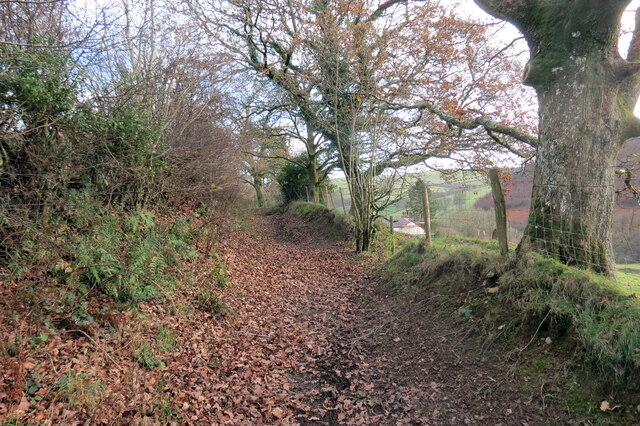
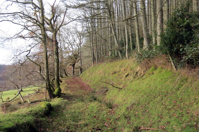
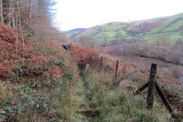
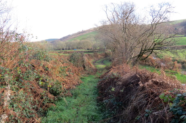
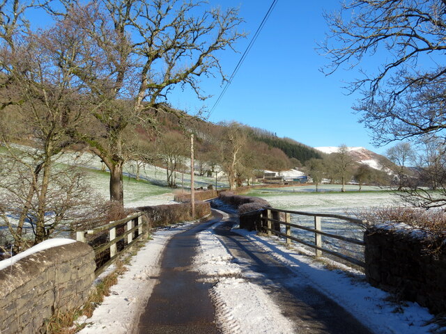
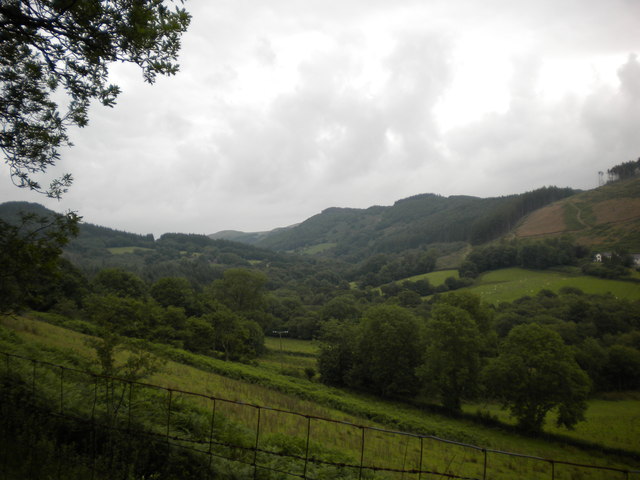
Allt Troed-rhiw-gelli-fawr is a wood located in Carmarthenshire, Wales. It is situated near the village of Troed-rhiw-gelli-fawr and covers an area of approximately 200 acres. The wood is known for its scenic beauty and rich biodiversity, making it a popular destination for nature enthusiasts and hikers.

The wood is predominantly composed of native broadleaf trees, such as oak, beech, and ash, which create a dense canopy overhead. This provides a habitat for a diverse range of wildlife, including various species of birds, mammals, and insects. Rare and protected species, such as the red kite and dormouse, have been spotted in the area, adding to its ecological significance.

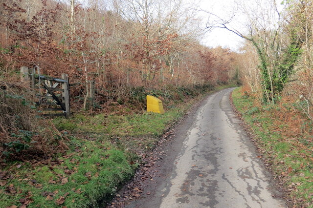
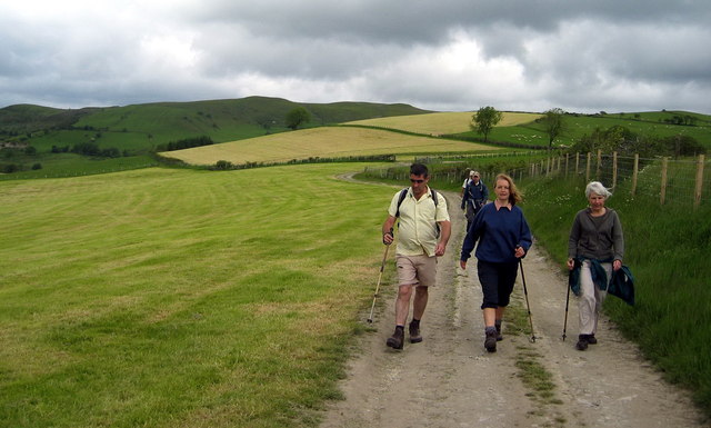
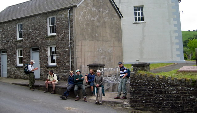
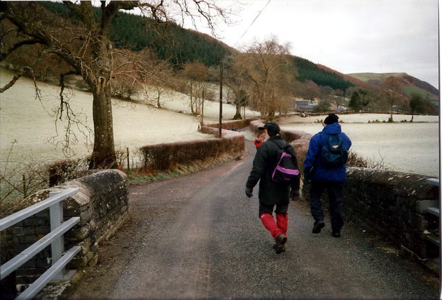
Several walking trails have been established within Allt Troed-rhiw-gelli-fawr, allowing visitors to explore the wood and immerse themselves in its natural surroundings. These trails vary in length and difficulty, catering to both casual strollers and more experienced hikers. Along the way, visitors can enjoy picturesque views of the surrounding countryside and may encounter wildflowers, babbling streams, and ancient ruins.

The wood also serves as a valuable educational resource, with local schools often organizing field trips to teach students about the importance of conservation and the natural environment. Additionally, Allt Troed-rhiw-gelli-fawr offers a peaceful retreat for those seeking solace and tranquility, away from the bustling city life.

Overall, Allt Troed-rhiw-gelli-fawr in Carmarthenshire is a captivating wood that showcases the beauty of nature while providing recreational and educational opportunities for visitors.

If you have any feedback on the listing, please let us know in the comments section below.

Allt Troed-rhiw-gelli-fawr Images

Images are sourced within 2km of 52.084055/-3.930231 or Grid Reference SN6744. Thanks to Geograph Open Source API. All images are credited.

Heol ger Bwlch-y-gilwen / Road near Bwlch-y-gilwen Heol fach ger anhedd-dy o'r enw Bwlch-y-gilwen.

A minor road near a property known as Bwlch-y-gilwen (trans. white nook pass)
Heol ger Bwlch-y-gilwen / Road near Bwlch-y-gilwen
Heol fach ger anhedd-dy o'r enw Bwlch-y-gilwen. A minor road near a property known as Bwlch-y-gilwen (trans. white nook pass)
Heol yn Allt Bwlch-y-gilwen / A road at Allt Bwlch-y-gilwen Heol fach yn mynd i lawr y waered yn Allt Bwlch-y-gilwen.

A minor road descending the hill at Allt Bwlch-y-gilwen (trans. fair nook pass).
Heol yn Allt Bwlch-y-gilwen / A road at Allt Bwlch-y-gilwen
Heol fach yn mynd i lawr y waered yn Allt Bwlch-y-gilwen. A minor road descending the hill at Allt Bwlch-y-gilwen (trans. fair nook pass).
Llwybr Allt Bwlch-y-gelain / Allt Bwlch-y-gelain Llwybr yn gadael yr heol fach o dan Allt Bwlch-y-gilwen.

A path exits the road beneath Allt Bwlch-y-gilwen.
Llwybr Allt Bwlch-y-gelain / Allt Bwlch-y-gelain
Llwybr yn gadael yr heol fach o dan Allt Bwlch-y-gilwen. A path exits the road beneath Allt Bwlch-y-gilwen.
Llwybr Aber-Mangoed / Aber-Mangoed path Llwybr yn mynd i gyfeiriad Ffarm Aber-Mangoed.

A path heading in the direction of Aber-Mangoed Farm.
 (trans. confluence of the Mangoed stream).
Llwybr Aber-Mangoed / Aber-Mangoed path
Llwybr yn mynd i gyfeiriad Ffarm Aber-Mangoed. A path heading in the direction of Aber-Mangoed Farm. (trans. confluence of the Mangoed stream).
Llwybr Aber-Mangoed / Aber-Mangoed path Llwybr yn mynd i gyfeiriad Ffarm Aber-Mangoed.

A path heading towards Aber-Mangoed Farm (trans. confluence of the Mangoed stream).
Llwybr Aber-Mangoed / Aber-Mangoed path
Llwybr yn mynd i gyfeiriad Ffarm Aber-Mangoed. A path heading towards Aber-Mangoed Farm (trans. confluence of the Mangoed stream).
Llwybr Aber-Mangoed / Aber-Mangoed path Cerddwyr yn dilyn llwybr o dan Allt Aber-Mangoed.

Walkers following a path below Allt Aber-Mangoed (trans. wooded slope near the confluence of the Mangoed stream).
Llwybr Aber-Mangoed / Aber-Mangoed path
Cerddwyr yn dilyn llwybr o dan Allt Aber-Mangoed. Walkers following a path below Allt Aber-Mangoed (trans. wooded slope near the confluence of the Mangoed stream).
Llwybr ger Ffarm Brynteg / Path near Brynteg Farm Llwybr yn agosau at yr heol ger Ffarm Brynteg.

A path approaches the road near Brynteg Farm (trans. fairhill).
Llwybr ger Ffarm Brynteg / Path near Brynteg Farm
Llwybr yn agosau at yr heol ger Ffarm Brynteg. A path approaches the road near Brynteg Farm (trans. fairhill).
Pont dros Afon Cothi / Bridge over Afon Cothi Heol fach wledig yn croesi pont sy'n rhychwantu Afon Cothi.

A minor rural road crosses a bridge spanning Afon Cothi.
Pont dros Afon Cothi / Bridge over Afon Cothi
Heol fach wledig yn croesi pont sy'n rhychwantu Afon Cothi. A minor rural road crosses a bridge spanning Afon Cothi.
Cwrt y Cadno Cyrraedd pentre bach gwledig Cwrt y Cadno. 

Entering the little rural village of Cwrt y Cadno (trans. Court of the fox).
Cwrt y Cadno
Cyrraedd pentre bach gwledig Cwrt y Cadno. Entering the little rural village of Cwrt y Cadno (trans. Court of the fox).
Tuat at Gwrt y Cadno / Towards Cwrt y Cadno Heol fach wledig yn mynd i gyfeiriad pentre bach Cwrt y Cadno.

A minor rural road heading towards the little village of Cwrt y Cadno (trans. court of the fox).
Tuat at Gwrt y Cadno / Towards Cwrt y Cadno
Heol fach wledig yn mynd i gyfeiriad pentre bach Cwrt y Cadno. A minor rural road heading towards the little village of Cwrt y Cadno (trans. court of the fox).
 A wide sweep The forestry on the horizon sits above the grazing land in the foreground: all is in the square.
A wide sweep
The forestry on the horizon sits above the grazing land in the foreground: all is in the square.
Llwybr Ceffyl Cwrt y Cadno bridleway Llwybr ceffyl yn arwain i lawr o Fynydd Mallaen at dreflan Cwrt y Cadno. Yn y pellter gellir gweld Capel Cwrtycadno.

A bridleway leading down from Mynydd Mallaen (trans. plains of Llain) Mountain to the hamlet of Cwrtycadno (trans. Court of the fox). Capel Cwrtycadno Chapel can be seen in the distance.
Llwybr Ceffyl Cwrt y Cadno bridleway
Llwybr ceffyl yn arwain i lawr o Fynydd Mallaen at dreflan Cwrt y Cadno. Yn y pellter gellir gweld Capel Cwrtycadno. A bridleway leading down from Mynydd Mallaen (trans. plains of Llain) Mountain to the hamlet of Cwrtycadno (trans. Court of the fox). Capel Cwrtycadno Chapel can be seen in the distance.
Llwybr Blaenau / Blaenau path Cerddwyr yn dilyn llwybr cyhoeddus i lawr o'r ucheldir tuag at Ffarm y Blaenau.

Walkers following a public path down from the hills in the direction of Blaenau Farm (trans. uplands)
Llwybr Blaenau / Blaenau path
Cerddwyr yn dilyn llwybr cyhoeddus i lawr o'r ucheldir tuag at Ffarm y Blaenau. Walkers following a public path down from the hills in the direction of Blaenau Farm (trans. uplands)
Festri Bethel Vestry Cerddwyr yn cael seibiant y tu fas i festri a chyn stablau Bethel Cwm Pedol, Capel y Bedwyddwyr.

Walkers having a rest outside the vestry and former stables of Bethel Cwm Pedol Baptist Chapel.
Festri Bethel Vestry
Cerddwyr yn cael seibiant y tu fas i festri a chyn stablau Bethel Cwm Pedol, Capel y Bedwyddwyr. Walkers having a rest outside the vestry and former stables of Bethel Cwm Pedol Baptist Chapel.
Hen Ysgol Cwrtycadno Old School Hen Ysgol Cwrtycadno sy wedi bod am flynyddoedd yn eiddo i Ysgol Gyfun Rhydfelen fel canolfan weithgareddau.

Cwrtycadno (tran. fox court) Old School has been for years the property of Rhydfelen (trans. brown ford) Comprehensive School and used as an activity centre.
Hen Ysgol Cwrtycadno Old School
Hen Ysgol Cwrtycadno sy wedi bod am flynyddoedd yn eiddo i Ysgol Gyfun Rhydfelen fel canolfan weithgareddau. Cwrtycadno (tran. fox court) Old School has been for years the property of Rhydfelen (trans. brown ford) Comprehensive School and used as an activity centre.
Ger Ffarm Brynteg / Near Brynteg Farm Cerddwyr yn croesi pont sy'n rhychwantu Afon Cothi wrth ddilyn yr heol tuag at Gwrtycadno.

Walkers crossing the bridge which spans the Cothi River while following the road toward Cwrtycadno (trans. fox court).
Ger Ffarm Brynteg / Near Brynteg Farm
Cerddwyr yn croesi pont sy'n rhychwantu Afon Cothi wrth ddilyn yr heol tuag at Gwrtycadno. Walkers crossing the bridge which spans the Cothi River while following the road toward Cwrtycadno (trans. fox court).
Cwm Fanagoed View up the Fanagoed valley, Erw-hen farmhouse on the right
Cwm Fanagoed
View up the Fanagoed valley, Erw-hen farmhouse on the right
Allt Troed-Rhiw-Gelli-Fawr The northern edge of the forest
Allt Troed-Rhiw-Gelli-Fawr
The northern edge of the forest
Show me another place!

Allt Troed-rhiw-gelli-fawr is located at Grid Ref: SN6744 (Lat: 52.084055, Lng: -3.930231)

Unitary Authority: Carmarthenshire

Police Authority: Dyfed Powys

What 3 Words

///jumpy.baseballs.crashing. Near Lampeter, Ceredigion

Related Wikis

Ffarmers

Ffarmers is a village near Lampeter, in the north of Carmarthenshire, Wales. It was named after the old "Farmers' Arms" public house, which is now closed...

Llanycrwys

Llanycrwys is a hamlet and community located in Carmarthenshire, Wales. Situated in the historical Cayo Hundred in the Union of Lampeter, it is situated...

Cynwyl Gaeo

Cynwyl Gaeo is a parish and community located in rural Carmarthenshire, Wales, near the boundary with Ceredigion, in the upper Cothi valley about halfway...

Dolaucothi Estate

The Dolaucothi Estate (also Dolaucothy) is situated about 1 mile (1.6 km) north-west of the village of Caio up the Cothi Valley in the community of Cynwyl...

Ffaldybrenin

Ffaldybrenin is a village in Llanycrwys community formed around the parish church in Carmarthenshire, Wales. In the late 19th century Church and State...

Dolaucothi Gold Mines

The Dolaucothi Gold Mines (pronounced [ˌdɔlaiˈkɔθɪ]; Welsh: Mwynfeydd Aur Dolaucothi) (grid reference SN662403), also known as the Ogofau Gold Mine, are...

Pumsaint

Pumsaint is a village in Carmarthenshire, Wales, halfway between Llanwrda and Lampeter on the A482 in the valley of the Afon Cothi. It forms part of the...

Caio, Carmarthenshire

Caio (or Caeo) is a village in the county of Carmarthenshire, south-west Wales, sited near to the Dolaucothi Gold Mines. == Location == It is located between...

Have you been to Allt Troed-rhiw-gelli-fawr?

Leave your review of Allt Troed-rhiw-gelli-fawr below (or comments, questions and feedback).